Schools close, local state of emergency declared after deadly weekend storm

Extensive storm clean-up continues, with at least ten fatalities reported after Saturday's devastating storms.
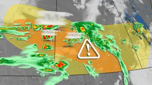
Widespread storm damage clean-up continues across Ontario and Quebec, after a derecho -- a widespread long-lived windstorm associated with a line of thunderstorms -- tore through over the weekend. The storms developed near Sarnia late Saturday morning, continuing to track northeastward over much of southern Ontario and crossing into the Ottawa region and Quebec through Saturday afternoon and evening.
MUST SEE: Nearly half of Canada's population hit by derecho, why it was harmful
The storms were set off by a cold front sweeping in, slicing through the heat and humidity that was in place. This resulted in torrential rainfall, hail, frequent lightning, and widespread, damaging wind gusts.
There have been at least ten fatalities reported, as well as extensive damage to trees, power lines and buildings. At the height of the storm, more than 1,000,000 customers were without power, with several outages still occurring Monday.
Hydro Ottawa is forecasting a two to four day outage, according to CEO Bryce Conrad, with the hopes to have the vast majority of service restored by the "latter part of the week." In some communities, emergency centres will be open for those who are facing several days without power and require help.
RELATED: 'As bad as it gets': Why what hit Ottawa was worse than the ice storm, tornadoes
Here is a breakdown of the impacts across Ontario and Quebec.
ONTARIO
Schools in the Durham, Toronto and Ottawa regions closed their doors on Tuesday, with storm damage clean-up and power outages still impacting the areas.
"The decision to close these schools has been made to protect the health and safety of students, parents/guardians and staff as electricity is needed to safely operate a school," the Durham District School Board said in a statement issued on Monday.
The Town of Uxbridge, east of Toronto, has declared a local state of emergency due to the extensive damage, which has impacted city streets with downed power lines and uprooted trees. Clarence-Rockland, east of Ottawa, also declared a state of emergency on Saturday.
As well, as reported by CBC News, Toronto Police responded to a call for a marine rescue in the area of Lakeshore Boulevard West and Thirty Ninth Street at around 1 p.m. A number of people were rescued and none required hospitalization.
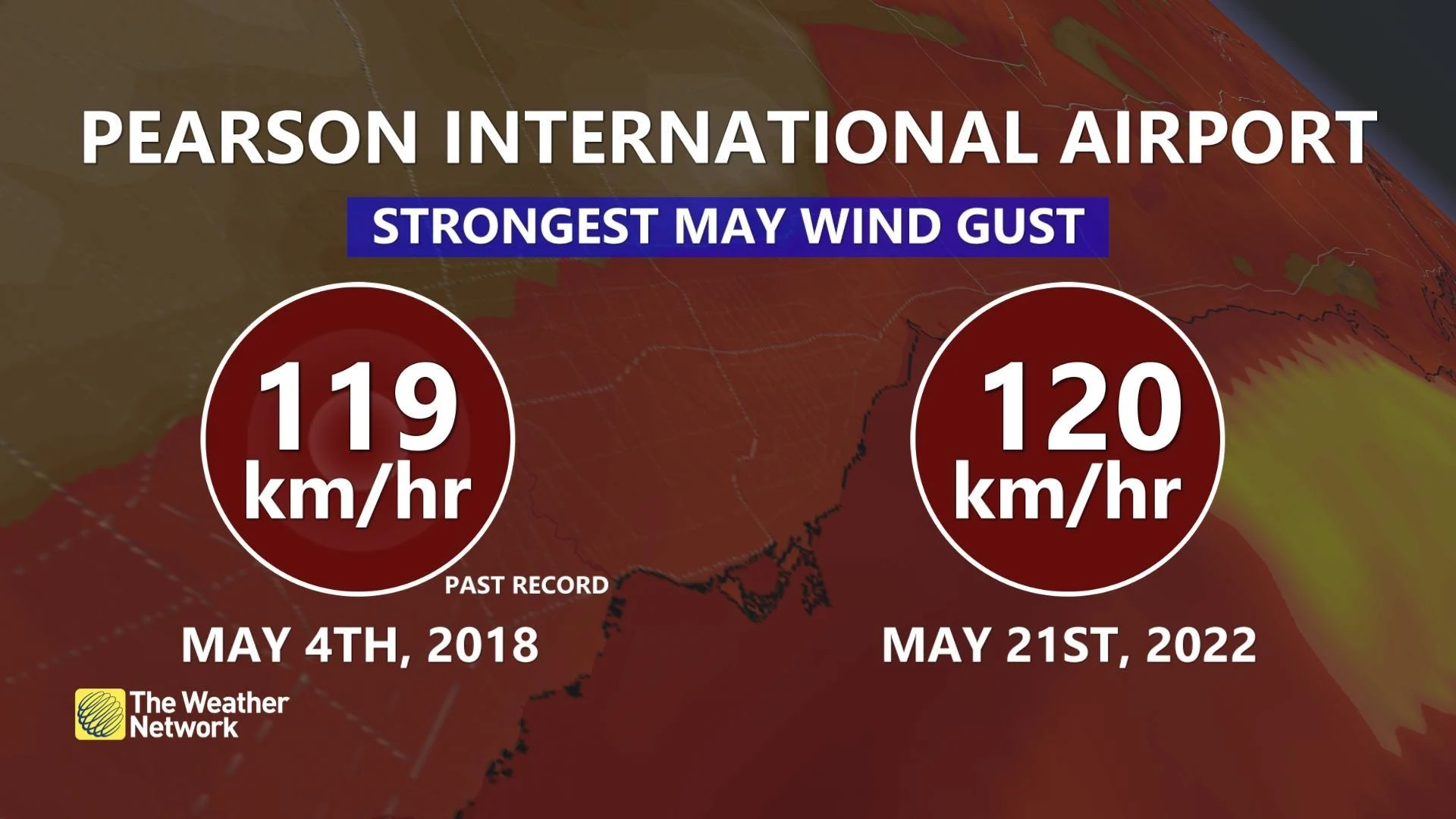
The storm unleashed some extreme wind gusts. Pearson International Airport saw its strongest May wind gust on record after hitting 120 km/h Saturday. It was its fifth strongest wind gust on record. It toppled its previous monthly record of 119 km/h that was documented on May 4, 2018.
Pearson wasn't the only airport to record intense wind gusts. Ottawa International Airport documented its second strongest May wind gust on record, reaching 120 km/h -- its fourth highest of all time.
Kitchener/Waterloo Airport recorded a 132 km/h gust that could be one of their strongest on record, according to Tyler Hamilton, a meteorologist at The Weather Network. Looking back on earlier totals, a 120 km/h gust was observed on March 30, 1981.
Other notable wind gusts documented include 104 km/h at Brantford airport, 100 km/h in Uxbridge and 110 km/h at Toronto Buttonville airport.
The Western University-based Northern Tornadoes Project (NTP) visited Uxbridge and southern Ottawa on Sunday to investigate the damage. In an update posted on Twitter Monday morning, NTP said "given the complexity of the damage due to the derecho, it will require thorough analysis in order to classify/rate the event. Work continues."
As well, an NTP survey team will head to the Rawdon, Que., area to investigate damage associated with a tornado-warned supercell that occurred ahead of the derecho.
WATCH: HURRICANE FORCE WINDS SHIFTS HOUSE OFF OF FOUNDATION
QUEBEC
Along an axis from Upper Gatineau to Montmagny, intense wind gusts resulted in numerous broken limbs, uprooted trees, damage to buildings and more than 500,000 homes without power. Several roads are blocked due to broken trees. Hail of 2-4 centimetres was also reported.
Peak wind gusts as reported by Environment and Climate Change Canada (ECCC) include 144 km/h at Lake Memphremagog, 128 km/h in Shawinigan, 100 km/h at Quebec City airport and 96 km/h in Trois-Rivières, among others.
See below for a collection of photos and videos of the storm that have surfaced on social media.
Thumbnail courtesy of @skree223/Twitter