
Tough travel likely in Quebec as winds whip up blowing snow

A potent winter storm blanketing Eastern Canada isn’t quite done with Quebec just yet.
A powerful winter storm barreling through the eastern half of the country will continue blanketing parts of Quebec with accumulating snow through Sunday morning. Heavy snow fell through the day on Saturday, covering roads and making travel difficult for folks trying to get around in the hardest-hit areas. More on what to expect through Sunday and the week ahead, below.
MUST SEE: Sprawling winter storm leaves footprint longer than the width of Canada
INTO SUNDAY: SNOW CONTINUES OVERNIGHT, BLOWING SNOW A TRAVEL HAZARD
Winter storm warnings remain in effect for the Eastern Townships and the Gaspé Peninsula on Saturday night as the last vestiges of a powerful East Coast storm make their final moves over eastern Quebec.
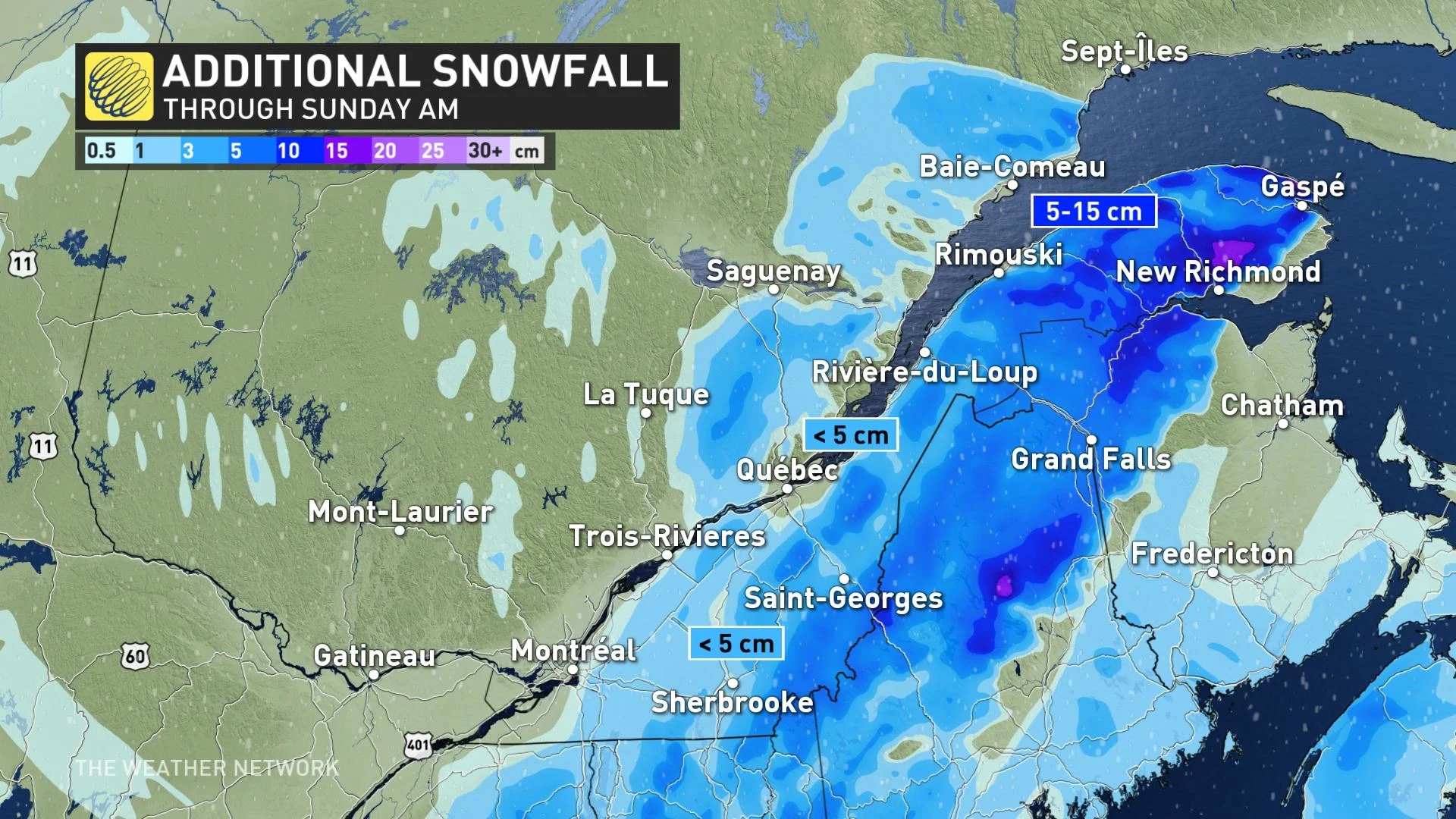
Light snow will continue for these regions into the overnight hours, gradually tapering off by Sunday morning. We’ll see modest accumulations for much of the region, with less than 5 cm likely for the Eastern Townships, and another 5-15 cm possible on the Gaspé.
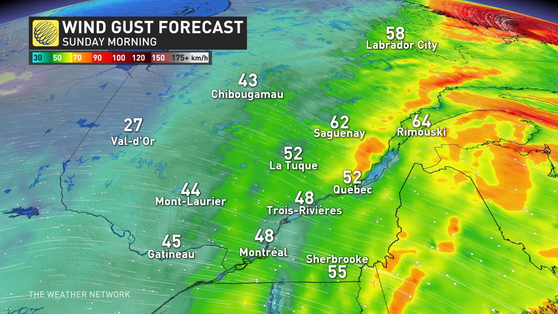
Even though the bulk of the snow is coming to an end, gusty winds will pick up through Saturday evening and continue into Sunday morning. These winds could whip up snow that’s already on the ground, leading to significantly reduced visibility for some areas. Use extreme caution when travelling, as visibility can change rapidly over short distances.
Weather conditions will gradually improve on Sunday. A ridge of high pressure building over the eastern half of Canada next week will allow temperatures to rise above freezing by early week. We could see double-digit daytime highs for some communities by next Thursday.
Thumbnail courtesy of @ThatMTLGirl/Twitter.
Check back for the latest weather updates across Quebec.


