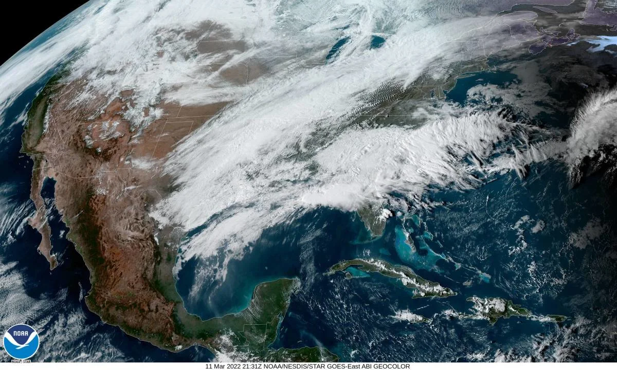
Impactful winter storm spans 3000+ kilometres

A mammoth winter storm pushing through Eastern Canada this weekend will leave a footprint of strong thunderstorms and snow from the American Southwest to Labrador, respectively.
The potent winter storm trekking across the East Coast will leave a sprawling footprint across the United States and Canada.
We’re likely to see a swath of snow measuring thousands of kilometres long by the end of the weekend, stretching from the deserts of Arizona to the bays of northern Labrador. Winter storm watches and warnings span the length of the storm’s predicted track.
GET THE LATEST: Batten down the hatches Atlantic Canada, major storm approaches
This system will rapidly intensify once it reaches the U.S. East Coast, intensifying to potentially record-setting levels by the time it reaches the Maritimes on Saturday. If current forecasts verify, this could be the most intense low-pressure system ever recorded in Canada during the month of March.
Watch the video above for more details on this sprawling late-season winter storm.
Thumbnail courtesy of NOAA/NESDIS.