Records shattered by heat in Ontario, but major cooldown on the horizon
Monthly records were set ablaze by the unusual October heat in Ontario, but it won't last for much longer as a significant pattern change will send temperatures plummeting and the summer clothing back into the closets this weekend
Several communities across Ontario saw see their warmest October days ever thanks to a large ridge of high pressure situated over the Great Lakes region.
The stubborn pattern has allowed us to see a very long stretch of abnormally warm conditions as we entered the first week of October, but don't get used to the heat. A change is around the corner, and it's going to feel like a shock to the system after what we've experienced.
DON'T MISS: Polar vortex to replace Canadian heat with chill, snow
Monday
Northern Ontario saw several monthly records broken for the month of October. A couple of places reached 30°C, such as Geraldton (30.0°C), Ont., with many other areas reaching into the high 20s.

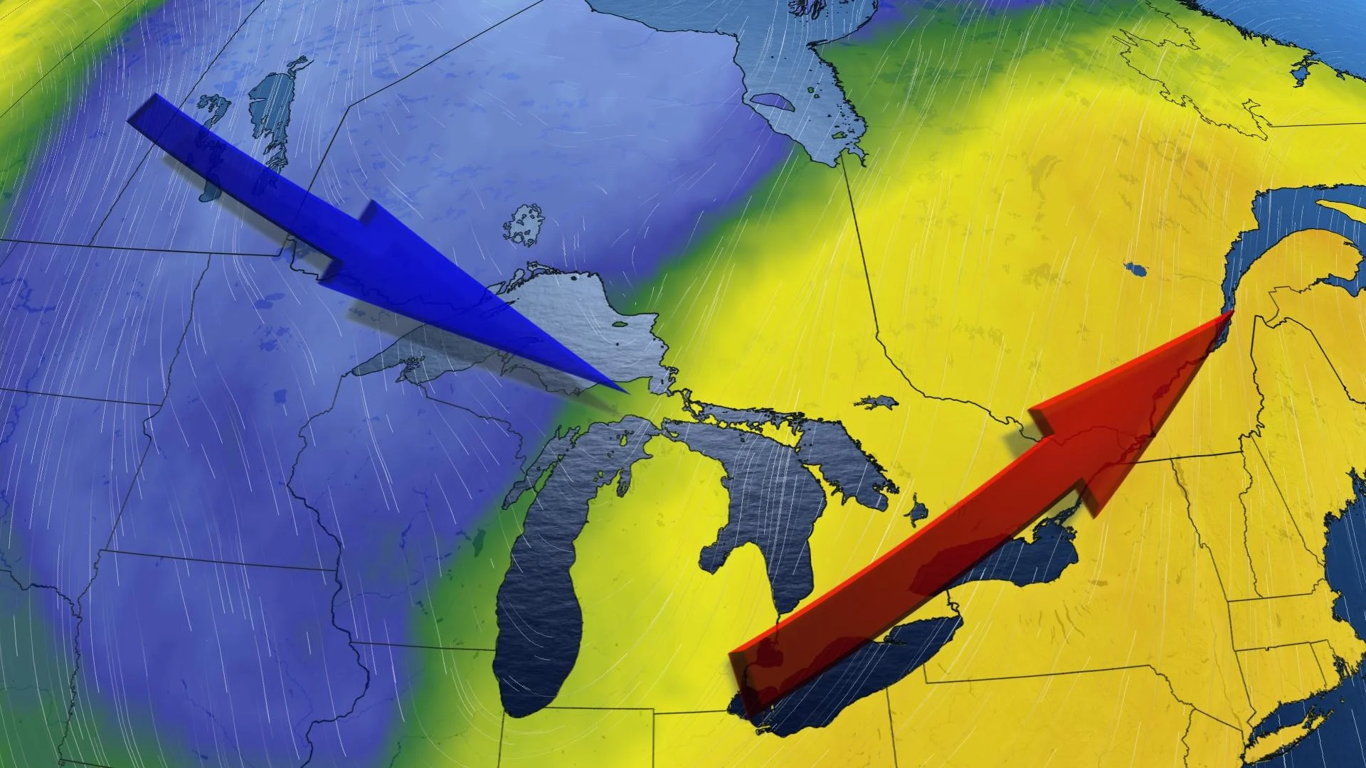
The recent flashback to summer that has been positioned over Ontario is courtesy of an atmospheric blocking pattern known as an Omega block.
Named for its resemblance to the Greek letter, Omega, this kind of blocking pattern sees a ridge of high pressure bookended by troughs on either side, essentially locking the ridge in place for days on end.
SEE ALSO: How a giant blockade over Canada will shatter October heat records
Tuesday
A pattern like this during the true heart of summer would bring a terribly dangerous stretch of excessive heat, but the idea of "seasonable" changes quickly this time of year.
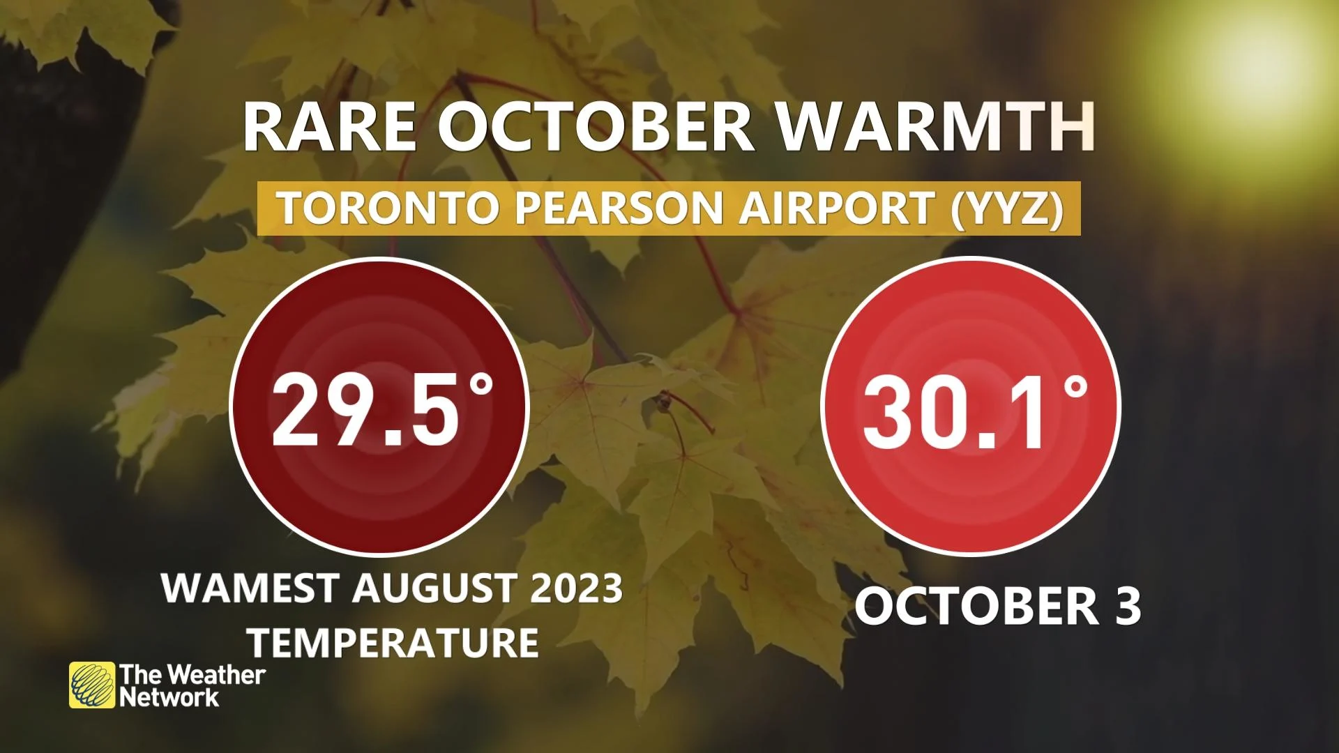
Warm temperatures moved southward, bringing 30°C temperatures to some areas. Pearson International Airport reached 30.1°C, making it the fourth-warmest October temperature on record. Ottawa reached 30.9°C, making it the warmest temperature recorded in October and the latest 30-degree day in the year in the city's history. It is also the only time it has hit 30°C in October.
DON'T MISS: October attempts to defy El Niño in Canada with atypical fall warmth
Wednesday
Areas: Eastern Ontario
Weather: After a record-breaking day on Tuesday for Ottawa, it has the chance to be just as warm or slightly warmer on Wednesday. Places like the Greater Toronto Area and southwestern Ontario will still be very warm for this time of year, but their peak temperatures occurred on Tuesday.

Visit our Complete Guide to Fall 2023 for an in-depth look at the Fall Forecast, tips to plan for it and much more!
Friday and beyond
Some sense of normalcy is en route and the warmth is on borrowed time. We’re going to see a major pattern flip toward more seasonable conditions by the end of the week and this Thanksgiving long weekend.
After recording-breaking temperatures early this week, the heat comes crashing down as colder temperatures move into the province Friday and into the holiday weekend. Shorts and T-shirts will be replaced by sweaters, pants and jackets, if going outside.

RELATED: From upper 20s to snow: Huge pattern flip looms for Central Canada
Find out what the rest of October has to offer in our October outlook.