
From upper 20s to snow: Huge pattern flip looms for Central Canada
We’ll plunge from mid-summer to mid-fall in a hurry as a major pattern change grips Central Canada in the days ahead
Conditions change fast in the heart of fall, and a looming pattern flip over Central Canada will feel even more dramatic as we lurch from record warmth to a sudden chill over just a few days.
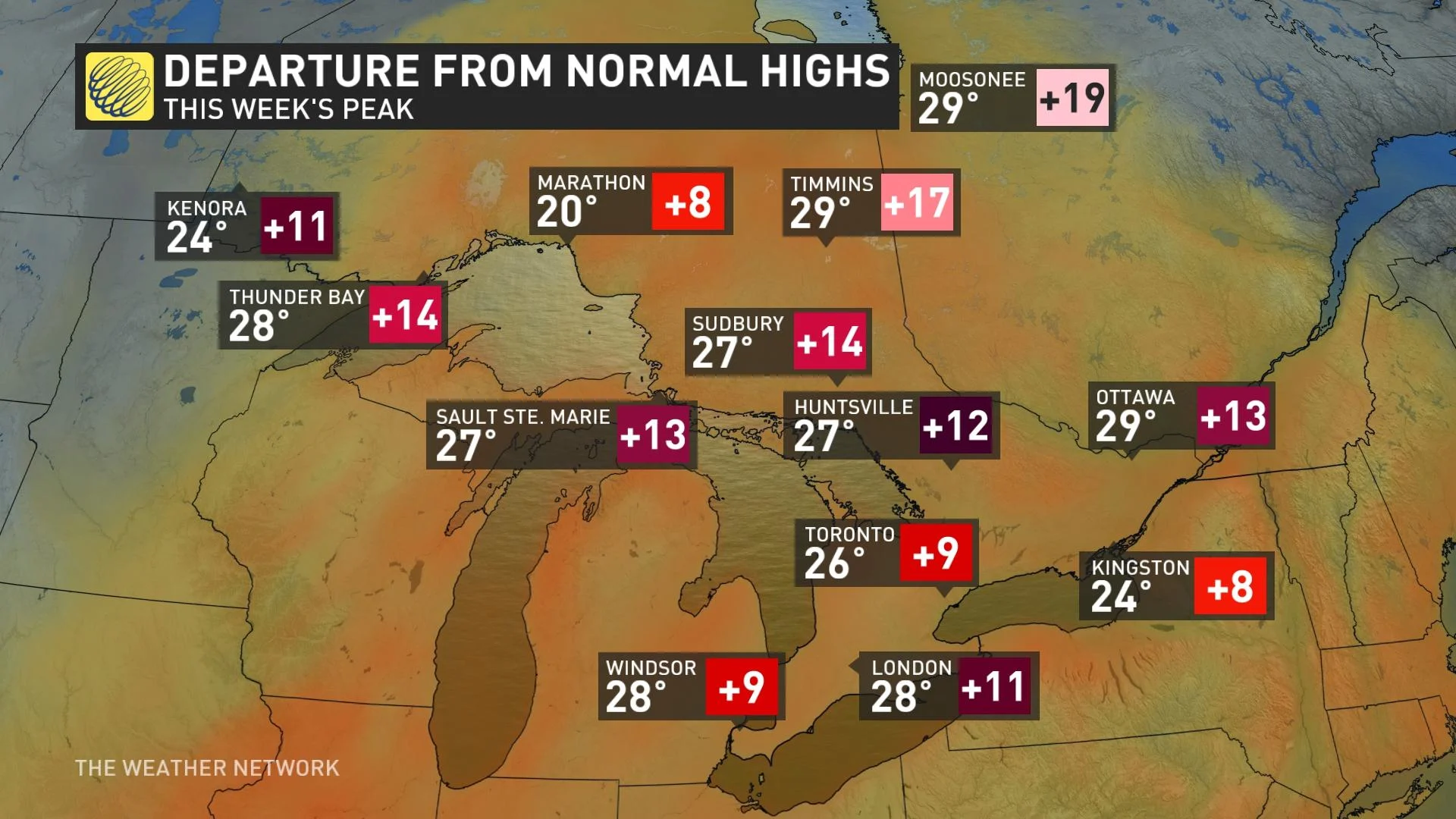
We’re starting October with a spell of summer-like heat blanketing a vast swath of Ontario, a stretch that promises to send daytime highs soaring 10 to even 20 degrees above seasonal for this time of year.
Visit our Complete Guide to Fall 2023 for an in-depth look at the Fall Forecast, tips to plan for it and much more!
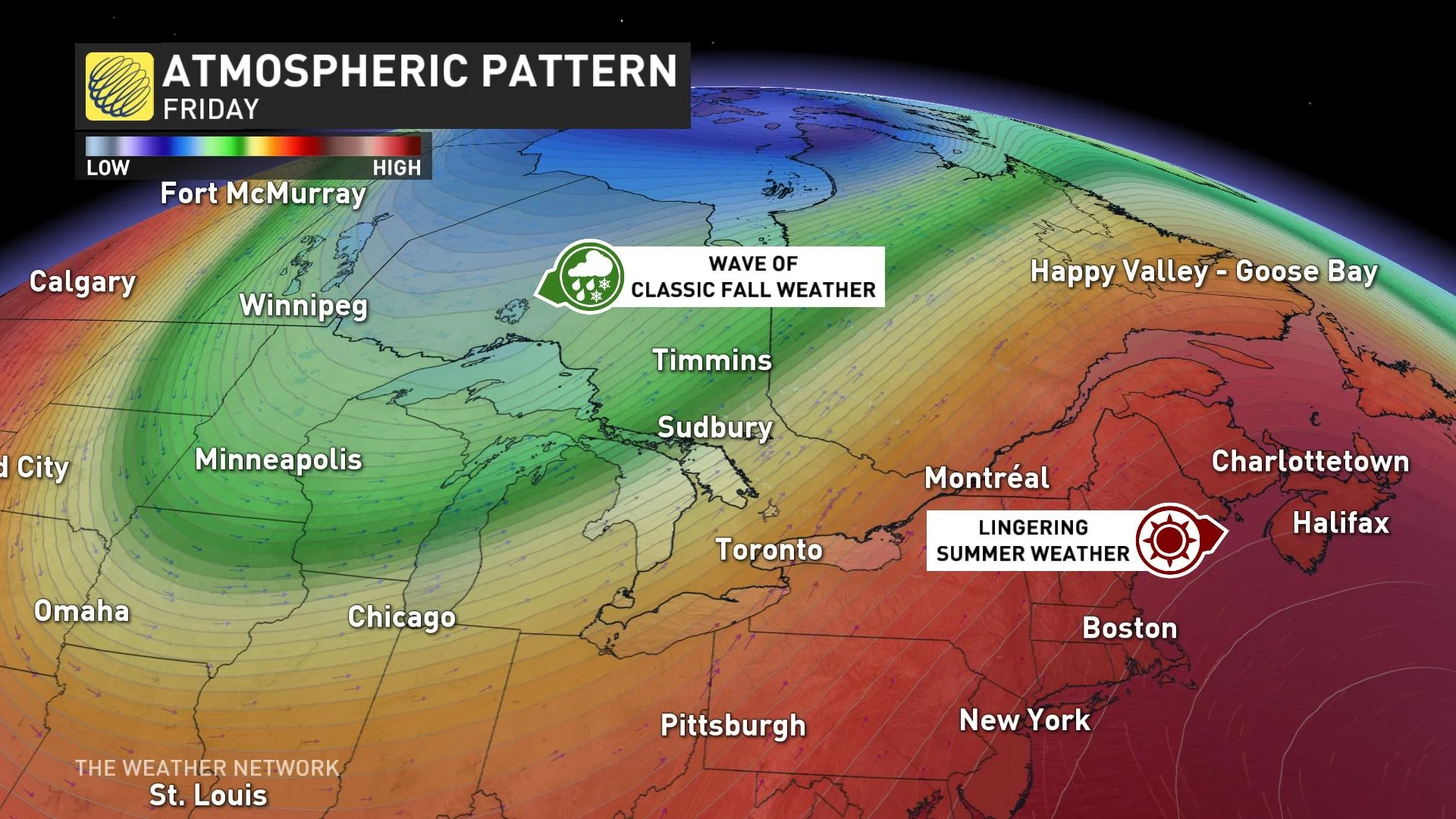
The atmospheric blockade fostering this unusual warmth will get punted out of the region stage-right by the end of the week, courtesy of a significant trough swinging down from Northern Canada.
SEE ALSO: How a giant blockade over Canada will shatter October heat records
This week’s spell of record-breaking warmth across Ontario will arrive beneath an Omega block, or a stubborn upper-level pattern that allows a ridge of high pressure to remain parked in place for days on end.
It’s not going to stick around forever, of course, and conditions are going to revert toward normal in a hurry by the end of the week.
YOUR OCTOBER OUTLOOK: October attempts to defy El Niño in Canada with atypical fall warmth
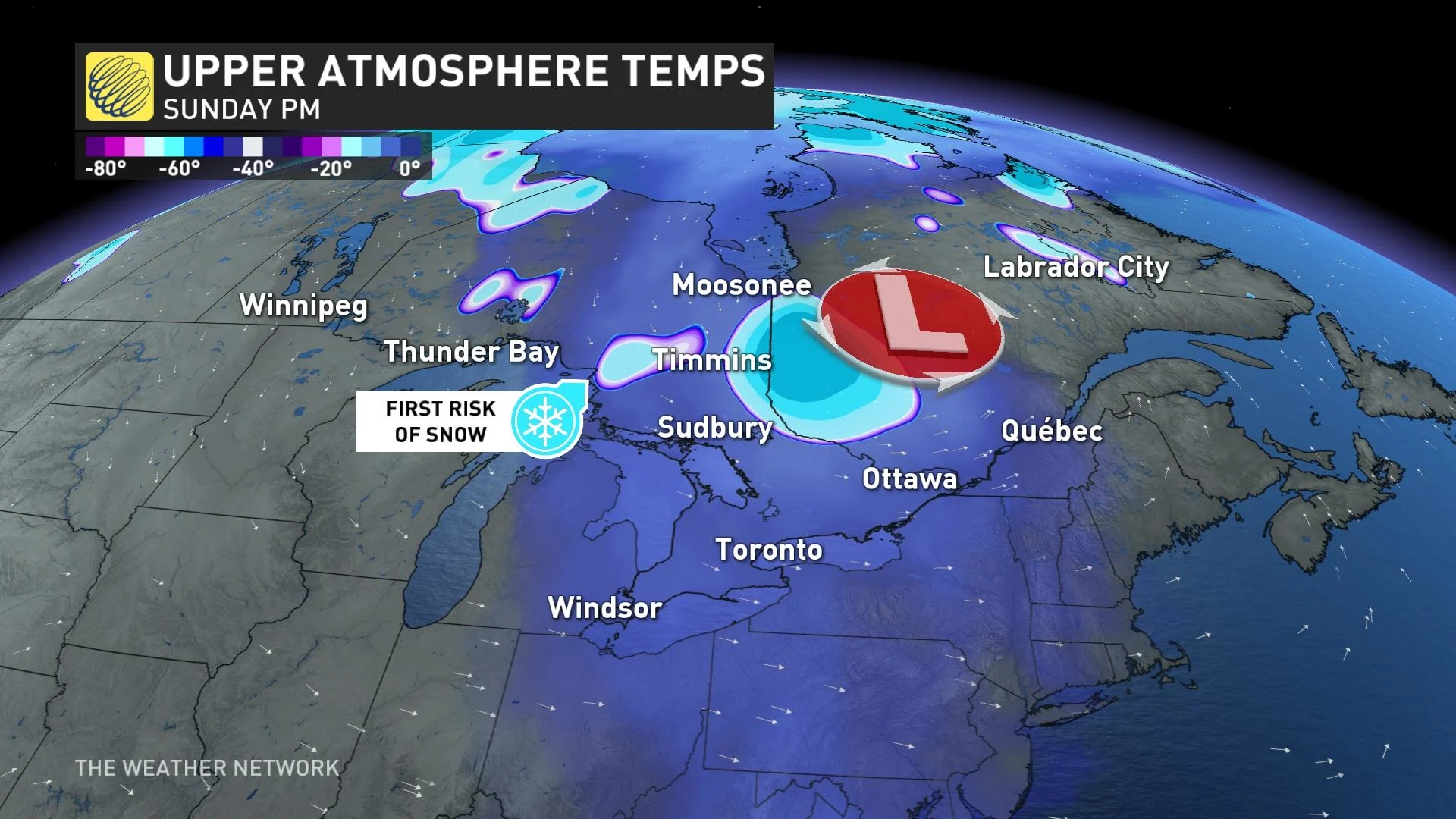
We’re watching the chance for a potent trough to dip out of Northern Canada by the end of the week and next weekend. This trough will drag a slug of much cooler air down with it, dislodging the unusual warmth and replacing it with air chilly enough to bring a chance for snow to some communities.
A remarkable temperature swing will push through many communities over the course of a few days.
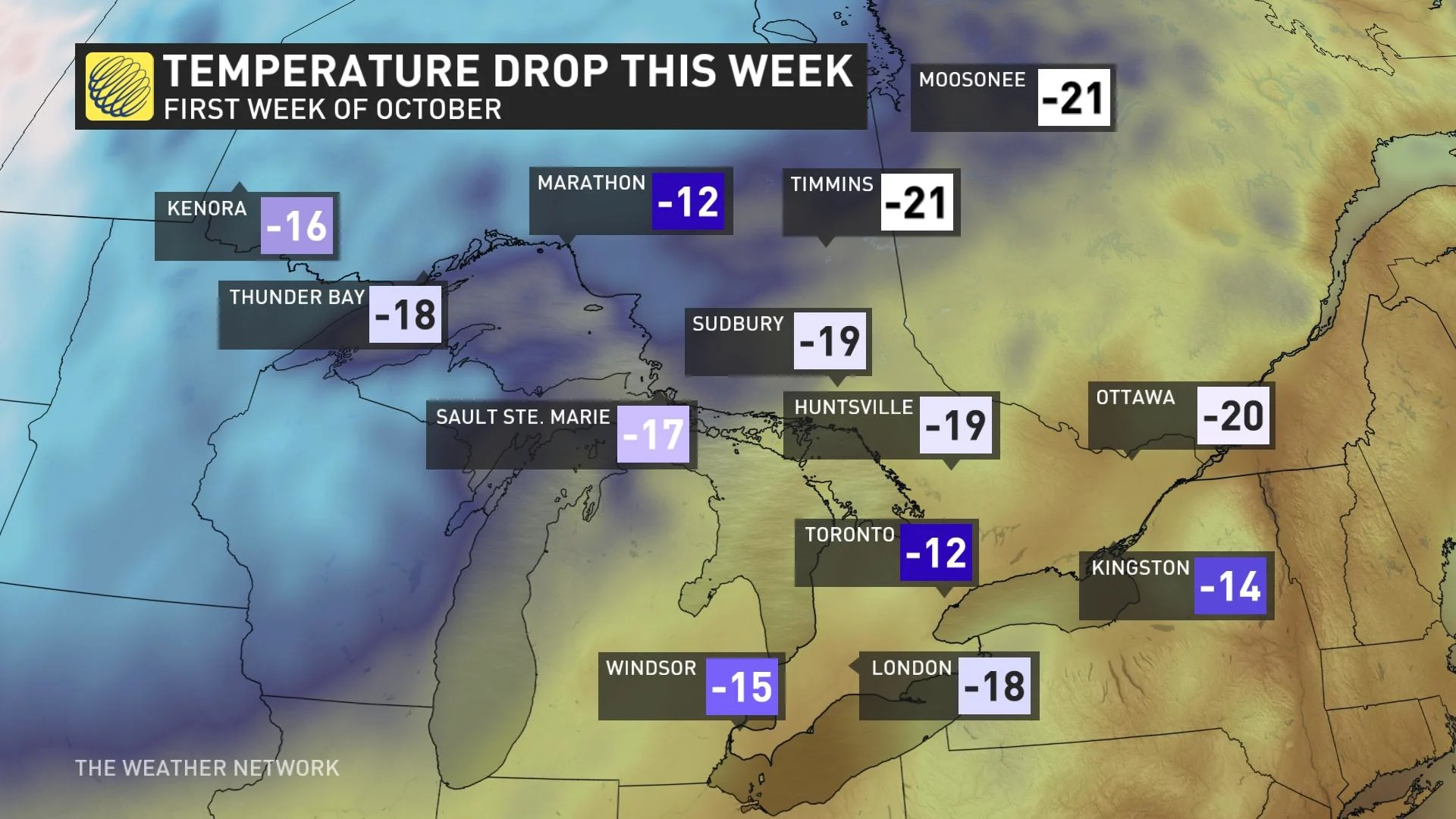
Moosonee could see its all-time warmest October day on record this week with a high temperature of 29°C. Behind the cold front, though, the community could drop into the upper single digits this weekend, making for a temperature swing of more than 20 degrees.
Steep drops are on the way for just about everyone else in Ontario, as well. Most of cottage country and eastern Ontario will see temperatures drop 15-20 degrees from their peak this week, with a more modest drop of ‘only’ 10-15 degrees on tap for southern Ontario and the Greater Toronto Area.
This return to more seasonable fall-like conditions will even bring a risk for snow to some areas, with northeastern Ontario possibly witnessing its first flakes of the season by next weekend.
Stay with The Weather Network for all the latest on these fast-changing conditions across Ontario.