
Record-breaking low pressure set to swirl across Eastern Canada

A rapidly developing system that will reach peak intensity near the Ontario-Quebec border early Monday morning has the potential to break low-pressure records for many areas
The ingredients are coming together to develop a sizable low for the middle of winter, but the problem is that it will be May.
The chilly upper trough remains situated over the Great Lakes region, as you may have already observed. This trough will merge with a Gulf of Mexico disturbance. When these two weather features phase, it will rapidly develop a new low-pressure system that will reach peak intensity near the Ontario-Quebec border early Monday morning.
SEE ALSO: Forecast could push Great Lakes water levels toward flood risk
When analyzing the pressure readings, the forecast pressure is significantly lower than an average barometer reading in May. For example, a pressure reading of 980 hPa is highly unusual for May in the Great Lakes region.
Here are current all-time low-pressure readings for May at some select Ontario and Quebec stations. Some of these records are likely to fall by Monday.

The cause
An unusually cold air mass across the U.S. Midwest is in the process of meeting up with Gulf moisture. A building ridge across Western Canada works to anchor in the upper trough, while warmer-than-average sea surface temperatures in the Gulf of Mexico brings up excess moisture.

Impact
A surface low of this magnitude will draw up significant moisture, so localized flooding is possible. The deeper area of low pressure means gusty winds are certain for southern Ontario.
There is even a risk of embedded thunderstorms across eastern Ontario Sunday night as the unstable air floods into the province.
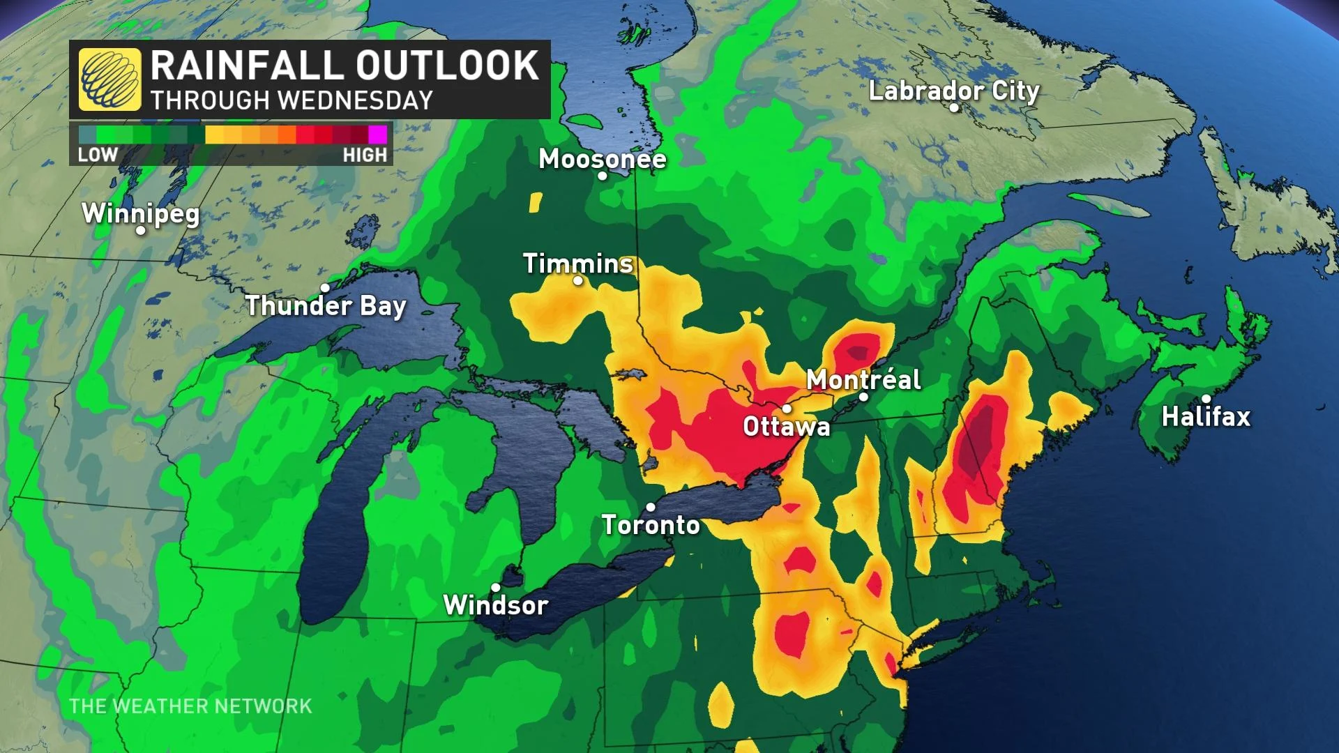
Lake levels and gusty winds are being monitored closely as this system approaches. Wind speeds of 40-60 km/h are expected along the north shores of lakes Erie and Ontario. Meanwhile, southern Quebec could encounter gusts as high as 90 km/h ahead of the approaching frontal system Sunday night.

Gusts nearing 80 km/h will accompany the northerly winds behind the low, mainly over Lake Superior. Additionally, the chilly, wraparound flow will increase the possibility of a wintry mix affecting southern Ontario's snowbelts by Monday evening.