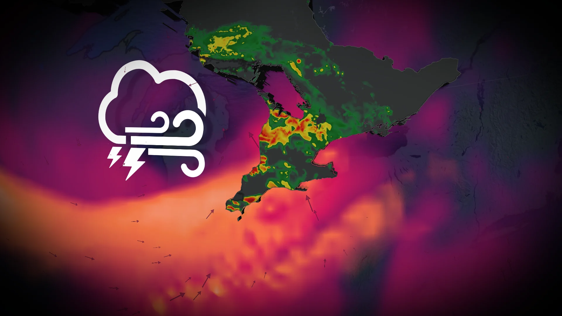
60+ mm: Severe storms threaten potential for torrential in Ontario
Heavy rain and thunderstorms could swiftly cause hazardous conditions throughout the region
Southern Ontario may be in for a hard stretch of weather as an exceptionally powerful June storm approaches the province, causing flooding rain, destructive winds and hazardous thunderstorms overnight Wednesday and Thursday.
The intensifying low-pressure system is forecast to deepen to 990 millibars or lower by Wednesday night, potentially challenging records near Windsor for the lowest June pressure ever recorded in the region.
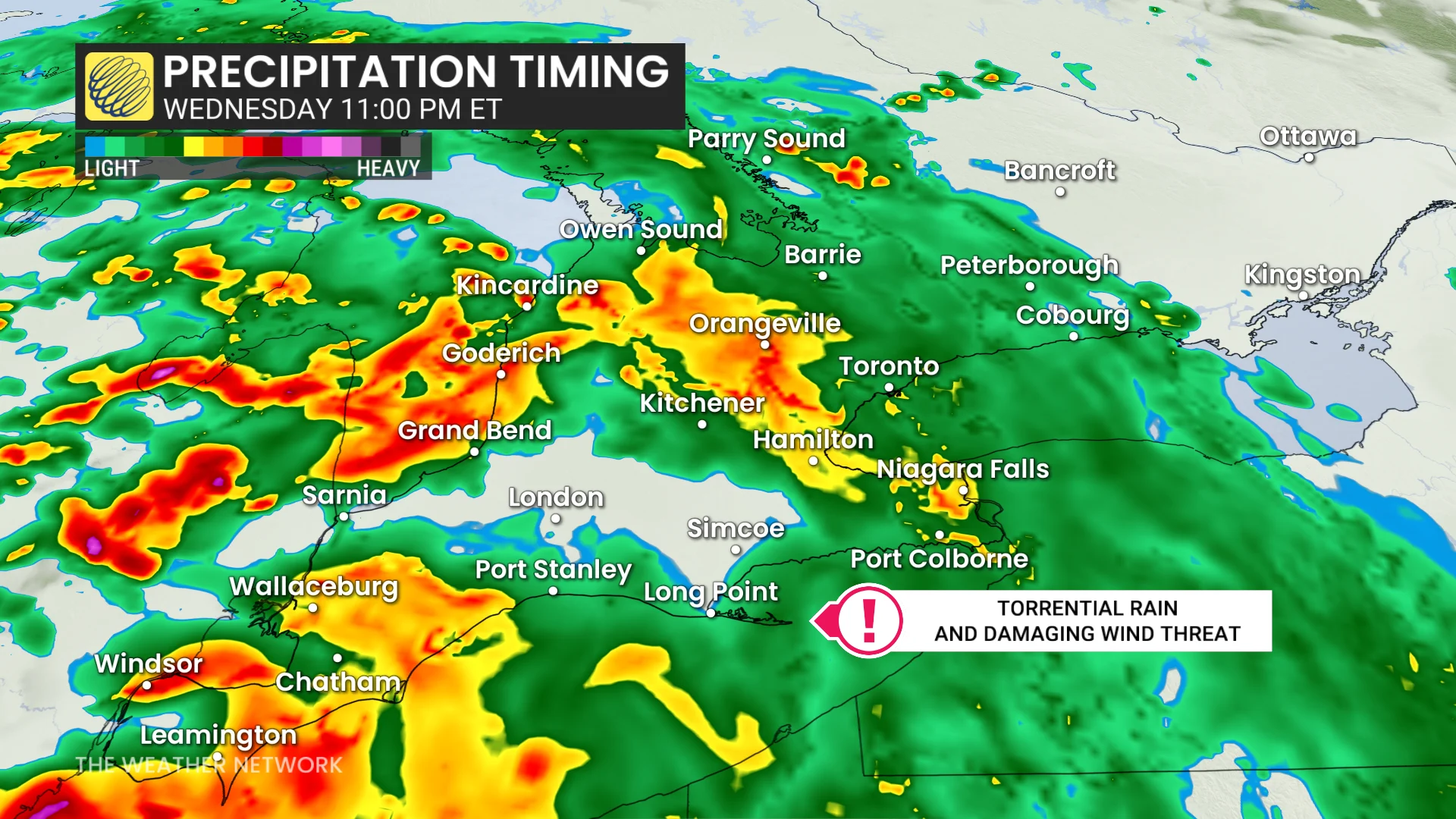
The first round of rain is projected to arrive Wednesday evening, with warm frontal showers developing throughout southwestern Ontario and along the Lake Huron shoreline before extending eastward into the Greater Toronto Area overnight.
RELATED: Exceptionally strong, and potentially record-breaking low set to hit Ontario
A soaking setup takes shape
As the storm moves into southern Ontario, it will draw into a rush of atmospheric moisture, resulting in heavy rainfall and embedded thunderstorms. The rainfall is expected to further intensify Wednesday overnight as a cold front approaches.
The most powerful storms could dump 50- 60+ mm of rain in some areas, raising fears about flooding in low-lying and poorly draining areas.
In addition to torrential rains, it's likely we'll see storms reach severe parameters as wind shear and spiralling updraft potentials become high to extreme. As such, forecasters cannot rule out the risk of an isolated tornado from the storms moving in from Michigan.
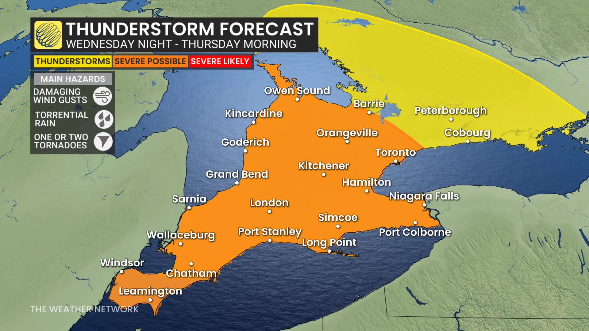
In fact, the same storm system is predicted to cause a severe weather outbreak south of the border, with areas of Illinois, Indiana and Ohio experiencing increased to moderate risks of severe thunderstorms.
June winds with a November punch
DON'T MISS: 5 astronomical events happening after we're gone
As the low swiftly strengthens, a strong, low-level jet stream is forecast to rush throughout the region, causing unusually violent gusts for this time of year.
Wind gusts of 80 to more than 90 km/h are predicted Wednesday night and early Thursday morning, before progressively decreasing later in the day. Conditions are predicted to continue blustery, with sustained west winds behind the leaving system.
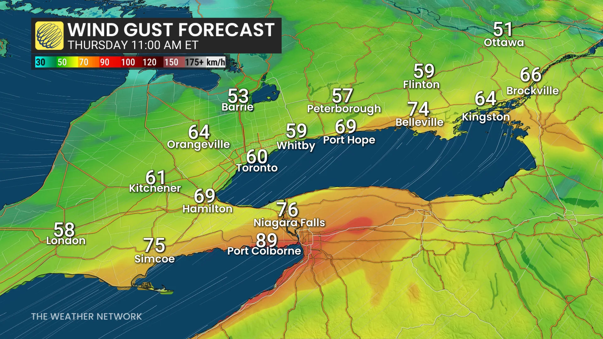
The highest gusts are expected along Lake Erie's shoreline and over the Niagara Peninsula, where some spots may temporarily approach 100 km/h, particularly in and around thunderstorms before sunrise Thursday.
For southern Ontario, it's a reminder that summer storms can be just as powerful as those associated with colder months and that this one may strike with little warning.
WATCH: What happens to your body if lightning strikes it
Stay with The Weather Network for the latest across Ontario