90+ km/h: Damaging wind and nocturnal severe storm risk in southern Ontario
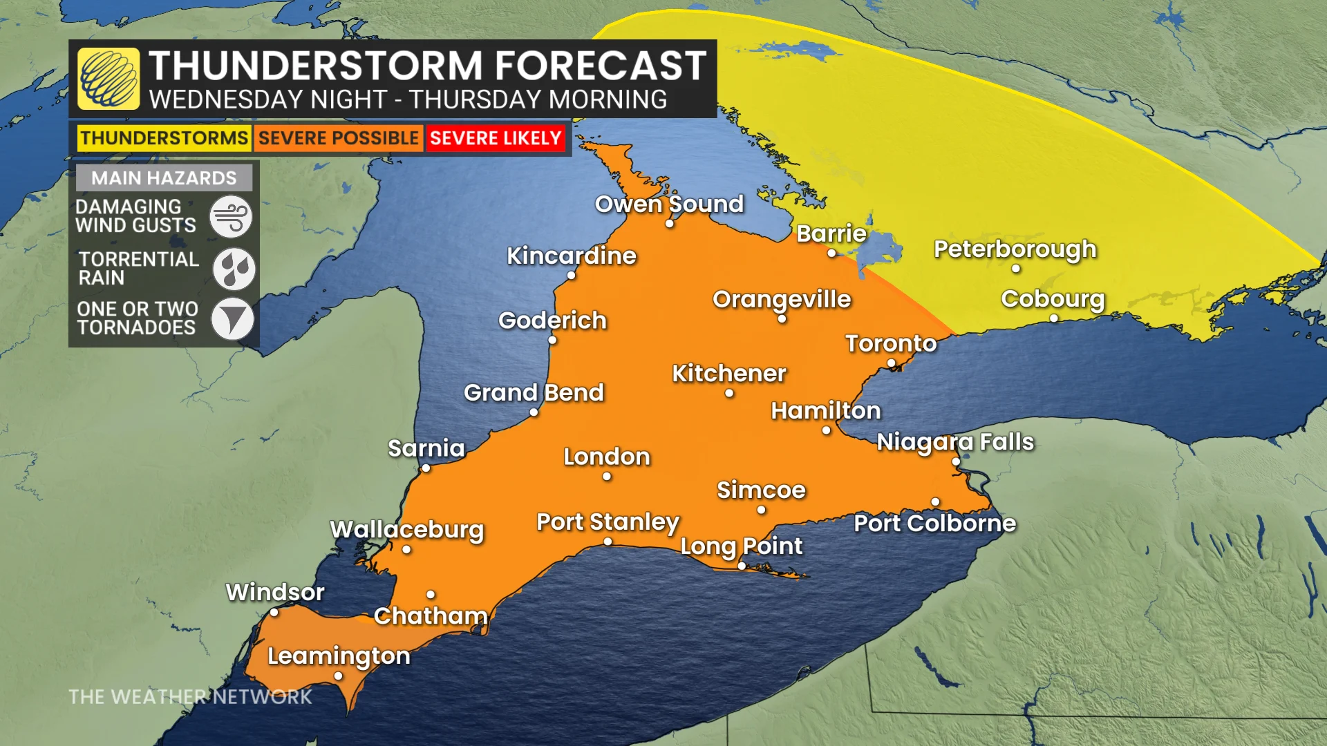
A nighttime thunderstorm risk, a potential for damaging winds (storm or no storm) and a low tornadic chance exist in parts of southern Ontario Wednesday night, possibly bringing hazardous conditions throughout the region
Southern Ontario may be in for a hard stretch of weather as an exceptionally powerful June storm approaches the province, causing flooding rain, destructive winds and hazardous thunderstorms from overnight Wednesday into Thursday morning.
Residents are advised to stay alert for severe weather watches and warnings Wednesday overnight, even after unwinding and turning in for the night.
RELATED: Exceptionally strong, and potentially record-breaking low set to hit Ontario
The intensifying low-pressure system is forecast to deepen to 990 millibars or lower by Wednesday night, potentially challenging records near Windsor for the lowest June pressure ever recorded in the region.
Severe storm, strong winds setup through Wednesday overnight
As the storm moves into southern Ontario, it will draw into a rush of atmospheric moisture, resulting in heavy rainfall and embedded thunderstorms. The rainfall is expected to further intensify Wednesday overnight as a cold front approaches.
The most powerful storms could dump 50- 60+ mm of rain in some areas, raising fears about flooding in low-lying and poorly draining areas.
In addition to torrential rains, it's likely we'll see storms reach severe parameters as wind shear and spiralling updraft potentials become high to extreme. As such, forecasters cannot rule out the risk of an isolated tornado from the storms moving in from Michigan.
DON'T MISS: 5 astronomical events happening after we're gone
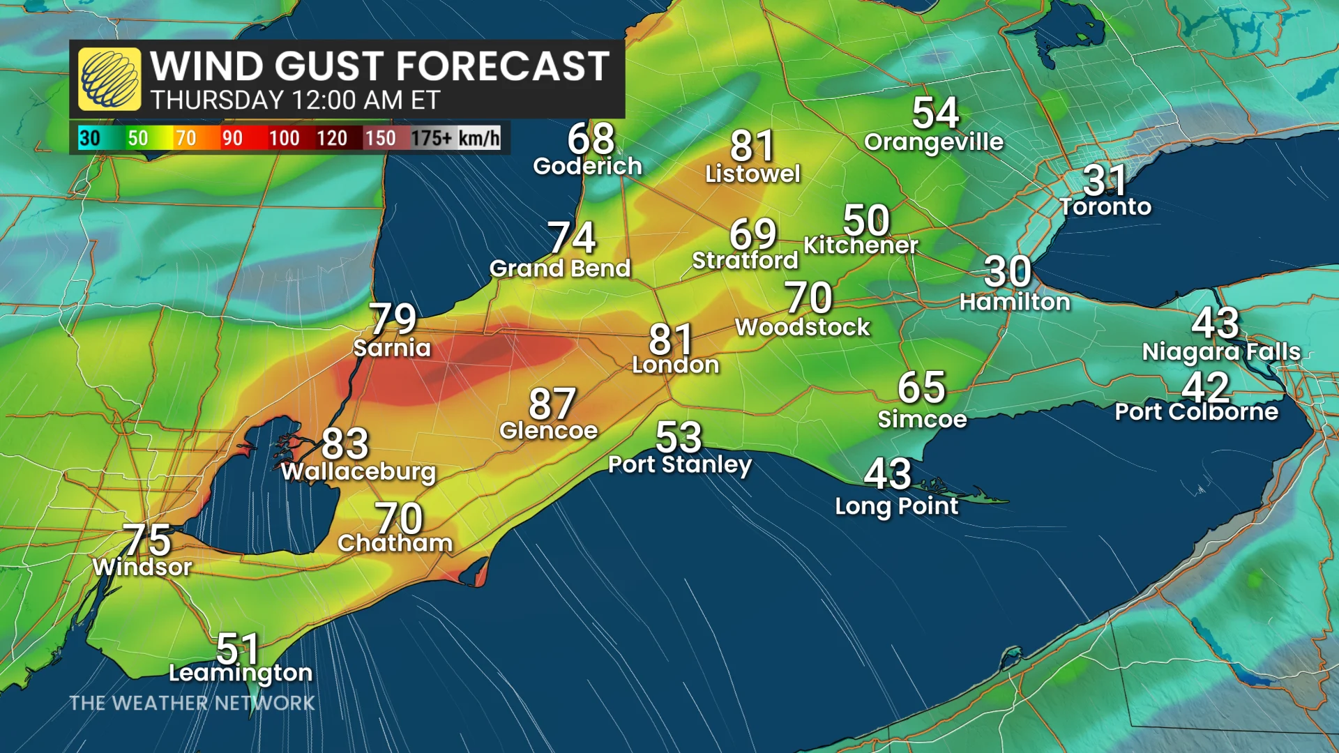
As the low swiftly strengthens, a strong, low-level jet stream is forecast to rush throughout the region, causing unusually violent gusts for this time of year.
Wind warnings have been issued for southwestern Ontario for these winds, with gale warnings on the American side of Lake Erie. The strongest gusts and waves will be pushed onto the Niagara shoreline.
Thursday morning thunderstorm and wind threat before subsiding
Wind gusts of 80 to more than 90 km/h are predicted Wednesday night and early Thursday morning, before progressively decreasing later in the day.
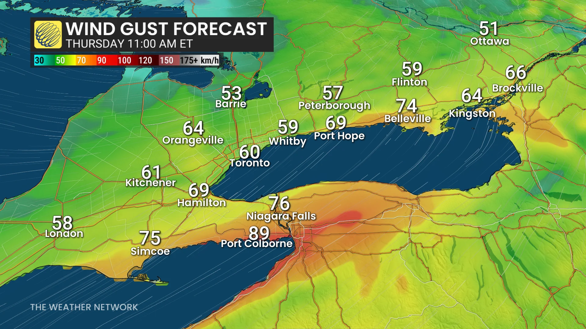
Conditions are predicted to continue blustery, with sustained west winds behind the leaving system.
The highest gusts are expected along Lake Erie's shoreline and over the Niagara Peninsula, where some spots may temporarily approach 100 km/h, particularly in and around thunderstorms before sunrise Thursday.
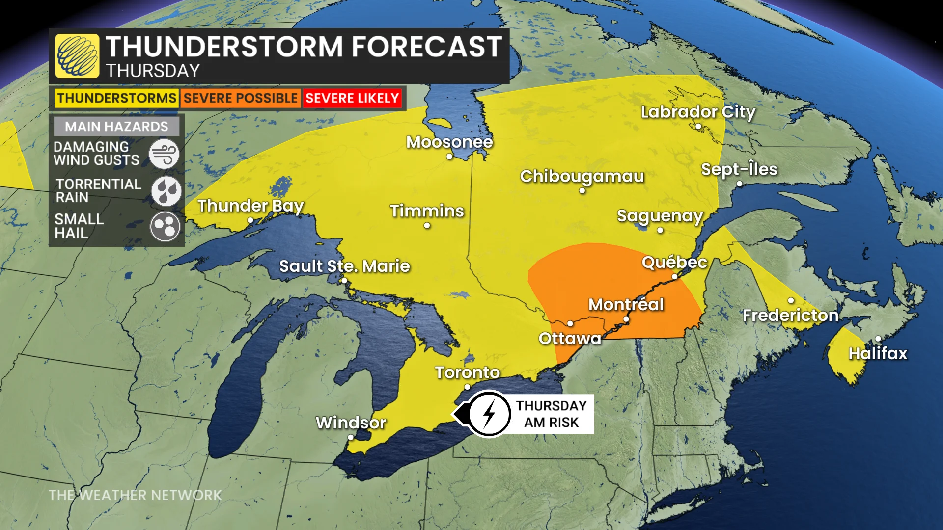
The thunderstorm threat for southwestern Ontario, the Greater Toronto Area (GTA), and much of central Ontario, will linger until late Thursday morning before improving through the afternoon.
WATCH: What happens to your body if lightning strikes it
Stay with The Weather Network for the latest across Ontario
Thumbnail courtesy of Unsplash.