Heavy snow, possible whiteouts continue in Newfoundland on Friday
Brace for a difficult travel day on Friday as heavy snow and winds blast through Newfoundland
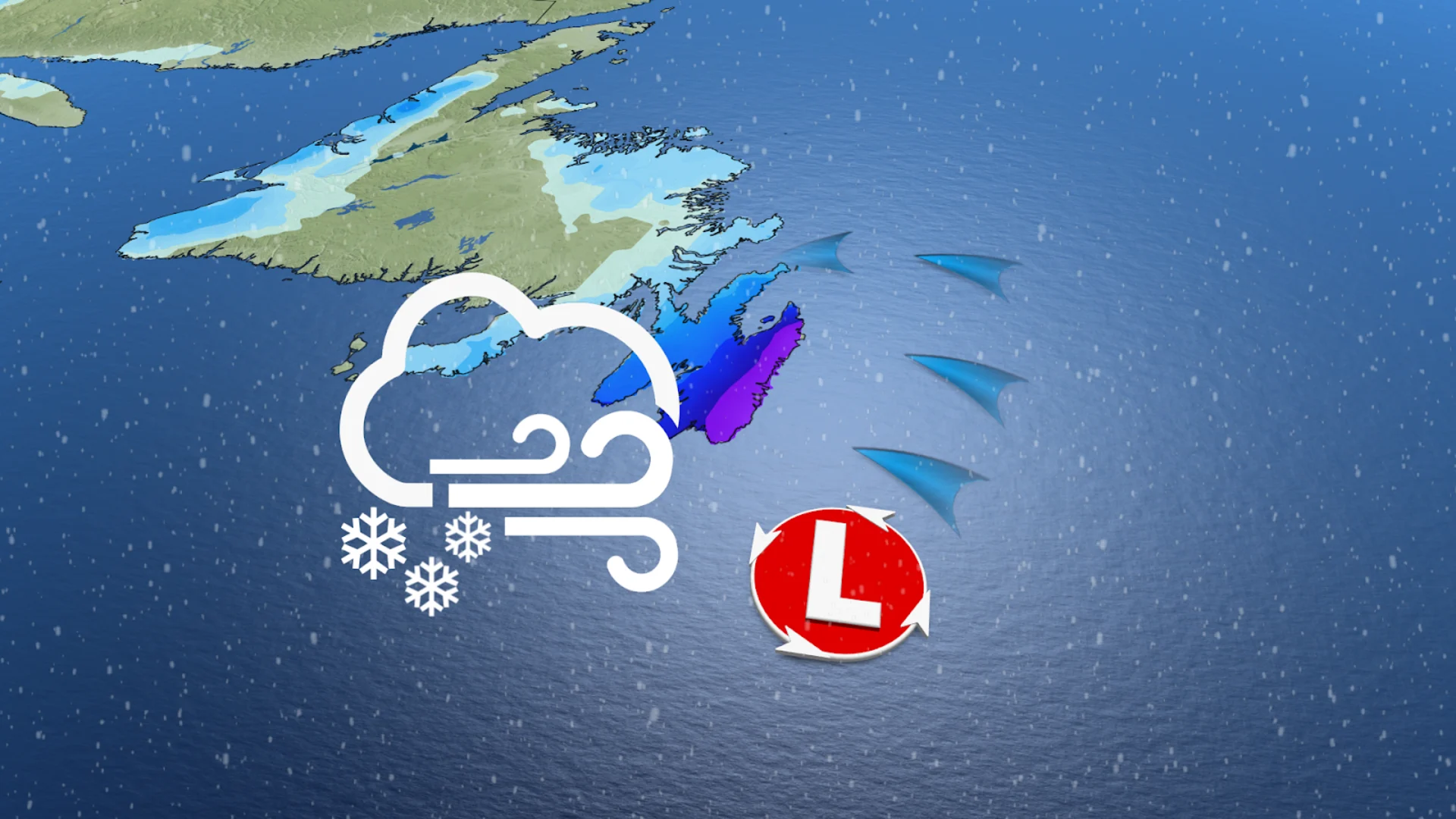
Winter storm warnings are in effect for a powerful system bringing heavy, blowing snow to Newfoundland's Avalon Peninsula.
The system intensified as it approached Atlantic Canada, tracking just south of Newfoundland on Friday. The system will travel through the region quickly, but will leave its mark, especially in southern portions of the province.

The storm underwent bombogenesis late Thursday and into Friday, peaking in strength south of Newfoundland. The lower the central pressure of a storm, and the faster the intensification, the stronger the winds it generates. The ultimate track will determine overall snowfall totals for the region, but at this point, it looks like 10-20 cm could fall including in St. John's.
DON’T MISS: Freezing rain and ice pellets are dangerous winter hazards
Make sure you stay up-to-date on your local weather alerts, and be sure to check the latest highway conditions before heading out.
Heavy snow threat for Newfoundland Friday
As the system strengthens south of Newfoundland, heavy snow and powerful winds will continue through the day on Friday. Luckily for the Avalon, the storm will only swipe along the side of the region. The track should remain at least 200 km offshore, but if it nudges northward, that could mean more snow for the Avalon.
RELATED: 'Weather bombs': Explosive storms that create ferocious conditions
Snow continued to spread northward across the Avalon throughout the morning, with heavier snowfall rates arriving through the afternoon. Although this snowfall event is not epic by Newfoundland's standards, the timing and gusty winds will create hazardous travel conditions throughout the day and into the evening on Friday.

Snowfall on the Avalon will range from 10-20 cm, from west to east, with St. John’s forecast to pick up near 15 cm through Friday. Peak snowfall rates will hit through the afternoon, before gradually easing late Friday night.

Although the strongest winds will remain offshore, coastal areas of the Avalon can expect gusts between 60-80 km/h Friday afternoon and night. The strongest winds 80-100 km/h are likely along the south coast of the Avalon.
Sustained winds over 40 km/h, combined with the freshly fallen snow, will create hazardous travel, and perhaps even blizzard-like conditions. Similar storms in the past have caused hazardous driving conditions and the cancellation of scheduled activities, according to the winter storm warning from Environment and Climate Change Canada (ECCC).
After a sluggish start to winter, February has been trying to bring St. John’s snowfall up to "normal."
As of Feb. 18, 86.6 cm of snow has fallen this month––more than the 72.2 cm that fell from October 2024 to January 2025 combined.

Stay with The Weather Network for all the latest on the snow scenario unfolding for Newfoundland.