'Weather bombs': Explosive storms that create ferocious conditions

Most storms come and go without much fanfare. But some of these systems become bomb cyclones and swirl their way into the history books.
Winter storms are a part of life in Canada. Some storms are so strong and disruptive, though, that it’s hard to just brush them off.
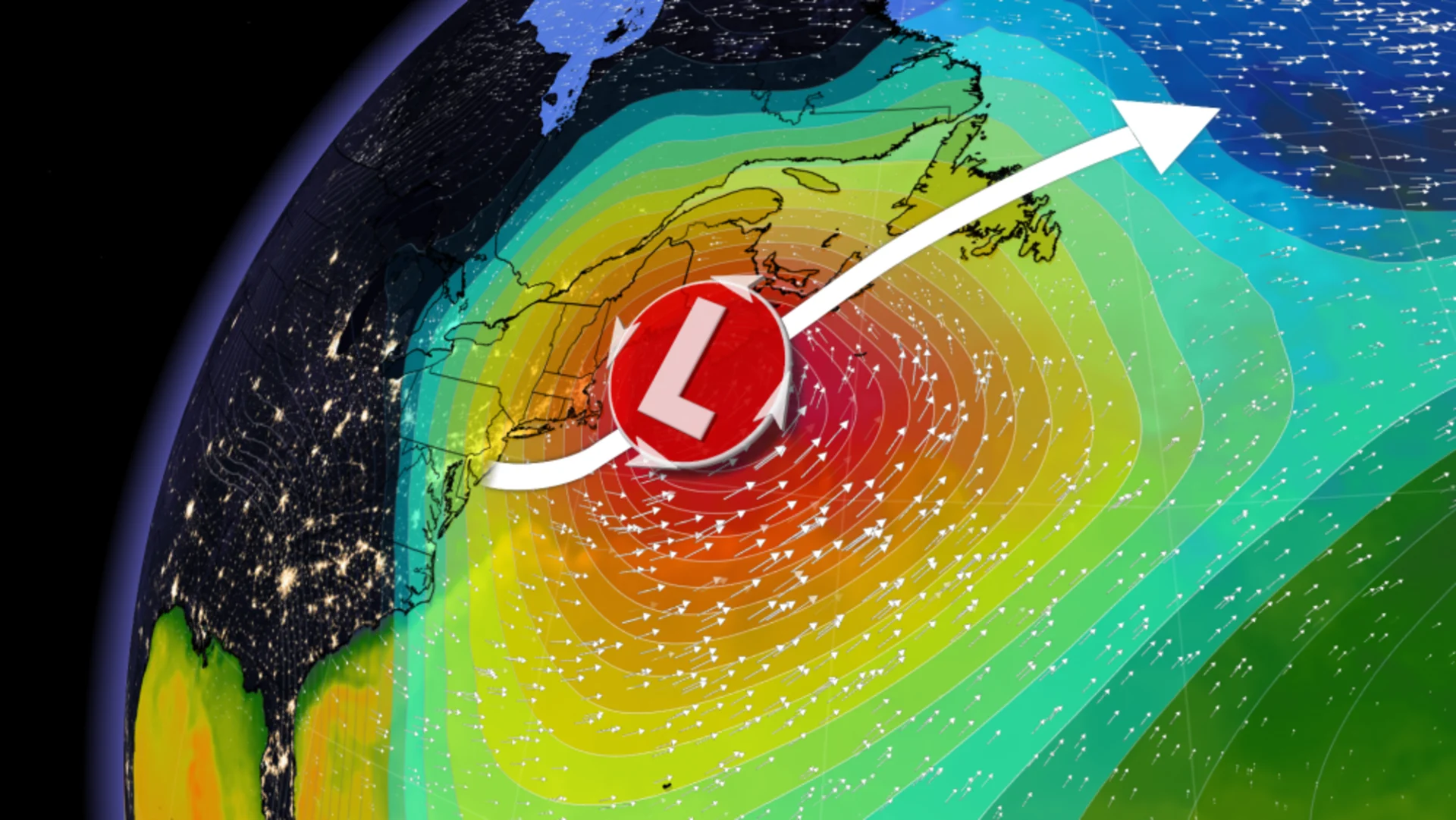
The heart of winter is prime season for 'weather bombs'. These intense storms often race up the East Coast and bury the Maritimes in a sea of wind-driven snow. It takes powerful forces to upgrade a humdrum winter storm into a bomb cyclone.
DON’T MISS: How jet streams can fuel some of the most powerful storms
Jet streams strengthen storms in a hurry
A jet stream is a powerful ribbon of upper-level winds that forms around the cruising altitude for passenger jets. Winds routinely scream through the jet stream at more than 200 km/h. It’s hard to believe that these fast winds many kilometres above the ground can so deeply affect the weather here at the surface, but it’s a major driver behind our daily conditions.
These winds diverge and converge as they twist and turn their way through the jet stream. When these fast winds diverge or spread out, air from the surface has to rush upward to fill in the void. As the jet stream strengthens and that divergence intensifies, the amount of air that gets sucked upward from the surface increases, leaving less air and a centre of low pressure at the surface.
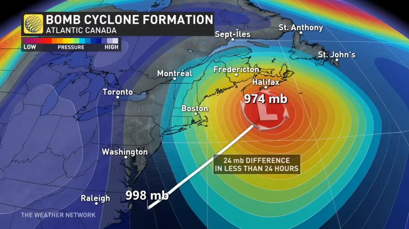
The phrases ‘weather bomb’ and ‘bomb cyclone’ stem from the term bombogenesis, or the rapid intensification of a low-pressure system in a short period of time. Meteorologists use different metrics to measure bombogenesis, but the most widely used criteria is when a low’s minimum pressure falls 24 mb in 24 hours.
Bombs away on the coasts
We typically talk about bomb cyclones when nor’easters are in the forecast. The warmer waters of the Atlantic Ocean can lend low-pressure systems a boost as they track up the eastern seaboard, combining with the jet stream to allow these storms to dramatically intensify in just a couple of hours.
RELATED: What is the polar vortex? How it’s responsible for dangerous cold
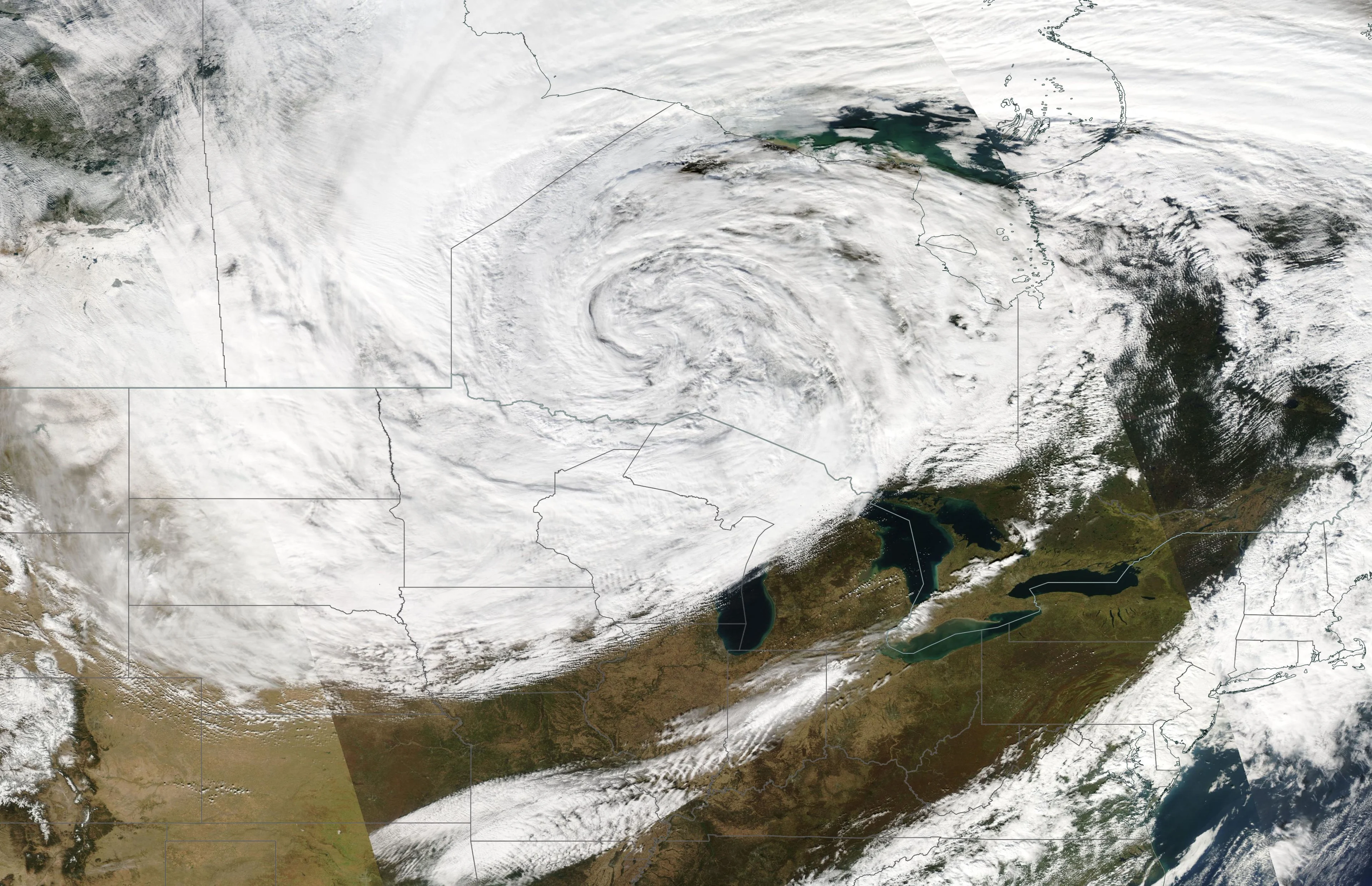
A visible satellite image of a particularly intense bomb cyclone that swirled into northern Ontario on October 27, 2010. (NASA Worldview)
Bomb cyclones are also common in the northern Pacific, as folks in British Columbia know first-hand, as well as on the Prairies. A particularly intense storm in October 2010 entered northwestern Ontario with a minimum central pressure equivalent to that of a strong hurricane.
Bomb cyclones can lead to major disruptions
What’s so special about a bomb cyclone? A rapidly intensifying low-pressure system has a greater opportunity to produce fouler weather for folks in the storm’s path. If a storm bombs out as it approaches the Maritimes, for instance, the region could be in for a rough ride.
A tight pressure gradient between the centre of the storm and the environment around it can lead to howling winds capable of producing damage, power outages, and coastal storm surges. Communities that ride out a weather bomb often compare the system to a hurricane for its ferocious winds.
Intense dynamics within the storm can force air in the middle and upper levels of the atmosphere to stretch and spread out. This stretching causes air to rise rapidly, creating bands of snow so intense that they can even produce thunder. The combination of ripping snowfall and blustery winds can lead to blizzard conditions.