Winter storm may ensure white Christmas for parts of the East Coast

Parts of Atlantic Canada will receive a hefty dose of snowfall and heavy rain as an early Christmas present this week, thanks to a potent storm that will march through, prompting widespread special weather statements.
For many in Atlantic Canada, it's beginning to look like it will be a white Christmas after what lies ahead. A significant winter storm is in the works, with a developing low looking to merge with a clipper to bring quite a snowy punch for some, beginning Wednesday. Travellers in northern New Brunswick, eastern Nova Scotia and a good chunk of Newfoundland will need to be plan ahead as there could be a swath of 10-20+ cm of snow for these regions, though there is still uncertainty in the final track and accumulations with this system that will ensure a white Christmas for many areas after it is finished with the region. The region will also be contending with howling winds Thursday, with Newfoundland potentially seeing gusts of 90-100 km/h. More on the timing and impacts with this pre-holiday storm, below.
Visit our Complete Guide to Winter 2022 for an in-depth look at the Winter Forecast, tips to plan for it, and much more!
MID-WEEK: STRONG WINTER STORM PUSHES ACROSS ATLANTIC CANADA, IMPACT TO TRAVEL LIKELY
A potent winter storm will soon enter the picture for Atlantic Canada, potentially guaranteeing a white Christmas for portions of the region. The scenario comes courtesy of a developing low-pressure system in the Gulf of Mexico that will join forces with a clipper to deliver a significant winter wallop, starting Wednesday and persisting through Thursday.
As a result, drivers are being warned now to expect major impacts to travel, as this mid-week storm threatens 10-20+ cm of snow over parts of the Maritimes and Newfoundland.
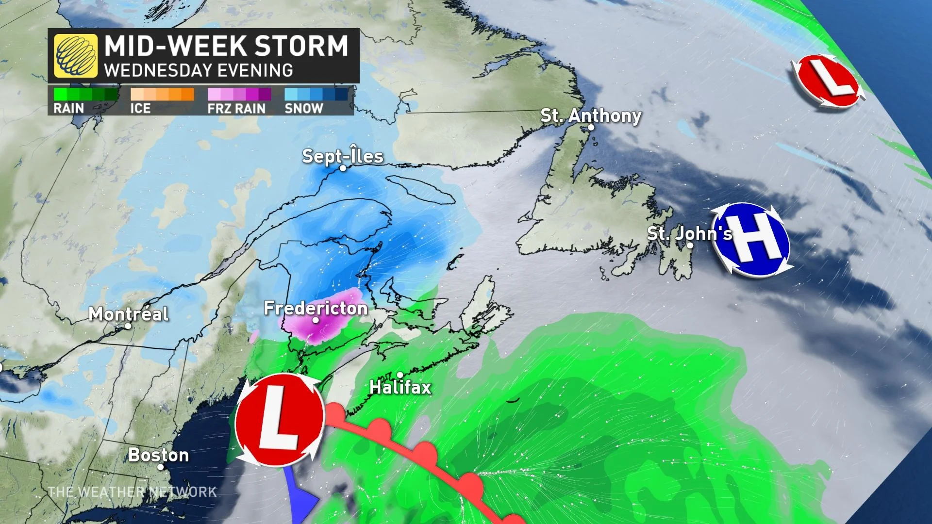
The precipitation will arrive Wednesday afternoon for New Brunswick, P.E.I. and Nova Scotia.
In the latter, precipitation may begin as a brief period of snow or freezing rain before changing to rain Wednesday evening over parts of the northern mainland and Cape Breton. Rain may switch to a period of heavy wet snow for a time before ending Thursday morning in some areas making travel difficult.
Where the line of ice develops will be dependent on how far north the system tracks, as well as how much cold air is present.
MUST SEE: Canada's 2021 Holiday Snow Report
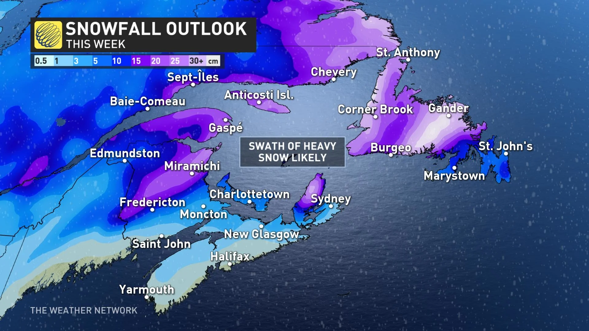
As for snowfall, current indications are that areas of central and eastern New Brunswick are most at risk to receive the highest amounts with this storm system. Snowfall accumulations may be limited in southern regions by a change to freezing rain or rain.
Special weather statements span the entire Atlantic Canada region in advance of the system, cautioning of the heavy snow associated with it and the hazarous driving conditions it could lead to.
"Motorists should expect potentially hazardous winter driving conditions during this time period and adjust travel plans accordingly," says Environment and Climate Change Canada in the statement.
The snow will gradually ease for the Maritimes Thursday morning.
"While confidence is high that a significant swath of snow is forecast to blanket parts of Atlantic Canada mid-week, confidence is low in the exact location of the heaviest snow," Sonnenburg adds. "Early forecast models suggest a swath of 10-20+ cm of snow is likely, but be sure to check back as we continue to fine-tune the forecast."
The storm is forecast to reach Newfoundland Wednesday overnight but due to its uncertain track at this time, it is too soon to determine how much of each type of precipitation will occur over any particular area. Nevertheless, the combination of precipitation types will likely make the day unfavourable for travel across a large swath of the island.
As well, the system will bring widespread blustery winds to Atlantic Canada. The Maritimes could see 60-70+ km/h gusts as it departs Thursday morning, but the windiest conditons will be found in Newfoundland that day, with gusts of 90-100 km/h at times.
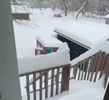
Thumbnail courtesy of Barbara Smith, taken in Fredericton, N.B.


