
Canada's 2021 Holiday Snow Report

For much of the country, snow on the ground on December 25th is almost a guarantee, but for millions of Canadians, it looks like it'll be down to the wire.
We're near enough to December 25th that your thoughts may be turning to whether or not there'll be snow on the ground when you open your curtains.
This year, the majority of Canada is likely to see a white Christmas, but for a third of the population, whether it's a white or green Christmas will come right down to the wire, and depend on how some particular details shape up in the leadup to the day.
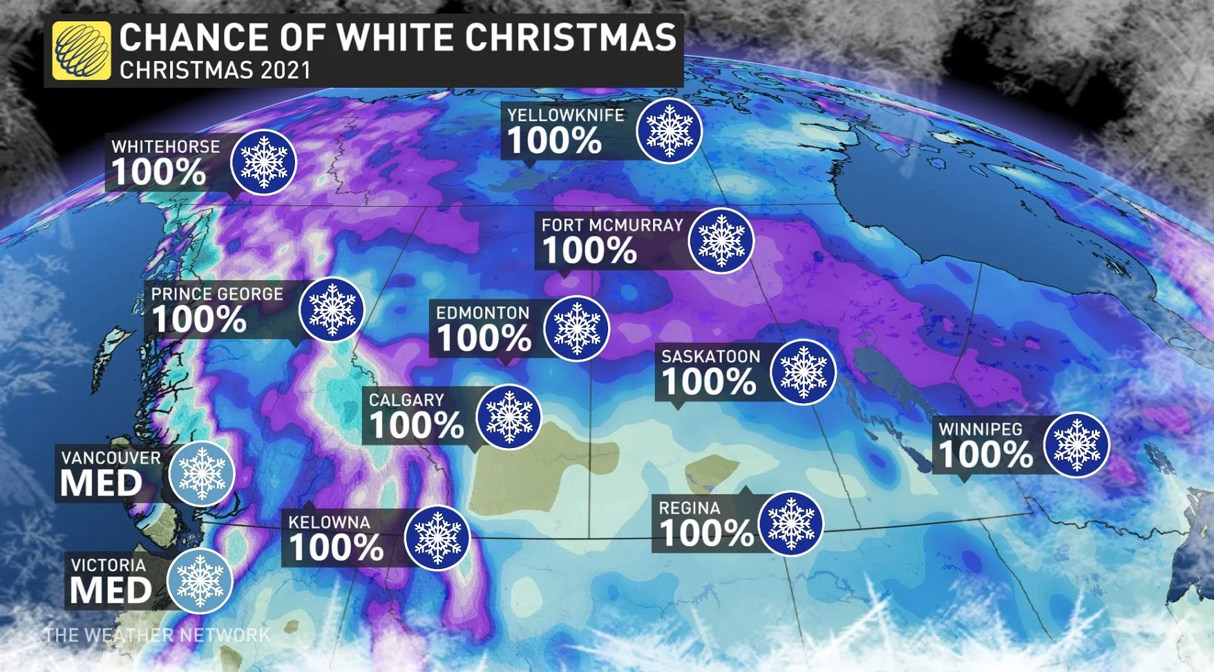
Presently, we can say with certainty that western Canada will be in the grips of a frigid pattern through Christmas with the potential for one of the coldest Christmases on record for part of B.C. and Alberta, including Vancouver and Edmonton.
With the Arctic air arriving in time for Christmas, the odds of a white Christmas are actually much higher than normal for the south coast of B.C., including Vancouver and Victoria. They key will be the exact timing and track of a system that is expected to bring a mix of rain and wet snow all the way to sea level during Christmas Eve with the precipitation changing to snow before ending on Christmas. The province's chances for a white Christmas jump with elevation and distance from the coast.
Beyond the Rockies, frigid temperatures mean that places that have snow will hold on to it through Christmas, and many add to their snowpack before Christmas.
Snow cover is relatively sparse across the more southern reaches of Alberta and Saskatchewan, but a weak system should act as a top-up between now and December 25th.
Further east, a white Christmas is likely across northern and eastern Ontario and across Quebec. Meanwhile, southwestern Ontario and areas near Lake Erie will see a green Christmas. For areas that are in between, including the Greater Toronto area, a white vs. green Christmas will come down to the wire. A fresh coating of snow is likely Thursday evening, but milder temperatures are likely on Friday and rain is expected Friday night. Therefore, most places that do not have a significant snowpack in place will lose it by Christmas morning.
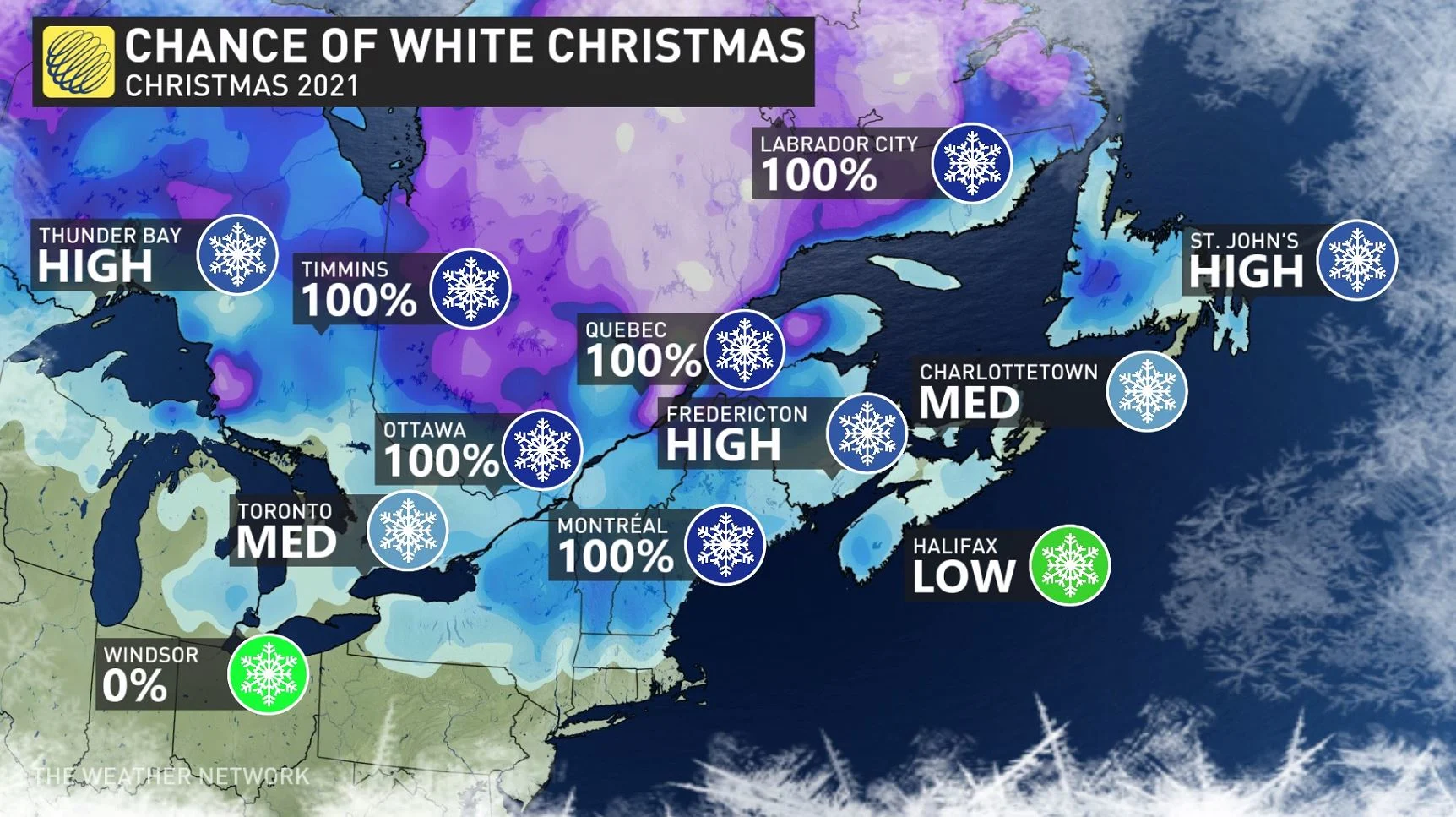
In Atlantic Canada, a major storm will impact the region before Christmas Eve. Widespread rain for southern parts of the Maritimes will wash away any dreams of a white Christmas. However, snow and ice for northern parts of the region will lock in a white Christmas for those regions. Most of Newfoundland should see a white Christmas due to the snow that is already on the ground and the additional snow and ice that is expected leading up to the 25th.
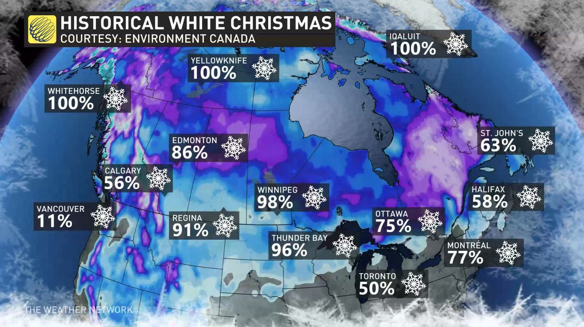
In all, however, we should say that while some areas feature a higher than average probability of a white Christmas this year, the country-wide Holiday Snow Forecast looks quite similar to historical trends (with the exception of the south coast of B.C.
With files from Daniel Martins and Doug Gillham.
Check back as we continue to monitor the forecast over the coming week.