Polar vortex could bring historically cold temperatures to Ontario

There is high confidence that Ontario will see temperatures well below seasonal since some of the most extreme temperature anomalies on Earth will soon move into this region.
Hot on the heels of our first 20°C of the season for many communities across Canada, the chilliest air relative to normal around the globe is set to swirl across Ontario by Friday.
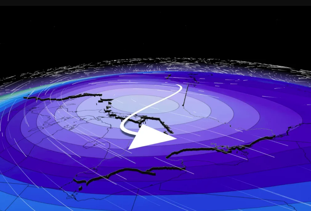
The patch of purple below shows temperatures nearly 20 degrees below seasonal aloft, and no other anomaly around the world will come close to this on Friday.

The polar vortex has remained in exceptional form over the past few months, and as you're reading this, the core of the polar vortex (tropopause) is streaking across Nunavut, roughly 4,000 kilometres away.
Much of the winter pattern in 2020 featured an intense polar vortex at high latitudes, even causing a temporary depletion of ozone, but it's a bit of a paradox – it remained unperturbed while most of North America basked in relatively warm temperatures.
SEE ALSO: 2020 is on track to be Earth’s warmest year on record
More recently, the atmosphere has featured much more mid-latitude blocking, which are the weather patterns that disrupt the typical westerly flow. The mid-latitude blocking will be the trigger that will send this extreme temperature anomaly on a collision course with Ontario.
For those yearning for balmy spring temperatures, unfortunately I can confirm that there is high confidence in the forecast for these below seasonal temperatures in Ontario. The magnitude of the cold air is also looking to be an exceptional outlier, much like the cold air mass that the region saw in April.
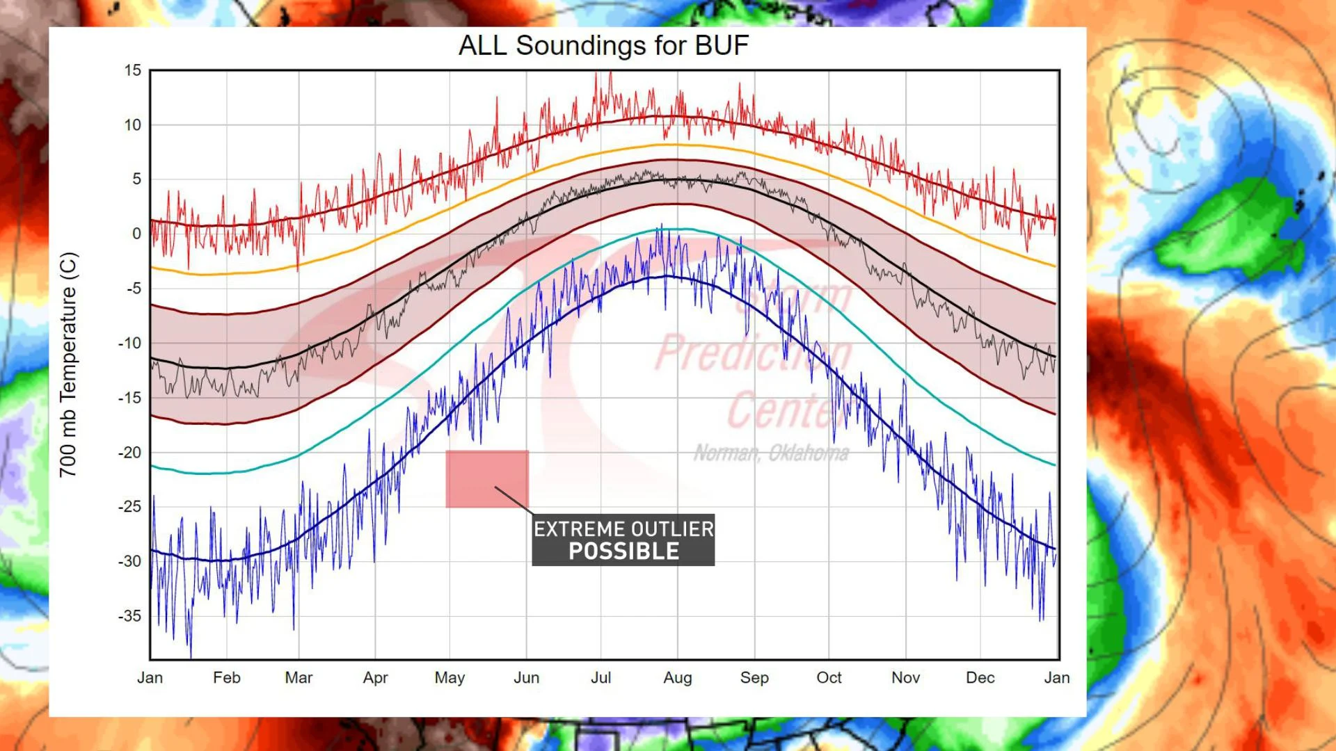
The blue line in the chart above traces the minimum temperatures recorded by thousands of weather balloons a few kilometres above Earth's surface. The red box is the projected temperature by this weekend, which falls well outside the climate record.
POTENTIAL FOR RECORD-BREAKING COLD
Back on April 22nd, a Buffalo weather balloon captured a profoundly cold late-season trough and recorded -20°C at 3000 metres elevation, which is the latest on record. But here's the thing. We might just break that late-season record, twice in one year – this time in May.
Just how cold can a daily high temperature be in May? It varies across much of Ontario.
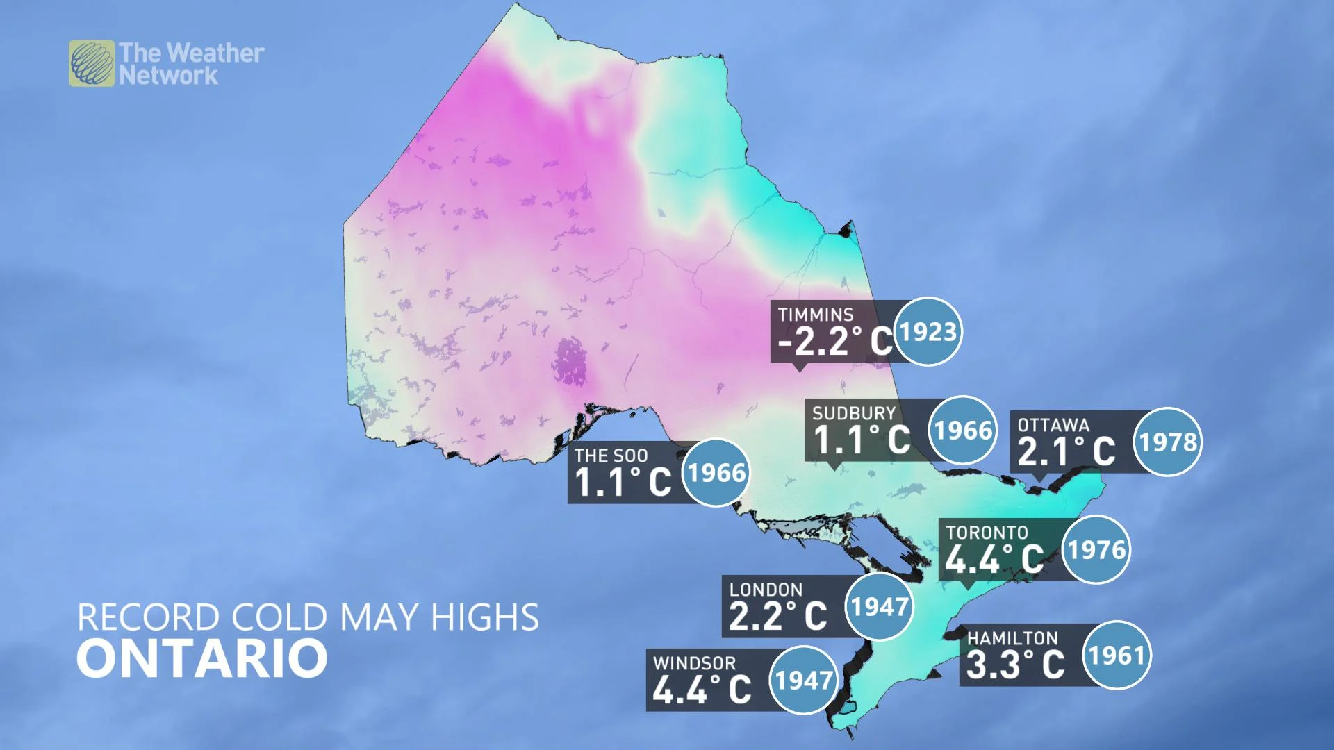
I suspect most of these temperatures are safe from being dethroned, but we run the slight risk of challenging one or two of these.
MAY SNOW THREAT
Snowfall isn't exceptionally unusual in northern Ontario in May, but it is quite extraordinary for parts of southern Ontario.
Toronto (YYZ) typically accumulates a few centimetres of May snowfall every couple of decades since the beginning of the climate record, but it was notably more common in the 1960s and 1970s.
This year’s snowfall threat will ramp up by Thursday for northern Ontario and by Friday for southern Ontario. It will also spill into the weekend with continuous threats of snow and rounds of graupel across the Great Lakes Basin.
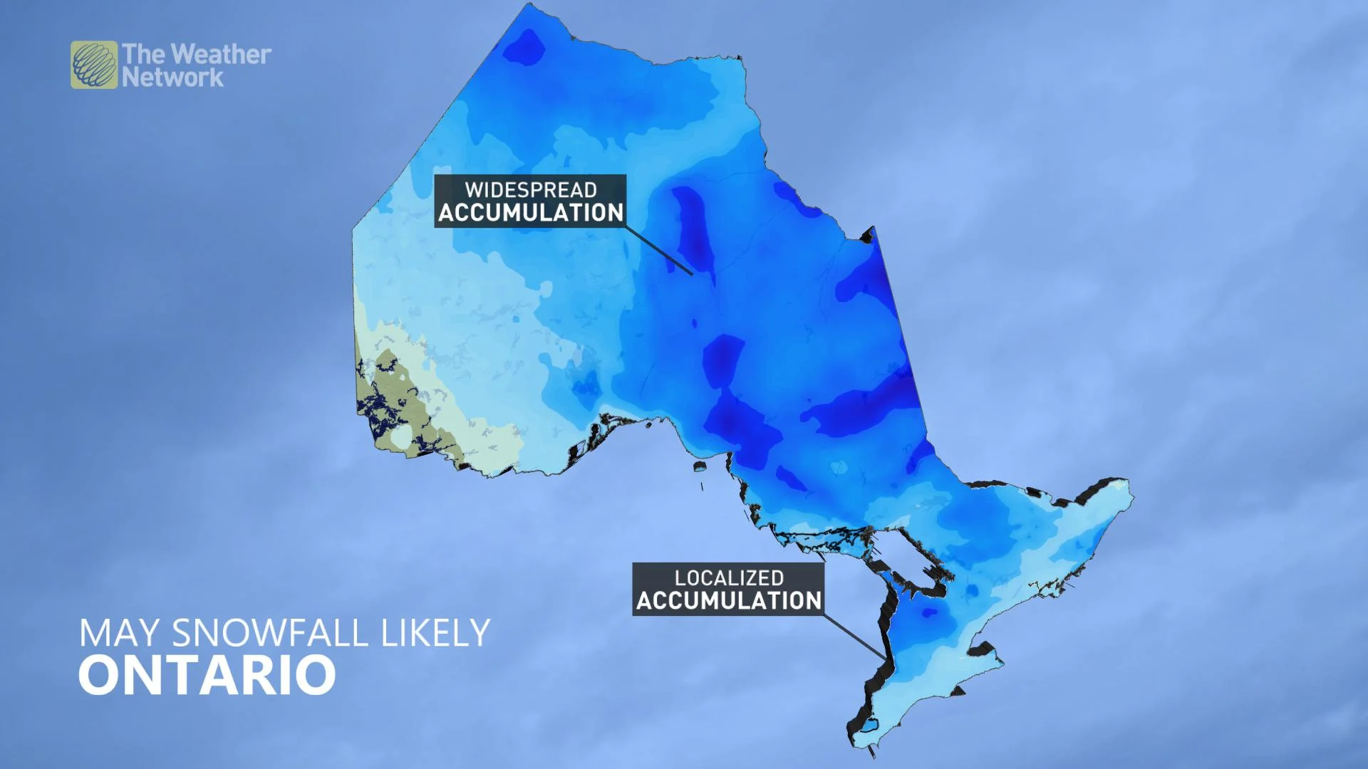
Once this cold air is entrenched, it's a favourable environment to develop a surface low along the periphery of the cold anomaly. This would create the potential for significant snow, particularly over higher terrain with the chilly temperature anomaly in place.
This pattern is incredibly dynamic and bears watching over the next several days, but safe to say some hard freezes are guaranteed, and lingering threats of wintry precipitation are begrudgingly on the table.


