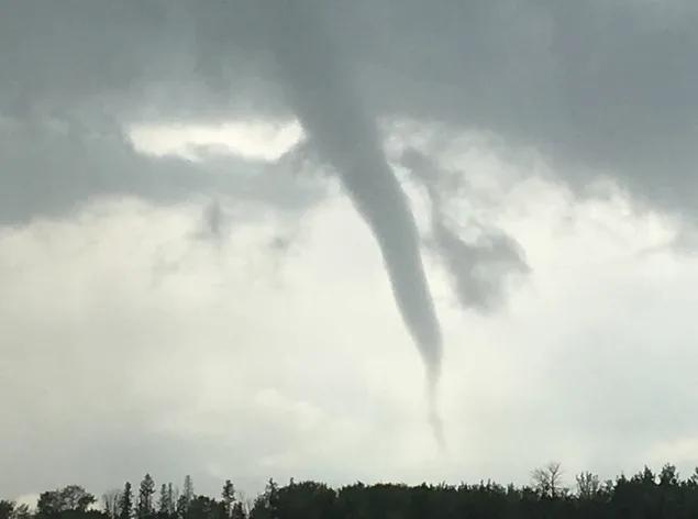
Photos: Funnel clouds form in Grande Prairie, Alberta

Funnel clouds were spotted in Grande Prairie, Alberta Wednesday for the second day in a row.
A funnel cloud advisory was in place at the time of the formation.
A surface trough that dropped south over northern Alberta is the cause for the rapid development of cumulus clouds, says Weather Network meteorologist Erin Wenckstern.
As the clouds quickly shoot up, "cold-core funnel clouds can often suspend beneath the base of these clouds," she explains.
"While they do look menacing, these funnel clouds form under rather different conditions than your typical supercell funnel clouds and rarely touch the ground."
If this type of funnel cloud makes contact with the surface, Wenckstern says it would likely become a landspout tornado, which is often much weaker and shorter-lived than a supercell tornado.
"Looking into Thursday, however, our focus will shift to southeastern Alberta and southern Saskatchewan, as we monitor for the risk for supercell thunderstorms capable of potentially producing tornadoes," she adds.
PHOTOS: FUNNEL CLOUD IN GRANDE PRAIRIE


