
Prairies: Severe thunderstorms continue as humidity builds

Temperatures will exceed 30 degrees for some
The later half of the long weekend will provide a break from the stormy conditions as the risk for thunderstorms largely moves east into northwestern Ontario. While there could be some storms briefly pop up, eyes are on the downward temperture trend with conditions becoming below seasonal by next week. More on the highest risk spots and cooling temperatures, below.
WEATHER HIGHLIGHTS:
Scattered showers continue through the Prairies
Temperatures dip below seasonal next week
Get updates on watches and warnings on our ALERTS page.
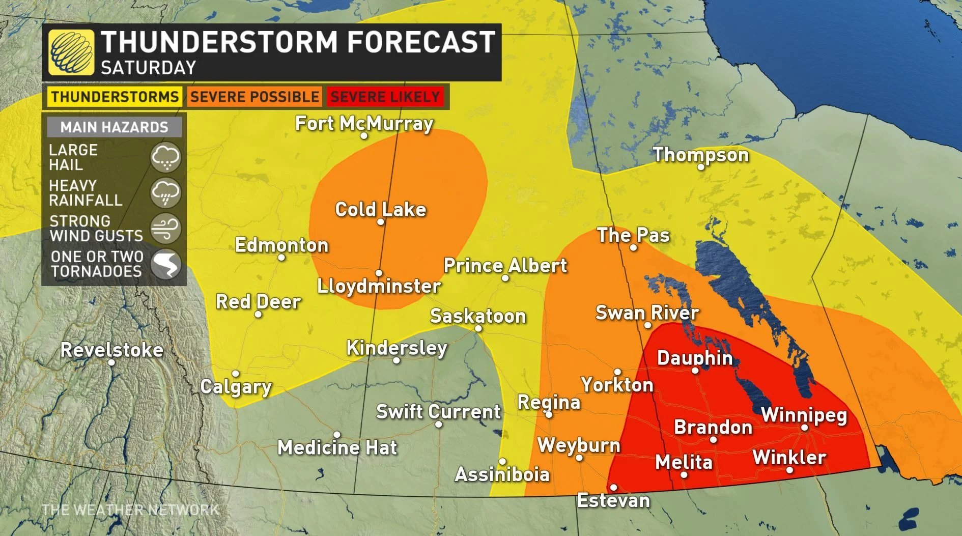
PERSISTENT STORMS TRACK EAST
Environment Canada confirmed that severe thunderstorms near Jimmy Lake and Lac La Biche, Alberta, had turned tornadic on Friday night and multiple tornado warnings were issued.
The severe thunderstorm risk continues Saturday afternoon and evening across a wide area that stretches through Saskatchewan and Manitoba, with a strong risk that further storms may turn tornadic.
The main threats associated with these storms are similar to the impacts that Alberta and Saskatchewan have recently experienced and include torrential downpours, hail, wind gusts near 120 km/h, and the chance of tornadoes.
Throughout the afternoon hours, the atmosphere will begin to cook and destabilize as the sun heats up the surface, which will humidex values near 40.
Simultaneously, the strong winds aloft will be overriding the region with extreme storm energy, which will provide support for deep convection and severe storm development.
WATCH BELOW: TRACKING THE THUNDERSTORM ENERGY
MUST SEE: 'Hand of darkness' cloud forms during Alberta storm
A line of storms is expected to fire up through southwestern and south-central Manitoba in the late afternoon and then progress eastward through the evening and overnight hours.
These strong supercell-type thunderstorms have the potential to bring large hail, heavy rainfall, powerful wind gusts, and the chance of tornadoes.
EXTREME HEAT FUELS SATURDAY'S STORMS IN MANITOBA
Building heat and humidity goes hand in hand with the severe thunderstorm risk, as humidex values jump to the low 40s across parts of southern Manitoba Saturday afternoon.
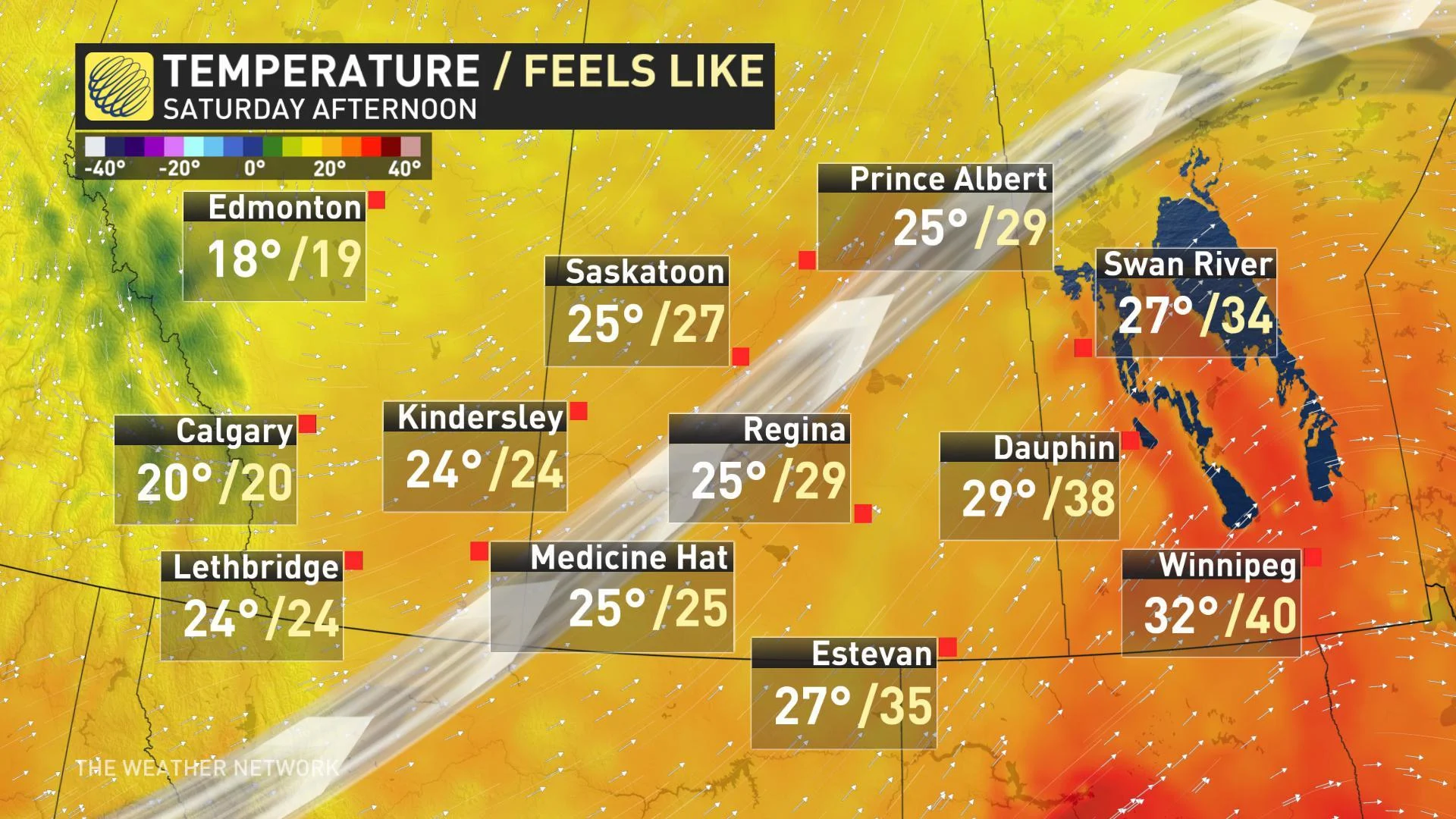
These scorching conditions are a result of a persistent trough that has slowly tracked across B.C. into the Prairies and is drawing up significant humidity from the U.S. that is not only fueling torrential rains but is adding to the sticky conditions that will linger into Sunday.
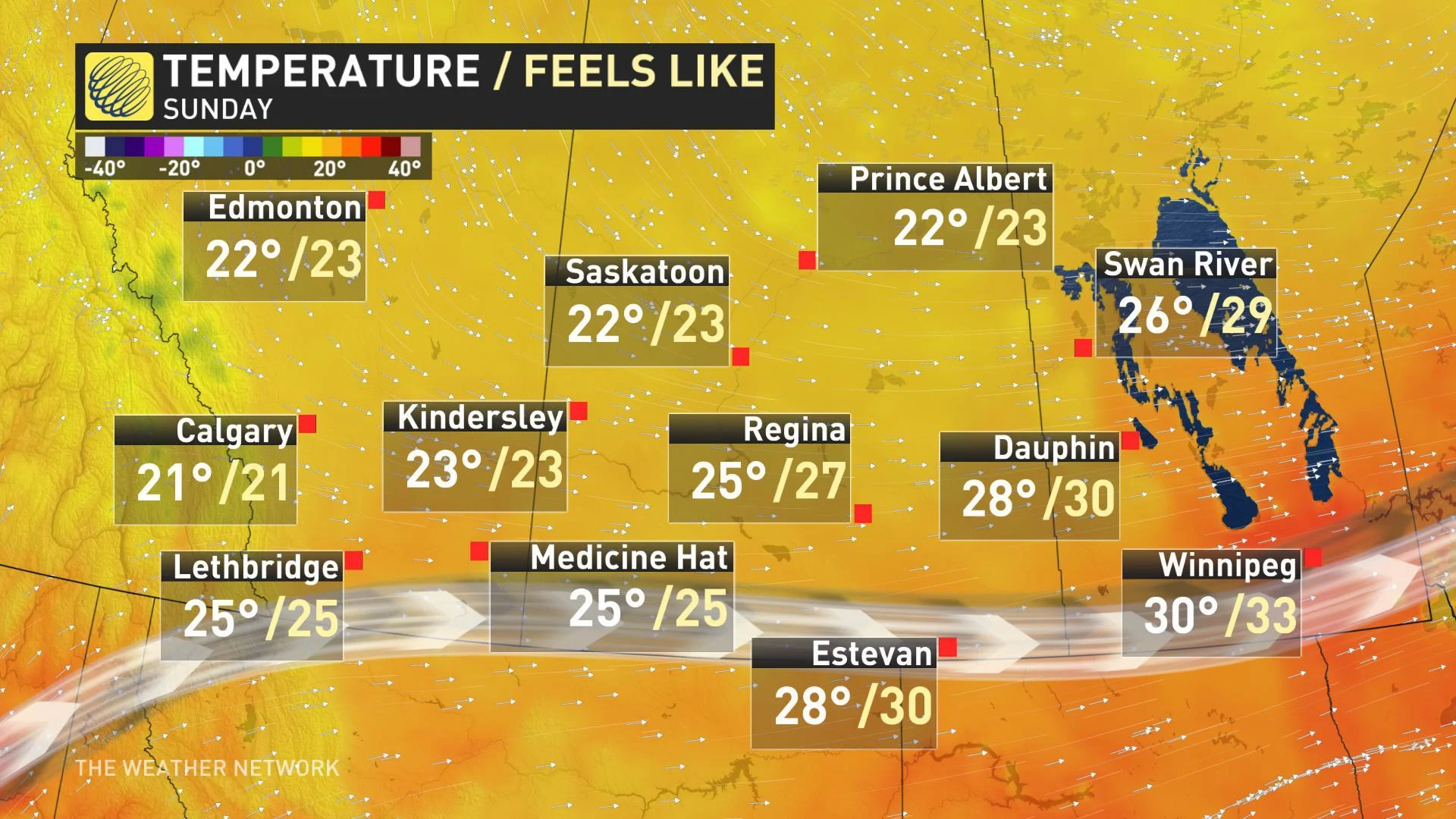
Majority of the region will see the temperature and humidex values peak on Saturday and then slightly decline by Sunday, although many will still see temperatures in the mid to high 20s or even the low 30s.