Persistent rains may close the gap on Atlantic Canada's dry August

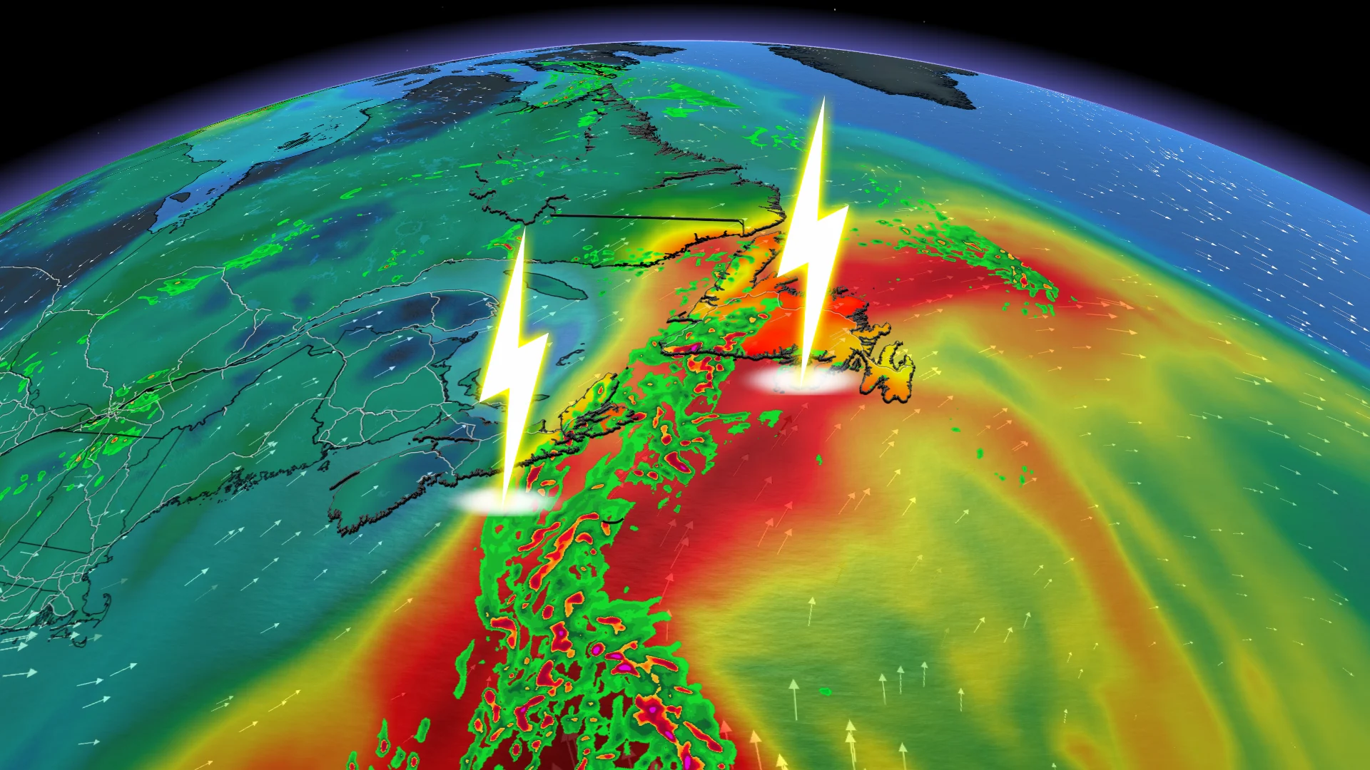
After a soggy weekend, rain and thunder will continue to dominate the forecast across Atlantic Canada through Monday.
Rainfall warnings and special weather statements have been issued across much of Atlantic Canada as persistent rains continue to fall through Monday.
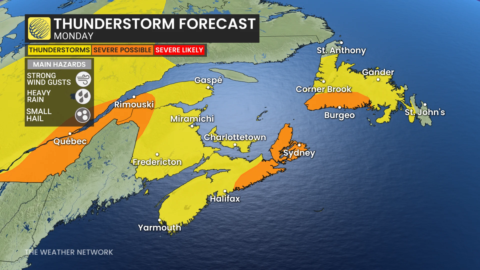
Strong to severe thunderstorms are also possible and may produce torrential downpours. Beware the threat for localized flooding beneath the heaviest storms.
DON’T MISS: Trouble may lurk beyond hurricane season’s very quiet start
Persistent rainfall continues into the midweek for many
A warm front lifted across the Maritimes on Sunday, dragging a rich reserve of atmospheric moisture over the region. Showers and thunderstorms will continue to tap into this ample moisture to produce very heavy rainfall throughout the region on Monday.
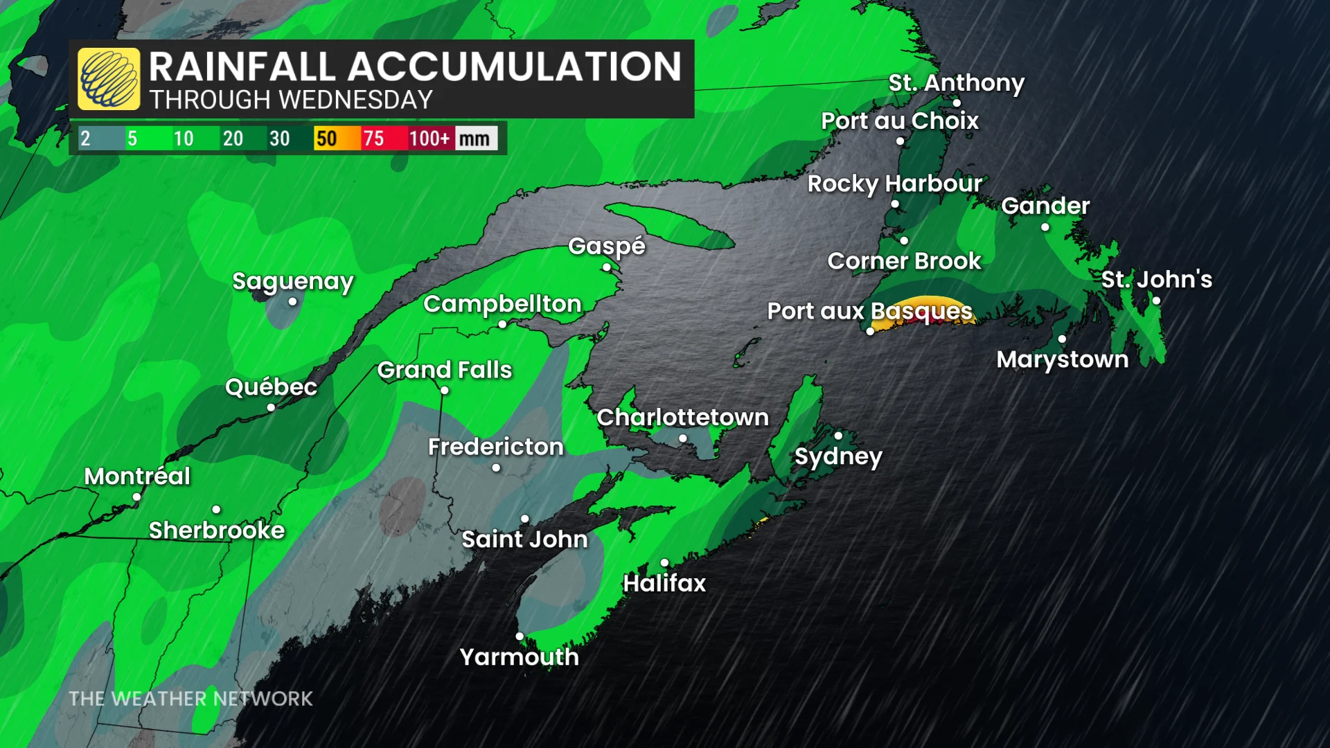
The band of heavy rain is forecast to stretch northwest into Newfoundland, including Port-aux-Basque, Ramea, and the Burin Peninsula.
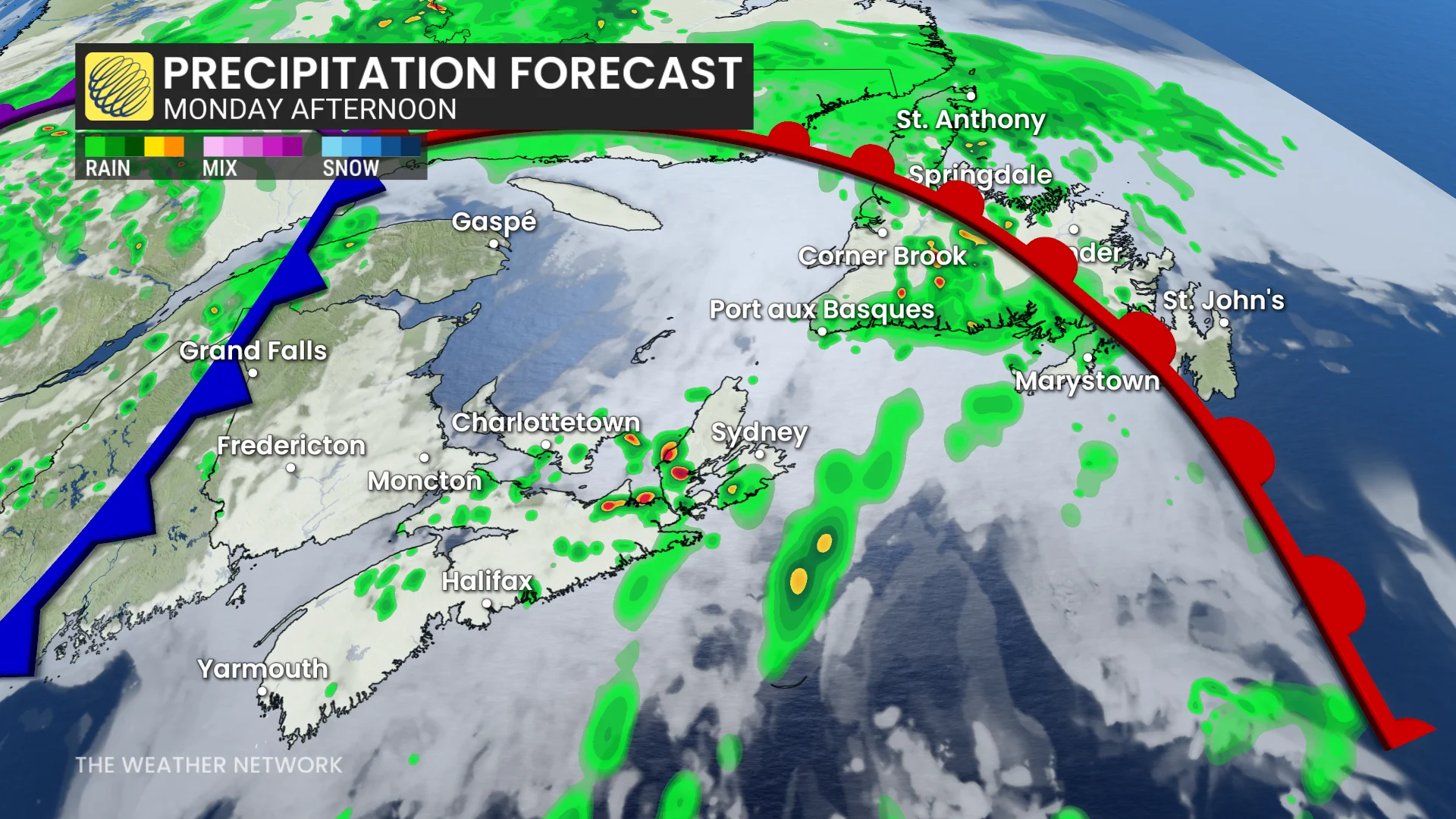
Under this band, areas east of Halifax, up to Sydney, could see an additional 20-30 mm of rainfall throughout the day.
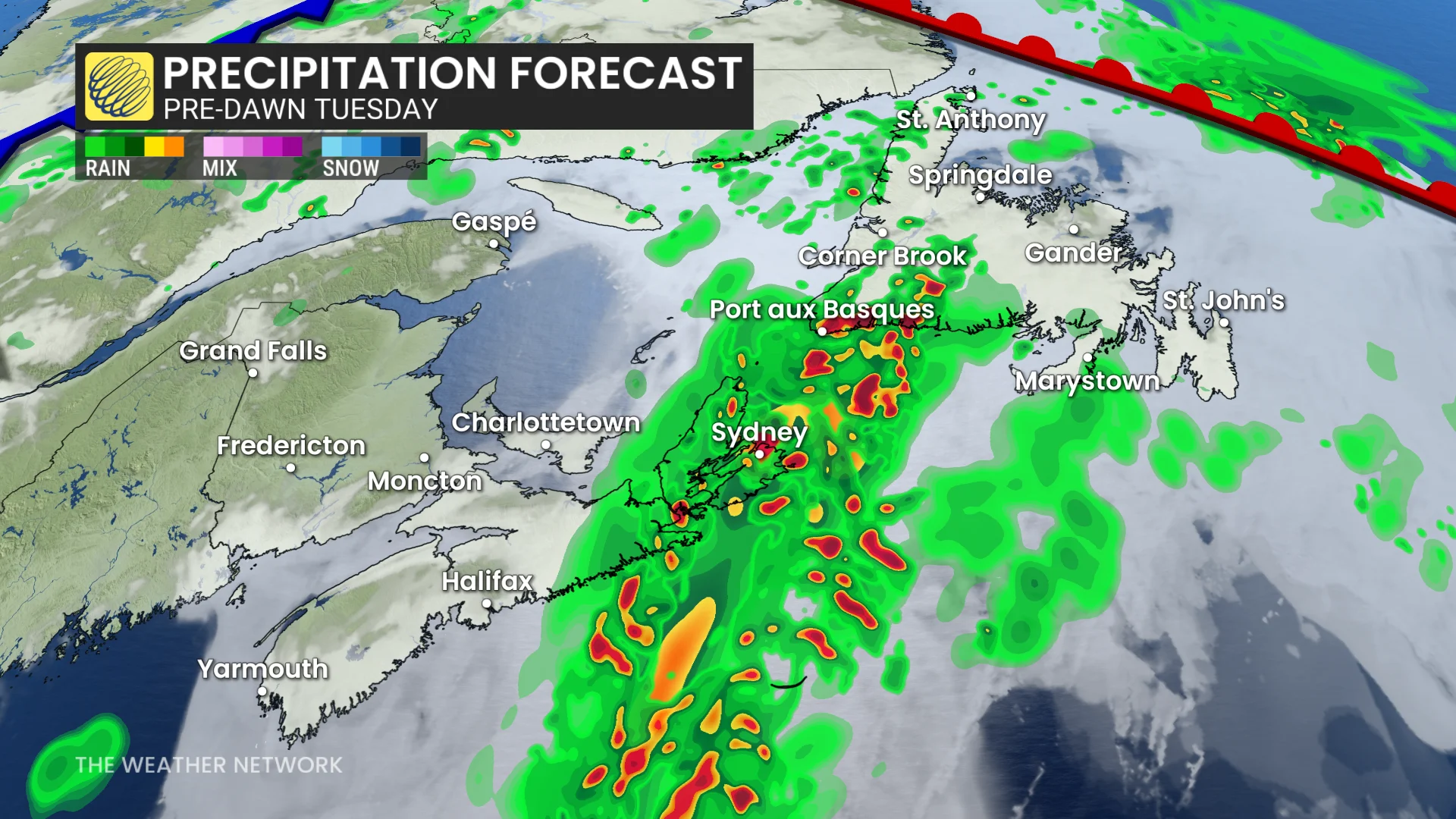
The rain is forecast to continue into Tuesday for the Maritimes, and into Wednesday for Newfoundland. In fact, parts of Newfoundland could see 40-70 mm of rainfall by the end of Wednesday. Most of the Avalon, including St. John's, is expected to escape the heaviest rain totals.
RELATED: Tips to stay safe during a flash flood as peak season draws near
This much rain in such a short period of time may lead to localized flooding in vulnerable areas. Remember, never try to drive across a flooded roadway. It’s impossible to tell how deep the water is until it’s too late, and it takes surprisingly little water to lift a car off the road.
Keeping an eye on tropical activity
It's been a quiet season for tropical storms in the Atlantic Basin, but that may change as forecasters watch two areas that may potentially develop into tropical systems.
The first area, southeast of Bermuda, could become a short-lived sub-tropical storm in the next day or so and bring heavy rainfall to eastern Newfoundland by the midweek as it weakens into a regular low-pressure system.
The second area of interest to forecasters is just beginning to push off Africa's west coast. It's too early to say whether or not it will have any land impacts, but it's being closely monitored.