Parts of B.C. face a nocturnal severe thunderstorm risk

Remain on the lookout for severe thunderstorms across portions of British Columbia overnight into early Friday
A round of much-needed rain will arrive for portions of British Columbia late Thursday as unsettled conditions build over the region.
Any strong to severe thunderstorms that bubble up could produce strong wind gusts, potentially leading to isolated power outages.
Stay aware of watches and warnings in your area through the evening and into the nighttime hours.
B.C.'s 2026 Summer Forecast: A hot, dry season ahead, thanks to El Niño
Overnight storm risk builds for the B.C. Interior
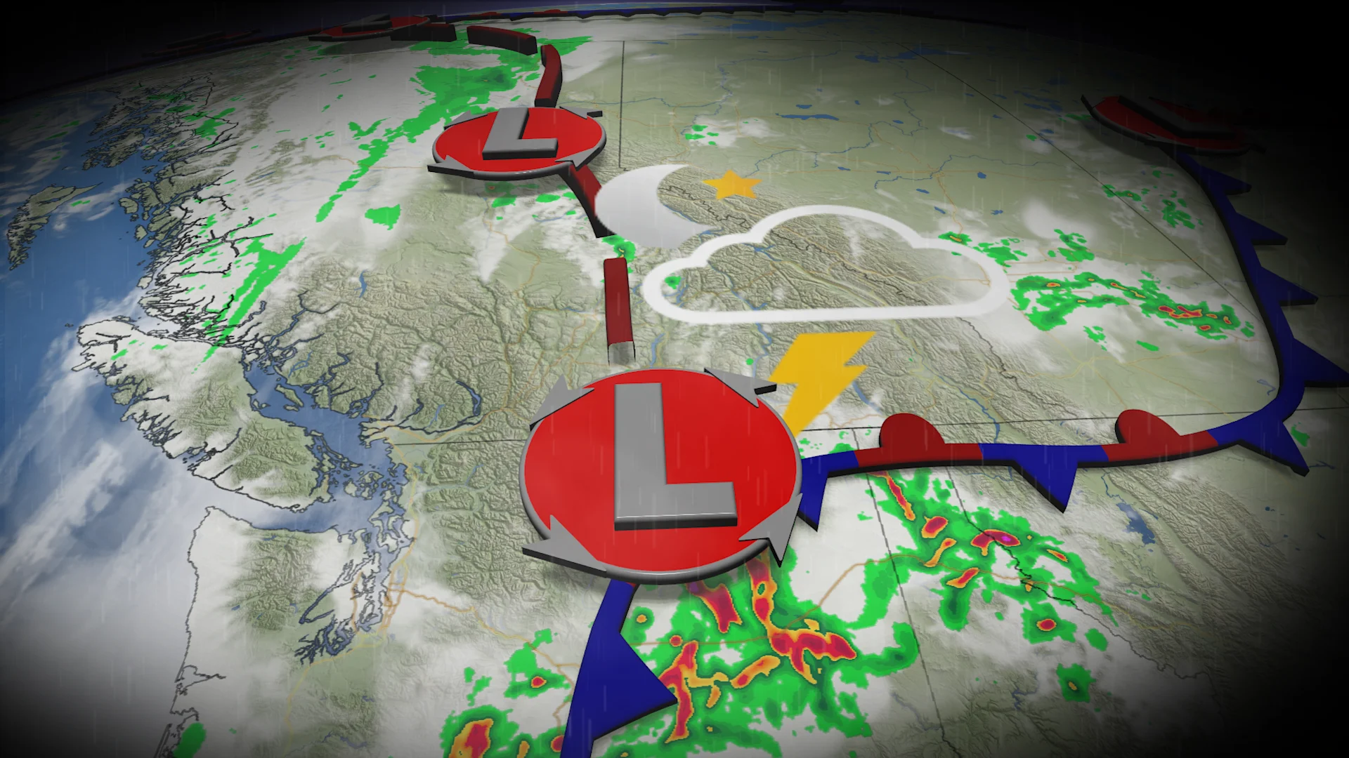
A low-pressure system moving in from Washington state will bring a risk for nocturnal thunderstorms and widespread rainfall for southern portions of B.C. from Thursday night into Friday morning.
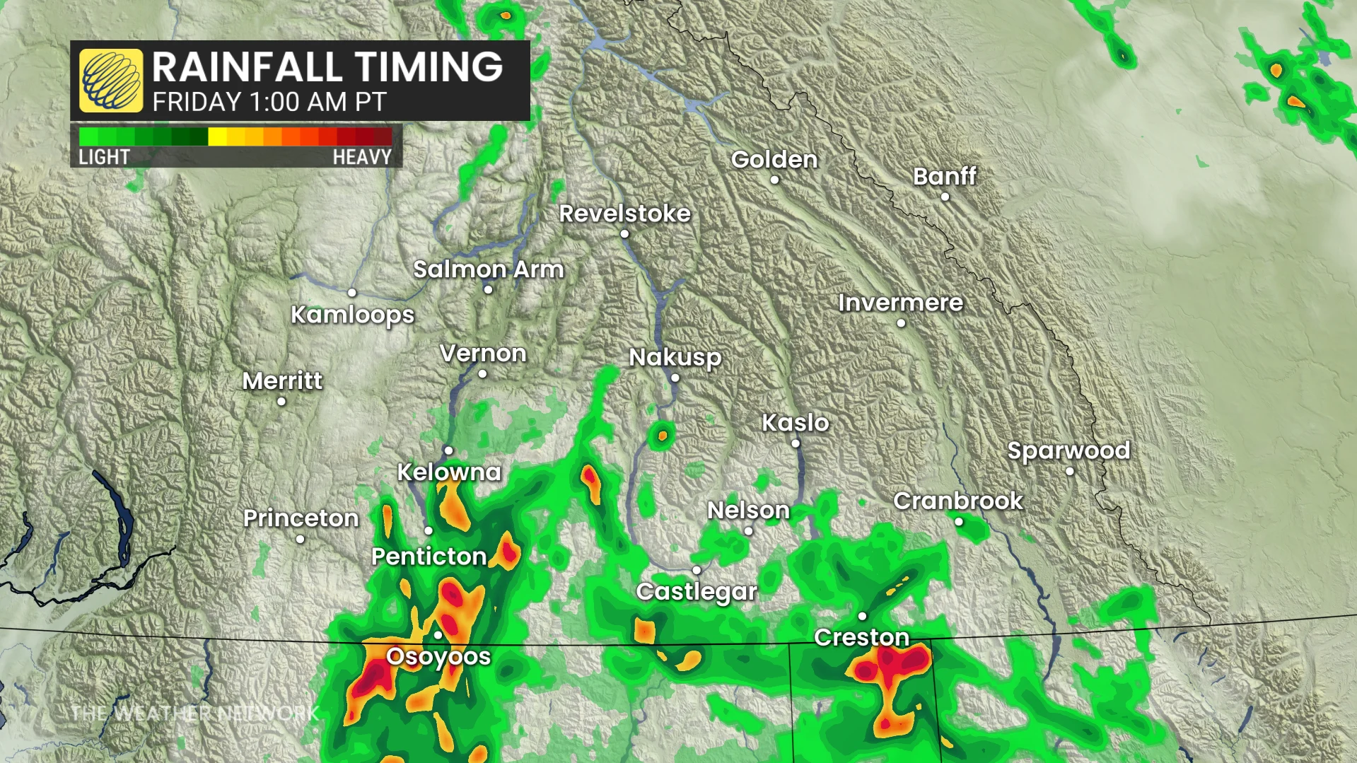
The system will produce periods of heavy rain, embedded thunderstorms, and gusty winds as it tracks through the B.C. Interior.
Storms with heavy rainfall will begin entering southern parts of the province around 11:00 p.m. local time Thursday, gradually advancing north into central regions by Friday morning.
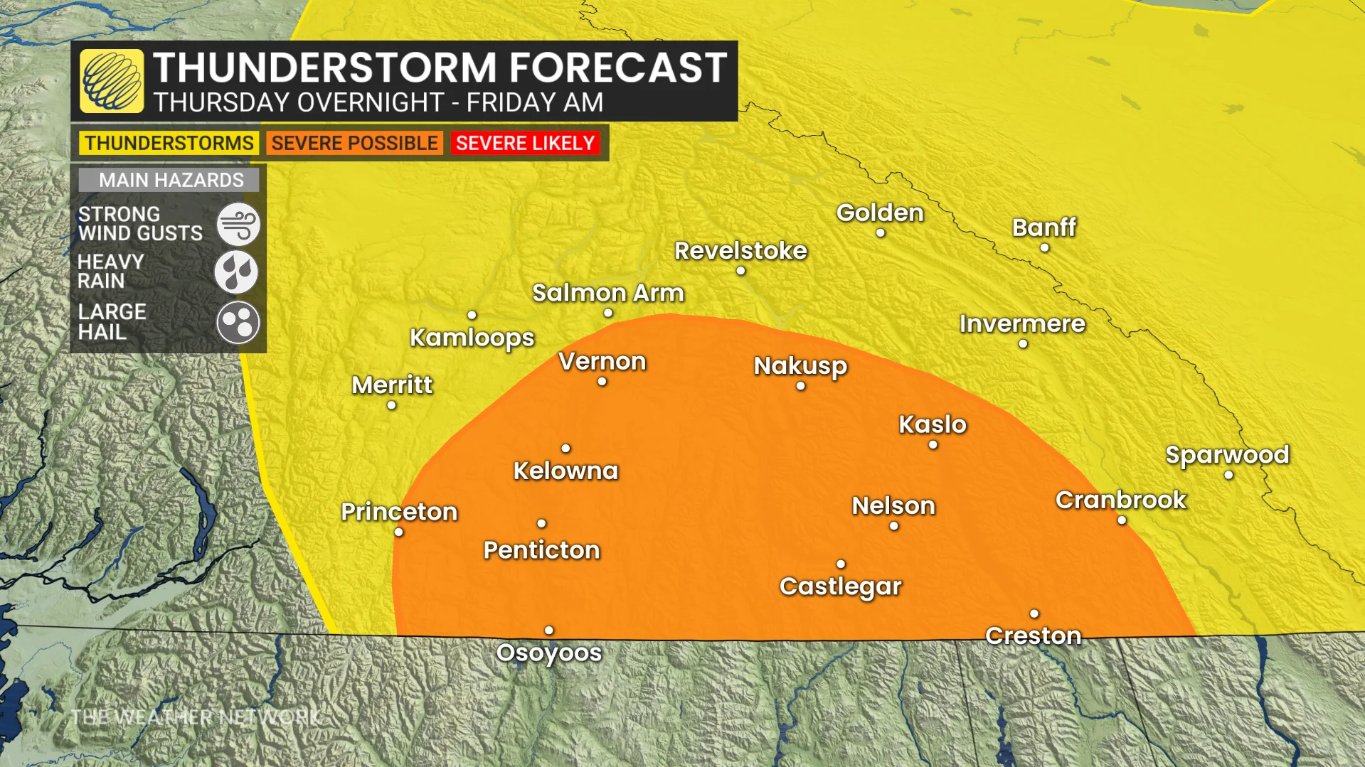
Wind gusts of 80-90+ km/h are possible within the line of storms, which could lead to isolated power outages across the region.
Some beneficial rainfall is on the way
Any rainfall is welcome news this time of year, especially with moderate to severe drought conditions present throughout the region as of the beginning of the month.
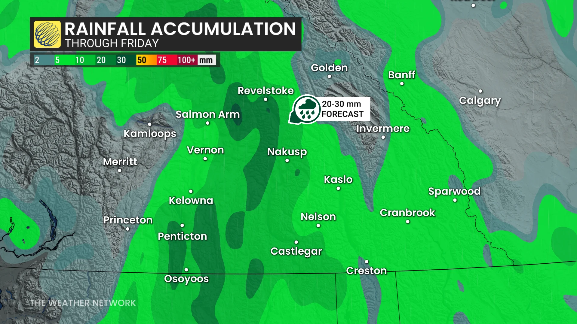
The greatest rainfall totals are expected along the Rockies and across the eastern Okanagan, where 20-30 mm of precipitation is likely. Depending on the timing and speed of the larger system, localized areas could exceed 30 mm of rain.
Impending rains will also aid firefighting efforts with two out-of-control blazes burning near the Elk Valley south of Cranbrook.