
Ontario's first official spring weekend to kick off on wet, snowy note
It may be spring, but you may want to consider keeping your winter tires on a little bit longer
Spring is officially here, Ontario, although it may not feel like it. Lake-effect snow squalls took the stage on Wednesday, bringing hazardous conditions to southern Ontario roadways.
However, that is not the only wintry blast Ontario will be getting as the new season kicks off.
SEE ALSO: April 8 solar eclipse is the must-see celestial event this spring
Cold air ushered in by Wednesday's system will give way to even more snow as a Colorado low passes Lake Erie and then moves over Lake Ontario on Friday.
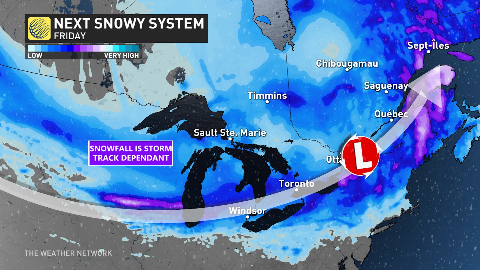
The low will move into southwestern Ontario on Friday morning and into the Greater Toronto Area (GTA) by the afternoon. The heaviest snow from this system will be in line with the Friday evening commute, so be sure to check your local road conditions before heading out and be weary of rapidly deteriorating roads.
WATCH: Will your garden survive the cold and snow in Ontario
DON'T MISS: Mild winter to blame for early pollen release in southern Ontario
The Golden Horseshoe and Niagara, specifically, will likely see the heaviest of the snow as the low picks up moisture from Lake Erie to the south and tracks through the region. Folks here could see upwards of 10 cm of snow fall on Friday before the system leaves the province Saturday morning.
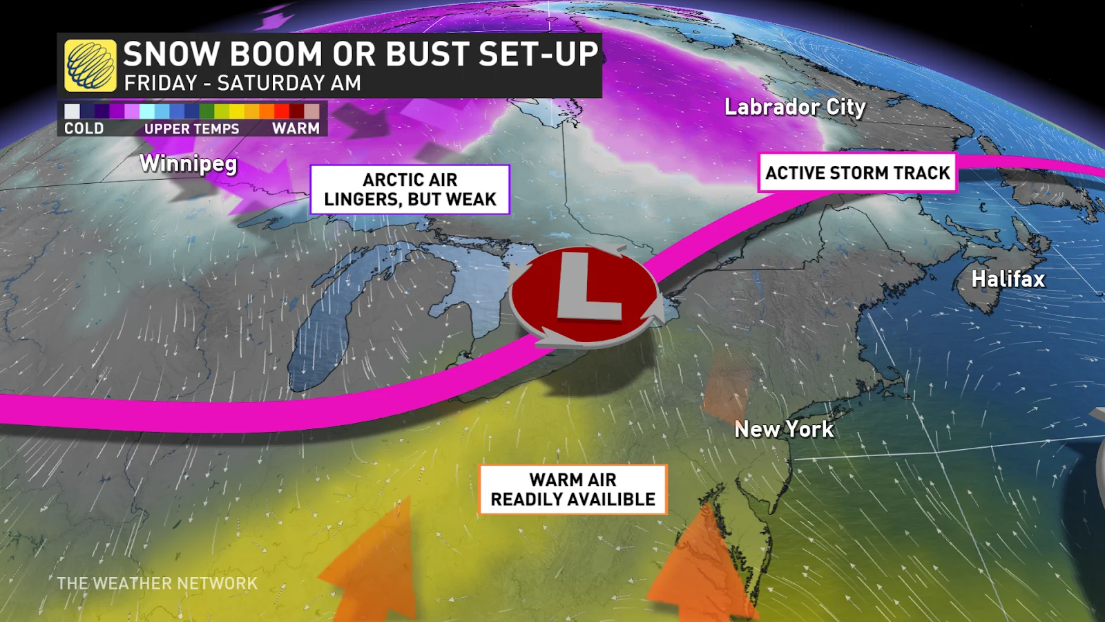
The exact amount of snow that will fall and accumulate is uncertain at this time, however, due to a mass of warm air sitting south of the border. This means that snowfall amounts are extremely reliant on the storm's track, as even a slight shift north could allow the warm air to usher forward and dampen snow totals with rain.
MUST SEE: Is hacking the atmosphere a 'cool' idea to offset global warming?
Stay with The Weather Network for more forecast details and updates for your weather in Ontario.