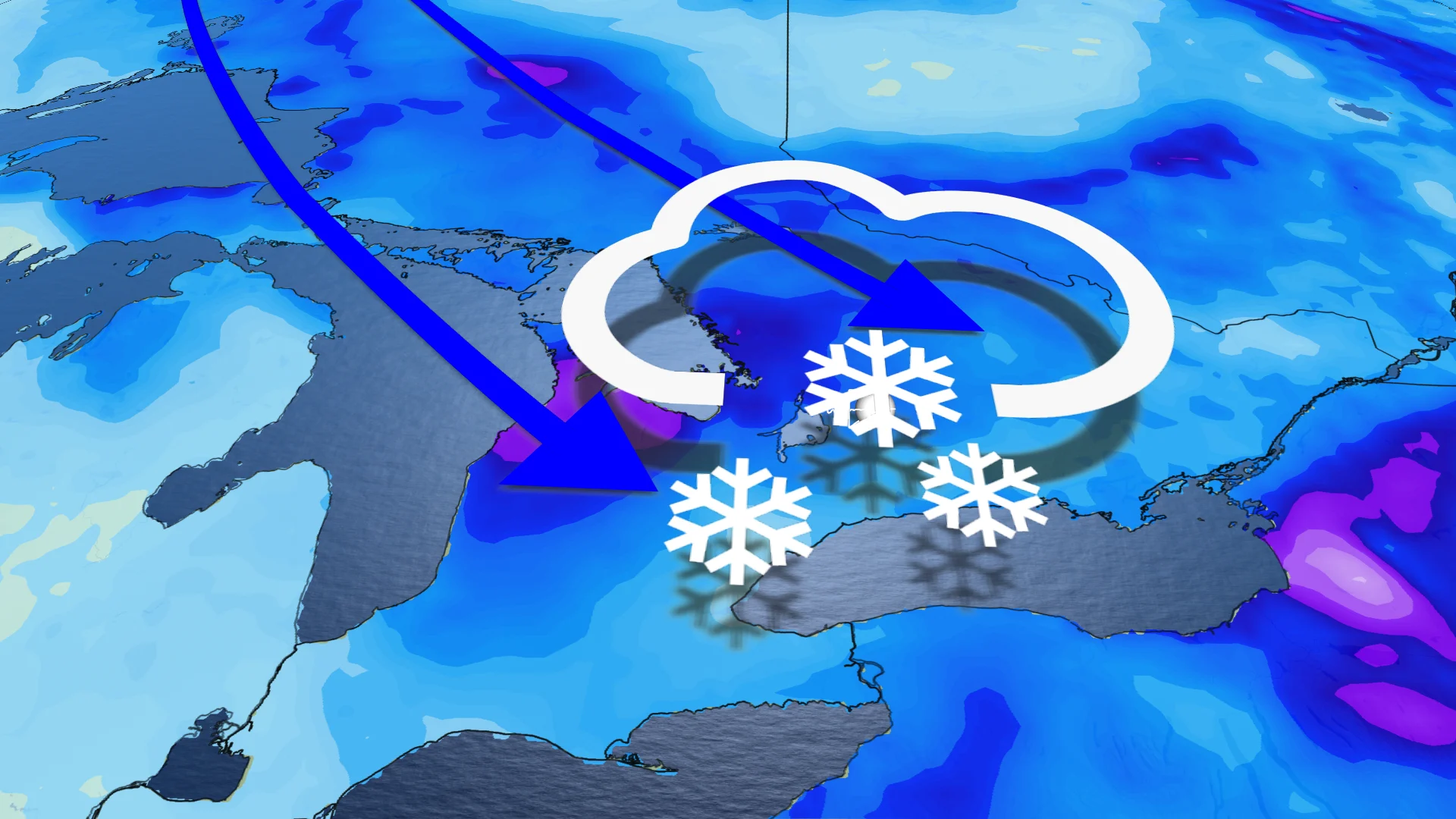
Ontario ushers in spring with wintry shot of snow and cold air
Spring officially arrives Tuesday, but it will certainly feel more like winter in Ontario as snow and cool temperatures will usher in the new season
While winter will be departing Ontario soon, the weather associated with that season will not be in a rush to leave the province that quickly.
A new system will herald the arrival of spring in the province, but it will be packing a wintry punch to it as the pattern makes a flip. That means considerably cooler temperatures than last week and another chance of snowfall, heaviest in areas near Lake Huron and Georgian Bay.
DON'T MISS: Canada's spring gets sidelined as winter fights back for start of the season
That doesn't mean areas farther south, towards and in the Greater Toronto Area (GTA), won't see any snowfall, however. Tuesday and Wednesday will offer the south bursts of flurries. Slick roads can be expected, with greater impacts on travel in parts of the snowbelt regions.
Tuesday: Resurgence of snow expected
Another low-pressure system developing across the northern Great Lakes will fuel a renewed risk for snowfall chances once again Tuesday.
MUST SEE: Is hacking the atmosphere a 'cool' idea to offset global warming?
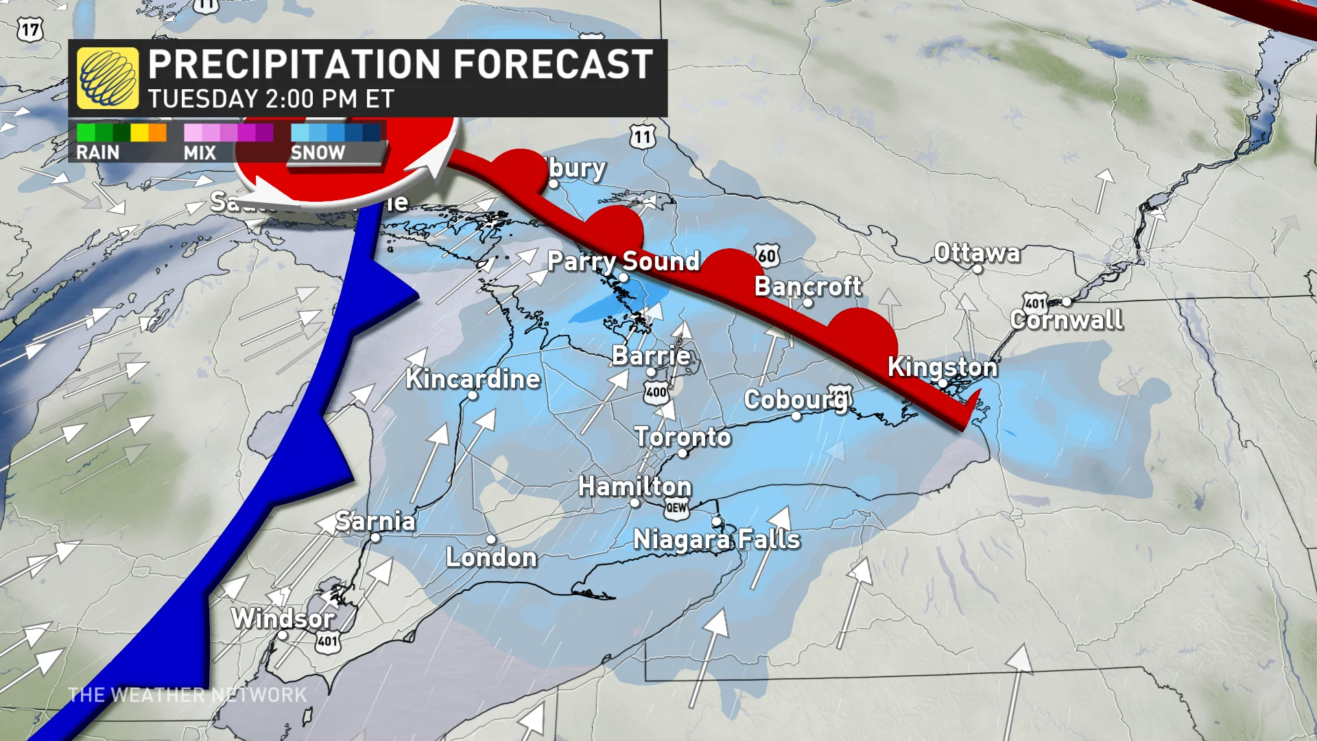
Bursts of flurries could be widespread across the rest of southern Ontario and the GTA on Tuesday around lunchtime, leading to reduced visibility and potentially slick roads throughout the region.
Those around cottage country have the possibility of locally higher totals, expect changeable driving conditions as visibility could be reduced throughout the day.
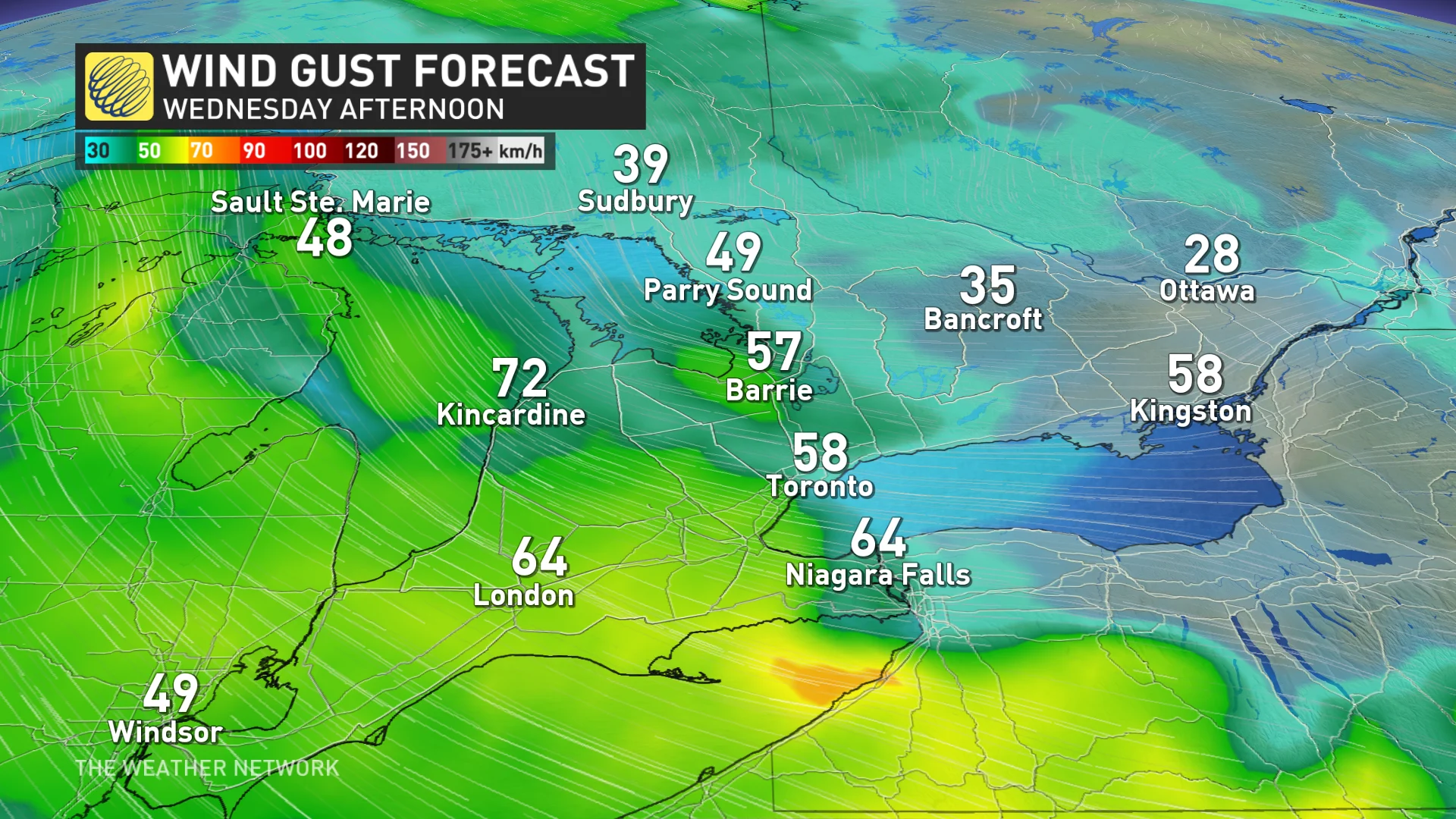
Wednesday: Another system moves in
Yet another low-pressure system will bring widespread snow chances across southern Ontario on Wednesday as we deal with several small systems this week.
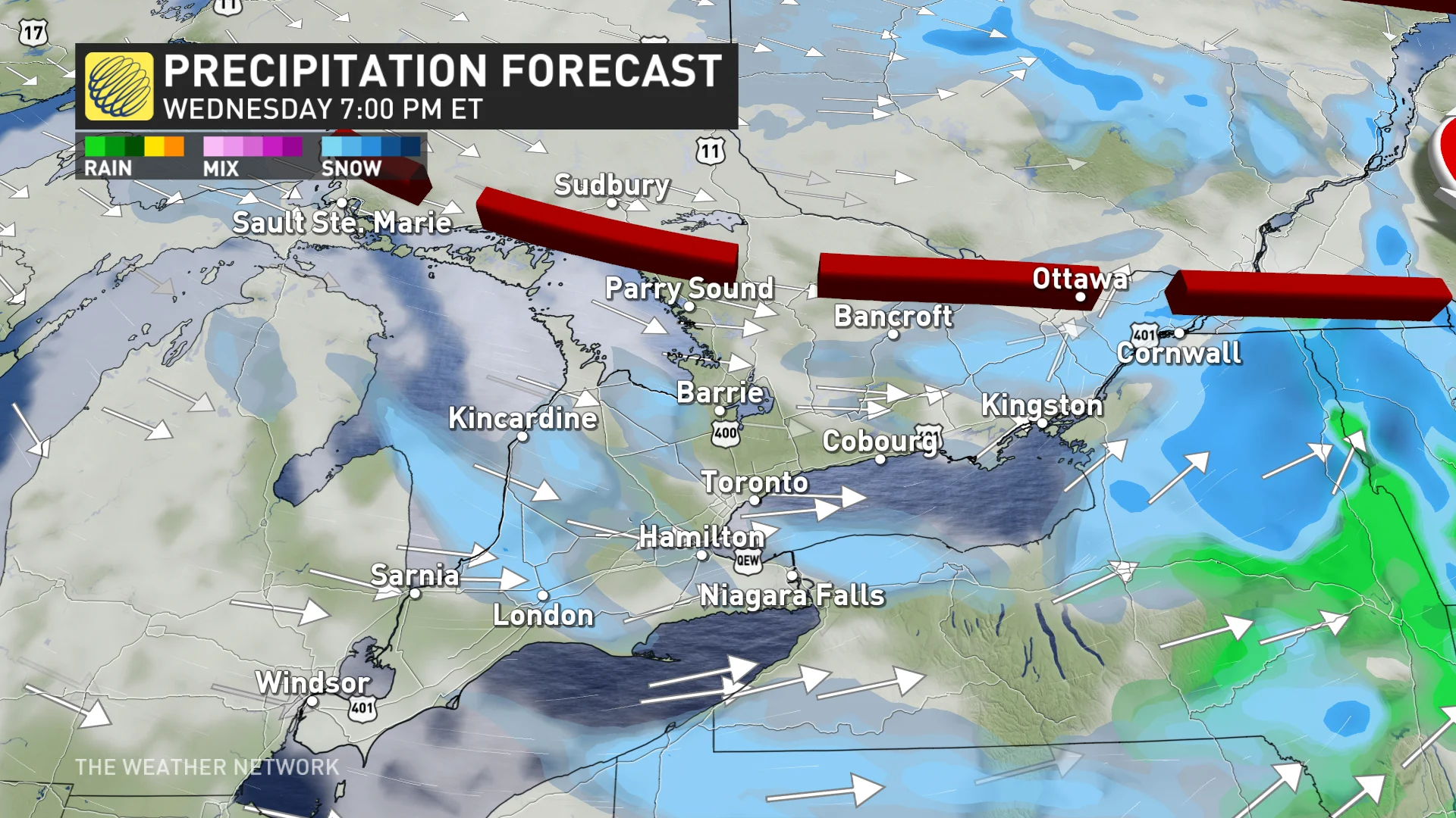
The GTA could see flurries off and on throughout the morning, with a chance for heavier snowfall to develop across Hamilton and Niagara throughout the afternoon, however there is still some uncertainty with how much could fall.
Lake-effect snow squalls will develop Wednesday evening across the snow belts, possibly impacting northern parts of the GTA as well.
The snow belts could see accumulations of 15-20 cm whereas southern Niagara could see 5+ cm of snow if heavy snow develops.
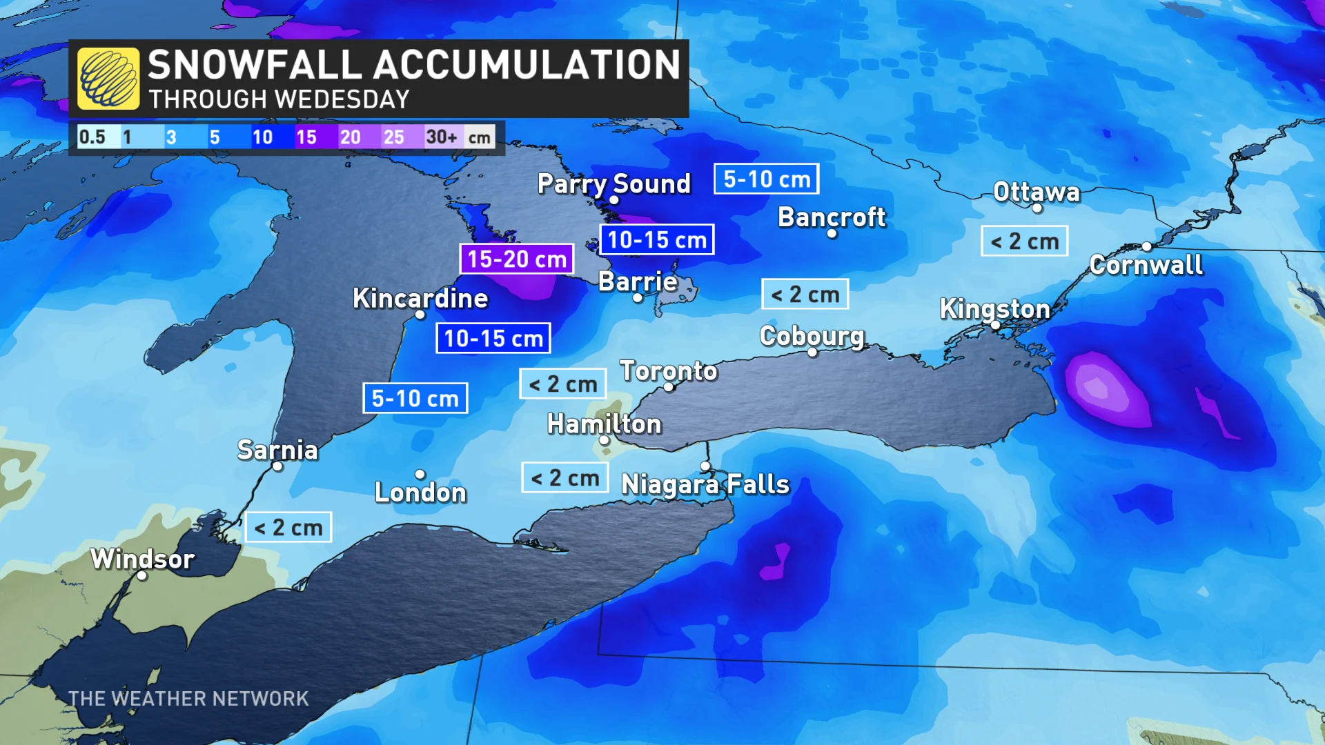
There is some uncertainty with the exact snowfall totals these systems could bring as they rely on several local factors including fluctuating temperatures, lake enhancements, and terrain.
Looking ahead, temperatures will remain around seasonal, that’s still cold enough to support the threat for wintry precipitation.
Stay with The Weather Network for the latest on your forecast across Ontario.


