Ontario faces rainy start to a long weekend that’ll end with a chill

Ontario will face an atmospheric compromise this long weekend: warm but rainy, or cool but dry?
The unofficial start of the summer season will arrive in Ontario this long weekend with some decidedly spring-like weather blanketing the region at times.
While parts of Western Canada continue struggling with above-seasonal temperatures this weekend, Ontario will face some dreary skies to start and a round of cooler temperatures just in time for fireworks on Monday.
SEE ALSO: How to turn your long weekend into a vacation
Friday
Conditions will feel like the beginning of summer for most on Friday, with daytime highs reaching the low- to mid-20s throughout the region.
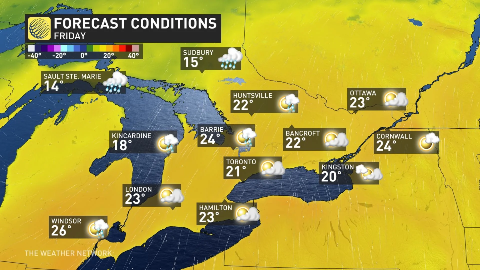
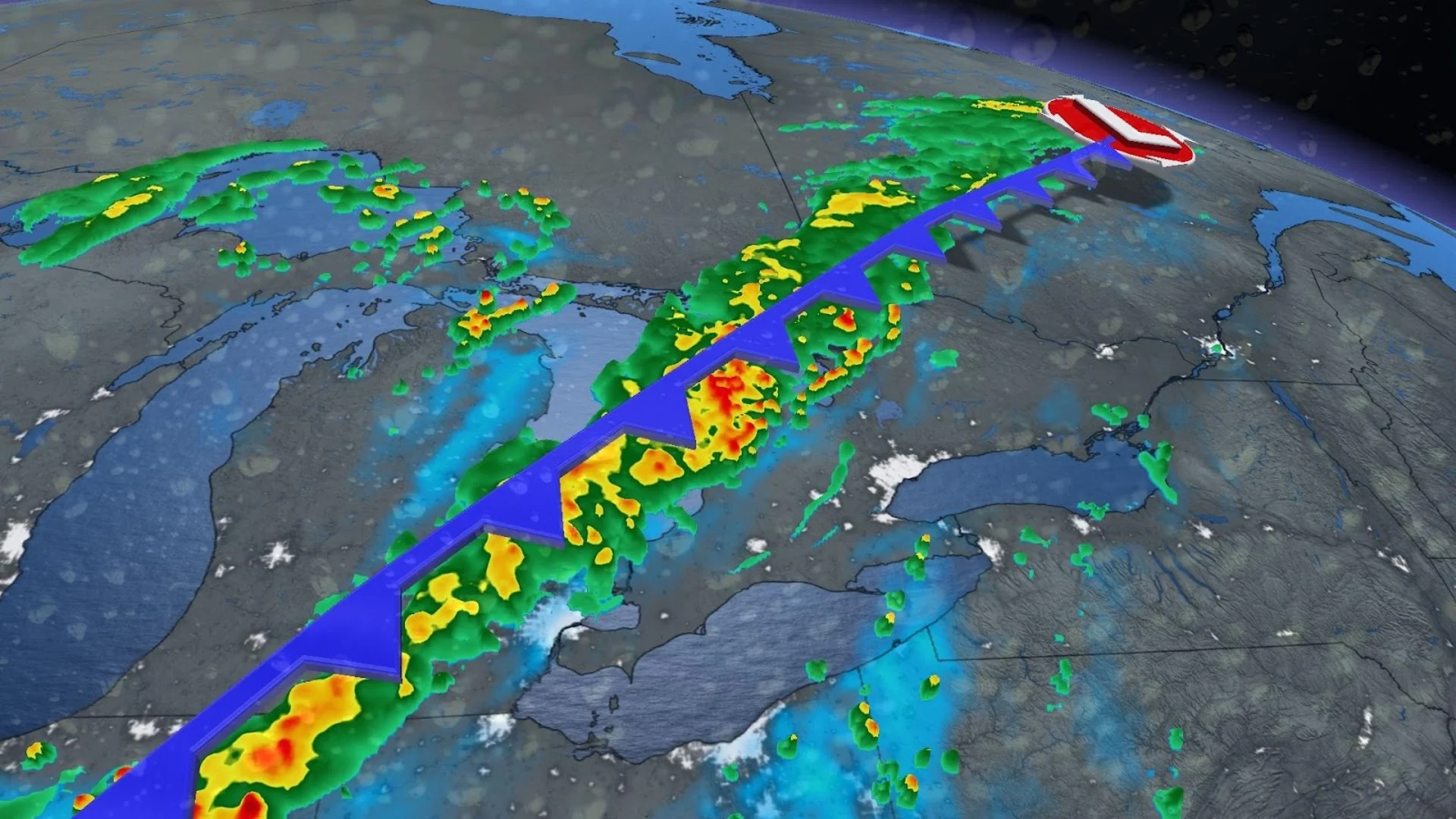
We’ll start the day on a dry note before some rain begins pushing into southwestern Ontario late in the afternoon. The precipitation should reach the Greater Toronto Area (GTA) just in time for the evening commute.
The day’s warmth could trigger a couple of thunderstorms for communities in southwestern Ontario, with the greatest opportunity for storms popping up around the Huron shores.
Saturday
Rain that persisted through the overnight hours will continue into the day on Saturday, with the heaviest rains falling into the morning.
We’re on track to see decent rainfall totals from this system, coming in around 20-40 mm for much of southern and eastern Ontario. Forecasters expect the heaviest totals in central Ontario and throughout cottage country.
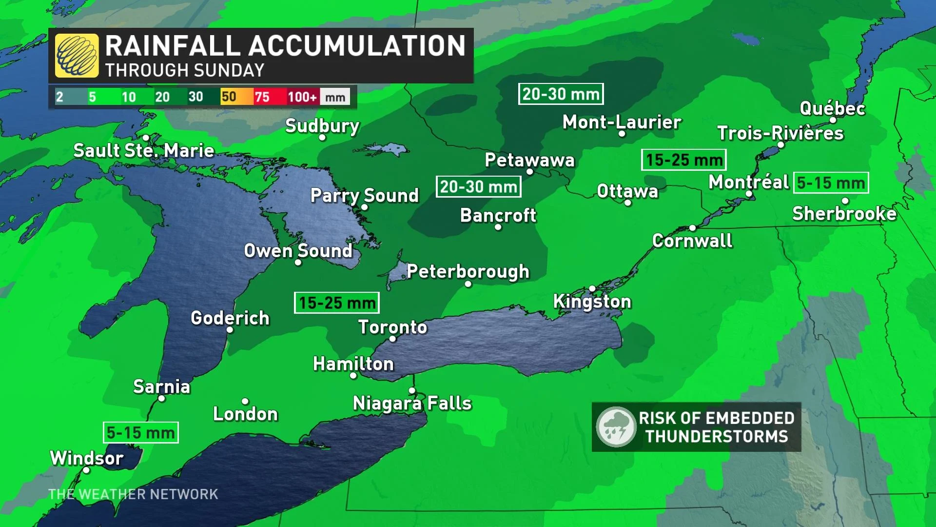
Skies will begin clearing out in southwestern Ontario by the late afternoon hours, with clouds breaking up over the GTA by the evening, and rain finally coming to an end in eastern Ontario by Saturday night.
Cooler temperatures will move into the province from west to east as the system gradually clears out of the region on Saturday.
Sunday and Monday
Folks across eastern Ontario could start their Sunday with some lingering showers, with dry conditions expected for the bulk of the province.
High temperatures on Sunday will just barely climb into the lower 20s for southwestern Ontario and the GTA, with highs in the upper teens likely into cottage country and the National Capital Region.
Folks on the shores of Lake Huron and Georgian Bay will feel the chill of the water, with temperatures only reaching the lower teens in spots.

Monday looks to be both the driest and chilliest day of the long weekend, with daytime temperatures locked firmly in the teens for just about everyone. Only folks in extreme southwestern Ontario stand a chance to hit the 20-degree mark.
Stay tuned for The Weather Network for forecast updates in Ontario.