What's a May long weekend in Canada without a snow threat?

For many Canadians, the Victoria Day holiday weekend marks the first time many camp, hike and stay outdoors for an extended period, so having an accurate forecast is crucial.
Welcome to the May long weekend in Canada, which celebrates the birthday of Queen Victoria.
For many Canadians, this weekend is the unofficial kick start to summer, marking the first time many camp, hike and stay outdoors for an extended period, so having an accurate forecast is crucial. However, many blazes have erupted, making smoke, evacuations and erratic wildfire behaviour a significant concern throughout the weekend.
SEE ALSO: The secrets behind a successful car camping trip
Western Canada
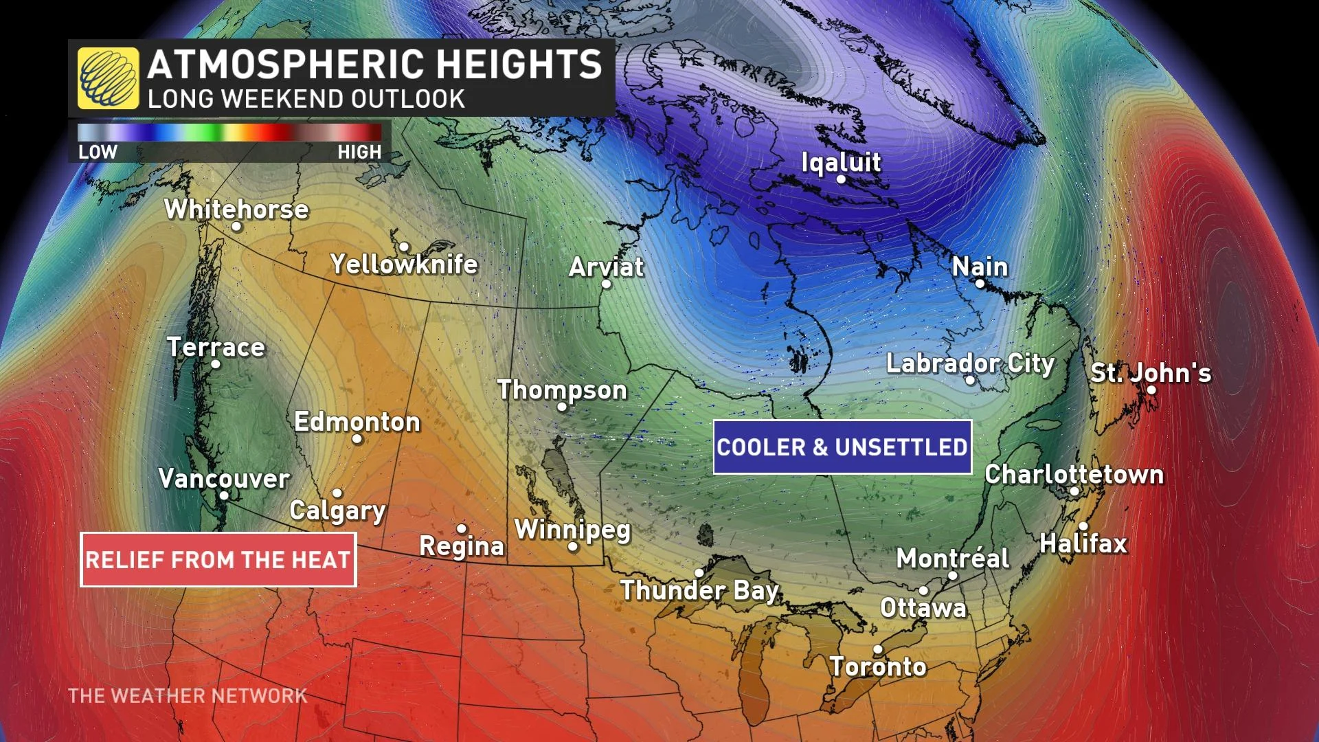
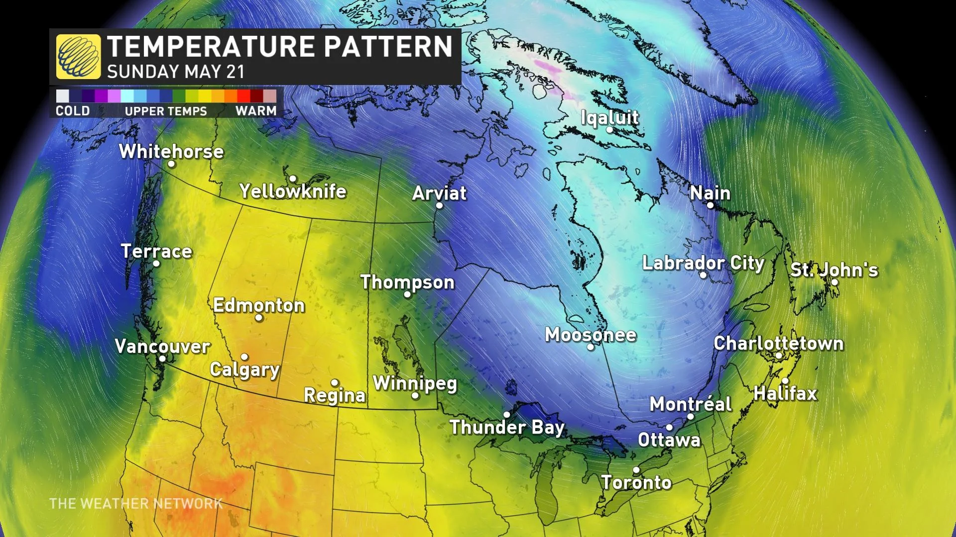
Hot and dry conditions will prevail during the start of the long weekend, with a ridge of high-pressure straddling British Columbia and Alberta. Temperatures will be 5-10 degrees above average, with temperatures cresting above 30 degrees for interior regions of B.C. and northern Alberta.
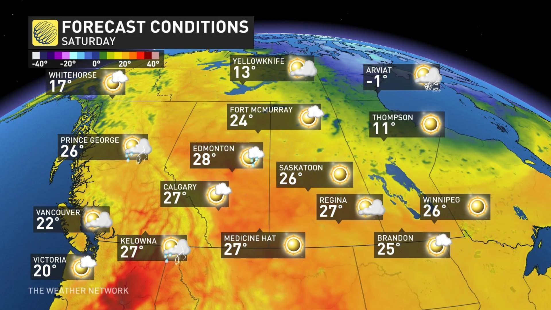
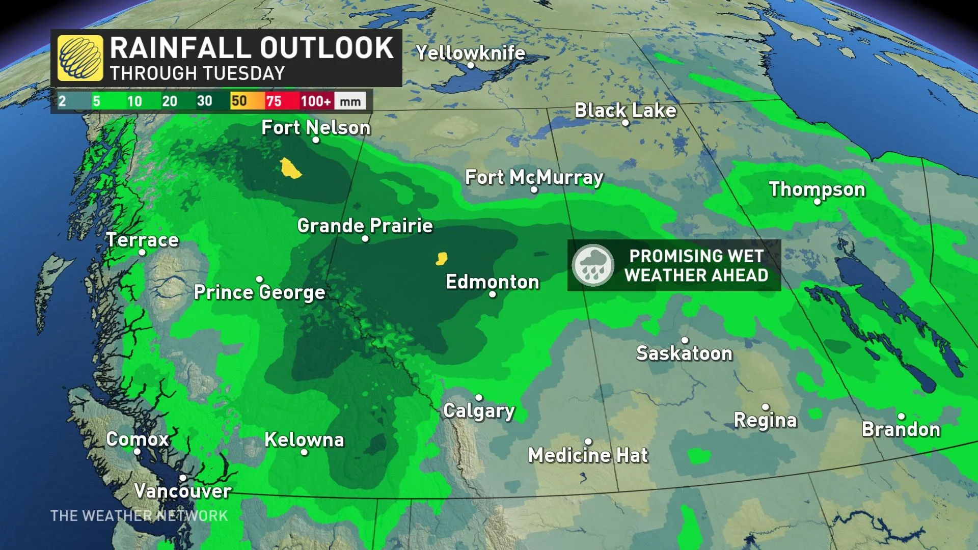
Be on guard for the risk of some isolated to scattered thunderstorms across the B.C. Interior and central Alberta and along the foothills, as well. Some much-needed rainfall will spill across the coast and Interior late Sunday and into Monday.
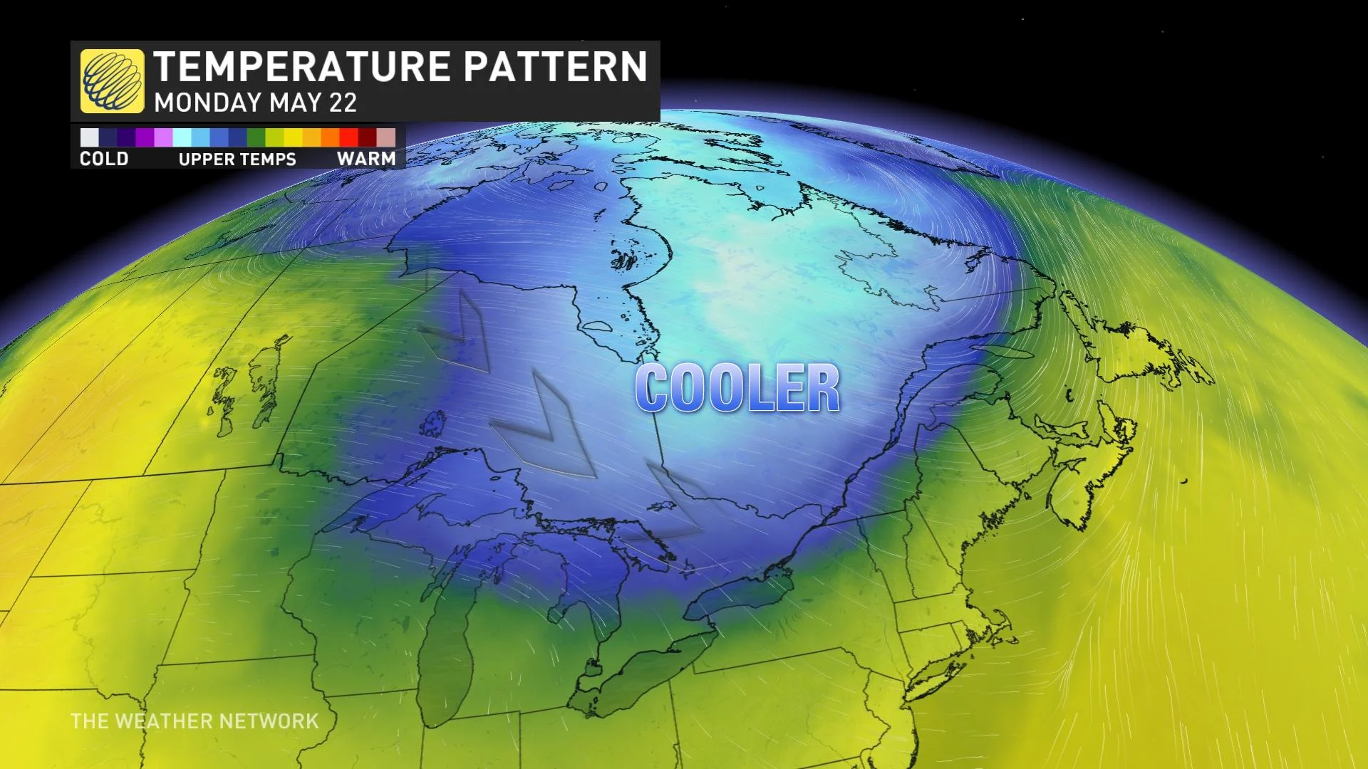
A Pacific trough is forecast to slide across British Columbia and Alberta with some beneficial rainfall, hopefully falling over some of the critical fire zones in the two provinces into early next week. Temperatures are also forecast to ease across the region with temperatures returning closer to seasonal. Mid to upper teens are forecast as daytime highs for the holiday Monday across much of British Columbia. Cooler temperatures will slowly arrive in Alberta early next week.
The eastern Prairies will be seasonably warm with more rounds of wildfire smoke likely spreading across the region.
Visit The Weather Network's wildfire hub to keep up with the latest on the active start to wildfire season across Western Canada.
Eastern Canada
To kick off the long weekend, a low-pressure system will move across the Great Lakes, bringing showery weather at times across Ontario and southern Quebec.
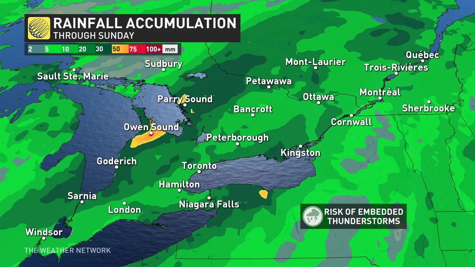
A line of rain showers and embedded thunderstorms will arrive along the shores of Lake Huron later Friday before a more organized low develops across southern Ontario Saturday keeping rounds of rain showers in the forecast for much of the day.
Temperatures Friday will be feeling more summer-like into the low to mid-20s before dipping a touch cooler with the rain on Saturday across southern Ontario and Quebec. Temperatures will rebound temporarily in the south on Sunday with a drying trend, before seasonably cool weather returns on Monday.
The same front will drag showers across much of Atlantic Canada on Sunday and into Monday. Newfoundland could see higher totals of rainfall as the front taps into some more moisture over the Atlantic Ocean.
As the weekend ends, Quebec will experience a colder upper trough, resulting in a fresh, northwesterly flow and below-seasonal temperatures. However, the coastal sections of Atlantic Canada will remain in a more southwesterly flow, maintaining seasonal temperatures.
Remember,bodies of water are chilly this time of year and can be fast-moving, so be cautious and practise water safety to avoid hypothermia. Although the forecast varies significantly across Canada, we wish you a safe and enjoyable May long weekend.
WATCH: Human-caused fires in B.C. a big concern ahead of long weekend
With files from Tyler Hamilton, a meteorologist at The Weather Network.