
Ontario's record-breaking November warmth won't last as temperatures plunge

Some northern communities experienced September-like temperatures Saturday, but a dramatic return to colder weather is just around the corner
Ontario saw an unexpected taste of September weather on Saturday, but the late-November warmth will not last.
On Nov. 21, temperatures climbed nearly 20 degrees above normal in portions of the province, with Sarnia achieving a statewide high of 18.9°C and northern municipalities shattering long-held late-season records.
READ: 5 astronomical events happening after we're gone
Northern Ontario breaks late-season warmth records
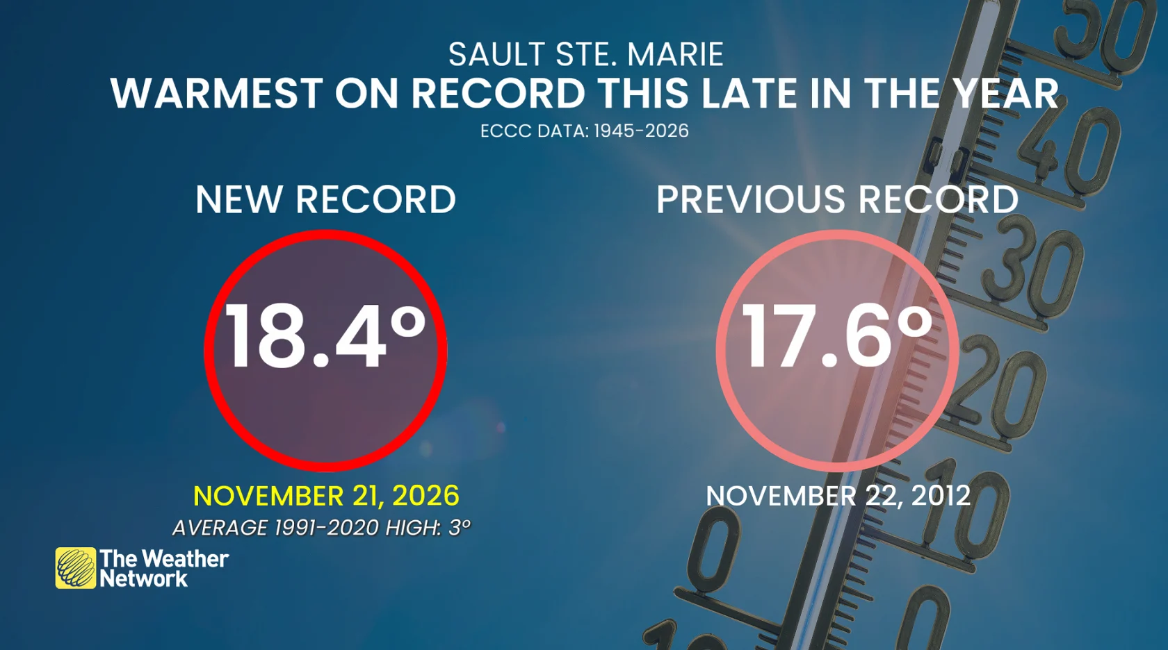
Sault Ste. Marie reached 18.4°C on Saturday, breaking its previous late-season record of 17.6°C set on Nov. 22, 2012, making it the warmest day of the year so far.
Timmins reached 18.1°C, breaking its previous late-season high of 14.4°C set on November 23, 1931. That's more typical of early September in a hamlet where the average high temperature on November 21 is only -1° Celsius.
Welland recorded an average temperature of 18.7°C, followed by Delhi and Wasaga Beach at 18.5°C, Brantford at 17.8°C, Goderich and Windsor at 17.5°C, and Guelph at 16.6°C.
SEE ALSO: This romantic Ontario city is your perfect fall getaway
Dramatic temperature plunge ahead
The September-like weather will be short-lived, as cooler air moves across Ontario to begin the week.
The dramatic drop will be most noticeable in northern Ontario, where Saturday's relatively pleasant weather will give way to temperatures more typical of late November.
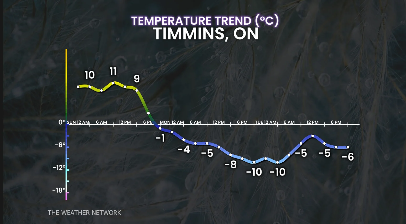
Temperatures might fall nearly 30 degrees lower than Saturday's highs by Monday, bringing the unusually warm weather to an abrupt end.
Stay with The Weather Network for the latests across Ontario