
Ontario: Ice storm threatens treacherous travel, outages this weekend

Travel could be impossible at times with the significant ice accretion, which is also bringing the chance for power outages.
EDITOR'S NOTE: This story is no longer being updated. Please click here for the latest forecast.
--
Wetter conditions return Sunday afternoon to Ontario, manifesting for parts of the province as an ice storm that could bring significant ice accretion, which could make travel nearly impossible at times. Other effects will range from showers to snow, depending on where you are and the time of day. Details and timing, below.
WEATHER HIGHLIGHTS:
Low-pressure system brings heavy rain, freezing rain and snow Sunday into Monday
Mild weather expected to dominate the final days of December
Stay up-to-date on the ALERTS in your area
SUNDAY: ICE STORM THREATENS THE REGION
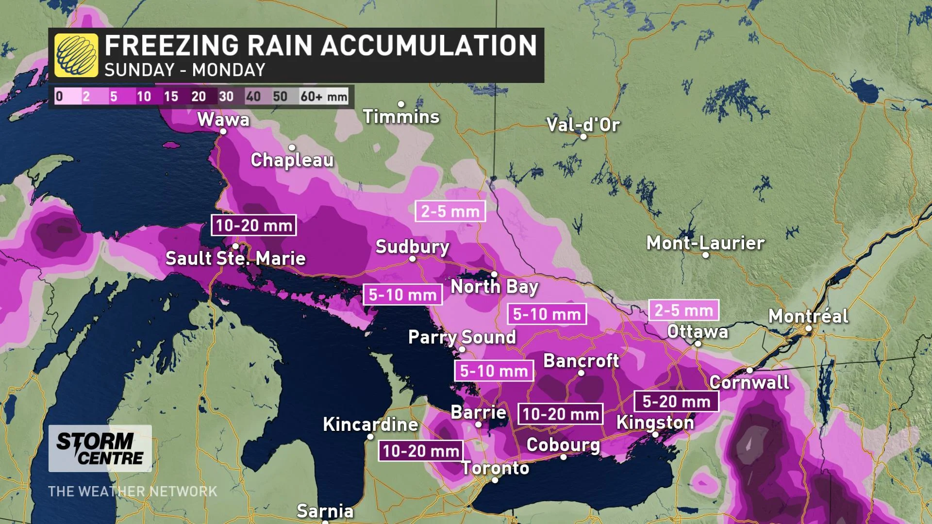
The next chance of rain and snow will come courtesy of a potent low-pressure system on Sunday, with freezing rain warnings already in effect Saturday for parts of eastern and northern Ontario.
The impacts will be wide-ranging and location-dependant, ranging from heavy snow in the north, ice pellets and freezing rain east of Georgian Bay and Lake Superior, and rain in the south.
During the early hours of Sunday, snow will lift into northwestern Ontario, while widespread rain will impact the south.

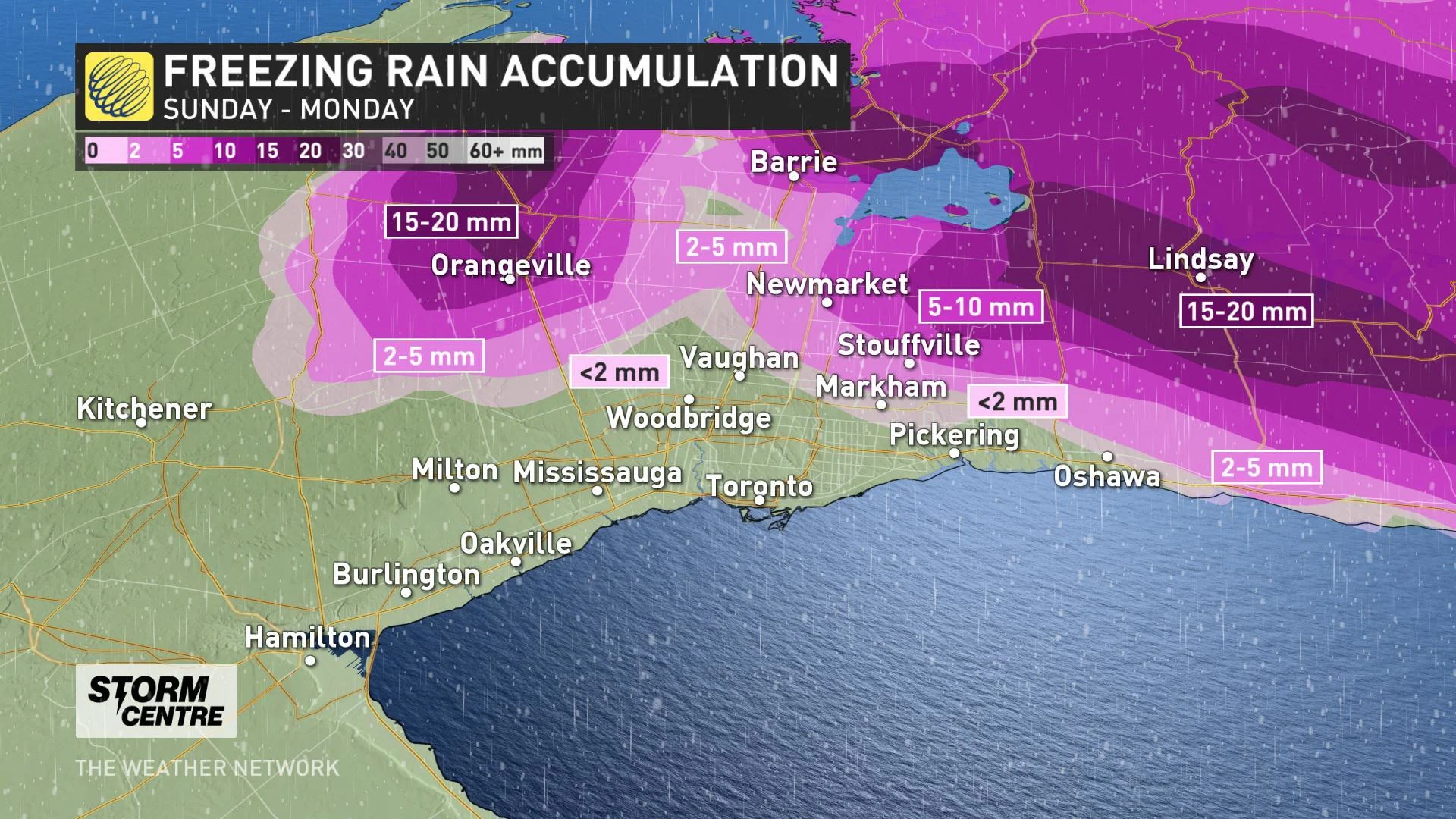
The heaviest amounts -- some 20-30 mm -- will be found along the shores, and somewhat north of lakes Erie and Ontario, with almost all the GTA included.

Bands of freezing rain, ice pellets and mixed precipitation will set up north and east of Lake Superior early Sunday and will then extend into parts of cottage country through the afternoon.
The freezing rain and snow will eventually reach the Ottawa Valley area through the afternoon and evening hours, and some areas through central and eastern Ontario will be looking at as much as 24 hours of freezing rain.
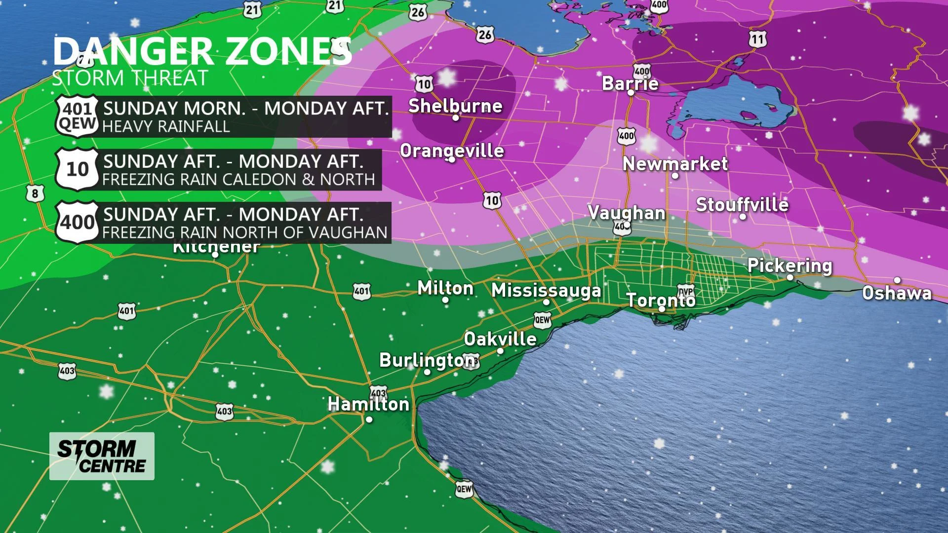
Most of the GTA and southwest isn't as likely to see freezing rain from this event, though the risk ramps up considerably for areas immediately to the north and east of the region. Travellers are encouraged to be mindful of the forecast and conditions before setting out.
As for the freezing rain risk north and east of the GTA, Sunday afternoon and Sunday overnight into Monday morning will pose the greatest time frame for ice to develop on surfaces to create slippery conditions and cause some localized power outages. Toronto and surrounding areas will remain ice free but wet conditions will persist Sunday into Monday.
Extended periods of freezing rain could lead to significant ice accretion or ice build up, which is concerning because it can can snap tree branches and weight down power lines, which can cause power outages. It also makes surfaces extremely slippery, which raises the danger for drivers as well as people walking on sidewalks and parking lots.
Travel is strongly discouraged in the regions that are expected to see significant icing and it is recommended that these areas prepare for possible power outages.

DETAILED LOOK AT THE STORM IMPACTS FOR OTTAWA AND EASTERN ONTARIO
A period of snow is also possible over the course of its events, with the heaviest amounts possible largely in the north, with significant amounts also possible along and west of the Ottawa Valley Sunday into Monday.

Once the system departs, colder temperature will follow and that will bring the chance for some flurries through the GTA and accumulating snow closer to Lake Huron and Georgian Bay.

Stay tuned to The Weather Network for the latest forecast updates.
WATCH BELOW: A CLOSER LOOK AT THE STORM'S GTA IMPACT BELOW
MILD WEATHER ENDS 2019 AND STARTS 2020
Temperatures will remain above seasonal across southern Ontario to close out the December, and into the first several days of January. Another system will track into our region at the end of next week and at this point it looks like we will see primarily rain.
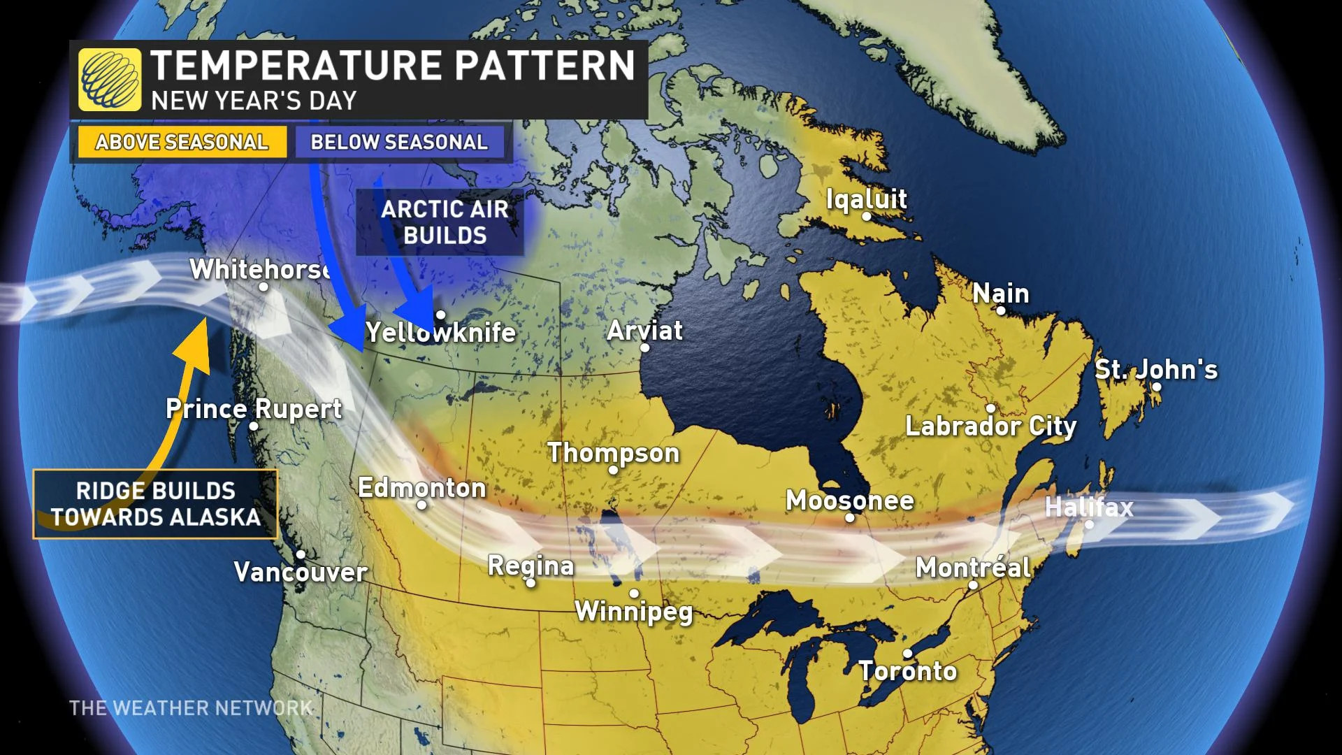
Beyond, a few days of colder (though near-seasonal) temperatures are expected after January 5th. There will be an abundance of frigid weather across western and central Canada through mid-January and some of that Arctic air will attempt to spread into our region. However, at this point it does not look like we will see consistent cold weather in our region - the focus of the frigid weather will likely remain well west of our region and mild weather is expected to surge into southern Ontario at times during the first half of January.