Ontario: Snow squall warnings issued, prepare for quickly changing conditions

Snow squall warnings in place for the southwest, watches for most of southern Ontario
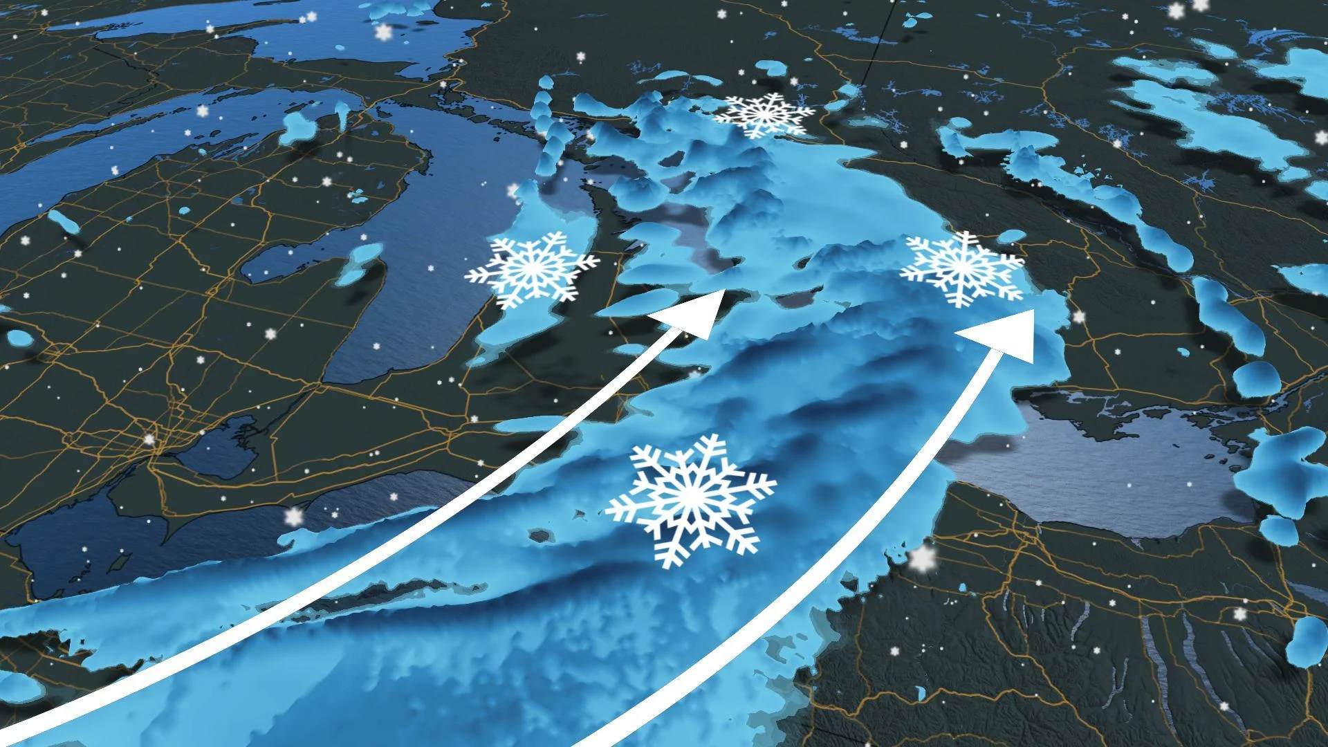
Those in southwestern Ontario should prepare for possible rapidly changing conditions as snow squall warnings have been issued by Environment Canada. Watches are in place for much of southern areas of the province.
The agency is warning of brief, but intense snowfalls, with strong wind gusts of up to 70 km/h in the squalls. The combination of heavy snow and strong winds will result in near-zero visibility.
"Travel is expected to be hazardous due to reduced visibility in some locations. Visibility may be significantly and suddenly reduced to near zero. Be prepared to adjust your driving with changing road conditions," warns Environment Canada.
LAKE-EFFECT SNOW MOVES IN TUESDAY
As the low pressure system slowly departs Ontario, wraparound snow will move through much of southern Ontario and the GTA for the morning commute, and could have a measurable effect on driving conditions, especially from the west.
Totals will range depending on where you are: 2-5 cm of snow is expected for the GTA up through the Barrie area, while amounts will increase to over 10 cm moving toward Orangeville and westward into the traditional snowbelt regions.
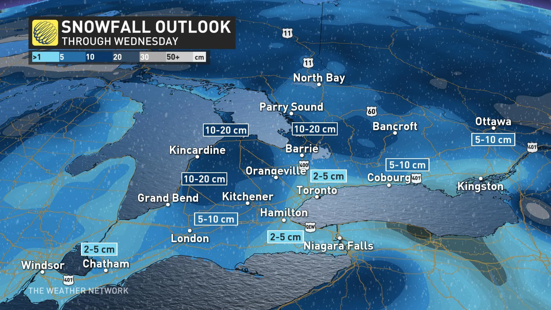
Bursts of widespread snow will linger across southern Ontario through much of the morning and early afternoon, before snow localizes to lake-effect squalls for areas south and east of Lake Huron and Georgian Bay for New Year's Eve.
MILD WEATHER ENDS 2019 AND STARTS 2020
Temperatures will remain near or above seasonal across southern Ontario as we welcome in January 2020. Another system will track into our region at the end of this week, and at this point, it looks like we will see primarily rain.
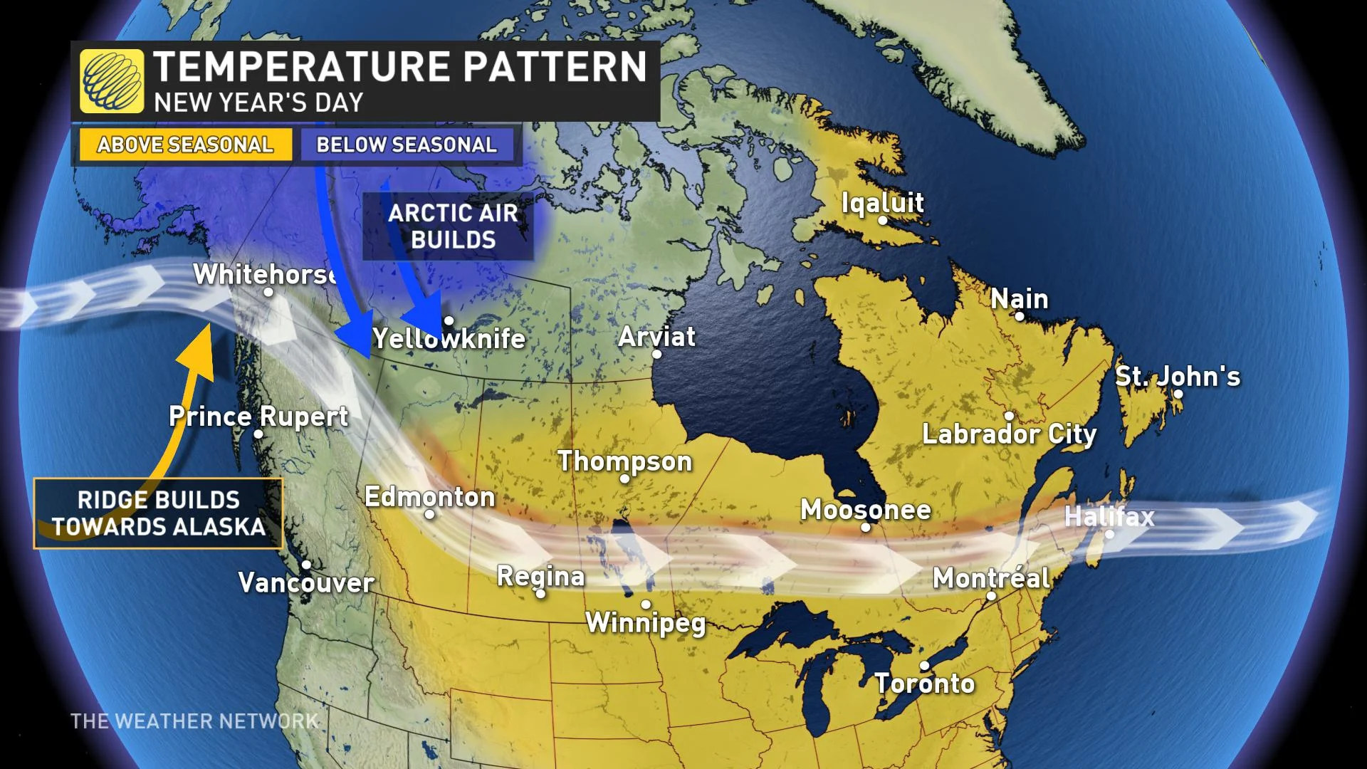
Beyond, a few days of colder (though near seasonal or slightly below) temperatures are expected after Jan. 5. There will be an abundance of frigid weather across western and central Canada through mid-January and some of that Arctic air will attempt to spread into our region.
"This should create an active pattern from the Great Lakes to Atlantic Canada. It is too early to know the exact storm track, but some high-impact winter weather is still likely for parts of the region despite the lack of consistently cold weather," says The Weather Network meteorologist Dr. Doug Gillham.
However, at this point it doesn't look like we'll see consistent cold weather in our region; the focus of the frigid weather will likely remain well west of our region and mild weather is expected to surge into southern Ontario at times during the first half of January.
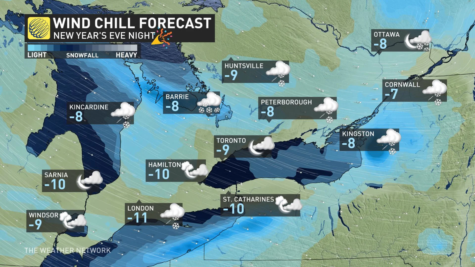
WATCH BELOW: GTA NEW YEAR'S EVE FORECAST
RECAP: IMPACTS FROM MONDAY'S ICE STORM
Extended periods of freezing rain overnight Sunday thorugh Monday afternoon led to significant ice accretion across central and eastern Ontario.
Tens of thousands across the region were without power on Monday, with dicey travel conditions impacting major travel arteries — including stretches of Highway 401 east of Trenton, Ont.
Thumbnail image courtesy of Sarah Ferguson, Twitter