U.S. predicts above-average Atlantic hurricane season

The U.S. National Oceanic and Atmospheric Administration predicts 13-19 named storms, with 6-10 reaching at least Category 1 hurricane status.
2020 looks to feature an above-normal Atlantic hurricane season, according to the U.S. National Oceanic and Atmospheric Administration (NOAA).
That prediction, released this week, comes soon after the first named storm of the year made its appearance a few weeks before the "official" Atlantic hurricane season, which runs from June 1st to November 30th.
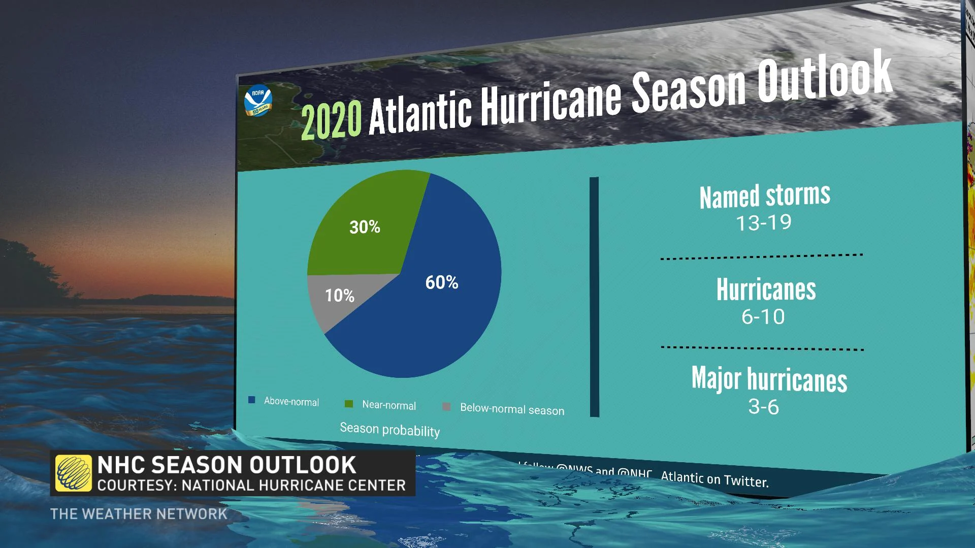
NOAA's Climate Prediction Center estimates there's a 60 per cent chance of an above-normal season, a 30 per cent chance of a near-normal season, and only a 10 per cent chance of a below-normal season.
What that means in practice is an estimated 13-19 named storms, with winds of at least 63 km/h, the threshold for a tropical storm. NOAA says, of those, 6-10 could cross the hurricane threshold (winds of 118 km/h or greater), and 3-6 major hurricanes (Category 3 and above, with winds of at least 178 km/h).
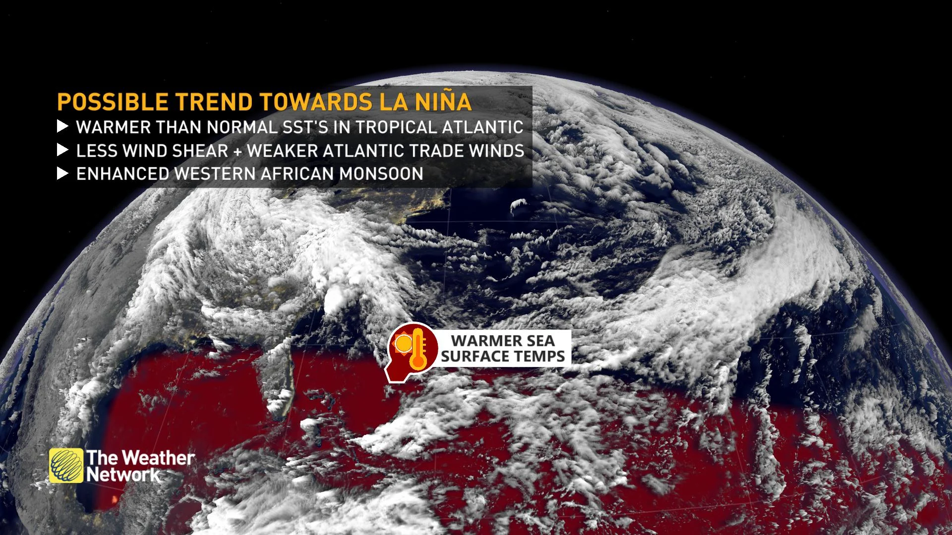
LA NIÑA CONDITIONS, WARMER SEA TEMPERATURES
The agency points to a number of climate factors driving their higher-than-average prediction.
First, NOAA says they do not expect El Niño conditions -- a cyclical warm-water anomaly in the Pacific -- this year. El Niño conditions have climate impacts far afield from the Pacific, and neutral or colder-trending conditions -- known as La Niña, El Niño's cooler counterpart -- translate into reduced checks on hurricane formation in parts of the Atlantic.
Closer to home, warmer-than-average tropical Atlantic and Caribbean waters will also aid hurricane formation, along with reduced wind shear, weaker tropical Atlantic trade winds, and a more active West African monsoon season.
"Similar conditions have been producing more active seasons since the current high-activity era began in 1995," a release from the agency reads.
SEASON ALREADY HAS A HEAD START
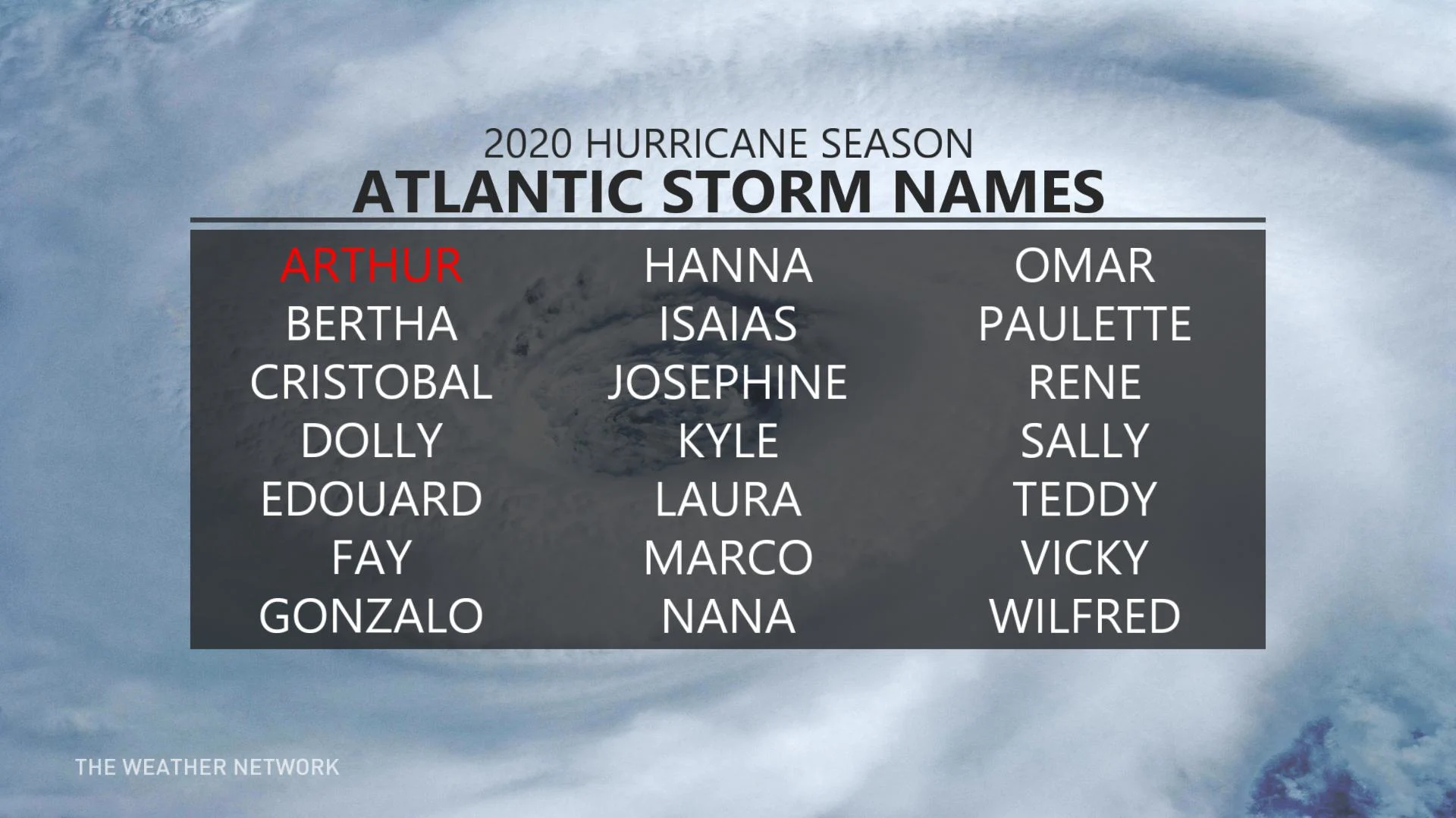
The 2020 season doesn't "officially" begin until June 1st, but the first named storm of the year has already come and gone.
An area of low pressure that formed near Florida and Cuba and moved gradually northward parallel to the southeastern U.S. coast crossed the tropical storm threshold on May 16th. Named Arthur, it did not approach land, and actually took a turn to the east in its final stage before dissipating on May 19th.
Earlier this year, experts at Colorado State University similarly predicted an above-average season.
As climate change continues, there's strong evidence that a warmer world will have a major impact on hurricane formation, though unevenly, depending on the location.
A study released earlier this year suggests climate change has already been a factor in the increase in the number of hurricanes in the North Atlantic and Central Pacific since the 1980s (though the western Pacific and southern Indian Ocean saw a decline over the same period).