Feisty B.C. storm threatens 100+ mm of rain through the weekend
Fresh on the heels of one storm is another moisture-laden system aiming for British Columbia with widespread heavy rain and high-elevation snows
We’re on the lookout for a formidable slug of heavy rain arriving on the West Coast this weekend as an atmospheric river winds its way toward British Columbia.
Milder temperatures will make this a heavy rain event for folks at lower elevations, while the mountain passes will see a renewed opportunity for snow.
MUST SEE: Canada's November Outlook: A smooth transition or a free fall into winter?
Heavy rain spreads over B.C. this weekend
Lower freezing levels allowed snow and freezing rain to fall across B.C.’s Interior with the system that hit on Thursday.
Our next system is arriving with an atmospheric river that will both enhance moisture levels and bring in milder temperatures. This combination will send freezing levels rising into the weekend, relegating most of the snow to higher elevations and some of the mountain passes.
This atmospheric river will likely be classified as a category one or two, meaning it could provide beneficial rains while also potentially bringing hazards depending on how quickly the rain falls.
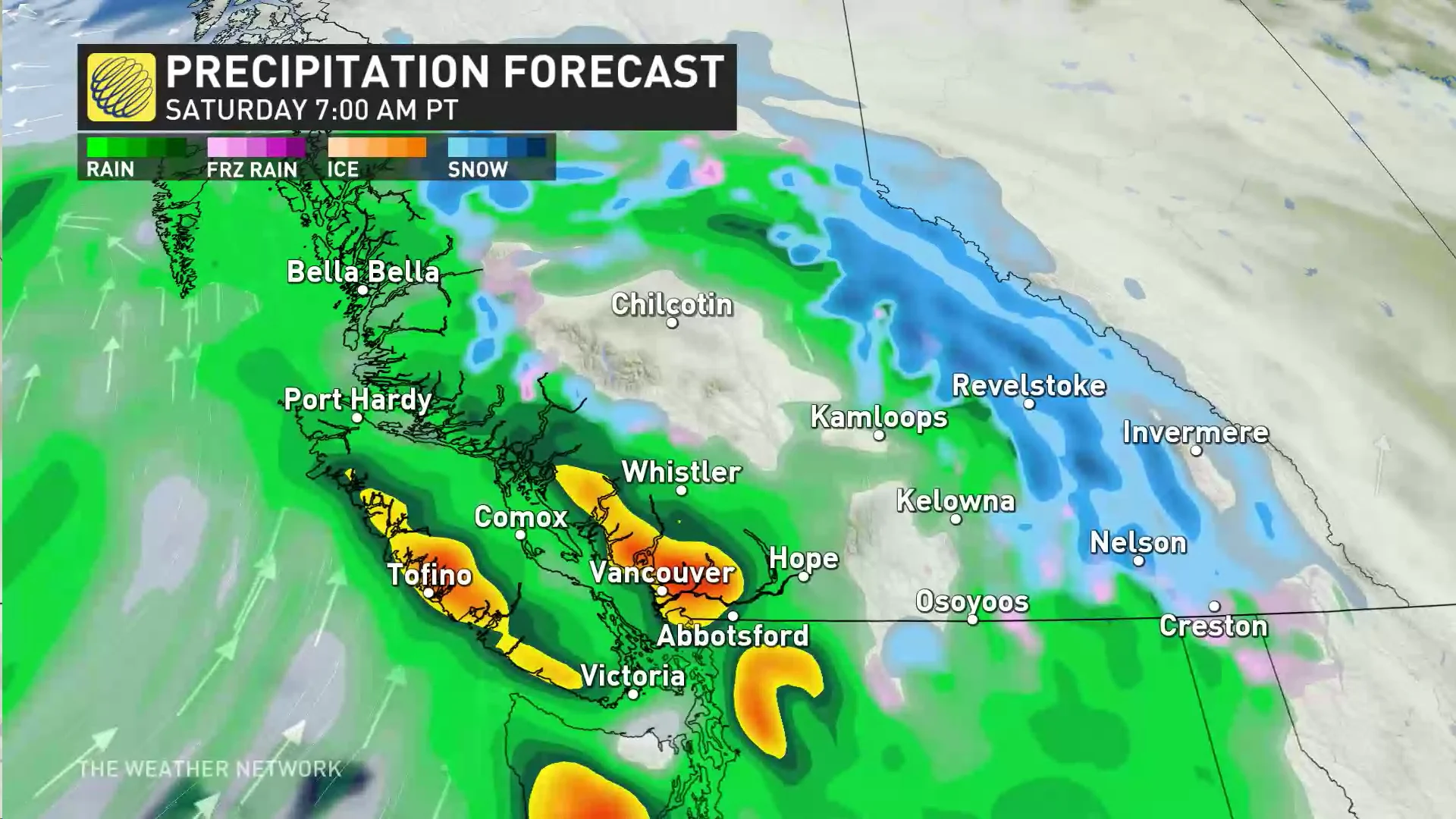
Vancouver Island, the coastal mountains, and the Lower Mainland can all expect heavy rainfall as they wake up on Saturday morning, with heavy showers persisting on-and-off straight into Sunday. This rain will prove heavier than what we saw with the system on Wednesday night and Thursday.
READ ALSO: Canada’s strong jet stream creates a bomb cyclone that will hit the UK, France
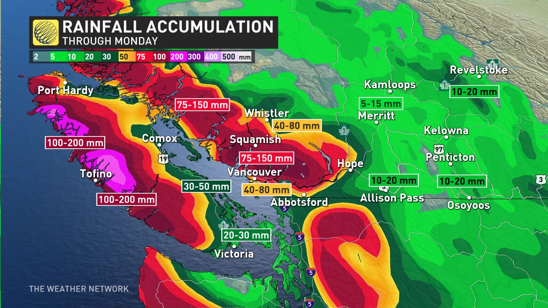
Rainfall totals through Sunday will exceed 50 mm for much of the Lower Mainland and Vancouver Island, with rain shadows in the usual areas like Victoria bringing lower accumulations. Some areas along the Fraser between Abbotsford and Hope could see rainfall totals of 75+ mm by Sunday.
Mild air from the Pacific will continue streaming ashore to replace colder air across the region, pushing the risk for frozen precipitation farther into the Interior, east of Kamloops, Kelowna, and Osoyoos.
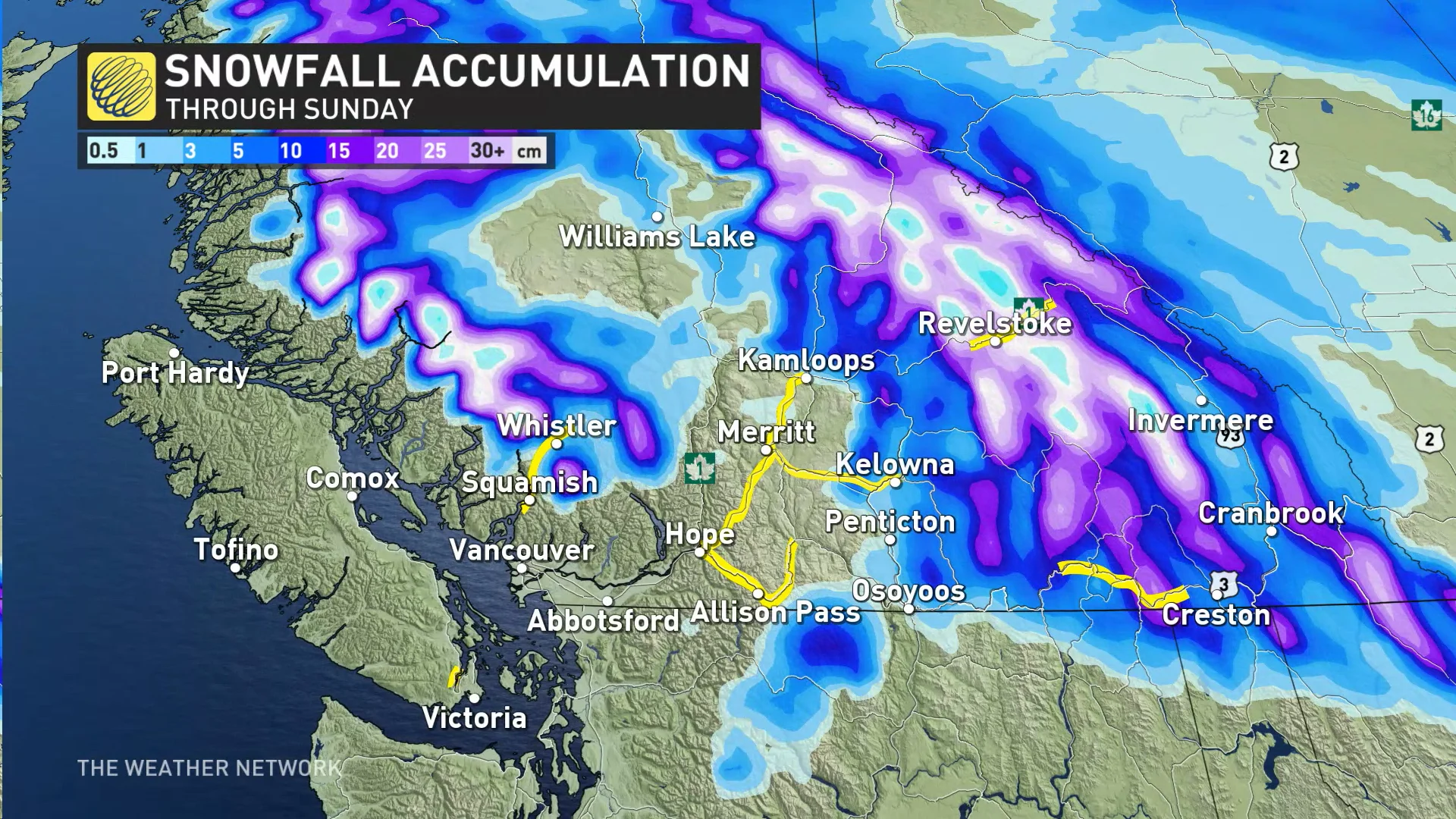
Eagle Pass, Rogers Pass, and Kootenay Pass will likely see accumulating snow through the weekend. Travellers planning to head through these regions should prepare for slick roads and slow going.
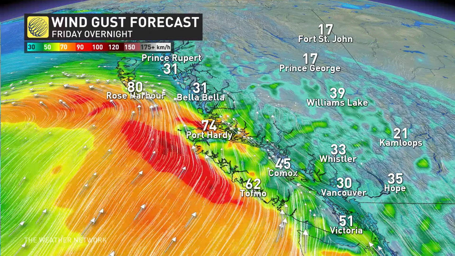
Winds will pick up as the system moves into the region, as well. Haida Gwaii and the northern coasts of Vancouver Island will likely see gusts of 70-90 km/h as the system approaches the shore overnight Friday into Saturday.
Environment and Climate Change Canada (ECCC) issued a wind warning for coastal sections of northern Vancouver Island ahead of the storm. “High winds may toss loose objects or cause tree branches to break,” ECCC said in its warning.
Unsettled weather is likely to continue through early next week before a spell of drier weather takes hold. Forecasters see an active pattern resuming by the end of next week and into the following weekend.
Stay tuned to The Weather Network for the latest on conditions across B.C.