Canada’s strong jet stream creates a bomb cyclone that will hit the UK, France

Powerful weather bomb Ciaran to impact Europe with violent winds and potential flooding
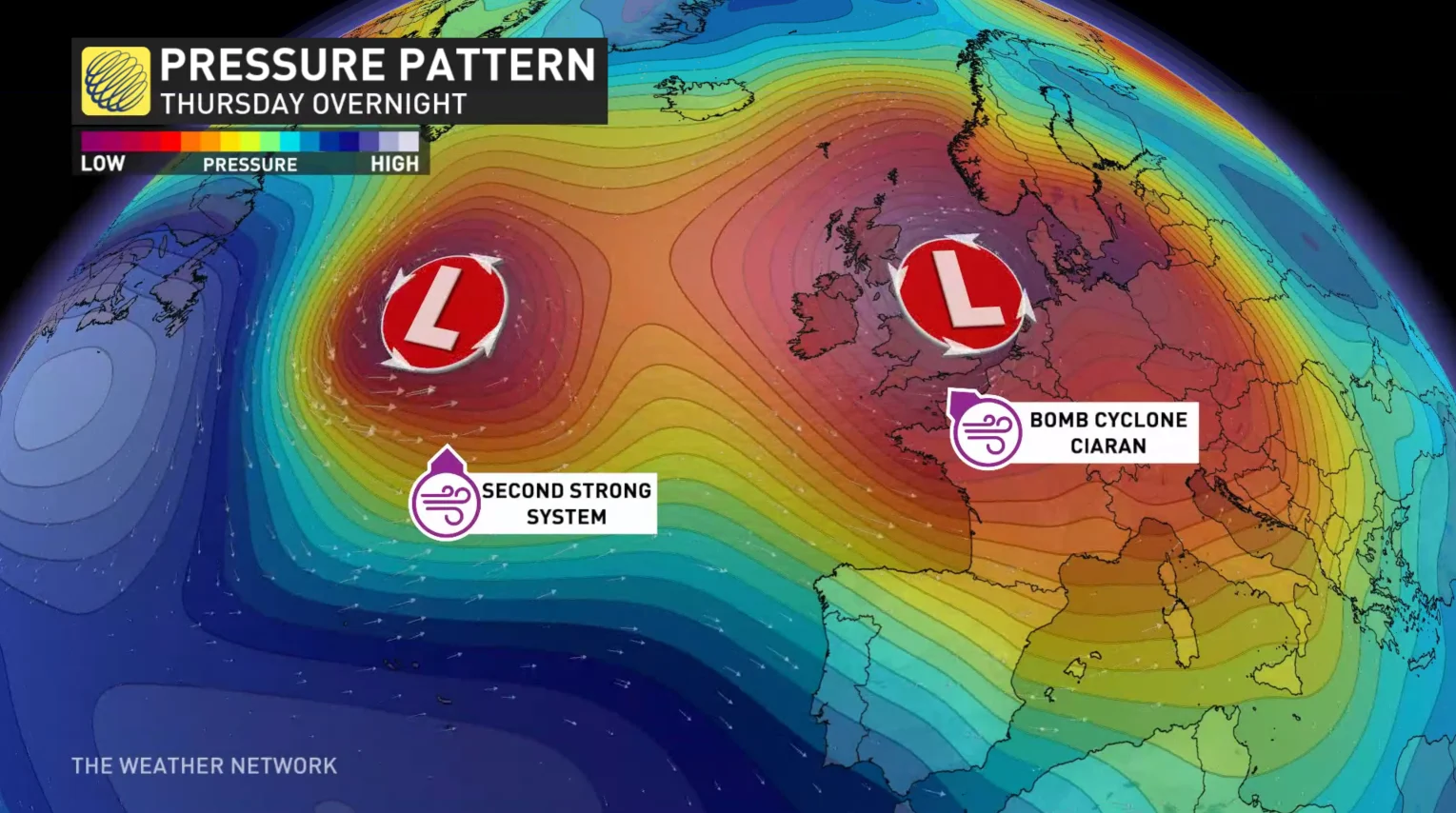
It's been less than two weeks since the powerful Storm Babet wrecked havoc across the United Kingdom. Now by Thursday, another named storm is on a collision course with the UK, Ireland and France. The UK Met Office has named this next strong storm, Ciaran.
It is forecast to become a weather bomb Wednesday into Thursday, dropping its pressure by more than 24 millibars in less than 24 hours, all because of a few weather ingredients over Canada.
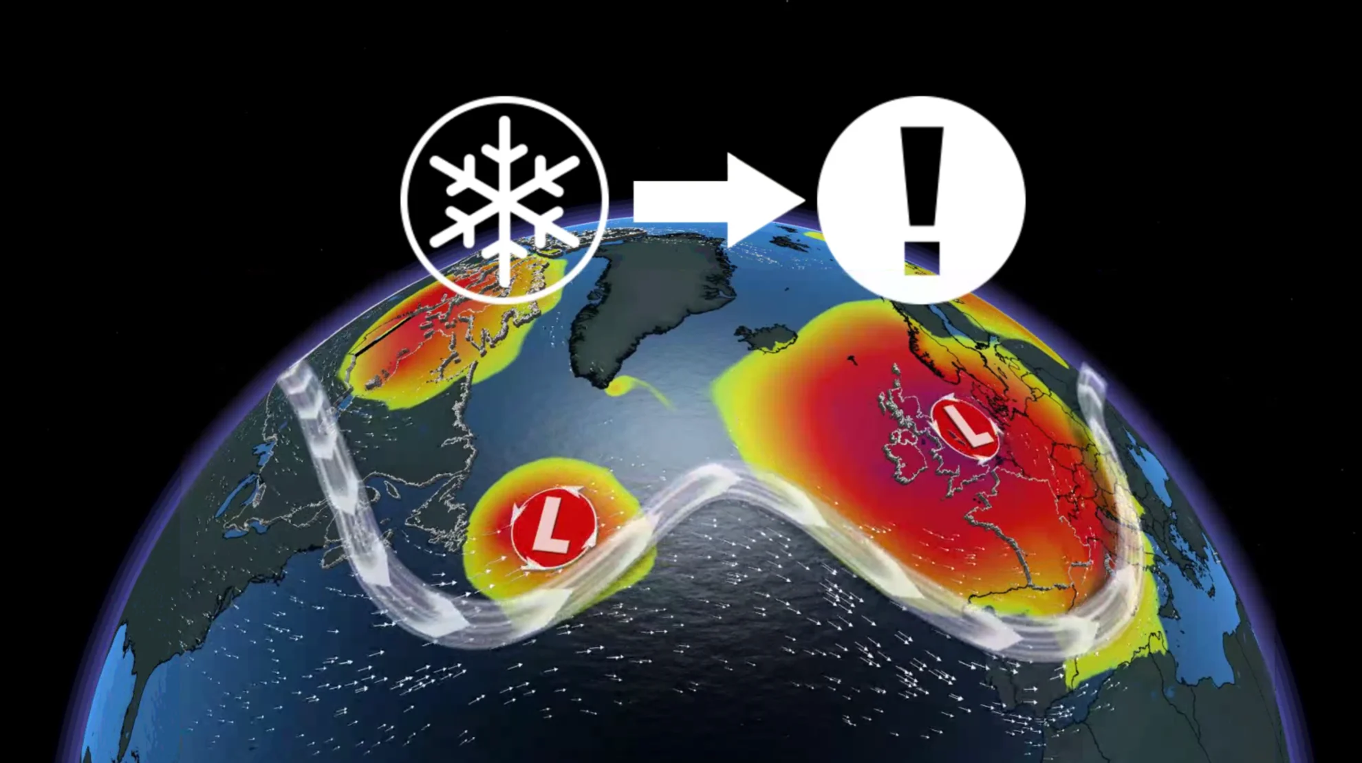
First, the jet stream over Canada's East Coast. It is so strong, aircraft have flown over Atlantic Canada with incredible ground speeds. We're talking well over 1000 km/h!
At around 8 p.m. on Tuesday, over 66 flights reported airspeeds of 713 miles per hour, or nearly 1150 km/h.
For perspective, the average ground speed of a plane is 925 km/h on the high end, so we're reporting a well over 200 km/h boost in speed.

Second, remember New Brunswick's first snowfall event on Monday, and how it left thousands in the dark across Moncton? That same low pressure system, accompanied by Canada's strong jet stream, will eventually create a beast of a storm as they traverse the Atlantic Ocean together.
RELATED: First snowfall leaves thousands without power in Moncton area
The jet stream injects ample energy and wind speeds into the low pressure system, allowing explosive development into Ciaran in the coming day or so.
As a result, very violent winds of hurricane strength are expected upon landfall late Wednesday through Thursday. High wind warnings have been issued for southern UK and Wales, warning of property damage as gusts reach 110-130 km/h Thursday.
Northeastern France has issued wind warnings as well, promoting very violent inland winds of 130-140 km/h, and up to an impressive 170 km/h for the exposed coast. Flooding rains are also a concern here, where 50-60 mm may fall in a short six hour timespan.

And that is not all.
Another similar Canadian weather combination follows closely behind. The same low pressure system bringing Nova Scotia's first snow Wednesday will swiftly follow Ciaran, and likely also be named by the UK Met office because of its building strength by the weekend.