Winter picks up steam in Ontario, 3 more rounds of snow, difficult travel ahead
Three storms in three days—Ontario on alert for more impactful winter weather
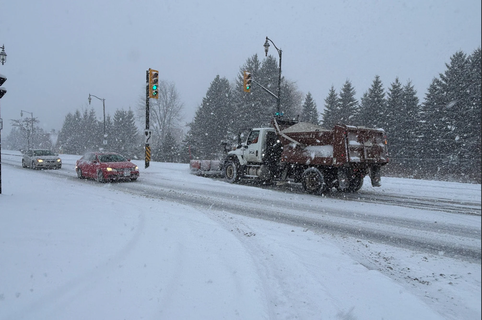
There's certainly no lack of winter weather across Ontario this week, with back-to-back storm systems bringing rounds of snow, gusty winds, and difficult travel to end off the month of January.
Drivers are urged to continue to brace for the quickly changing and deteriorating conditions.
SEE ALSO: Thundersnow is a rare and electrifying experience
Lake-effect snow, another clipper system, and a Texas low -- there will be three different types of snow events to watch out for over the next three days.
Stay up-to-date with the latest weather alerts in your area, and be sure to monitor road conditions throughout the region.
Wednesday - Day 1:
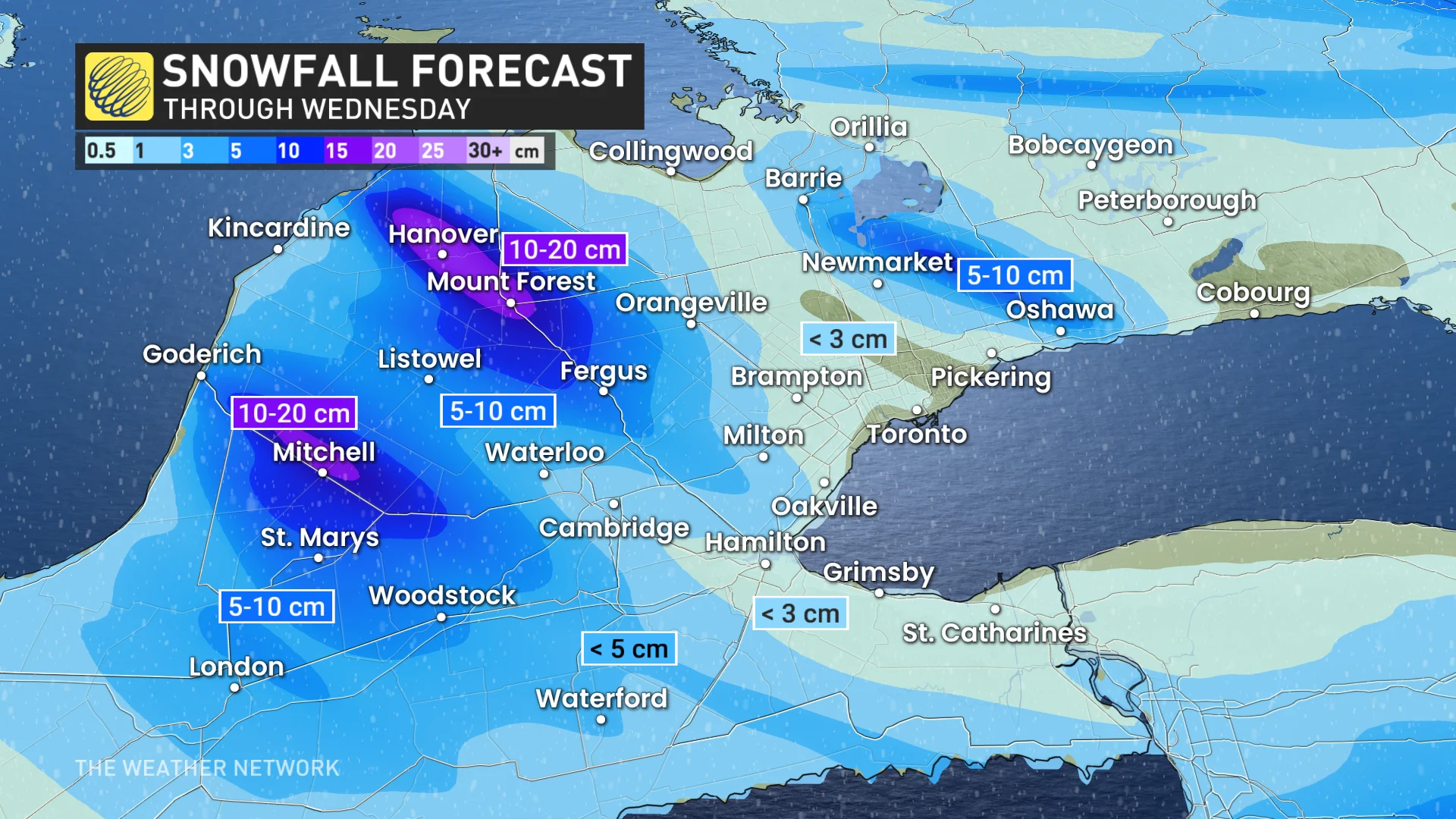
Snow from Tuesday's clipper system continues across eastern Ontario on Wednesday, with 5-10 cm falling in the Ottawa region. This resulted in several school bus cancellations across the region first thing Wednesday.
Brief bursts of heavy snow and gusty winds also prompted winter weather travel advisories across parts of the Greater Toronto Area (GTA) early Wednesday, warning drivers of lower visibility at times.
"If visibility is reduced while driving, slow down, watch for tail lights ahead and be prepared to stop," said Environment and Climate Change Canada (ECCC) in the alert.
RELATED: Winter hasn't been so kind to Ontario's snowbelt regions so far
As the system moves out, lake-effect snow will burst sporadically across southern Ontario. Three dominant bands could lead to an additional 10-20 cm of snow, locally.
The lake-effect snow will bring little impacts to the GTA.
Thursday - Day 2
Another clipper system will move in from the Prairies, spreading snow from Thunder Bay to Ottawa through Thursday afternoon. That could bring another 5-10 cm of snow to the impacted areas.

Southern Ontario and the GTA will miss out on this snow, but eyes are on a potentially more impactful event for Thursday night and into Friday.
WATCH: Thundersnow flashes over Ontario during early morning storm
Friday - Day 3
Forecasters are closely watching a Texas low develop and track close to Lake Erie.
At this time, there is still much uncertainty with the storm’s track, and how it interacts with a clipper to the north, and Colorado low to the west.
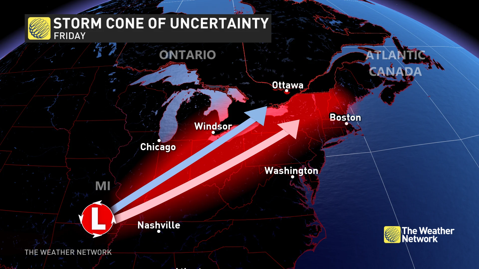
Currently, some computer models have the storm staying south, missing Ontario all together.
RELATED: How Colorado lows and Texas lows affect our weather in Canada
Other models move the storm into Windsor, and the west GTA by Thursday night. This scenario would bring a rain and snow mix into Friday morning, changing to heavy snowfall by the afternoon, as the colder air takes over.
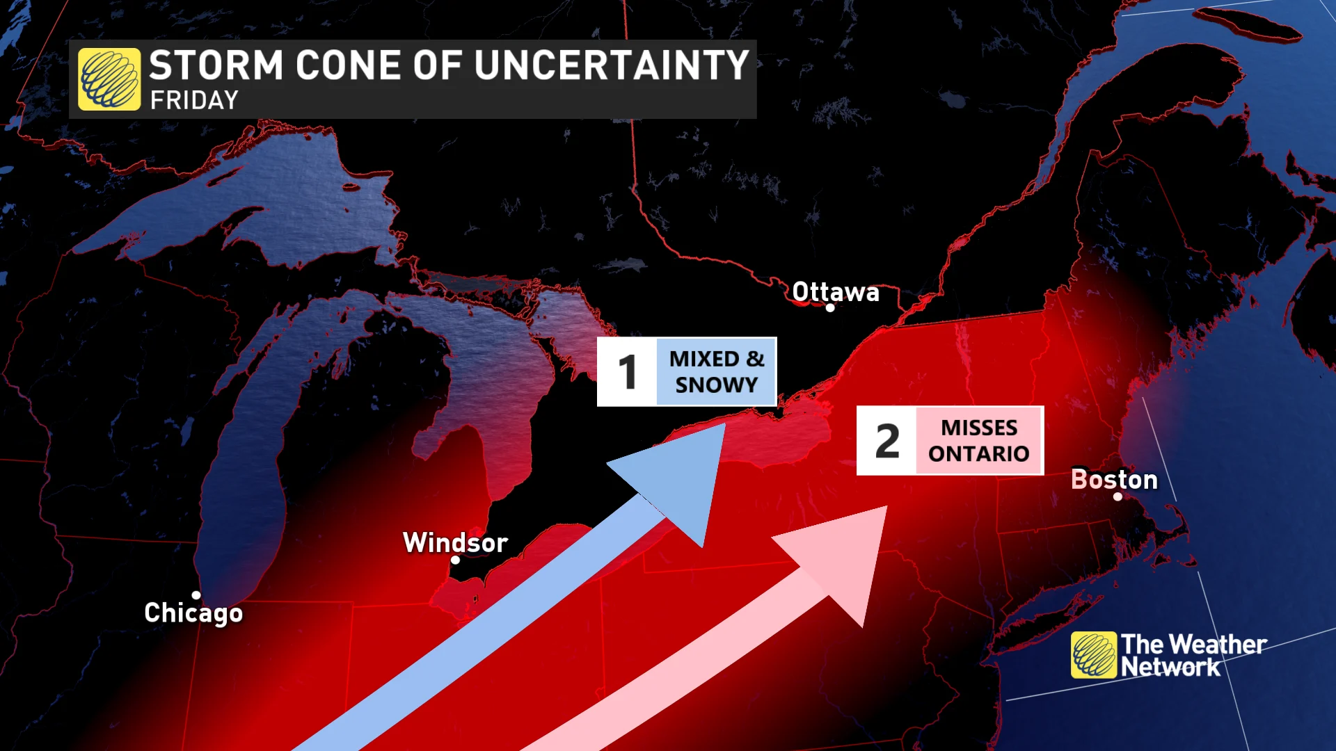
Texas lows are known for carrying a lot of moisture. If the snow event pans out, it could be quite significant for the region on Friday. It will definitely be something to keep an eye on over the coming days.
Temperatures will plunge into the minus teens in southern Ontario by Saturday, making for the coldest day of the weekend.
'Volatile' pattern as February begins
An active and volatile pattern is expected for the first few weeks of February, as the region remains the battleground between cold and mild air masses.
DON’T MISS: January’s jet stream drama leads to February pattern swap in Canada
This pattern is conducive for messy winter systems.
WATCH: Treacherous travel with gusty winds across Ontario
Be sure to check back for the latest forecast updates across Ontario.