More snow on the doorsteps for Ontario amid looming pattern swap
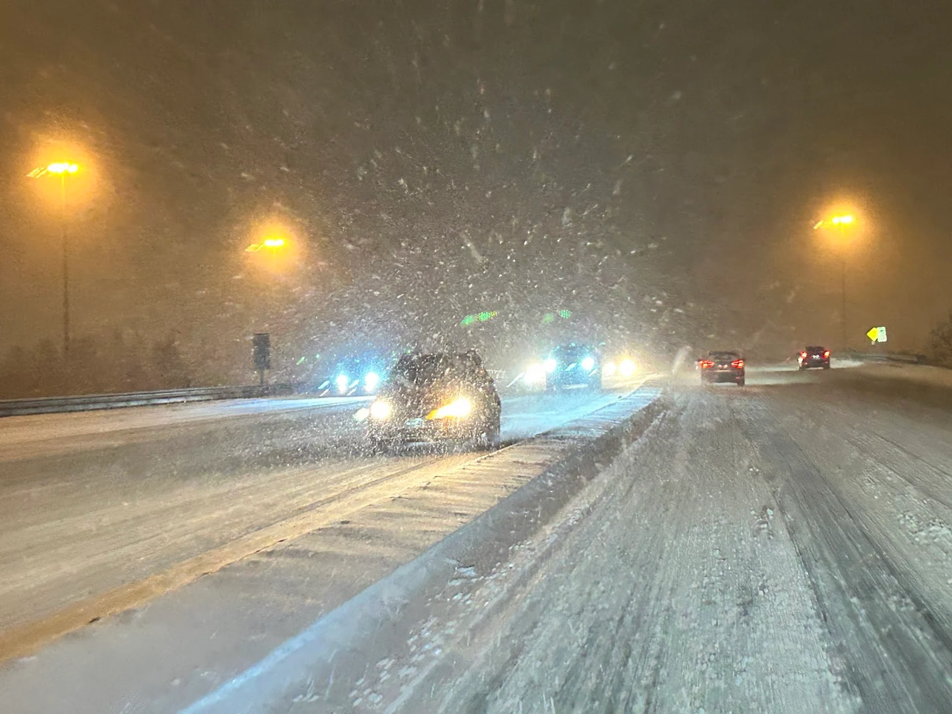
How much snow will you wake up to, Ontario? After a snowy Tuesday evening, impacting the commute, bands of lake-effect snow will pick up once again as the clipper departs the region Wednesday.
Many southern Ontario residents will want to keep the snow-clearing equipment handy through Wednesday, and again in the foreseeable future, as the region undergoes a pattern change to usher in February.
After a snowy Tuesday evening, impacting the commute, bands of lake-effect snow will pick up once again as the clipper departs the region Wednesday, with locally higher snowfall totals and dangerous whiteout conditions likely. Snow squall watches and winter weather travel advisories are in place.
DON'T MISS: Ice shoves are the hidden danger of the Great Lakes
Drivers are urged to brace for the changing and deteriorating conditions. If visibility is reduced while driving, turn on your lights and maintain a safe following distance.
The active weather doesn’t end there, either, with more systems that will impact Ontario this week, and into the weekend. A volatile pattern is expected as we head into February, as the region remains a battleground between the contrasting air masses. This type of pattern can produce messy Colorado and Texas lows, which will tap into Gulf moisture.
RELATED: The crucial extra item you must include in your winter emergency kit
Tuesday night into Wednesday: Brace for snowy travel impacts
A potent clipper system moved across Ontario Tuesday evening, with snow becoming heavier across the snowbelts before reaching the Greater Toronto Area (GTA). This time, the snow was wetter and stickier, bringing some decent totals through Wednesday morning.
The heaviest snow totals will fall across the snowbelt region once again, with 10-25 cm forecast through Wednesday. As the cold front passes through on Wednesday, additional snow squalls will kick up, with locally higher totals and whiteout impacts expected.

"Visibility may be suddenly reduced at times in heavy snow. Surfaces such as highways, roads, walkways and parking lots may become difficult to navigate due to accumulating snow," Environment and Climate Change (ECCC) said in the snow squall watch.
Drivers are urged to brace for the changing and deteriorating conditions. If visibility is reduced while driving, it's important to slow down, watch for tail lights ahead, and be prepared to stop.
Stay up-to-date with the latest weather alerts in your area, and be sure to monitor road conditions throughout the region.

Volatile pattern takes shape as we kick off February this weekend
We're closely watching the track of a Texas low, which is expected to push south of the region during Friday. This system will be a primarily rain event for the eastern U.S., but there could be some ice and snow along the northern edge of the system. It is possible that this system will track too far south of the border to have a significant impact on southern Ontario, but a more northerly track would bring the threat for snow, ice and rain into the region.
DON’T MISS: January’s jet stream drama leads to February pattern swap in Canada
An active and volatile pattern is expected for the first few weeks of February, as the region remains the battleground between cold and mild air masses. This pattern is conducive for messy winter systems.
WATCH: Treacherous travel with gusty winds across Ontario
Be sure to check back for the latest forecast updates across Ontario.