
More snowy impacts as February begins with back-to-back storms over East Coast
Winter begins to pick up steam across Canada's East Coast as back-to-back storm systems bring snowy impacts through the start of February
After a snowy mid-week storm that prompted early school closures across parts of the Maritimes on Wednesday, an active pattern will stay locked in place for Atlantic Canada as we kick off the month of February this weekend.
That means more messy winter storms and the potential for travel impacts.
Keep in mind however, that this type of set-up is normal for this time of year, and while the back-to-back storm systems may feel overwhelming at times, it is nothing unusual for the region in February. It may just feel slightly heightened in terms of activity based on an overall quieter first half of the winter season so far.
DON'T MISS: January’s jet stream drama leads to February pattern swap in Canada
Stay up-to-date with the latest weather alerts in your area when winter storms hit, and be sure to monitor road conditions throughout the region.
Thursday: Snow squalls kick up as cold westerly winds strengthen
The heaviest snow has now moved out of the Maritimes, and the worst of Wednesday's storm has passed, but some sea-effect snow bands will continue to impact Cape Breton and parts of western Newfoundland through the day on Thursday.
Under the snow squall bands, visibilities will be significantly reduced with wind gusts over 60 km/h, and snow will quickly accumulate.
"Surfaces such as highways, roads, walkways and parking lots may become difficult to navigate due to accumulating snow," warned Environment and Climate Change Canada (ECCC) in a snow squall watch issued for the region first thing Thursday.
This weekend: More snow with a couple of systems to watch
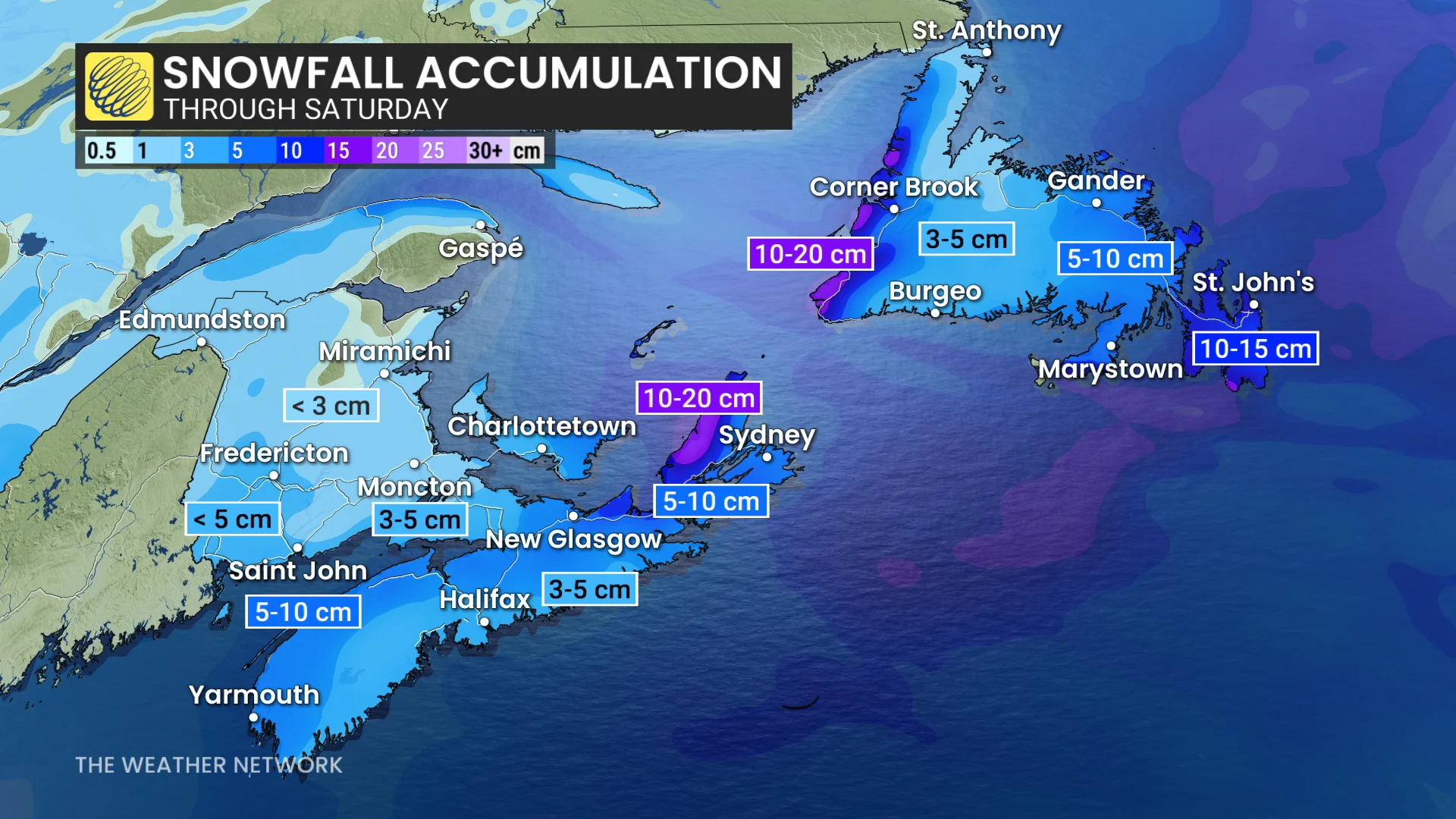
Additional snowfall is forecast across Atlantic Canada heading into the weekend, as well.
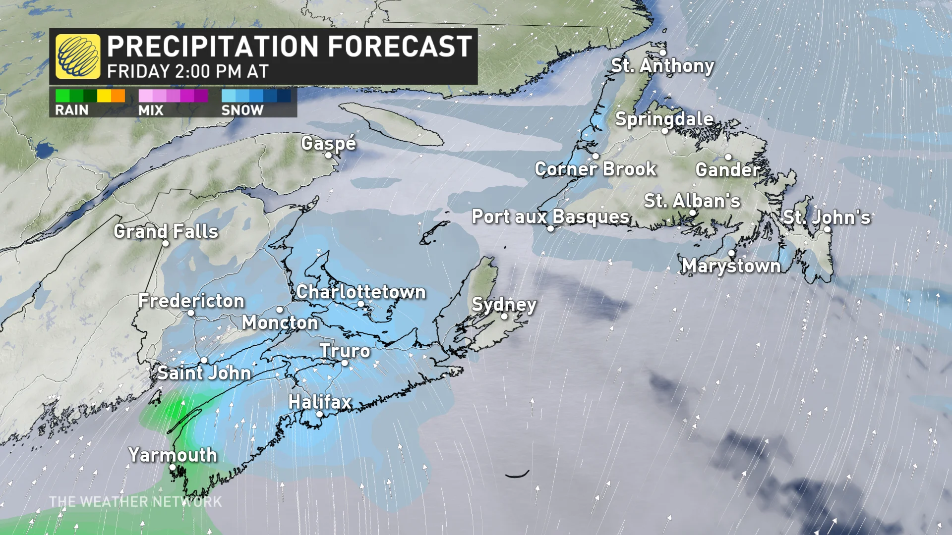
On Friday, a weak system will move over the Maritimes, bringing 3-5 cm of snow to much of New Brunswick, PEI and southern Nova Scotia. Heavier snow totals between 5-10 cm are forecast to fall in eastern sections of Nova Scotia.
The system will move towards Newfoundland through the overnight hours and into Saturday morning, with heavy snow once again targeting the Avalon and Burin peninsulas. Totals could reach between 10-15 cm, which is much more significant than anything the area has seen for much of this winter so far.
Another significant system is expected early next week, but the exact track and impacts are still uncertain at this time.
WATCH BELOW: Happy kids head home early due to snow in Halifax
The temperature rollercoaster will continue across the region, as warm and cold air masses fight to win out over each other.
On Thursday, temperatures will plunge well into the minus digits in the wake of the heavy snow, also helping to generate the sea-effect squalls.
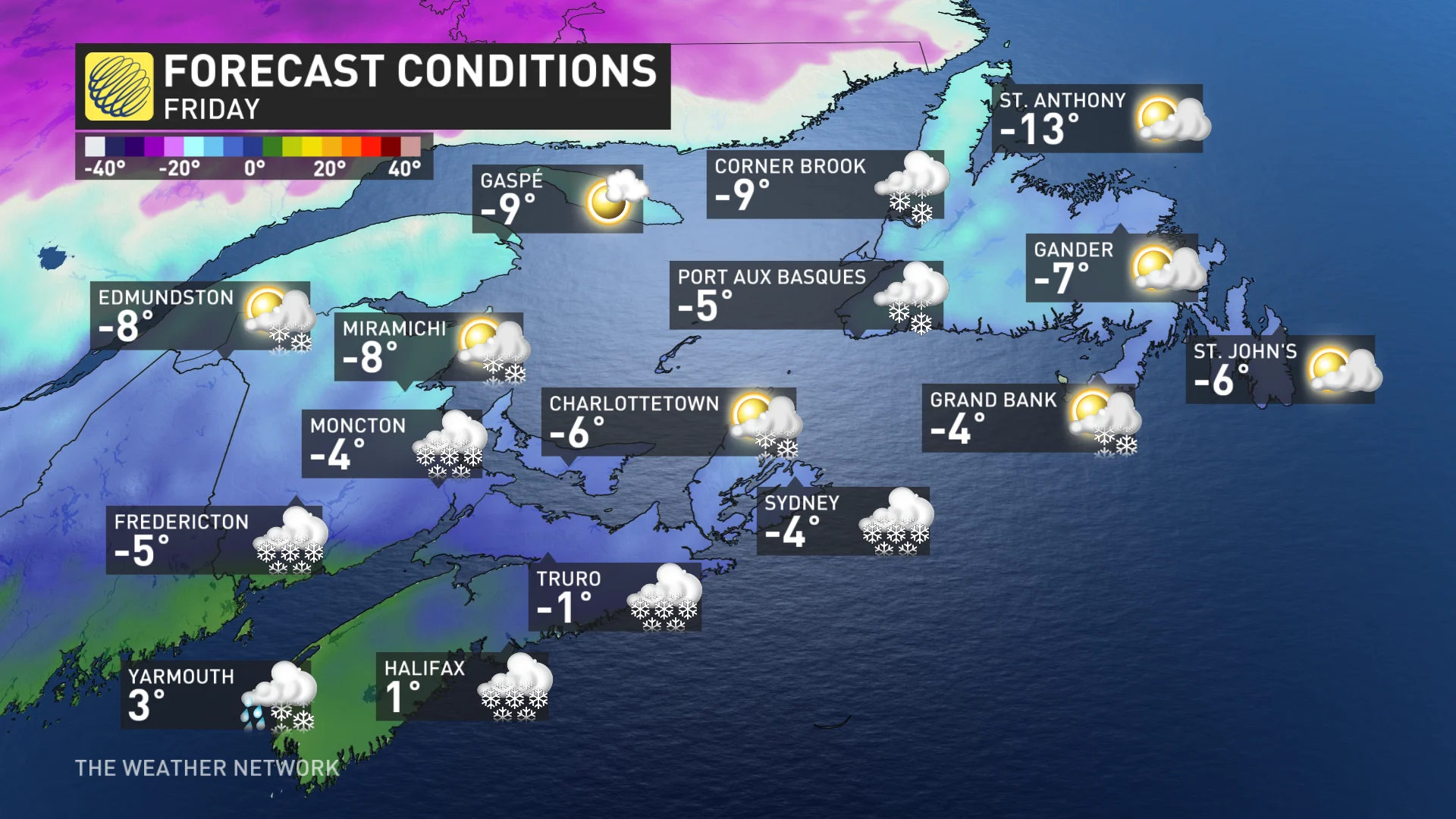
Temperatures will rebound across the southern Maritimes for Friday, turning colder once again for the start of the weekend on Saturday.
SEE ALSO: Claws vs. Paws: Nova Scotia’s lobster and groundhog compete for spotlight
This type of pattern with the flip-flopping temperatures can be conducive to more messy and moisture-packed winter storms.
Stay tuned to The Weather Network for the latest forecast updates for Atlantic Canada.
WATCH BELOW: Car crash happens live on air during snowy conditions in Halifax
Thumbnail courtesy of Matthew Drover.