Messy, wintry precipitation dampens East Coast's long weekend
Back-to-back stormy systems will continue to bring winter-like impacts across Atlantic Canada this Easter long weekend.
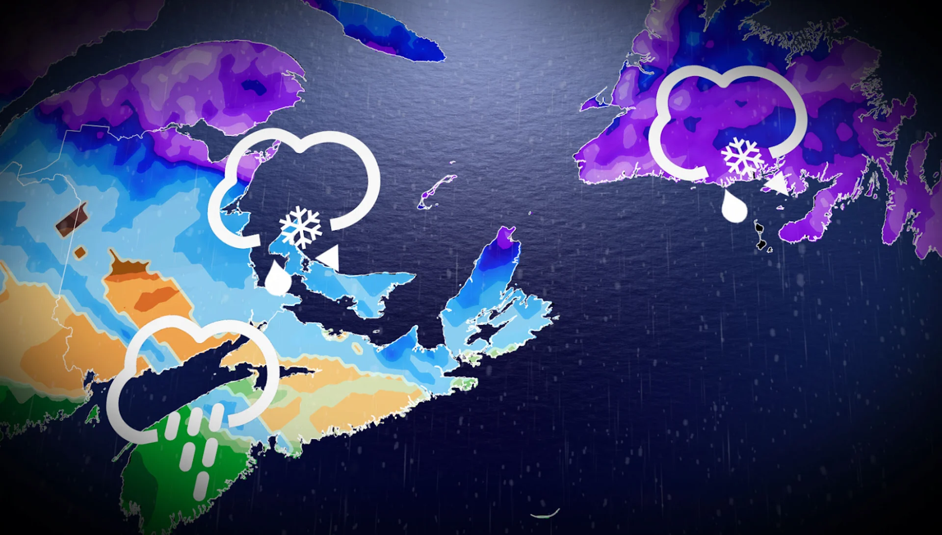
Atlantic Canada braces for back-to-back winter storms on Saturday and Sunday. Snow, ice, and potential road closures may cause travel disruptions, with isolated power outages also possible.
Weather Highlights:
Saturday: Snow, ice, and rain across NB, P.E.I., and Nova Scotia, with 10-20+ cm of snow hitting southern Newfoundland
Impacts: Travel disruptions, road closures, and power outages possible
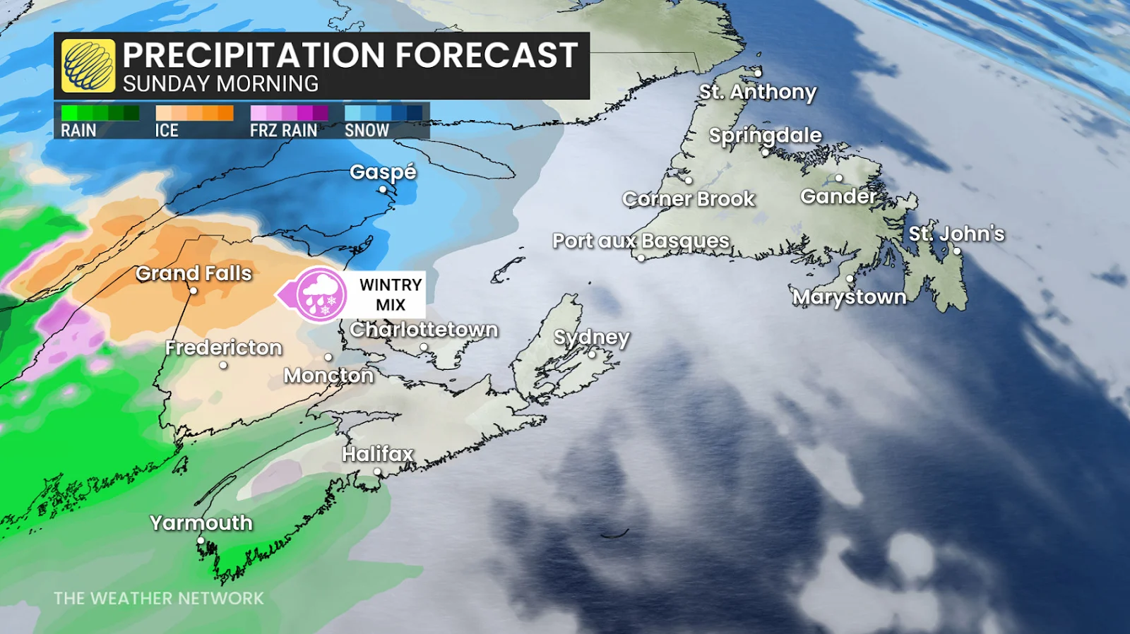
Second System: Another 10-20 cm of snow, 10-30 mm rain, and several hours of freezing rain Sunday
DON'T MISS: Will Canada's April bring a summer preview or a winter rewind?
Winter storms to deliver snow, ice, and rain to Atlantic Canada this Easter weekend
The first winter storm kicked off Friday with gusty winds and widespread snow that lingered in parts of Newfoundland Saturday morning after moving out of the Maritimes.
The gusty winds and blowing snow are forecast to persist into the afternoon along Newfoundland's southern coastline, as well as the Burin and Avalon Peninsula; but a brief break for all of Atlantic Canada will occur Saturday afternoon, as high pressure moves through, accompanied by cooler temperatures.
The focus is now shifting to a second system that will follow a similar path, spreading a wintry mix of precipitation north, and rain to the south through Sunday.
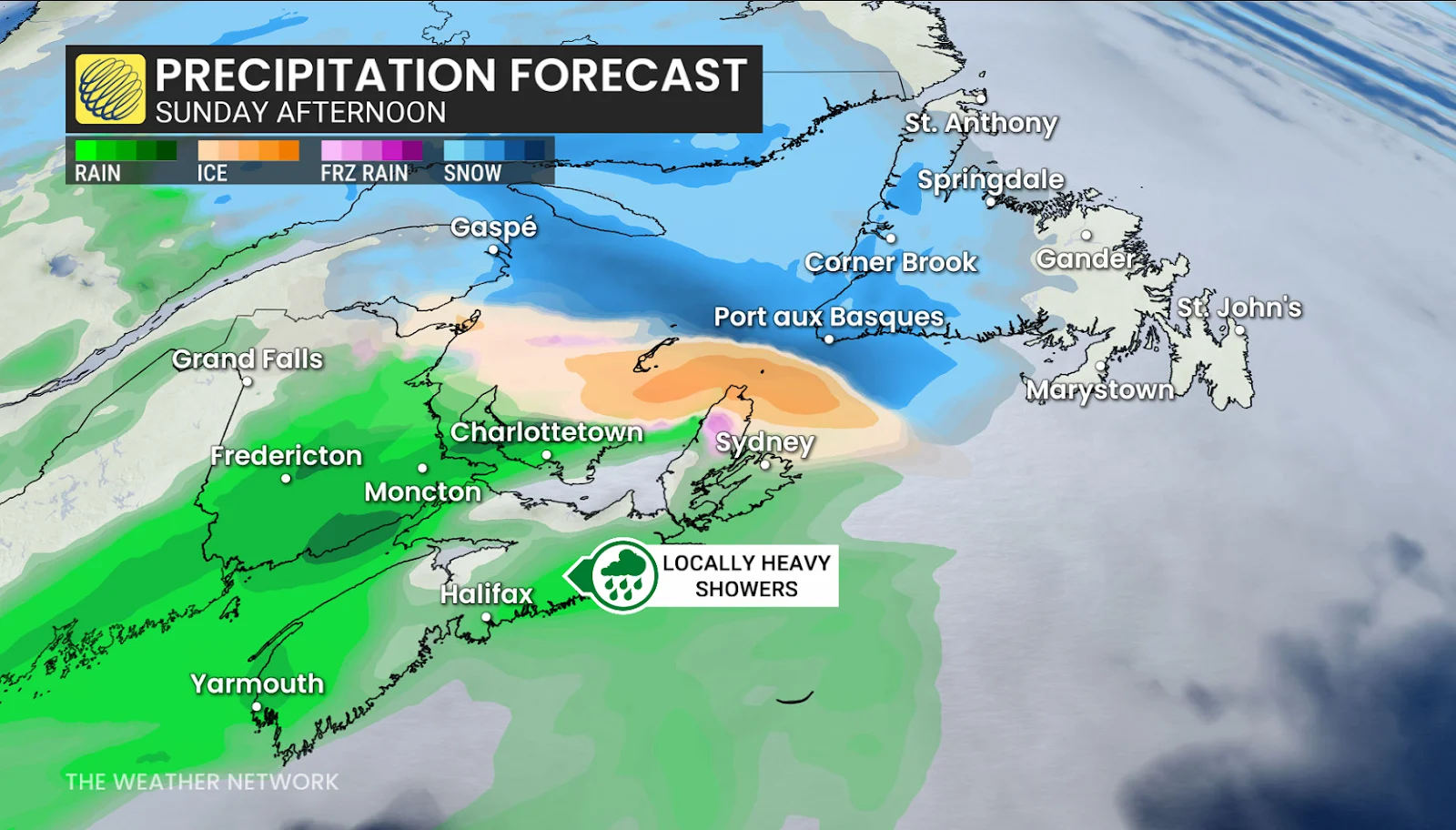
Another 10-20 cm of snow is expected across extreme northern New Brunswick, with several more hours of freezing rain in some areas as warm air moves above the cold surface. This will make for some tricky travel north of Fredericton, along Hwy 8 toward Miramichi. Hwy 11, north of Shediac, will also likely be slick throughout Sunday, as a wintry mix sweeps across the area before transitioning to rain in the afternoon.

P.E.I. and Cape Breton will also have to contend with a brief period of wintry precipitation on Sunday afternoon.
RELATED: Are we on the cusp of a “Super El Niño?” Here’s how strong it may grow
Meanwhile, in the southern Maritimes, we could see 10-30 mm of rainfall through Sunday and into Monday.

Another stalling frontal system will keep up the showers across eastern Newfoundland on Monday, brining pockets of 30 mm rainfall to southern parts of the province.
Behind the stalled system, in western Newfoundland and the Maritimes, we will see cooler air fill in and maybe a few bursts of snow-showers.
Stay with The Weather Network for more information and updates on your weather across the East Coast.