Newfoundland the next target of wintry mess after Maritimes were hit
After a snowy system brought hefty accumulations to parts of the Maritimes Wednesday, leading to power outages, the storm will be focused on Newfoundland on Thursday as it continues to move east
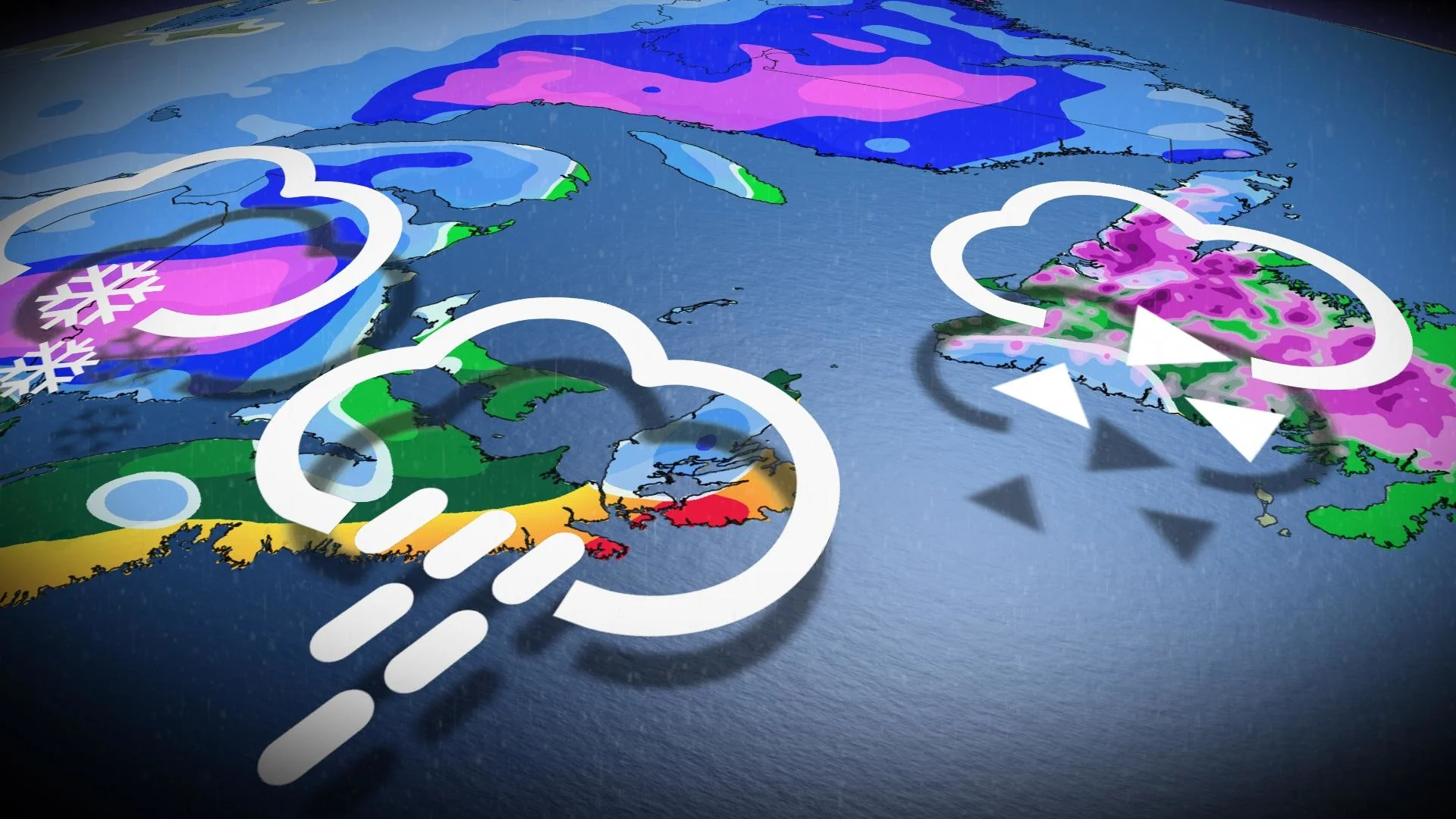
Atlantic Canada is the midst of another wintry, impactful system this week.
DON'T MISS: ‘Weather bombs’ are explosive storms that create ferocious conditions
Thousands of customers were left in the dark in Fredericton, N.B., after reports of 15 cm of snow surfaced by Wednesday evening. Meanwhile, heavy rain is targeting Nova Scotia, with 40-70 mm possible for some areas.
As the stormy weather begins to ease off in the Maritimes on Thursday, it will be Newfoundland's turn to brace for the messy impacts.
However, on the plus side, winds are forecast to be much lower than our previous system, so the risk of wind-caused power outages is fairly low.
The Maritimes
Heavy wet snow winds down across central New Brunswick overnight, but power outages are expected to remain a concern with the heavy, wet snowfall.

Meanwhile, heavy rain parallels the coast of southern Nova Scotia through Thursday morning. Totals could hit 20-40 mm in northern Nova Scotia and 40-70 mm for the coastal section in the south.
Wind gusts will be breezy throughout, hitting 50-70 km/h in the Maritimes. Some coastal sections, however, may surpass 70 km/h, but will be much lighter than the prior system.
WATCH: 50-75 mm of rain with the potential for strong wind gusts for Halifax

Newfoundland
The precipitation will start Thursday afternoon and spread through all of Newfoundland, including the Avalon, by the evening.
A wintry mix is forecast to develop Thursday afternoon through the early overnight. Several hours of freezing rain is expected, especially along the Trans-Canada Highway from Gander to Corner Brook.

Ice accretion is expected, which could create some icy conditions on the roads, sidewalks, and could lead to some local power outages.
The wintry mix will transition overnight into Friday morning for central and western areas, and the spread over the Avalon.
Western and northern areas of the island will also see a fair amount of snow, with 5-15 cm for the latter region.

Remember to drive according to conditions and be wary of ice on the roads -- especially if you don't have winter tires. Sidewalks could also become slippery as ice accretion is expected, which could also lead to some local power outages.
The rain will eventually clear from west to east late Friday morning and afternoon.
MUST SEE: Brace for chill: Arctic air oozing into Canada for next week
Looking ahead, conditions will be blustery and turning colder behind the system. Much colder-than-normal temperatures are expected for Friday through the weekend.
Forecasters will be watching the potential for a more active pattern next week, with the risk of one or two significant systems with high-impact winter weather for parts of the region. However, it is much too early for any certainty or specifics.
Stay tuned to The Weather Network for the latest forecast updates in Atlantic Canada.