Ontario kicks off December with warm temperatures and rain, snow to the north
Welcome to December! A soggy start to the new month, with much of southern Ontario in for a couple days of rain
After a week that brought the season's first potent lake-effect snow squalls, December will now kick off with back-to-back messy systems across Ontario.
None of these storms will be considered 'major' in terms of impacts, but the systems will track south of the Canada and U.S. border, along the boundary between very mild weather to the south and somewhat colder weather to the north.
Depending on where you are, rain or wet snow may fall.
MUST SEE: Canada's Winter Forecast: El Niño a critical factor for the season ahead
Some more chilly weather is expected for a couple of days during the middle of next week, then trending somewhat milder again late week and weekend, especially for western parts of the region.
Here's how the start of December shapes up.
Friday through Saturday
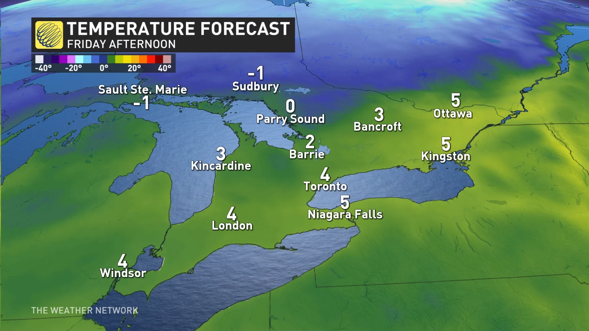
A weak disturbance will move into southern Ontario on Friday, bringing rain for most throughout the day.
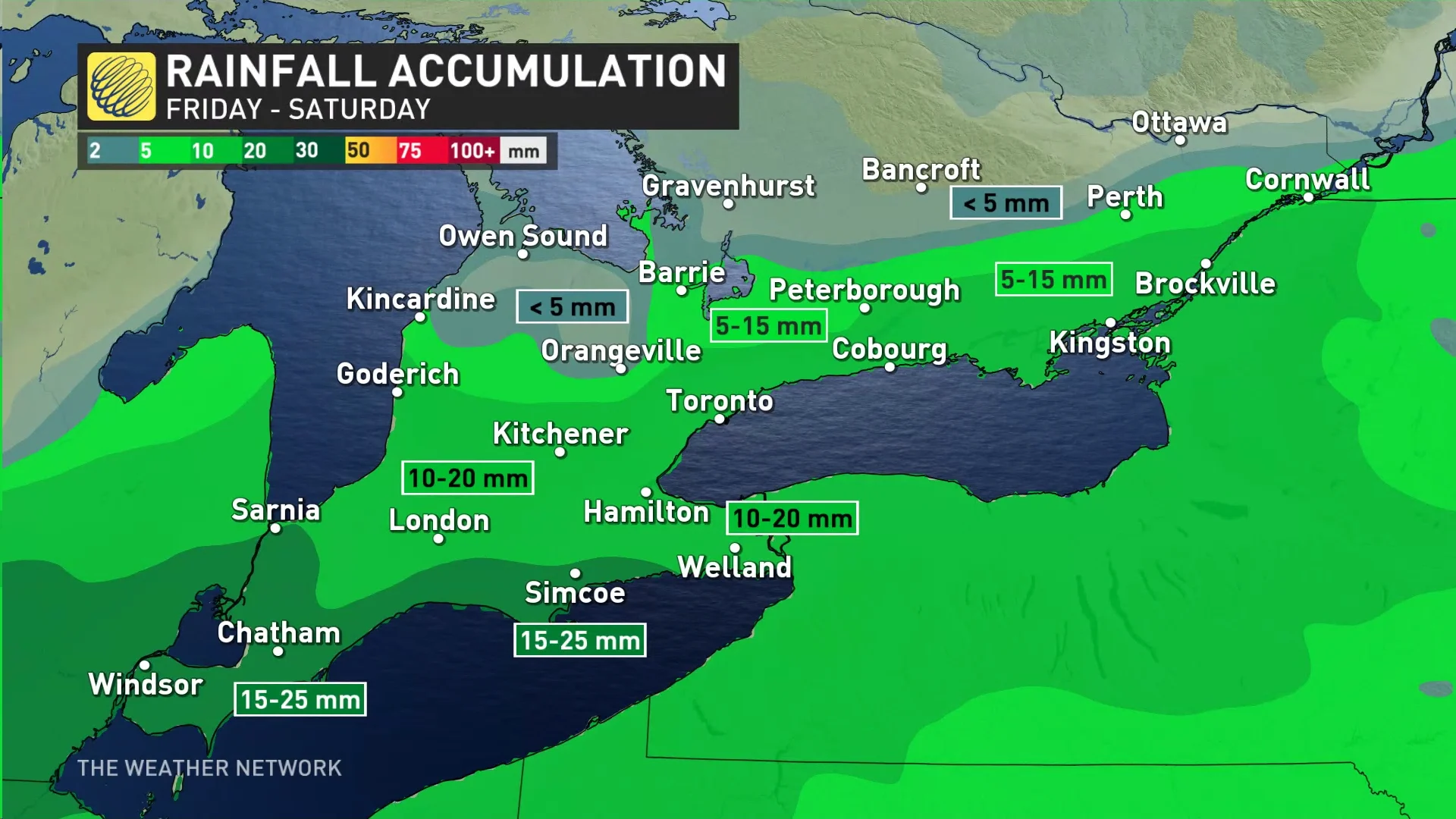
The rain moves into southwestern sections early Friday morning, reaching the Greater Toronto Area (GTA) midday, and into eastern Ontario for the afternoon and evening. A widespread 10-20 mm can be expected before easing later on Saturday.
Rain is the dominant precipitation type as temperatures sit comfortably above the freezing mark, with a bit of snow expected for the higher elevations near Orangeville, Shelburne, and Owen Sound.
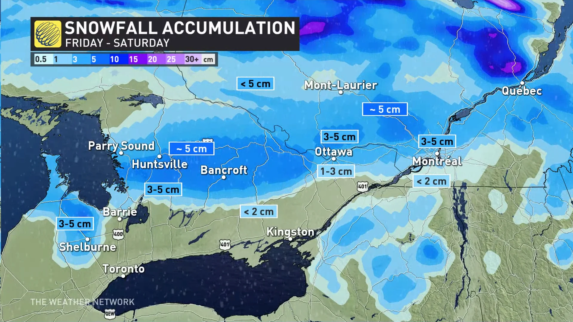
With the second wave of moisture coming Friday overnight to Saturday, snow will continue in those areas, but also move into Gravenhurst, Bancroft, and into Ottawa and Gatineau, as well.
RELATED: PHOTOS: Parts of Ontario walloped by season's first lake-effect snow
For the rest of southern Ontario rain is expected to continue through Saturday, before tapering fully through the evening hours.
In all, roughly 3-5+ cm of snow is forecast in the areas that stay cooler and pick up the snow, with locally higher amounts up to 15 cm.
This weekend's storm will be much more straight forward than the last few. Areas starting as rain will remain as rain, as well as areas that start as snow -- Orangeville, Kawarthas, Bancroft.
The storm is lacking much in the way of temperature overlap so freezing rain won't be a concern, simply straight rain and snow.
Widespread chilly conditions are expected to return for the middle of next week, before trending somewhat milder by next weekend. The cooler weather will linger longer to the east, however.
WATCH: Snow squalls reduce visibility on southern Ontario roads this week
Stay with The Weather Network for all the latest on conditions across Ontario.