Snowfall warnings on the East Coast as ‘weather bomb’ approaches
Warnings are in effect as some communities brace for 20+ cm of snow
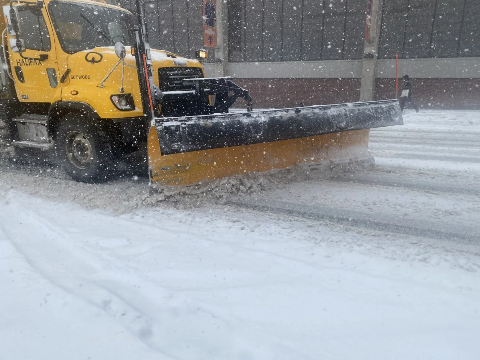
Get ready for an impactful winter storm across much of Atlantic Canada, where some communities are bracing for more than 20 cm of snow on Friday.
A low-pressure system will rapidly intensify as it tracks into the region, likely reaching ‘weather bomb’ criteria as its minimum central air pressure falls 24 millibars in just 24 hours.
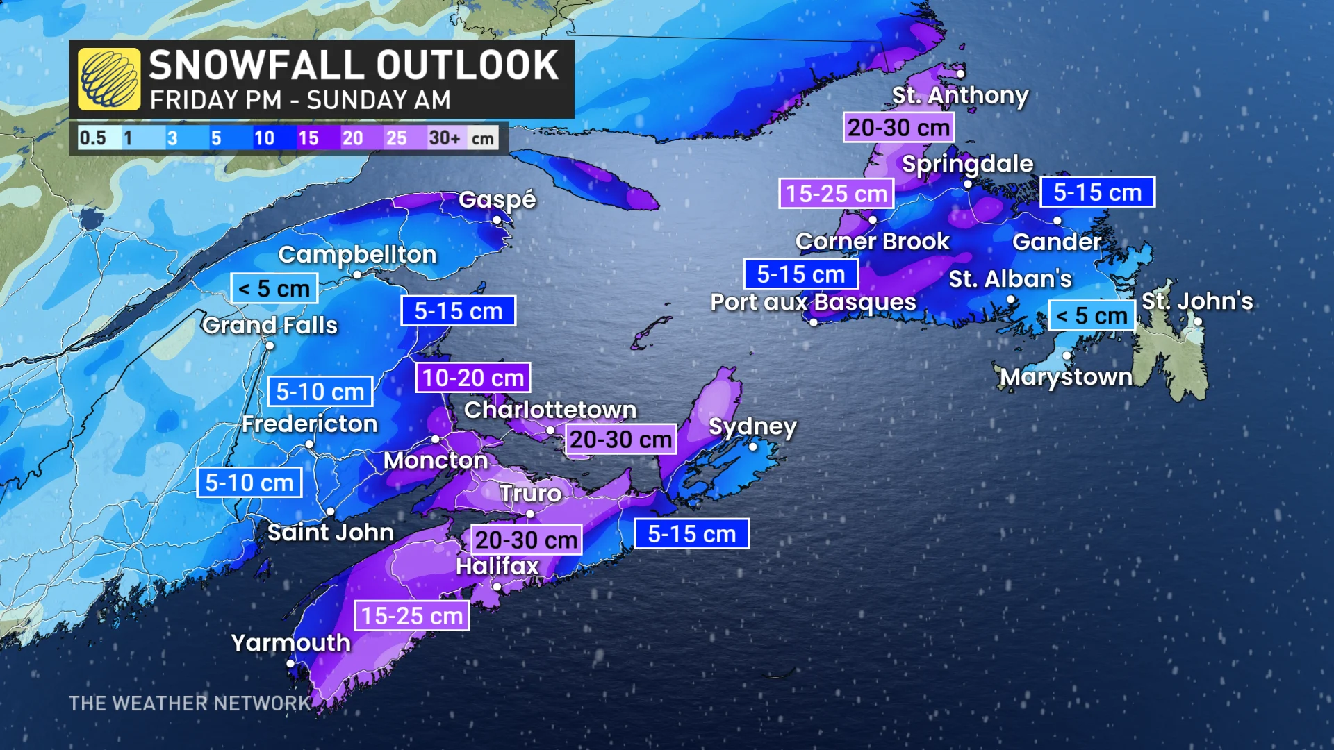
Significant travel disruptions are likely as 15-25+ cm of snow falls across parts of the Maritimes, while several hours of freezing rain threatens much of interior Newfoundland.
SEE ALSO: Emergency kits: The crucial extra item you can't miss for winter
Drivers are urged to plan ahead based on the changing road conditions. Holiday travel plans are also likely in motion, so it'll be important to stay weather-aware, and up-to-date on all of the warnings in your area. Widespread windy conditions are likely across the region, as well, with the risk for localized power outages. Be sure to charge up your devices before the storm moves in.

The first system that swept through the Atlantic provinces on Thursday was an appetizer ahead of the main course arriving Friday night. This second and stronger system will track south of the Maritimes overnight Friday before heading into Newfoundland through the day on Saturday.
This system’s southerly track will place the heaviest snowfall squarely over parts of southern New Brunswick and much of Nova Scotia. Peak snowfall rates could reach up to 5 cm per hour at times.
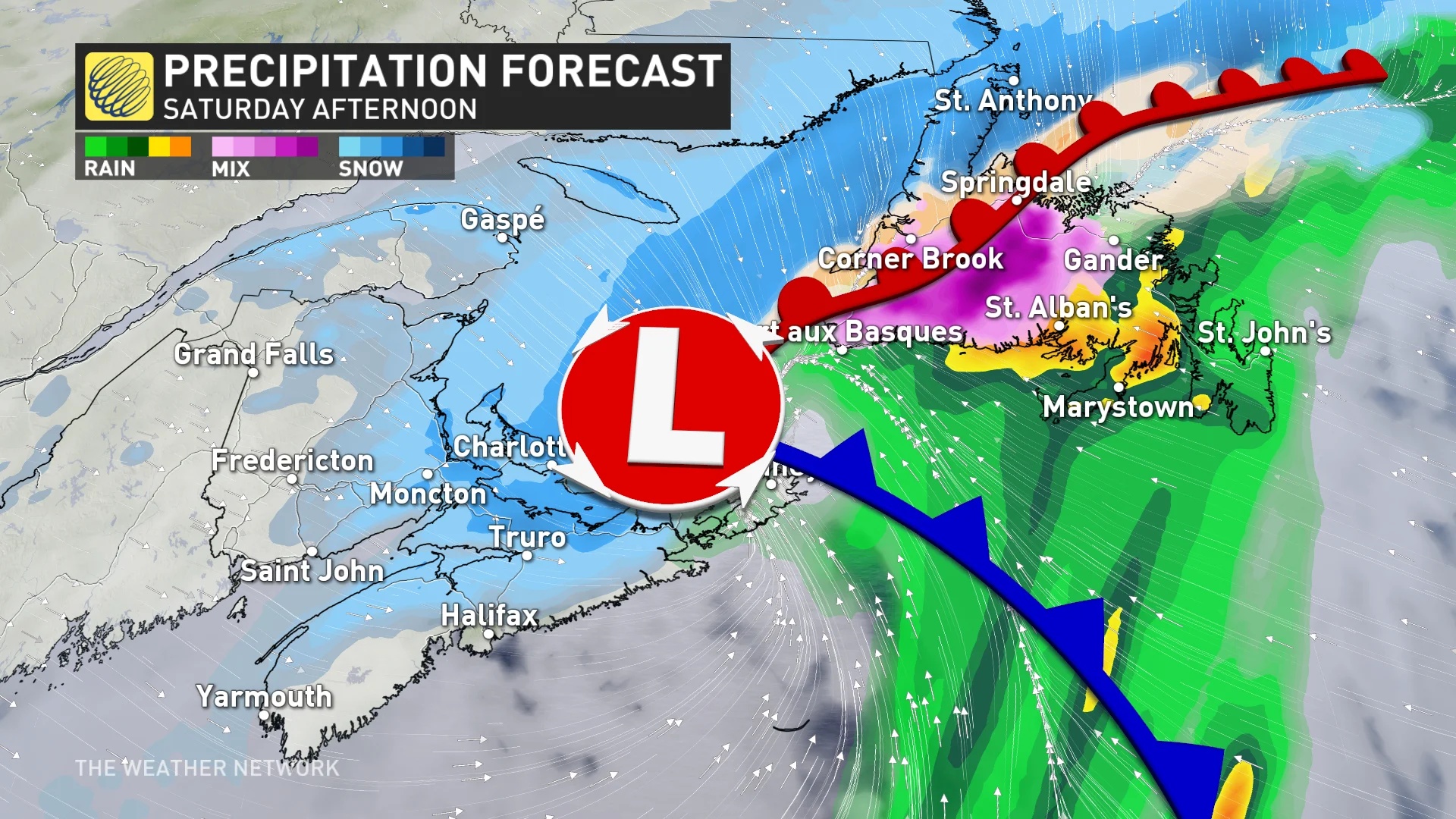
Southeastern portions of Nova Scotia have the chance to transition to rain for part of the event, which could contribute to more of a slushy mess. It's possible for some ice pellets to also fall in the Halifax area, but the greatest chance for the icy mix will be just east of the city.
There will be a swath of accumulating snow that could range from 15-25 cm, and even higher in some spots of Nova Scotia, PEI, southwest New Brunswick and western Newfoundland.
“Surfaces such as highways, roads, walkways and parking lots may become difficult to navigate due to accumulating snow,” Environment and Climate Change Canada (ECCC) said in its snowfall warning for Nova Scotia.
Eastern Newfoundland might see some flurries to start, but rain will be the primary precipitation type for the Avalon.
Western Newfoundland, on the other hand, will be engulfed in snow by Saturday morning, with an area of freezing rain moving northwest through central parts of the island. A snowy, slushy, and icy mix is expected from Gander to Port aux Basques.

"Anyone planning travel should be prepared for adverse weather conditions," warns Environment Canada in its special weather statement for Newfoundland.
Risk for whiteouts and power outages
Breezy conditions will heighten the threat for whiteout conditions for parts of the Maritimes and western Newfoundland. Gusts between 50-70 km/h are forecast across the Maritimes, with even higher gusts up to 90 km/h possible for the Avalon.
The combination of wet snow and gusty winds may also result in localized power outages.
DON'T MISS: White Christmas odds are looking good for millions of Canadians
Colder temperatures will flood in behind this system, so whatever snow is on the ground will stick around for Christmas.
Colder-than-seasonal temperatures will continue through early next week, then temperatures will rebound around the mid-week mark, with above seasonal temperatures expected for the end of the week. A mild pattern is expected for the final days of December and into the first week of January.
Be sure to check back for the latest weather updates across Atlantic Canada.