Major winter storm in Ontario threatens to halt holiday travel plans

If you have any holiday travel plans coming up in southern Ontario late week, you may want to adjust them accordingly, and go earlier than planned to avoid a disruptive winter storm that will make for hazardous road conditions
The holidays are around the corner, but that doesn't mean Mother Nature will be taking any time off this year. In fact, it's looking like it will be in full force for much of Canada, including southern Ontario. A significant, potentially historic, winter storm is going to be targeting the region late week, likely to throw a wrench into people's holiday travel plans as the roads will be in rough shape Friday and Saturday.
DON'T MISS:90% of Canadians will see a white Christmas, are you included?
Early details on impending storm
Special weather statements are already in place across southern Ontario.
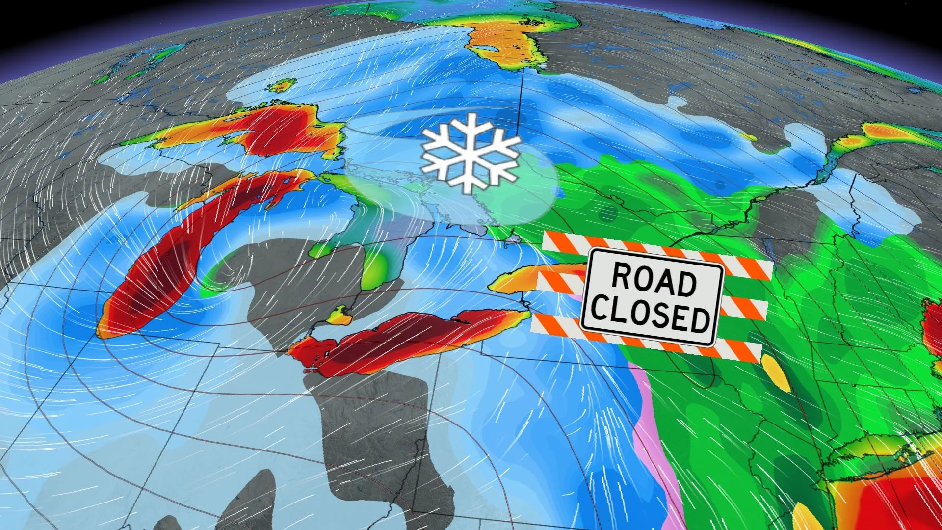
A historic surge of Arctic air will spend the next few days diving south from the Arctic to the Gulf of Mexico. In the process, the air mass will trigger an incredibly strong storm heading into the holidays.

As the storm track begins to narrow, confidence of a roller-coaster of weather conditions for southern Ontario and Quebec is growing.
Arctic air will clash with subtropical warmth and moisture over the Mississippi Valley, sparking a 'weather bomb' over the Great Lakes – a situation usually reserved for Atlantic Canada.

The initial snowfall on Thursday evening will quickly give way to a surge of warmth and a transition to heavy rain right across southern and central Ontario. This will remain the situation through Friday morning until the cold front arrives.
WATCH: What you need to have prepared in the car as a holiday storm targets Ontario
Southwesterly wind gusts exceeding 80 km/h will blanket the 401 corridor, and could even surpass 120 km/h along the Lake Erie shores. Temperatures will drop by as much as 15°C from the morning commute to the evening hours.
The temperature dive, paired with the freezing surface moisture and transition to snow, will result in a flash freeze -- making travel dangerous through the evening commute.
Rapidly falling temperatures will be accompanied by strong to potentially damaging winds along with snow that may be heavy at times. Blizzard conditions are possible late Friday into the weekend for areas downwind of Lake Huron and Georgian Bay.

"Consider altering plans through the holiday weekend as travel conditions may become dangerous. Extensive utility outages are possible. Temperatures Friday night into the weekend will likely be the coldest of the season to date," Environment and Climate Change Canada (ECCC) warns in the statement.
Winds will remain strong through Saturday morning, resulting in the development of lake-effect snow for the eastern shores of the Great Lakes, Niagara and Muskoka regions, which will be the main targets through Christmas Eve.
WATCH: Would you rather?
Check back for the latest on the forecast across southern Ontario.