Severe storm threat kicks off holiday weekend in Manitoba, northwestern Ont.

Severe storms will be possible in parts of Manitoba and northwestern Ontario Saturday, so make sure you stay alert and have a safety plan in place if you are spending time outdoors
The Civic Holiday weekend could get off to a stormy start in parts of Manitoba and northwestern Ontario, potentially putting a damper on any outdoor plans Saturday. Make sure to stay alert and have a safety plan in place.
DON'T MISS: Severe storms may dampen some Canadians’ long weekend plans
Late afternoon and evening look to be when the storms could fire up Saturday in portions of Manitoba and northwestern Ontario, with the risk of heavy rainfall, large hail and strong wind gusts. Nocturnal storms will be possible in northwestern Ontario, but should remain below severe-warning criteria.
Sunday will see the threat dwindle somewhat and shift, but severe weather will still be possible in northwestern Ontario.
Saturday
Areas: Southeastern, northeastern Manitoba and northwestern Ontario
Timing: Late afternoon and evening
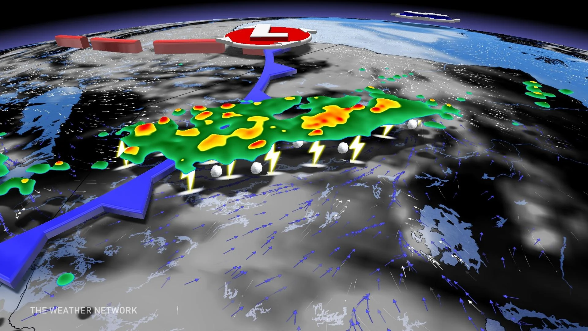
Weather: As the surface-level low draped over the eastern end of Manitoba pushes into far northwestern Ontario, it could bring severe storms with it. The cold front is going to be activating many of these storms into the evening as the daytime heating further combines with instability of the front to make them pop off.
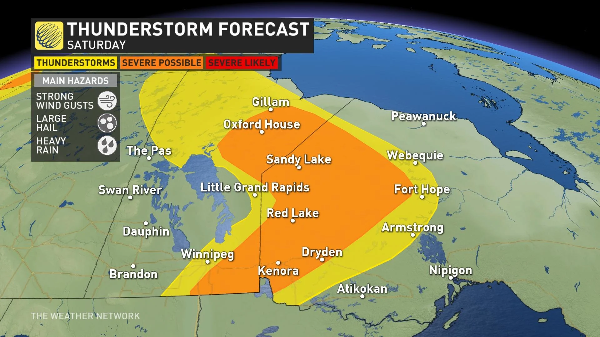
The main hazards with these storms are heavy rainfall and strong wind gusts ahead of the front, along the possibility of large hail up to toonie-sized. Areas in southern Manitoba can see these storms Saturday afternoon before they move northeast.
As the fronts continue to move towards the east, these storms will continue into the overnight for northwestern Ontario. The storms overnight will be less severe in nature, and quite scattered, but do expect to hear some rumbles and see some heavy downpours.
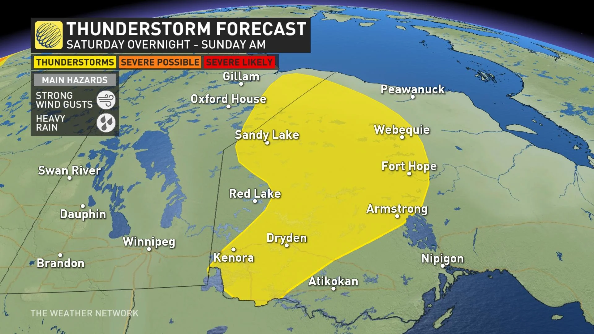
Confidence: Confidence is high for these storms for the timing and strength.
Sunday
Areas: Northeastern Manitoba, northwestern Ontario
Timing: Afternoon and evening
Weather: The low continues to move through northwestern Ontario on Sunday, moving farther north in the region with similar hazards as Saturday. The hazard include heavy rain, large hail and strong winds.
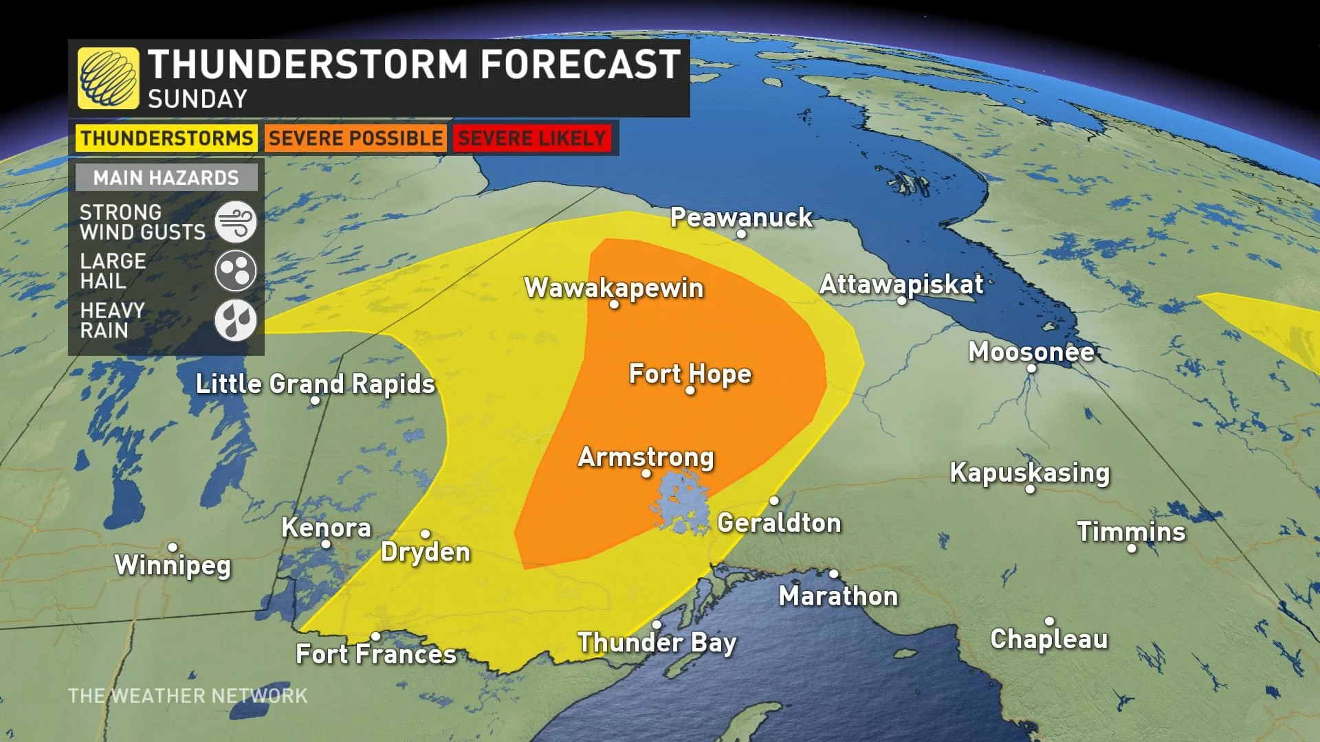
The storms on Sunday will be more scattered in nature behind the fronts as another low begins to develops in far northwestern sections, creating the trough that will be responsibile for increasing the instability.
ALSO READ: Get to know the weather terms you'll be hearing about this summer
Prepare
Make sure to keep up-to-date on your local forecast information and alerts. If you are outdoors in an area with a severe weather threat, make sure you have a safety plan in place in case you need to get to shelter.
Camping this long weekend? Check out The Weather Network's Camping Guide before heading out!
If a severe thunderstorm approaches your location, remain mindful of trees or tree limbs that loom near your home. Trees falling into buildings are a significant source of injury during strong storms. Try to avoid rooms where trees may cause damage during high winds.
The greatest danger in any thunderstorm is lightning. If you can hear thunder, you’re close enough to be struck by lightning.
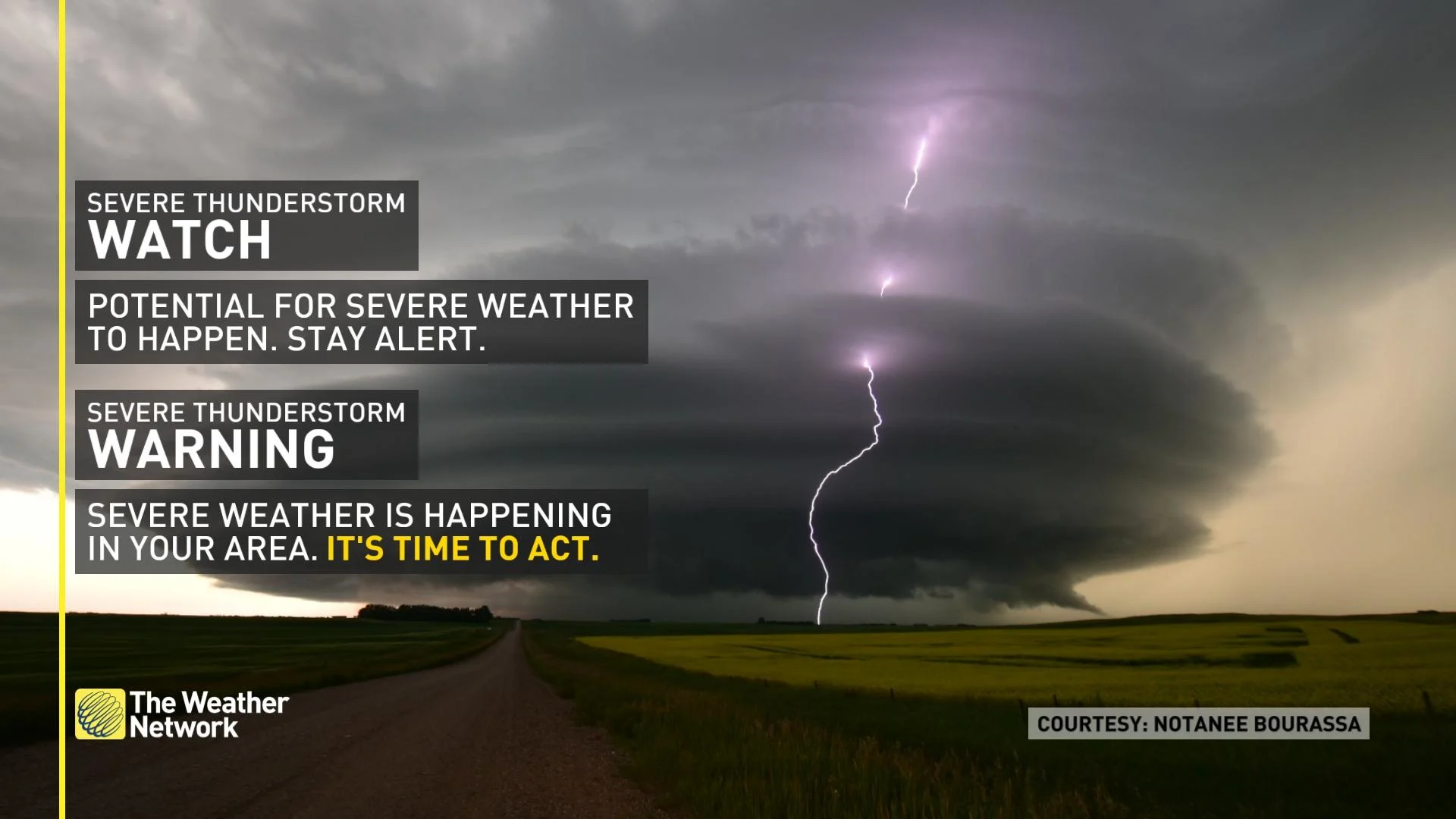
Watches mean conditions are favourable for the development of severe thunderstorms. Warnings mean they are imminent or are occurring in your area.
Keep checking back to The Weather Network for more forecast updates and information across Manitoba and northwestern Ontario.