Long-duration ice and snow threaten weekend outages, travel delays
A high-impact ice and snow event will affect Ontario this weekend, arriving in two rounds between Friday and Monday
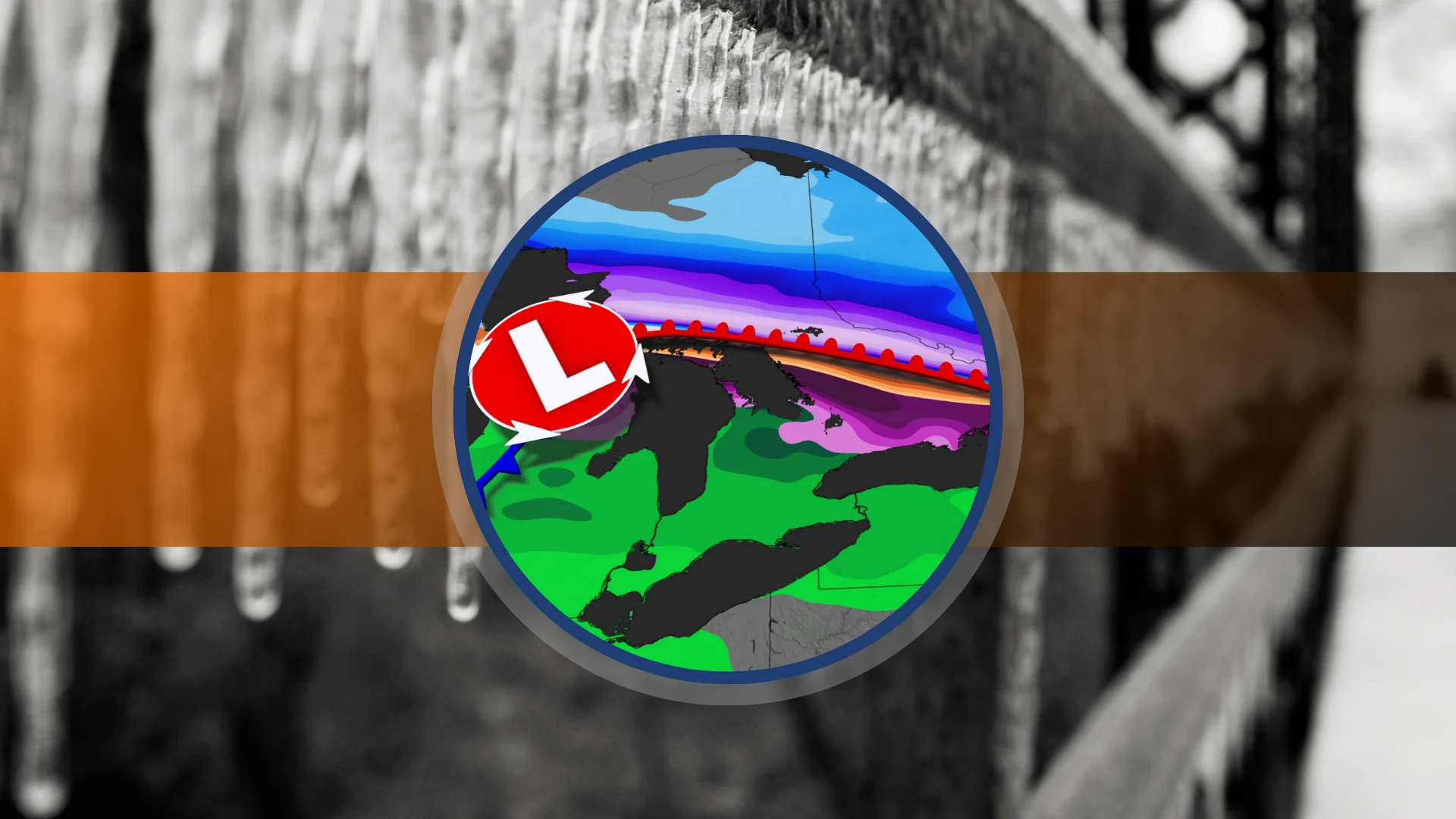
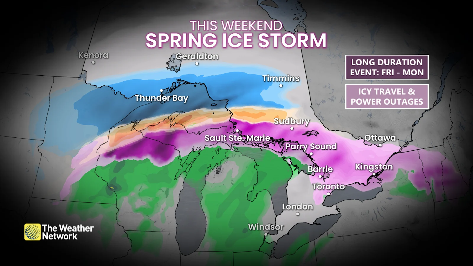
A long-duration ice storm is on track for parts of Ontario this weekend as multiple rounds of wintry precipitation swing across the region.
We’ll see a sharp contrast between air masses over the province, bringing snow to Ottawa, mostly rain for Toronto, and significant ice accretions for many communities in between.
Visit our Complete Guide to Spring 2025 for an in-depth look at the Spring Forecast, tips to plan for it and much more!
Significant ice buildup will likely lead to some major impacts as roadways become dangerously slippery and power lines become bogged down by the heavy ice. Folks should expect significant impacts to travel over the weekend, and anyone in the region should prepare for localized power outages.
Be sure to check highway conditions and local weather alerts before heading out if necessary.
DON'T MISS: Freezing rain and ice pellets are dangerous winter hazards
Round 1 arrives Friday evening into Saturday
A sharp contrast between warm air to the south and cold air to the north will generate the whole spectrum of wintry weather across Ontario this weekend. Precipitation will push into the southern half of the province through the latter half of the day Friday.
SNOW: By Friday evening, we’ll see snow in northeastern Ontario push along the Ottawa Valley toward the National Capital Region—and then on toward Montreal. These areas could see 10-20 cm of snow through Saturday.

ICE: Freezing rain will develop east of Georgian Bay on Friday evening, covering communities north of Parry Sound to Barrie and Orillia, then east toward Bancroft, Peterborough, and Kingston. It’s possible that parts of the Greater Toronto Area (GTA) could see a brief period of freezing rain.
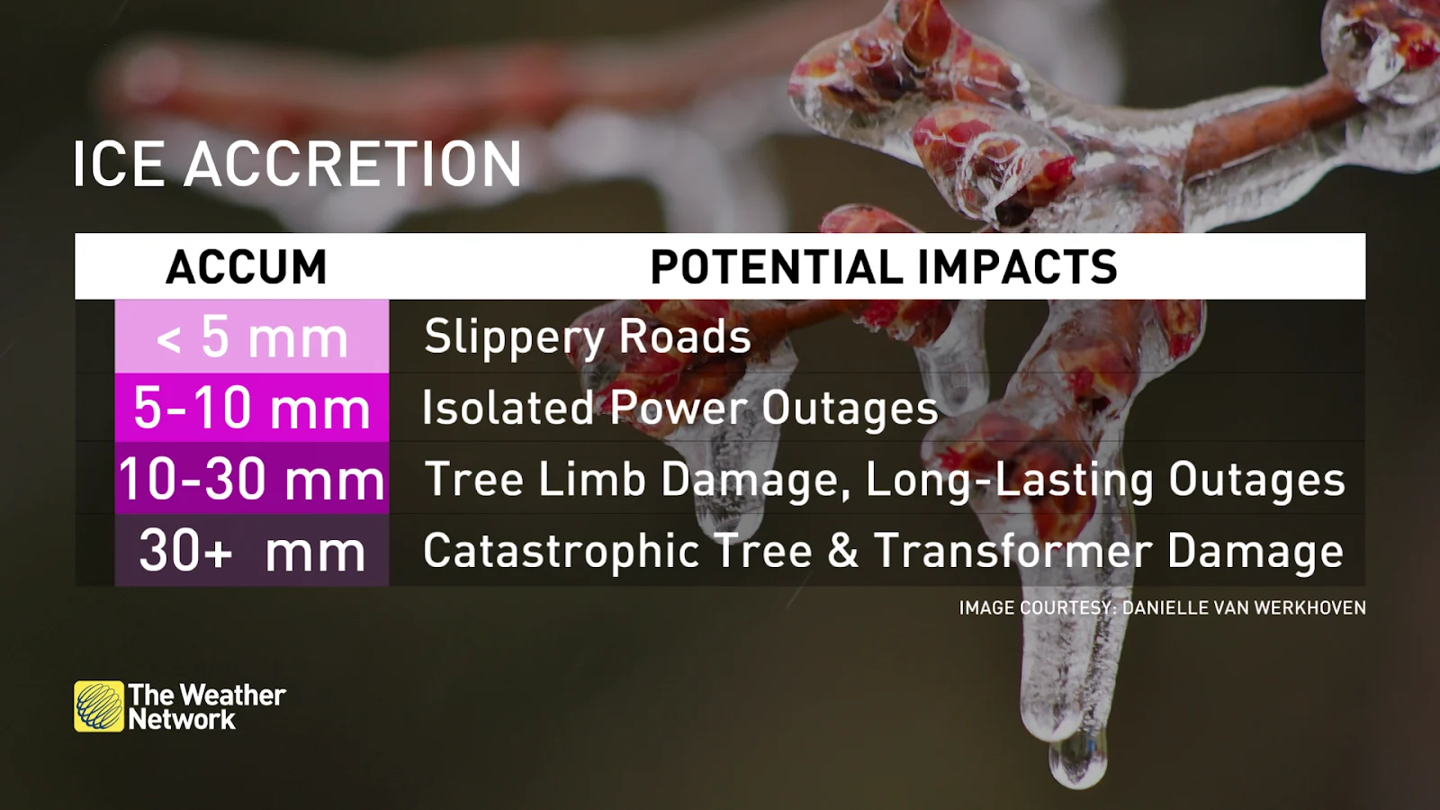
Ice accretion could reach 15-20 mm (1.5-2 cm) in the hardest-hit areas. Beware extremely slick steps, sidewalks, driveways, and roads during and after freezing rain. This much ice buildup could lead to tree damage and downed power lines, potentially leading to long-lasting power outages across the affected areas.
RAIN: We’ll see plain old rain develop Friday afternoon across southwestern Ontario, including communities from Toronto down toward Windsor.
Freezing drizzle risk on Saturday
The threat for icing won’t diminish once the first round of precipitation wanes on Saturday.
SEE ALSO: What weather can Canadian voters expect on April 28? A historical look
It’s possible that freezing drizzle could fall on Saturday across the same locations that saw freezing rain overnight, which can slowly add more ice onto what has already accumulated.
Our next round of significant precipitation will follow the freezing drizzle threat by Saturday night.
Round two arrives with a Colorado low
A Colorado low is expected to track into Ontario along the same boundary that brought the first wave of wintry precipitation to the region.
Luckily, this boundary will eventually push north through the day on Sunday, allowing temperatures to rise and the threat for snow and ice to shift. As a result, the temperature divide won’t be as great on Sunday as we saw a day earlier.
SNOW: We’ll see snow develop farther north this time around, affecting northeastern Ontario and the Lake Superior shorelines. These areas could see an additional 15-25 cm of accumulation through Monday.

ICE: As the warm front moves in, freezing rain is possible Sunday morning across the GTA before temperatures warm in the afternoon. Some areas east of the GTA may see freezing rain persist a little longer, with a quick millimetre or two of accretion that may lead to slippery conditions.
DON'T MISS: Sweet or sticky? How weather can make or break maple syrup season
Freezing rain is likely for the same areas that saw ice from the first round of precipitation—but it won’t last as long this time, and it’ll push farther north toward Ottawa, the Ottawa Valley, and into northeastern Ontario.
Another 5 mm of ice accretion is possible for areas that already saw freezing rain, with upwards of 2-5 mm of ice possible for the Ottawa area. For areas that saw snow from the first round of precipitation, this will give the fresh snow an icy shell that will make shovelling even more difficult.
Stay with The Weather Network for more forecast information and updates on your weather across Ontario.