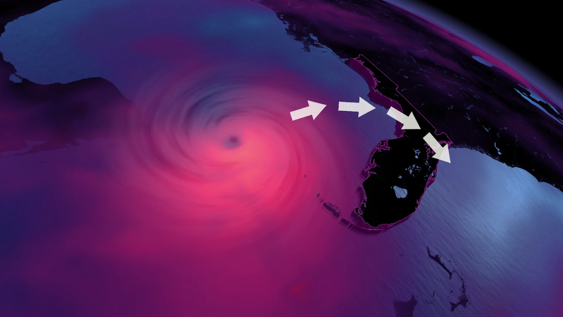
'Life-threatening' impacts set for Florida coast with Idalia's landfall

Idalia made landfall as a Category 3 hurricane at 7:45 a.m. on Florida's west coast Wednesday morning
Visit The Weather Network's hurricane hub to keep up with the latest on tropical developments in Canada and around the world
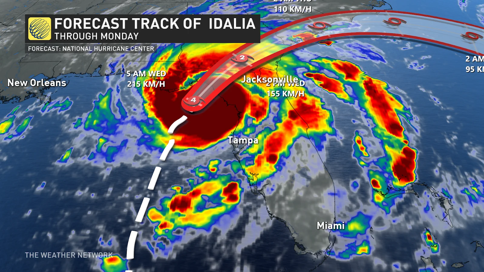
The National Hurricane Center has confirmed that Idalia officially made landfall as a Category 3 hurricane at 7:45 a.m. Wednesday morning in the Big Bend region near Keaton Beach. Idalia has since been downgraded to a Category 2 storm. The storm has maximum sustained winds of 175 km/h and even higher gusts.
Idalia is the strongest storm to make landfall in the Big Bend region in more than 125 years and the third hurricane to make landfall in Florida in the past 12 months, following Hurricane Ian in September 2022 and Hurricane Nicole in October 2022.
SEE ALSO: The curse of storm nine: Why so many “I” hurricanes are monsters
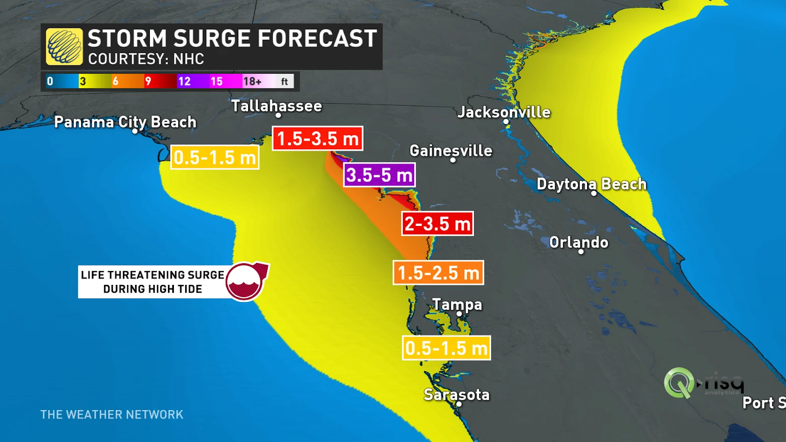
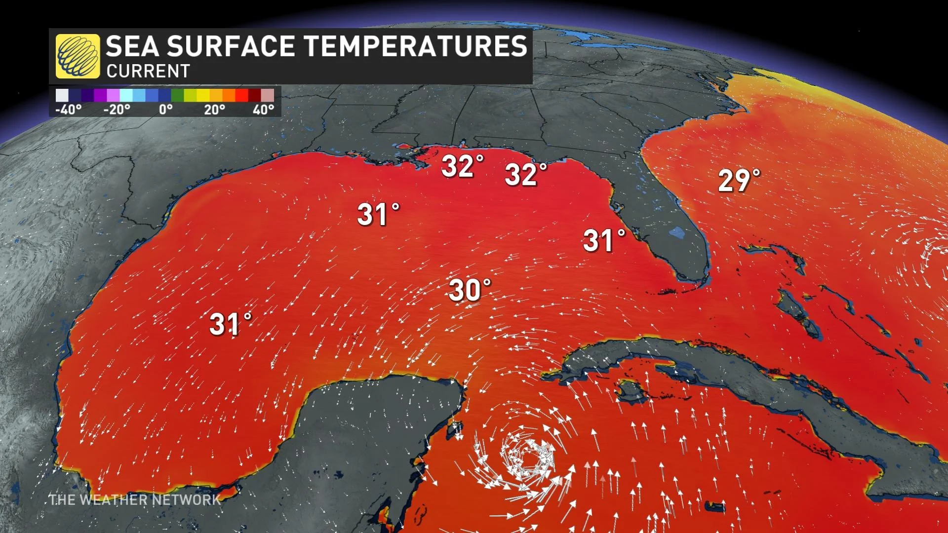
Storm surge is a major concern as the landfall is expected to coincide with Wednesday’s blue supermoon, meaning high tide will increase water levels.
Life-threatening storm surge of 0.5-1.5 metres is forecast for Tampa Bay, with a higher storm surge farther north with 3.5-5 metres from Aucilla River to Yankeetown. Rough surf and rip currents are likely across the entire Gulf Coast as the storm gathers strength. Hurricane and storm surge warnings are issued for the west coast of Florida, including the Florida Panhandle.
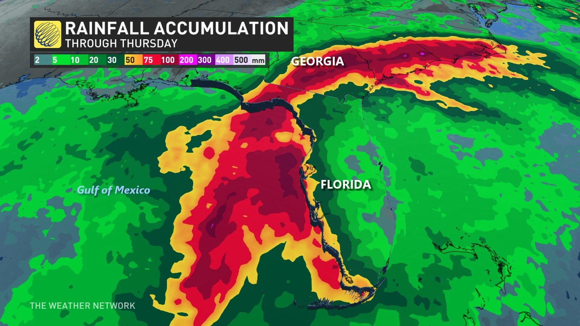
Flooding rains and Category 2-strength winds will also batter the Gulf Coast, prompting several counties, from Tampa Bay up the Florida Panhandle, to issue evacuation orders.
As of 9:15 a.m., there are more than 245,000 Floridians without power according to poweroutage.us. The majority of the outages are around the Big Bend region of the state.
The storm’s high winds, heavy rain, and isolated tornadoes would extend far away from the centre of the storm. These hazards will likely push deep into the southeastern U.S. -- including Georgia and the Carolinas -- toward the latter half of the week.
It’s likely the storm will re-emerge into the Atlantic late Wednesday near the Carolinas, albeit significantly weaker. Rainfall amounts are forecast to be within 4-8 inches (100-200 mm) and possibly higher.
WATCH: Canadian Snowbird Watches Doorbell Cam as Hurricane Idalia Targets Florida Home
It’s important to note the region’s history as many storms in similar scenarios have strengthened all the way up to landfall. That tendency toward sudden intensification often catches residents and visitors off guard after they expected a much weaker storm than the one they ultimately endured.
Visitors in the region should closely monitor the forecast and heed the advice of local officials in case further evacuation orders are issued.
Atlantic season to take a breather for two or three weeks
The Atlantic basin has been hyperactive for the past 10+ days, a pattern that will continue for a few more days. However, as we head through the peak of the hurricane season, the tropics will become much quieter for two to three weeks.
Another storm is possible during that time period, but we will see a significant lull in the season during the time of year when the tropics are typically most active, according to Dr. Doug Gillham, a meteorologist at The Weather Network.
"However, the hurricane season should come back to life again [in] late September.[We're] watching for another burst of tropical activity before the season winds down," Gillham adds.
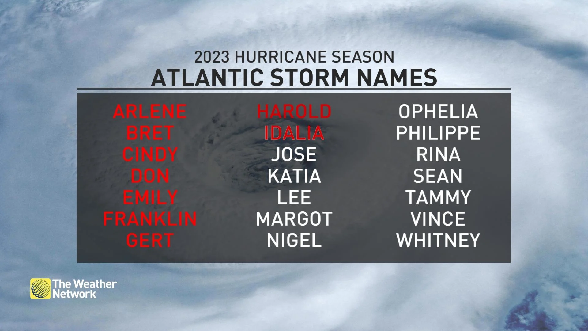
(If you’re curious -- even though ‘I’ is the ninth letter of the alphabet, the storm count is off by one this year because our first system was an unnamed subtropical storm back in January.)
Keep checking back to The Weather Network for more updates on the 2023 Atlantic hurricane season.