Four tropical cyclones form as the peak of the Atlantic hurricane season hits

The Atlantic hurricane season just kicked into high gear, as three tropical storms developed over the weekend. Residents of the Dominican Republic and Haiti are on alert for direct impacts and the Texas Gulf coast is also being monitored.
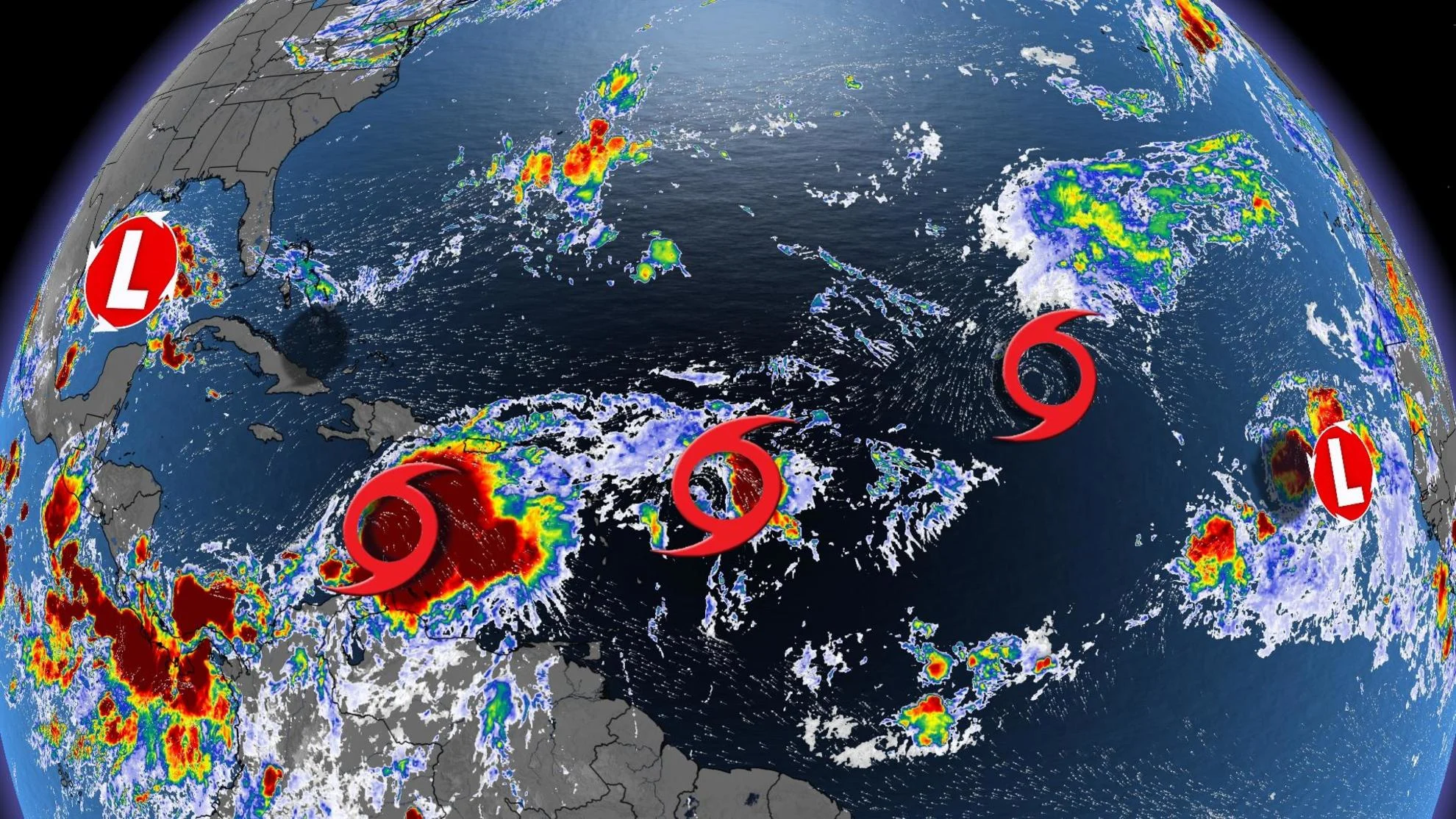
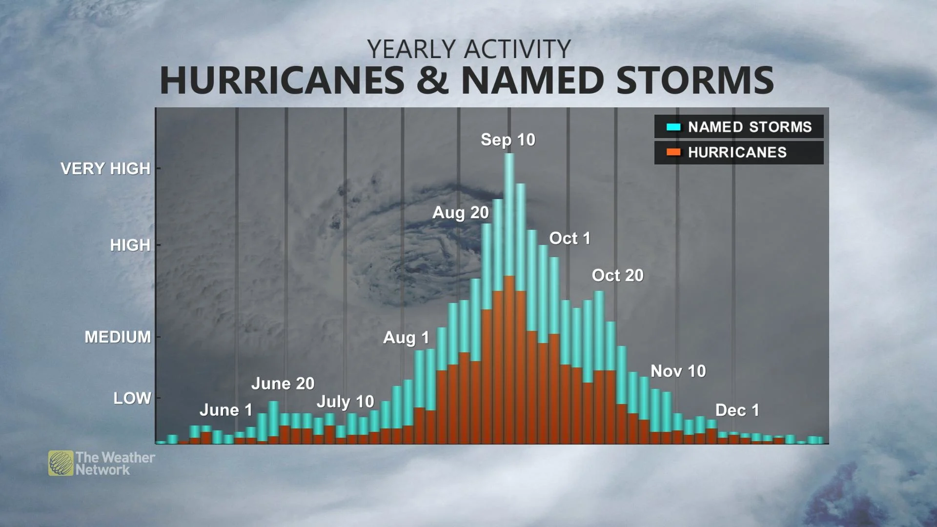
August 20 marks the climatological start to the more active portion of the Atlantic hurricane season, and right on cue, three tropical cyclones formed over just 24 hours this past weekend.
These latest developments also come less than two weeks after the National Oceanic and Atmospheric Administration's (NOAA) Climate Prediction Center raised its prediction for the 2023 season from a near-normal level of activity to above normal.
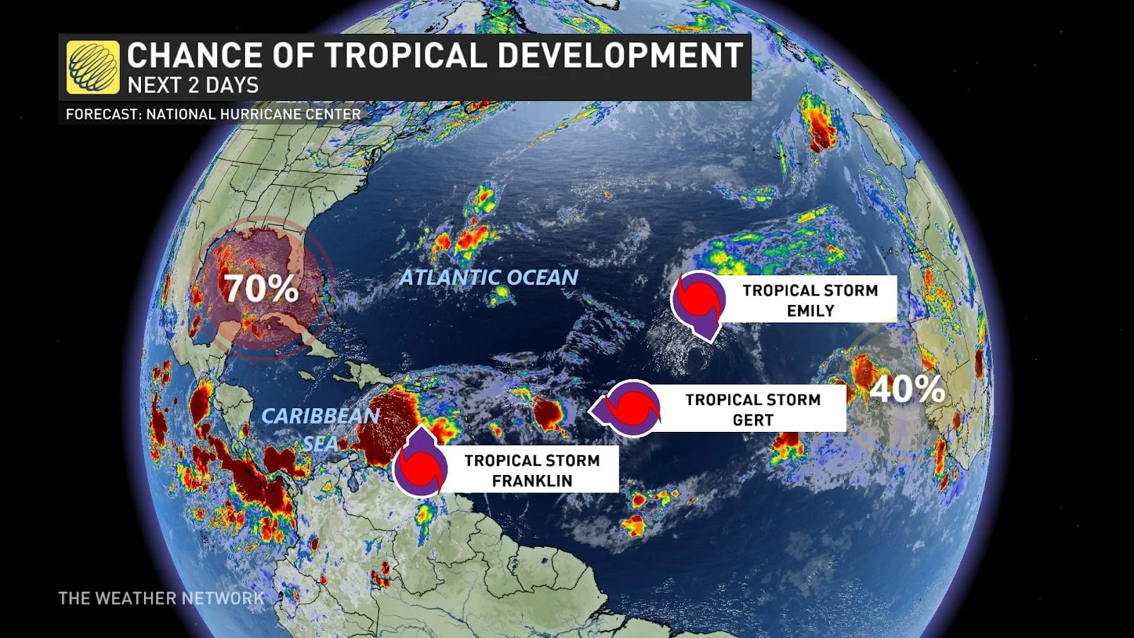
Gert, Emily, and Franklin all gained tropical storm status over the weekend, making it only the third time in history that three Atlantic tropical cyclones formed over 24 short hours.
MUST SEE: Heat, hurricanes, haboobs—deserts are a hotbed of extreme weather
The last time a tropical cyclone outbreak like this occurred was on August 22, 1995 and before that, August 15, 1893.
Gert
Tropical Storm Gert became tropical depression 6 on Saturday at 5 p.m., later named Tropical Storm Gert by 12 a.m. on Monday. According to the U.S. National Hurricane Center (NHC), Gert will be a short-lived tropical storm, expected to weaken and "unravel" into Tuesday. There are no coastal watches or warnings in effect for the storm.
Emily
Tropical Storm Emily formed at 11 a.m. on Sunday, but weakened to a post-tropical cyclone just 24 hours later. By 11 a.m. on Monday, Emily was classified as a remnant low, with slow weakening expected during the next couple of days.
RELATED: Tropical Storm Hilary releases fury on Southern California
Franklin
Franklin formed as a tropical storm on Sunday at 5 p.m., with impacts to Haiti and the Dominican Republic expected later this week. The government of the Bahamas has issued a Tropical Storm Watch for the Turks and Caicos Islands.

On the forecast track, the centre of Franklin is forecast to reach the southern coast of Hispaniola late Tuesday or Tuesday night. Franklin is expected to produce rainfall amounts of 50 to 100 mm, with isolated higher amounts of 150 mm across Puerto Rico through the middle of the week. A storm surge will also raise water levels by as much as 1 to 3 feet above ground level along the immediate coast near and to the east of where the centre makes landfall in Hispaniola, the NHC warns.
On top of the three named storms, there are two other areas of interest -- one off the west coast of Africa and the other in the Gulf of Mexico. The one in the Gulf of Mexico will be one to keep an eye on, as it could become a named storm before moving onto the continental U.S.