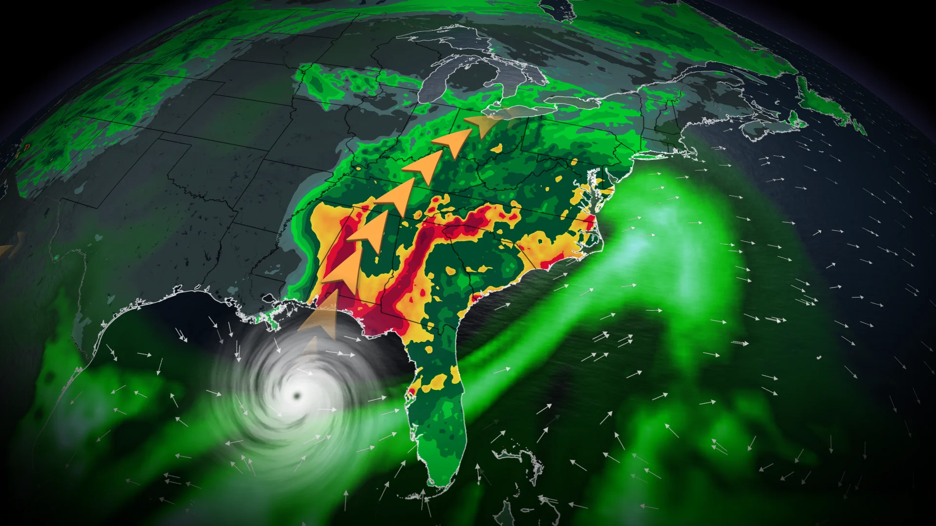
Isaias strengthens into major hurricane, Canadian impacts possible

Hurricane Isaias reached Category 3 intensity on Friday morning
Hurricane Isaias continued to intensify Thursday evening as it moved over the very warm waters of the Gulf of Mexico, and officially reached major hurricane status early Friday morning.
The system, which is the first hurricane of the Atlantic season, will make landfall along the northern Gulf Coast late Friday evening into early Saturday morning.
DON'T MISS: Canada's Winter Sneak Peek: El Niño puts record warmth in play
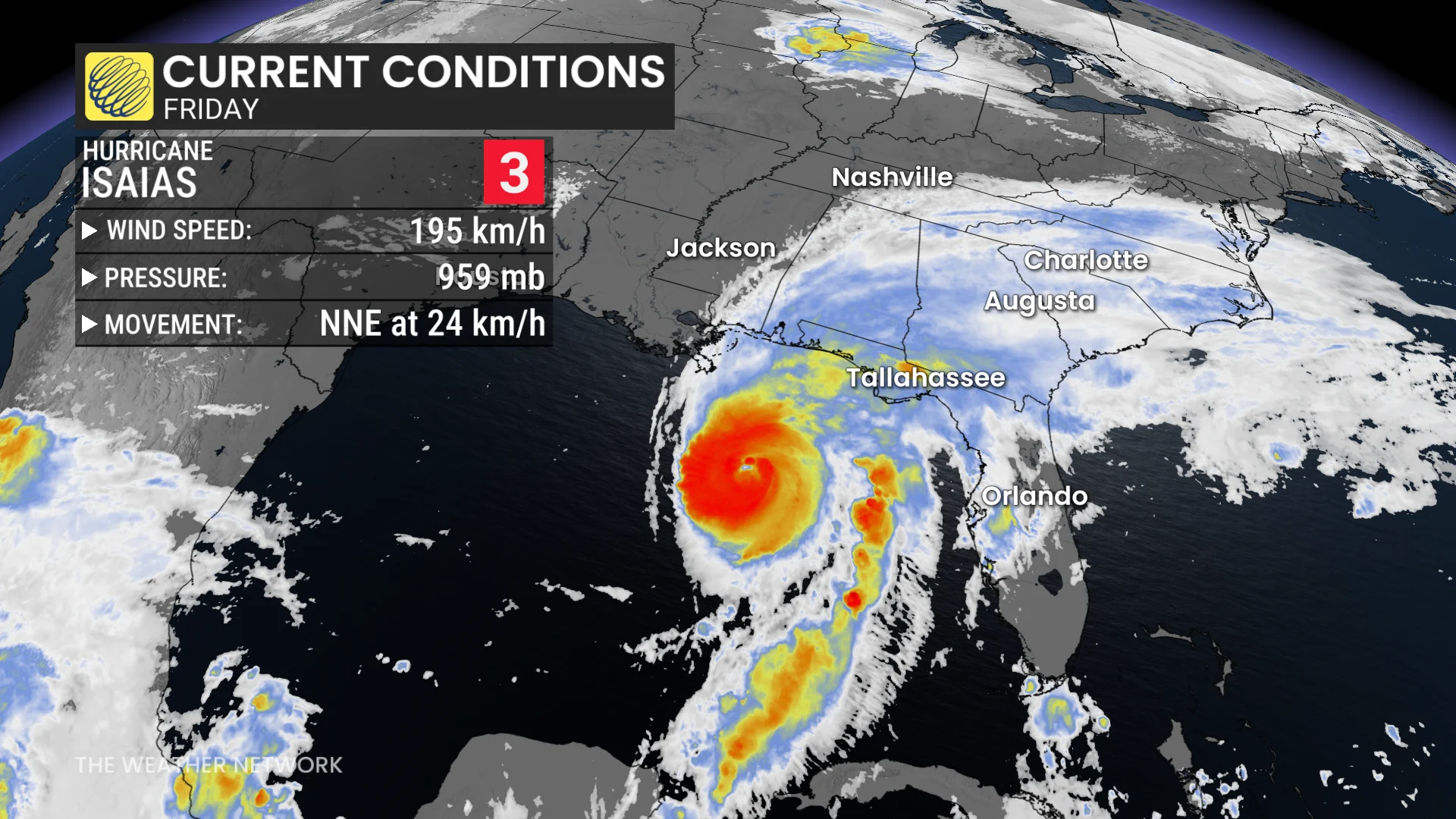
A strong hurricane heading for landfall
Isaias, the latest Atlantic hurricane on record, packed 195 km/h winds on Friday morning as it continued moving north through the central Gulf of Mexico.
Hurricane warnings cover the coast to include Gulfport, Mississippi; Mobile, Alabama; and Pensacola, Florida. This includes most of the region’s popular beach destinations. Tropical storm watches extend as far inland as Birmingham, Alabama.
High winds will cause tree damage and power outages in the warned areas. Life-threatening storm surge flooding could reach 1-2+ metres above ground level from Dauphin Island, Alabama, east toward Panama City, Florida.
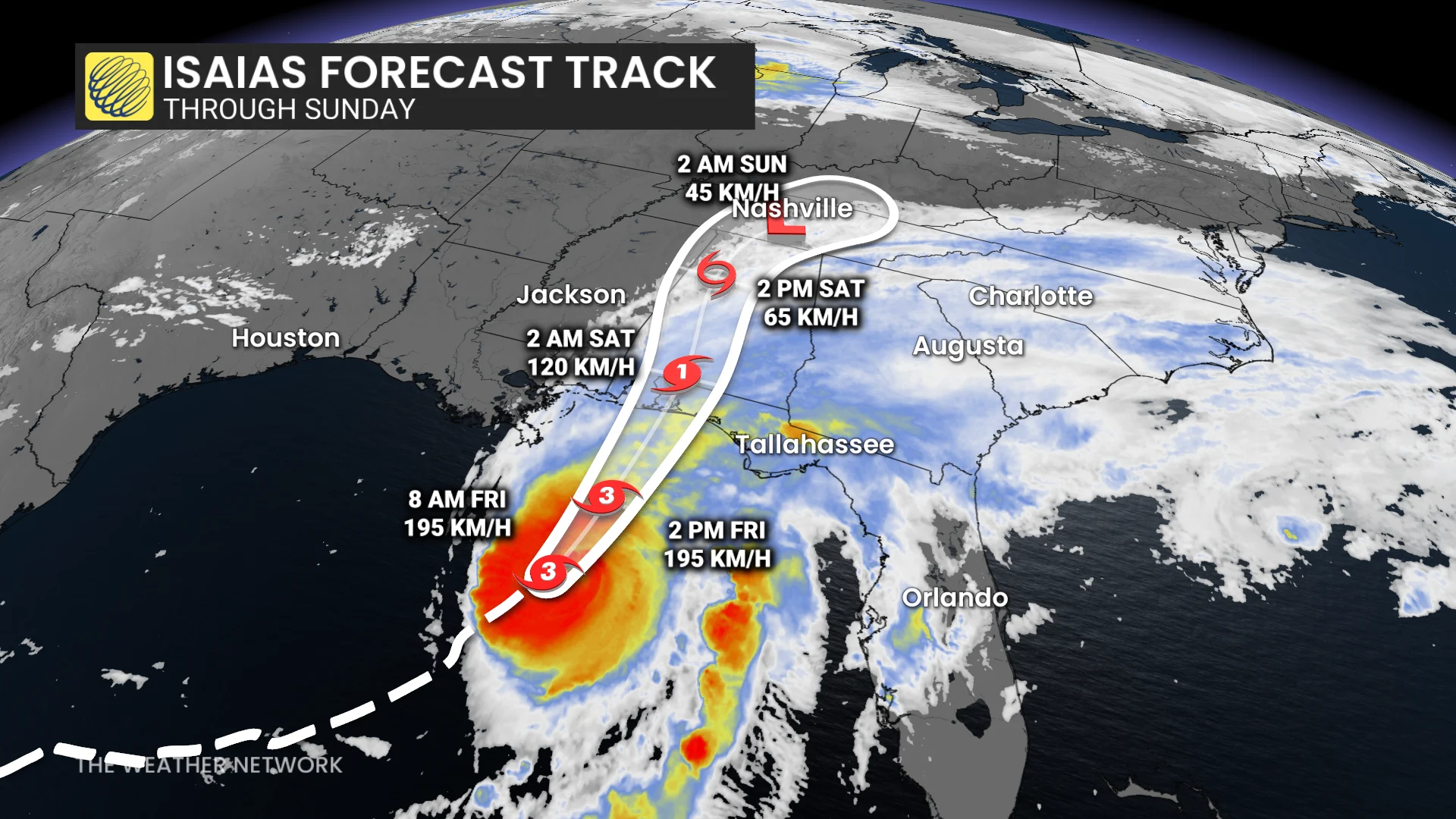
States of emergency have been declared in parts of Alabama and Florida. Florida Gov. Ron DeSantis has urged residents to begin preparations immediately. Mandatory evacuation orders are in effect for two counties in the Florida Panhandle.
RELATED: The curse of storm nine: Why so many “I” hurricanes are monsters
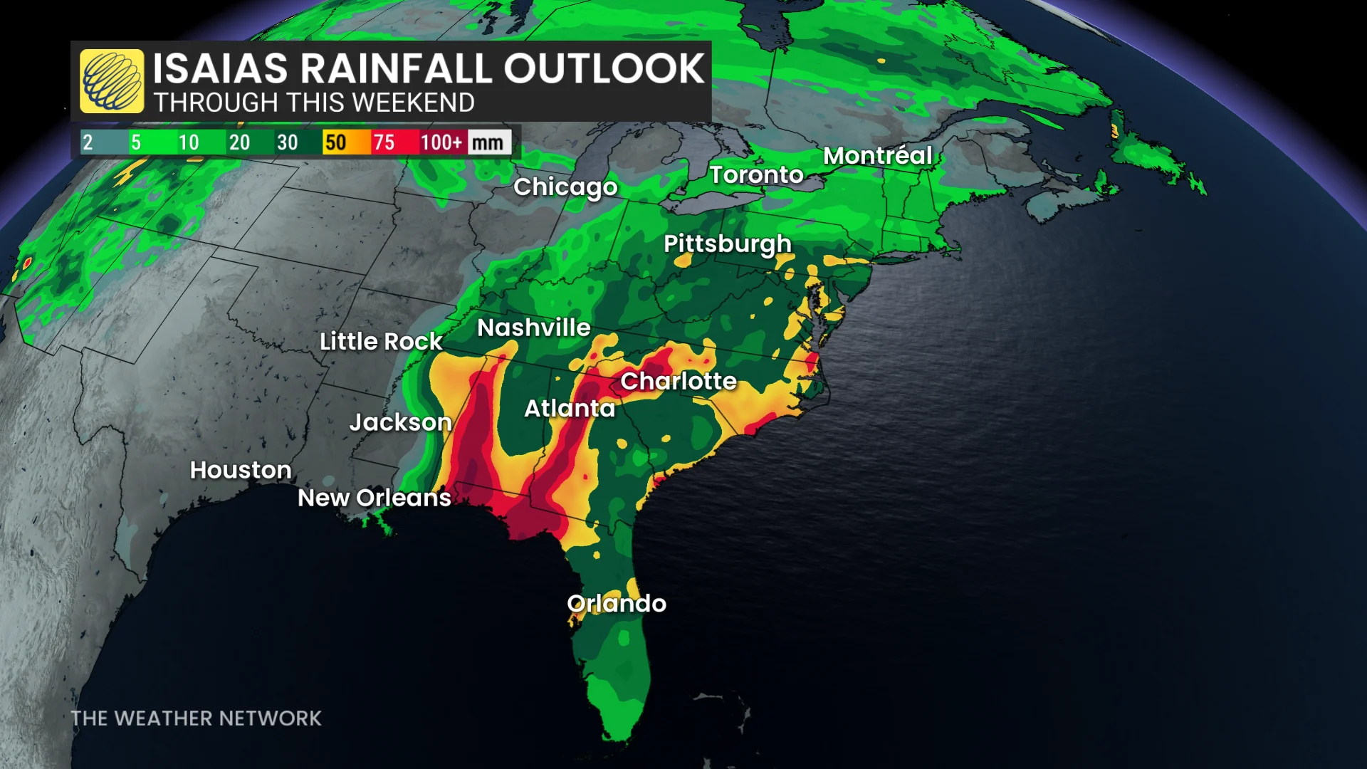
Rainfall amounts are projected to reach 75-150+ mm in parts of Louisiana and across the Florida Panhandle. Flash and urban flooding are possible, with a risk of isolated river flooding.
A risk for tornadoes will develop across the Southeast states on Friday and Saturday as the storm makes its way inland.
Storms effects could reach Ontario, Quebec
While its direct impacts are concentrated on the Gulf Coast, the remnants of Isaias could extend far north, potentially bringing rainfall to Ontario over Thanksgiving weekend.
A lack of high pressure weather systems in the region could allow Isaias’ remnants to track towards the Great Lakes by early Sunday.
DON'T MISS: Canada's Winter Sneak Peek: El Niño puts record warmth in play
Parts of southern Ontario might experience rain bands through Sunday. The rain may also clip the Ottawa region and Quebec's Eastern Townships. However, a front to the north will act a block to the stormy system and prevent any tropical moisture from heading farther north.
The west half of southern Ontario is expected to stay in the dry section through Sunday, but folks from the Golden Horseshoe all the way to Windsor could see 5-10 mm of rainfall. Locally higher amounts could reach 10-20 mm for some areas. Folks may also hear a few rumbles of thunder throughout the day.
Record set during sluggish hurricane season
The lack of hurricanes in the Atlantic Ocean this season can at least be partly blamed on a "super" El Niño in progress. Activity in the Atlantic is running just 13 per cent of normal compared to this point in an average hurricane season.
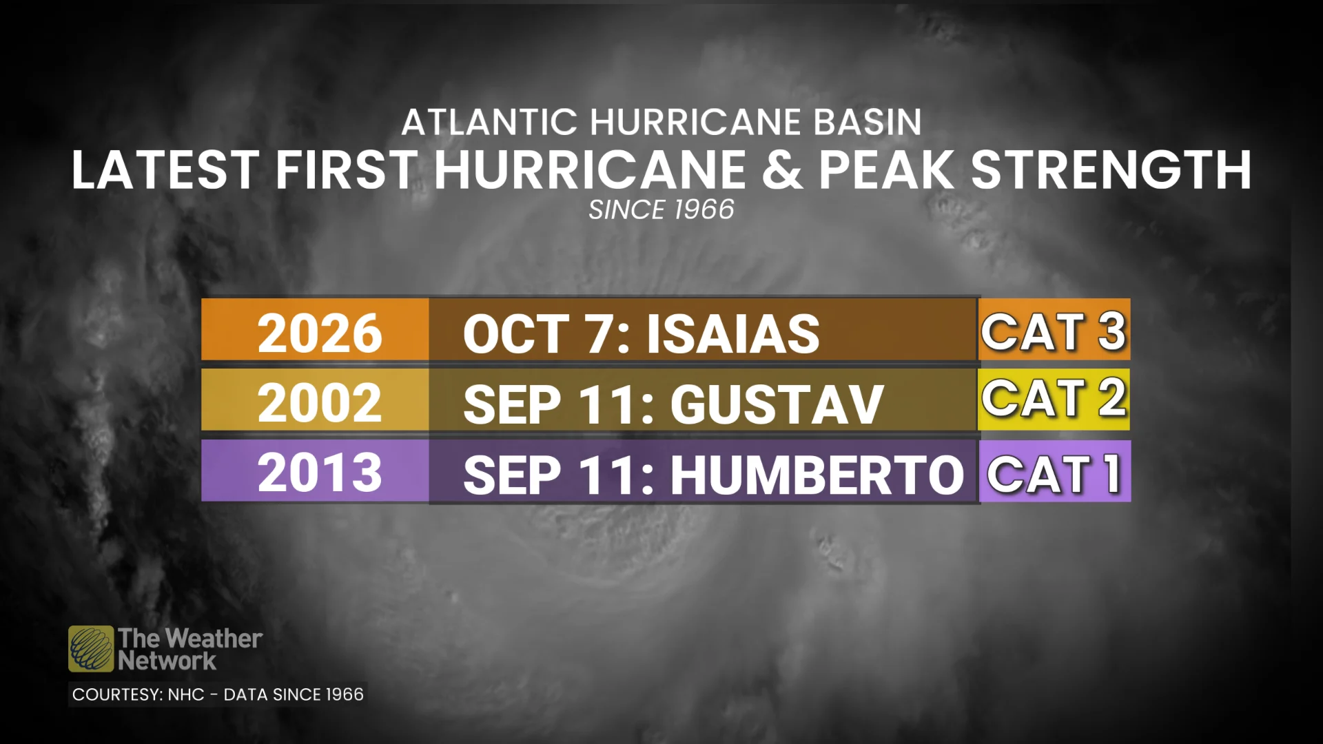
Isaias is the latest first hurricane observed in the Atlantic basin since the satellite era began in 1966. The storm reached hurricane intensity at 11:30 p.m. EDT on Oct. 7, beating the previous record by more than 27 days.
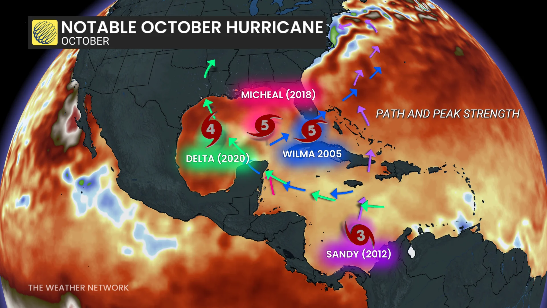
Of the top three latest hurricanes on record, Isaias is also the strongest among them. It is important to note, though, that this is not the strongest October hurricane on record.
The official pronunciation of Isaias (ees-ah-EE-ahs) comes from the Spanish language. Tropical cyclones around the world are assigned names based on the predominant languages that surround that ocean basin. Atlantic storm names are drawn from English, Spanish, and French.