Ontario: Thunderstorm risk lingers before conditions improve

A welcome pattern change will bring warmer temperatures back to southern Ontario Friday, albeit with showers, thunderstorm risk lingering from the previous day.
Temperatures are on the up thanks to the warm front from the latest system to bring showers to southern Ontario, though Friday sees those same showers continue until the afternoon for some, with a slight thunderstorm risk. Beyond, the long weekend starts out pleasant enough, but rain will return for its second half. Details and timing, below.
WEATHER HIGHLIGHTS
Rain continues through Friday afternoon
Chance of non-severe thunderstorms continues Friday
Warming up into the weekend, with rain in second half
Keep on top of active weather ALERTS in your area.
DON'T MISS: The Weather Network's official 2020 Summer Forecast coming to all platforms on June 1.
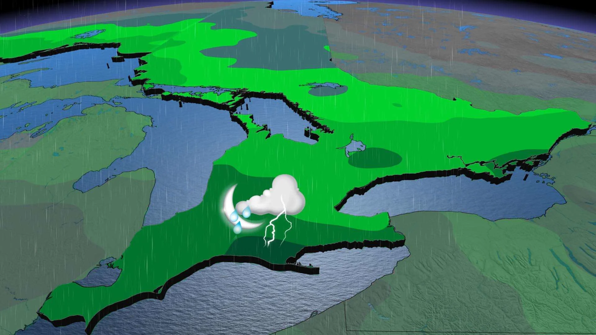
FRIDAY: RAIN, THUNDERSTORM RISK PERSISTS IN AFTERNOON
Showers will linger in the south Friday, with some rain-free periods, and thunderstorm risk in the afternoon. While most of the threat will remain non-severe, there is a marginal potential for isolated severe thunderstorms in Niagara region and areas on the eastern side of Lake Ontario including Kingston.

By the evening hours, the risk will diminish and there will be clearing, especially in areas north of the 401. Daytime highs will approach 20°C, though cooler by the lakeshore, in the south, while the southwest may reach the mark.
Additional rainfall amounts will be 5-15 mm across the south, with locally higher amounts in thunderstorms, and as much as 20 mm in parts of central and eastern areas.

THE LONG WEEKEND: PLEASANT START, BUT SOAKING RAIN RETURNS IN SECOND HALF
Saturday will feature the best weather of the weekend - a mix of sun and clouds with near seasonal temperatures. Daytime highs will be a few degrees cooler along the shoreline of Lake Ontario, but areas away from the lake will be approach 20°C.
The long weekend won't be completely dry, however. A system will track into the Great Lakes region Sunday with a soaking rain spreading across southern and central Ontario. Showers will hold off until nighttime in eastern areas, but it is still a very close call for this region. A more southerly track than initially expected means the northern edge of the system will just clip these areas and Monday could end up dry for Ottawa and Montreal. However, showers will linger into Monday across southern Ontario.
Beyond the long weekend, cool weather will continue into Tuesday but there is a very tricky temperature forecast for the second half of next week and weekend. A blocking pattern in the North Atlantic and a slow-moving subtropical storm offshore of the U.S. will cause a system to be cut off from the jet stream and stall (and re-develop) near the U.S. East Coast.
"This will really slow down the west to east progression of weather systems and delay the arrival of much warmer weather, which will be found just to the west of the Great Lakes region. Also, this will give southern Ontario an extended period with easterly winds, which will keep the GTA cooler than surrounding areas," says Weather Network meteorologist Dr. Doug Gillham.
The warmer weather should reach southern Ontario by next weekend, possibly earlier if the East Coast trajectory changes, but some lakeshore areas will remain considerably cooler. Temperatures will trend back to near seasonal or just below seasonal during the final week of May.
Check back as we continue to monitor the forecast