Hot and dry or cool and rainy? Contrasting weather to end July in Canada

Canada’s weather patterns close out July with contrasting conditions: Hot in the West, rainy in the East
As July draws to a close, contrasting weather patterns will persist across Canada this week.
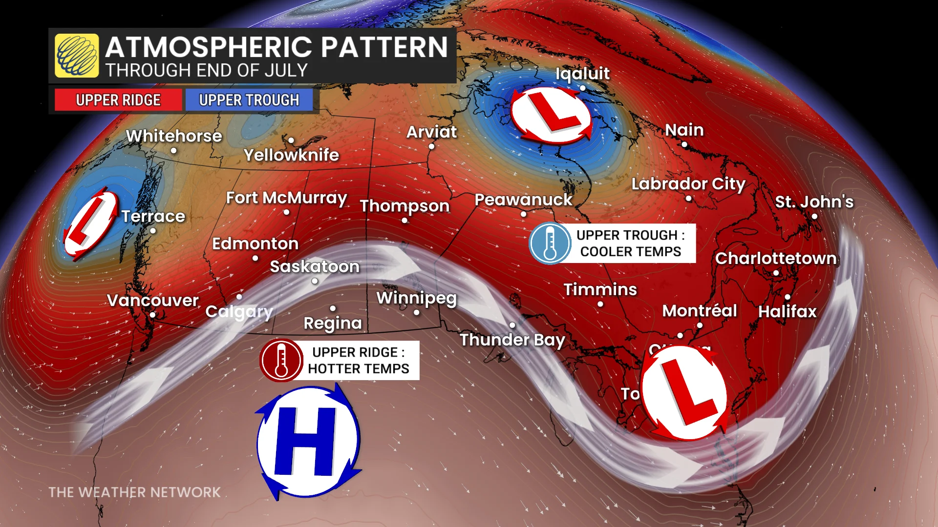
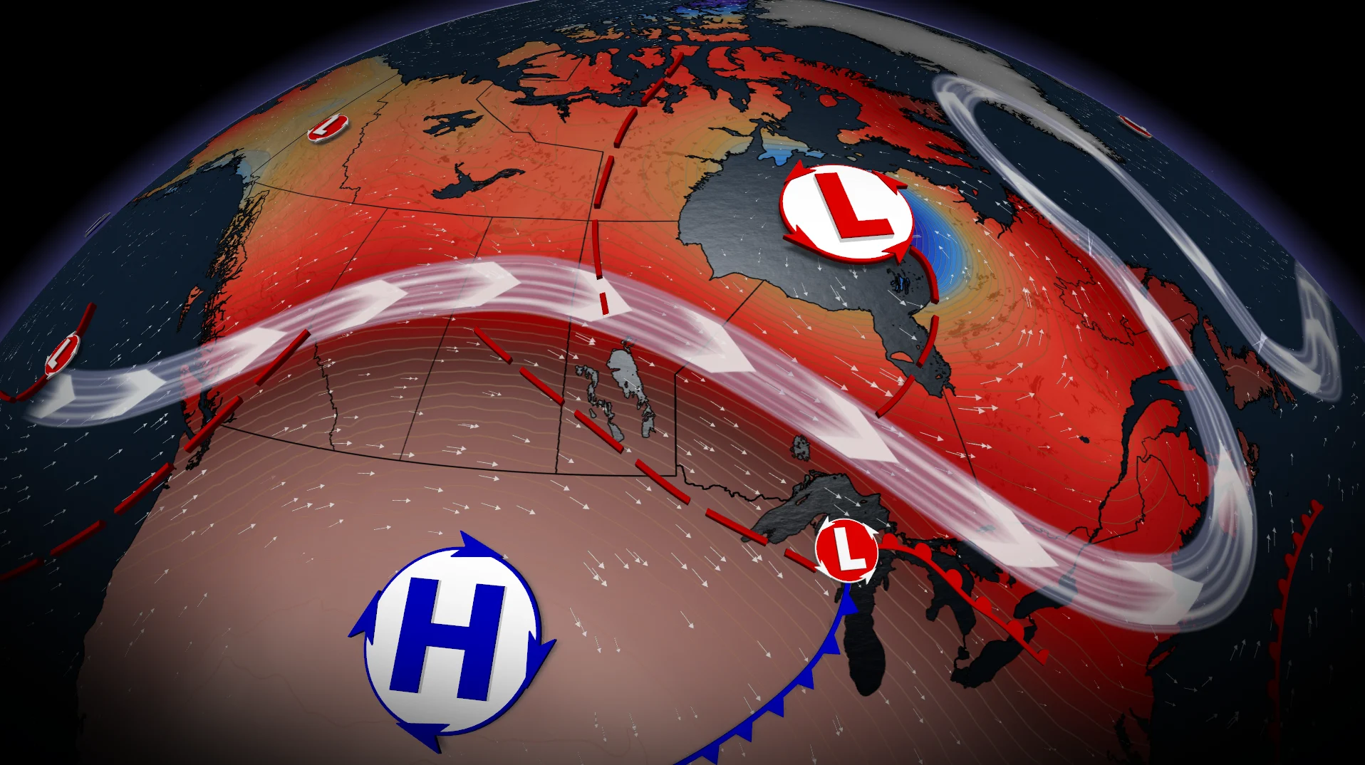
A ridge in the West will bring prolonged heat, while a trough in the East sets the stage for rain and cooler temperatures.
Western Canada: Hot and dry
The B.C. Interior and the Prairies will see above-normal temperatures.
Southern Alberta and Saskatchewan could experience highs in the mid-30s, with humidex values reaching the upper 30s.
DON'T MISS: Destructive Alberta tornado narrowly misses Rocky Mountain House community
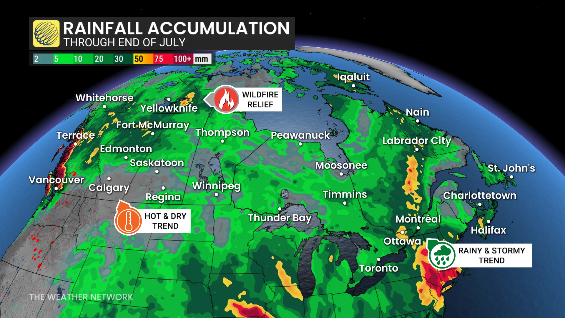
A prolonged dry spell is expected across the southern Prairies, with rain and storms shifting northward, providing some relief to wildfire zones.
Eastern Canada: Cooler and wet
Ontario and Quebec will experience near-seasonal or slightly above-normal temperatures.
However, an unsettled pattern will bring a multi-day thunderstorm risk this week.
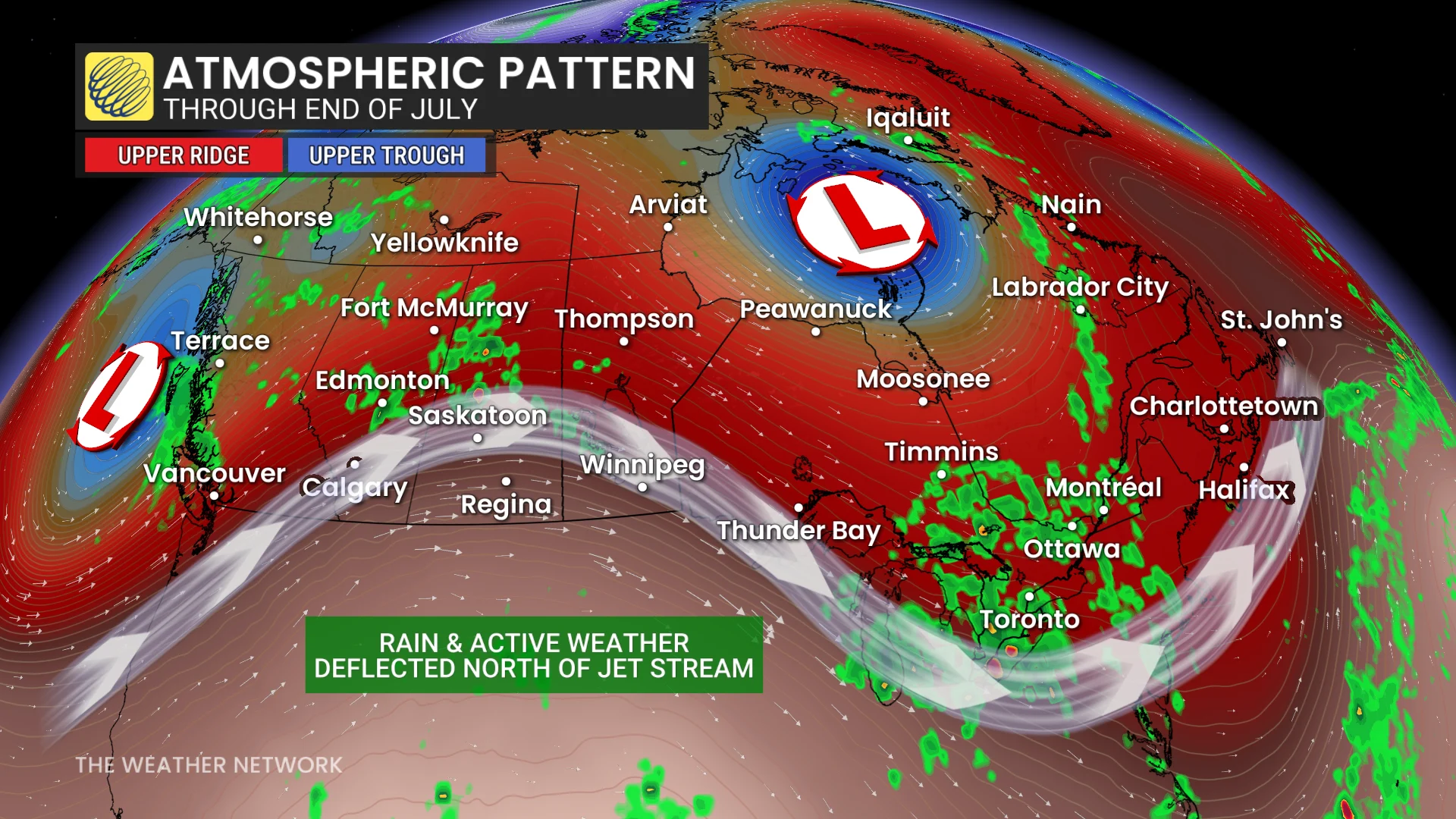
The storm risk on Sunday gets heightened into Monday with an elevated threat of flash flooding from heavy downpours.
Storm risk continues into Tuesday for much of southern Ontario. Main hazards will be strong wind gusts and flooding downpours.
The stormy pattern is expected to stick around in Central Canada until mid-week, giving the region a few dry days before unsettled weather returns.
DON'T MISS: 720,000+ hectares burned: Ontario on track for worst wildfire season ever
Wildfires and air quality concerns
High wildfire activity persists in B.C. and the Northwest Territories, with smoke periodically reducing air quality over western regions. Occasionally, this smoke may travel eastwards.
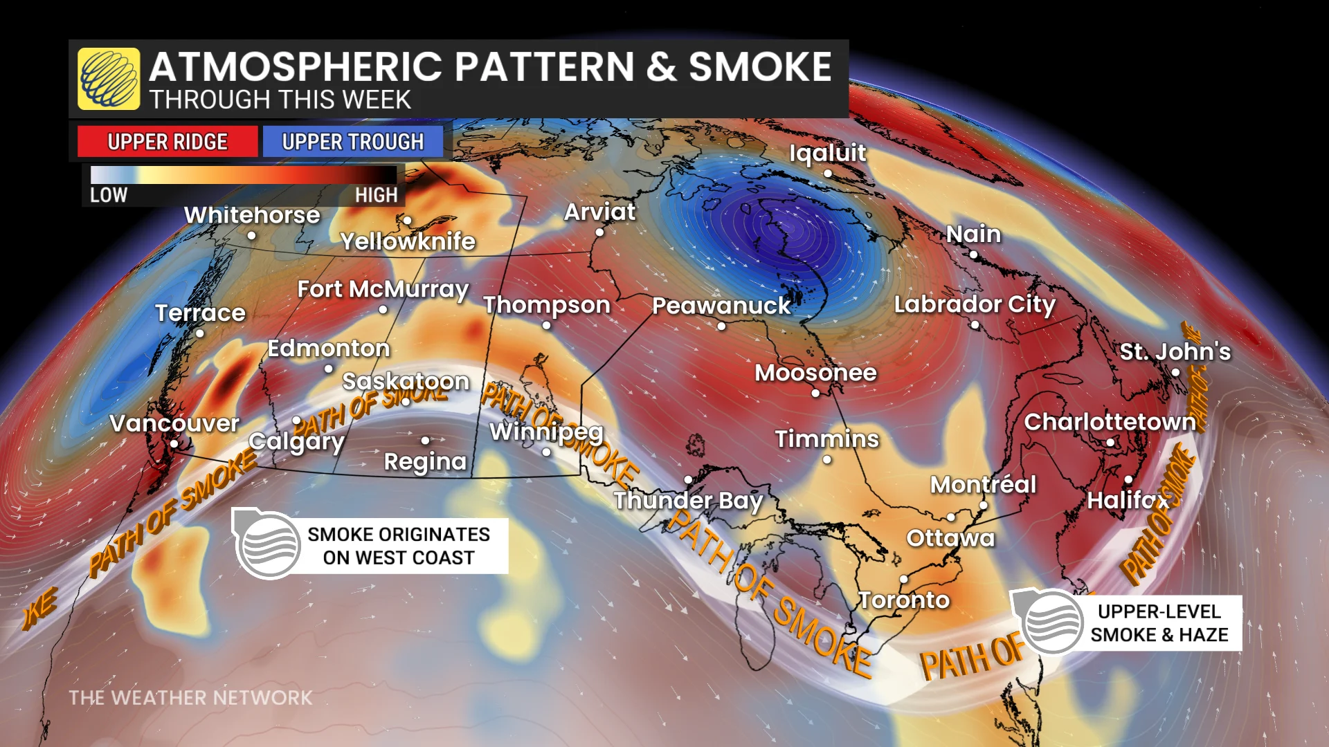
As well, fire activity is high in the U.S. states of Washington and Oregon, sending smoke north over the border.
Air quality risk again for B.C. interior and southern Alberta, courtesy of the southwest flow bringing smoke up.
Smoke is set to travel the length of the country this week as the jet stream will help carry West Coast wildfire smoke all the way through Ontario and Quebec.
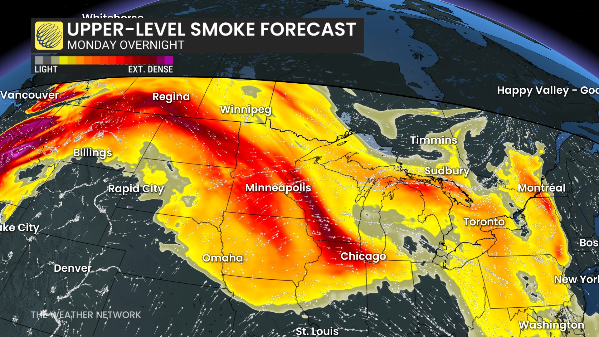
The good news is there won't be a real threat to air quality, but we will have hazy skies above with smoke in the upper-levels of the atmosphere.
Temperature averages for July so far:
Toronto: 24.0°C (2°C above normal)
Calgary: 19.2°C (3°C above normal)
Vancouver: 18.1°C (0.2°C above normal)