Soggy start to holiday weekend as heavy rain washes into B.C.

California gets a break this weekend as a plume of Pacific moisture brings steady, heavy rainfall to B.C.’s South Coast through the holiday weekend.
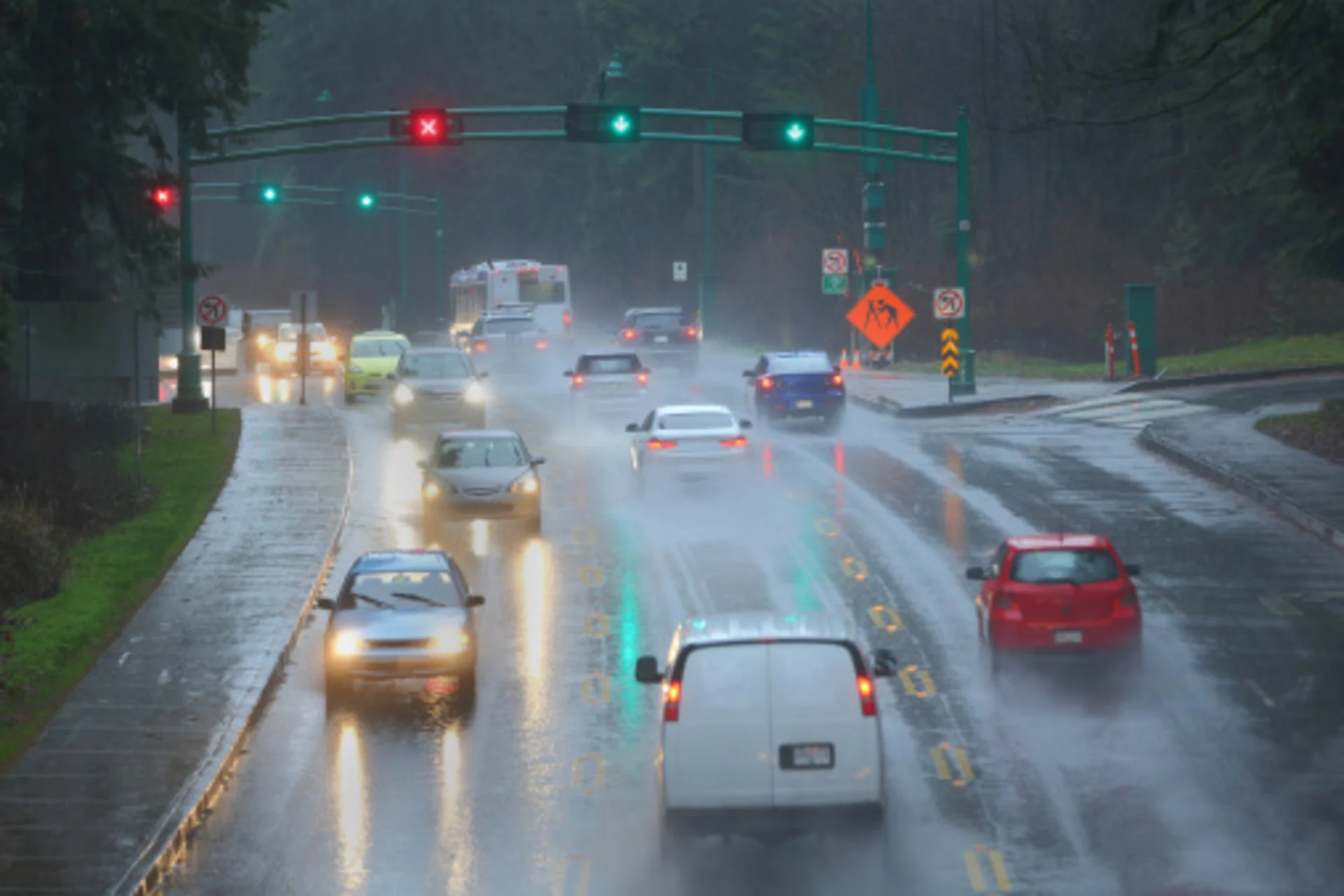
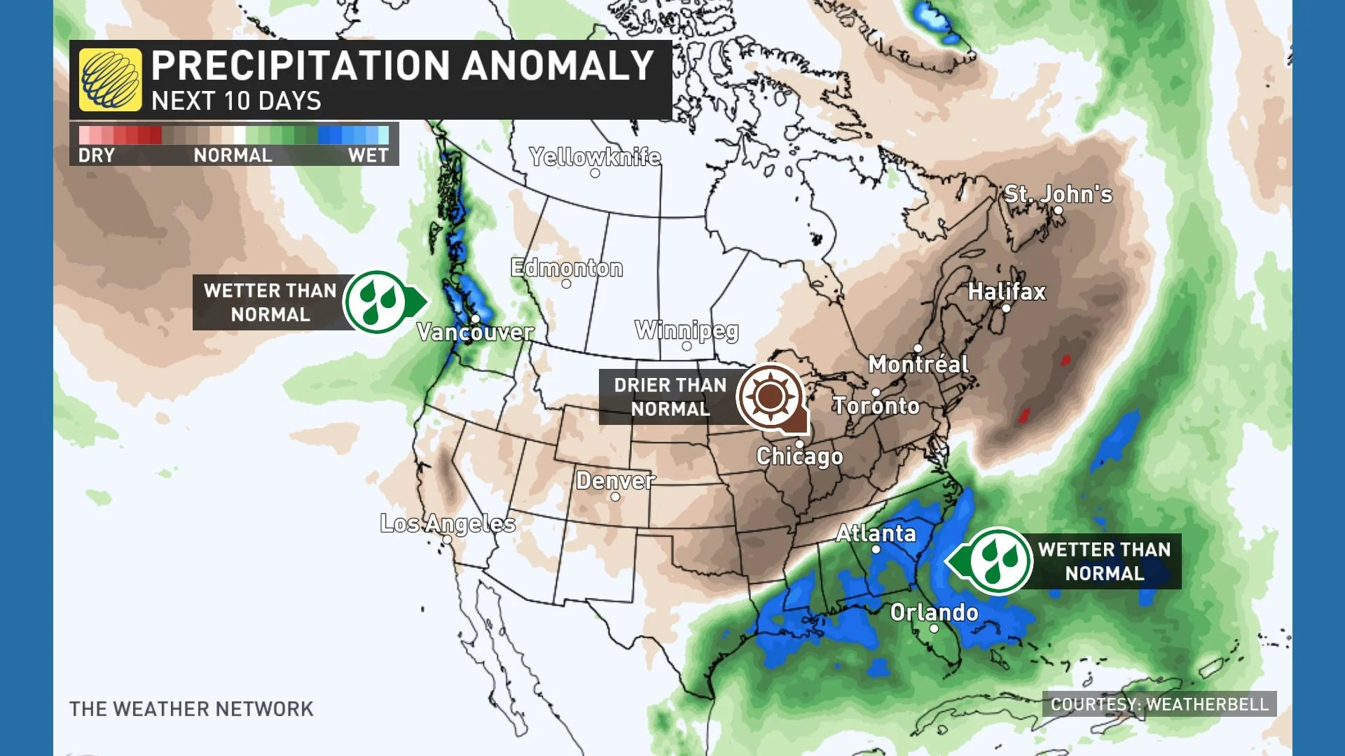
It’s going to be a soggy start to the holiday weekend for many on the sunshine coast. An atmospheric river has set its sights on B.C. bringing in large and at times heavy rounds of moisture to the province.
We’ll see widespread drenching rains across the region straight through to early next week, with a risk for localized flooding in some areas. This pattern will also raise the avalanche danger heading into the weekend.
DON’T MISS: 200 mm of rain or 20C and sunny? Canada’s holiday weekend forecast
This ongoing stretch of gloomy weather comes courtesy of two plumes of Pacific moisture aimed at B.C.’s South Coast.

Precipitation will become lighter at times throughout the day on Friday, with many seeing periods of no rainfall. That all changes as round 2 powers up with heavier precipitation on Friday evening and into Saturday morning.
Areas on Vancouver Island and north of Vancouver can expect to see wind gusts upwards of 60-70km/h through Saturday morning. The rainfall will continue throughout the majority of the day on Saturday, just in time for the next front to roll in on Sunday morning - packing an even bigger punch.
Rain will be very heavy at times throughout Sunday afternoon, becoming moderate going into the evening hours on Sunday.
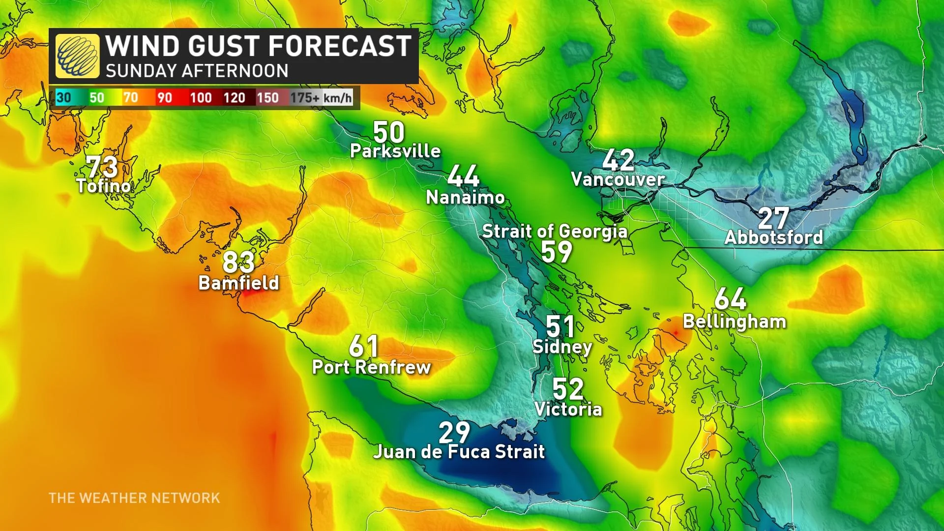
As the front moves over the region on Sunday, wind gusts could exceed over 80 km/h in parts of the province. Power outages and ferry cancellations are possible, so be sure to plan ahead and adjust plans accordingly.
Rain gauges are going to get some good use over the next couple of days, for sure, with more than 100 mm of rain expected across much of western Vancouver Island, with 50-75 mm of rain possible north of Vancouver toward Squamish.
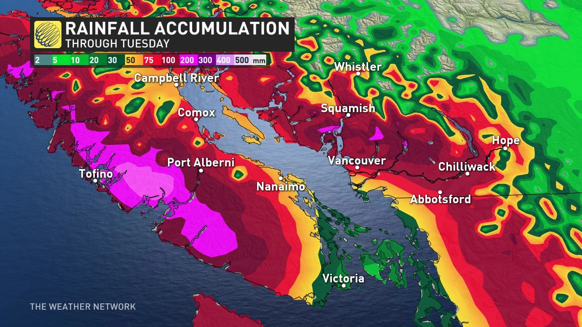
After the second round of rain arrives for the latter half of the weekend, storm total rainfall accumulations could push 200+ mm for some areas.
MUST SEE: Rising Antarctic ice melt will dramatically slow global ocean flows, study finds
B.C.’s River Forecast Centre issued a high streamflow advisory for Vancouver Island and the South Coast in anticipation of the persistent heavy rainfall. “Current forecasts are indicating the potential for localized flooding in low-lying areas,” the agency said in their advisory.
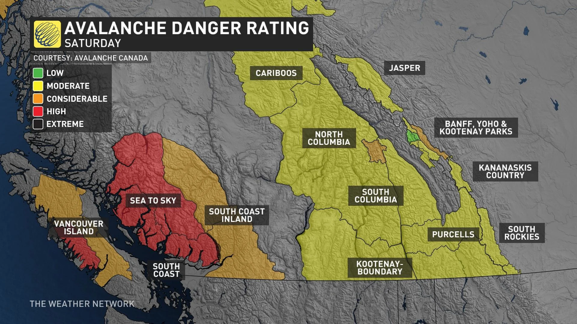
This push of Pacific moisture will also bring rising freezing levels heading into the weekend, raising the avalanche danger across B.C. Parts of the South Coast will face a high avalanche danger on Saturday, with a moderate danger for the interior ranges. Anyone venturing into the mountains is urged to use extra caution with the heightened risk of avalanches in the area.
Temperatures will remain slightly below seasonal this weekend, with sunshine returning by mid-next week. Looking ahead, temperatures will remain cooler than normal through mid-month.
Check back for the latest on the heavy rain moving into British Columbia this weekend.