Heavy rain, severe storms target southern Ontario

A slow-moving storm system brings repeated rounds of thunderstorms, heavy rain and a growing flood risk into midweek
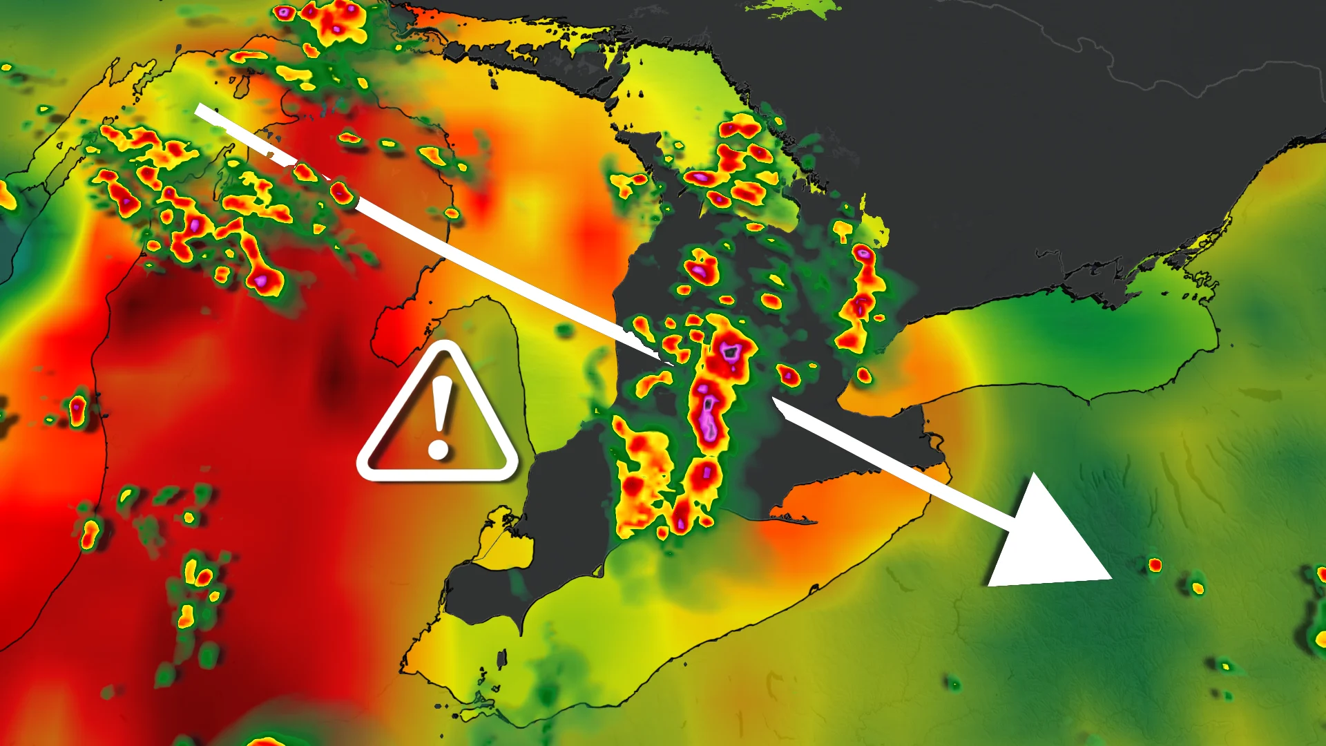
Southern Ontario is in for a stormy start to the week as a slow-moving weather system brings many rounds of thunderstorms, with some locations potentially collecting more than 80 mm of rain.
The most serious danger will be if storms frequently pass over the same locations, causing rainfall totals to rapidly rise. Localized flooding, low visibility and dangerous driving conditions are all conceivable, particularly in the evening and overnight hours.
DON'T MISS: How the weather could be influencing your music taste
Storms build through the day, peak overnight
Thunderstorms are predicted to form around Lake Huron and Georgian Bay counties Monday afternoon, then spread over southern Ontario. The storms will pass over south-central Ontario before hitting the Greater Toronto and Hamilton Area in the late afternoon and evening.
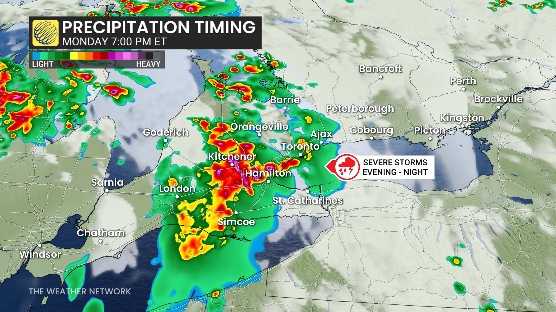
The threat will persist overnight as the low-pressure system and its associated cold front pass through the region. Areas under persistent thunderstorms may receive 30 to 80 mm of rain, with torrential downpours, frequent lightning and severe wind gusts possible.
Southwestern Ontario will also see oppressive humidity, with humidex levels approaching 40. Farther east, confidence remains low, with mainly isolated thunderstorms expected and some regions remaining dry.
SEE ALSO: 5 astronomical events happening after we're gone
Flooding threat shifts east through midweek
The unsettled trend will persist into Tuesday and Wednesday as the slow-moving low remains over the province, transferring the biggest storm threat to eastern Ontario, including Ottawa and Kingston.
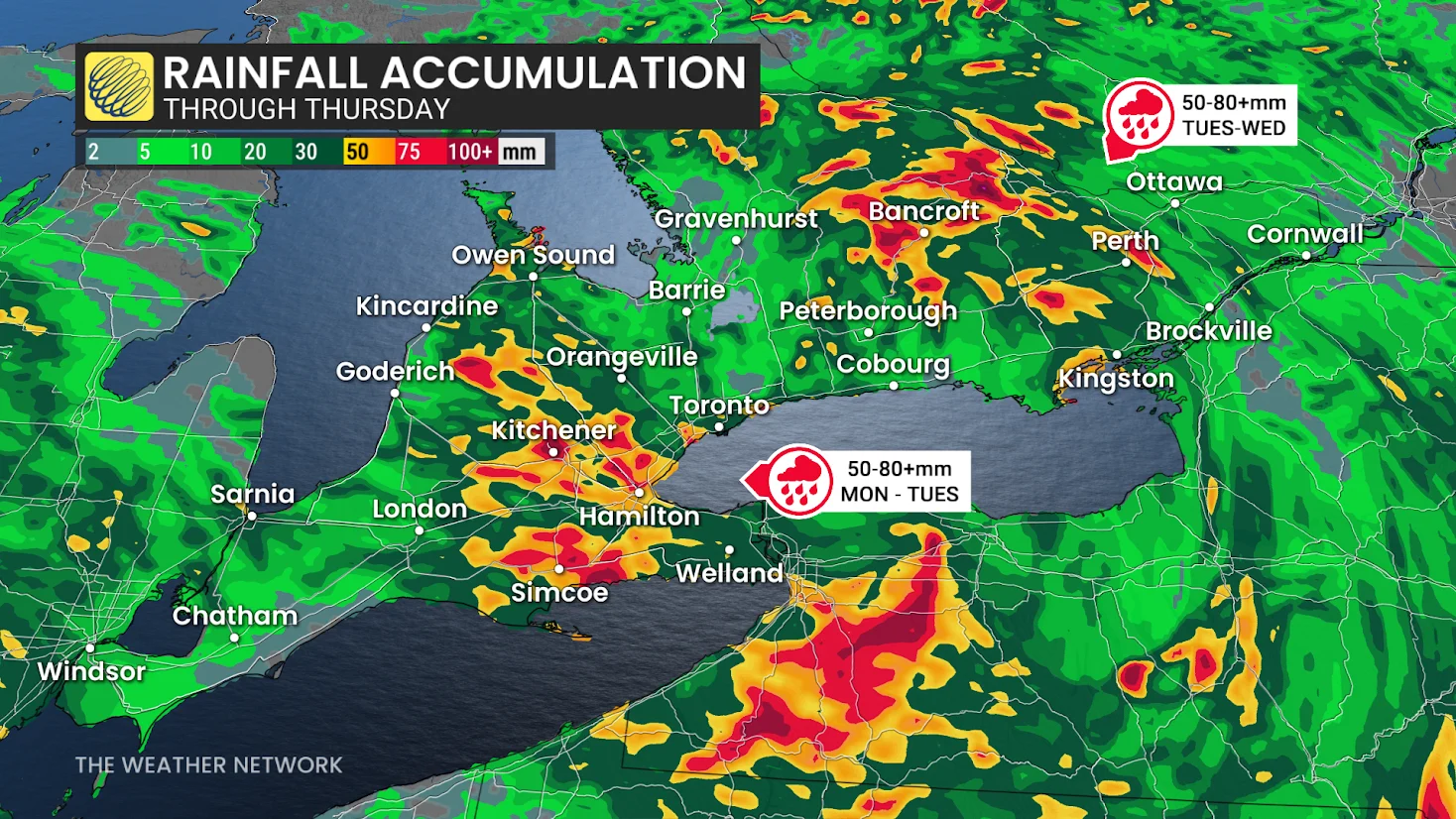
As long as warm, humid air persists, another round of heavy rain and thunderstorms may occur. Localized rainfall totals may again approach 50 to 80 mm when storms strike frequently, raising flooding risks.
Showers are forecast Tuesday morning, with thunderstorms increasing throughout the afternoon. Some of the most powerful storms could approach during the evening commute in Ottawa and into Montreal, with heavy rain perhaps lasting until Wednesday.
Stay with The Weather Network for the latest updates