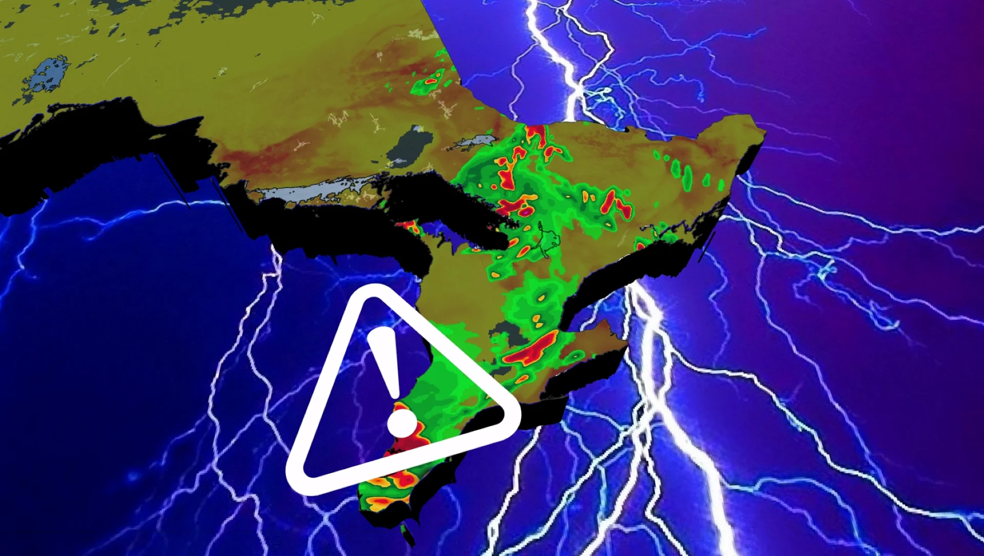
Heightened flood concerns in southern Ontario from heavy rain, severe storm risk

Prepare for more stormy weather in southern Ontario on Tuesday with additional heavy rain and thunderstorms. Hazards include torrential downpours, strong wind gusts, and even small hail for some areas.
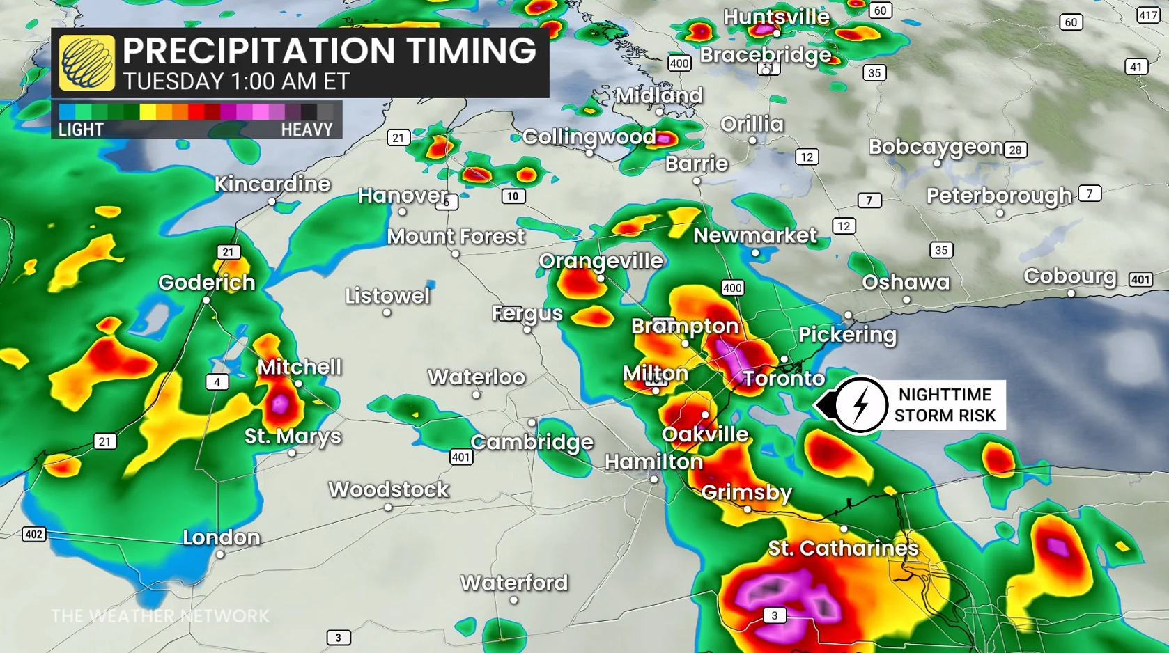
Parts of southern Ontario are in for a stormy Monday night and active day on Tuesday, with some locations potentially collecting more than 80 mm of rain by the time the active weather concludes.
The most serious danger will be if storms frequently pass over the same locations, causing rainfall totals to rapidly rise. Localized flooding, low visibility and dangerous driving conditions are all conceivable, particularly in the evening and overnight hours.
DON'T MISS: How the weather could be influencing your music taste
Storms continue Monday overnight for parts of southern Ontario
Storm activity will continue from Algonquin to Windsor through Monday overnight as a low-pressure system continues to push eastward.
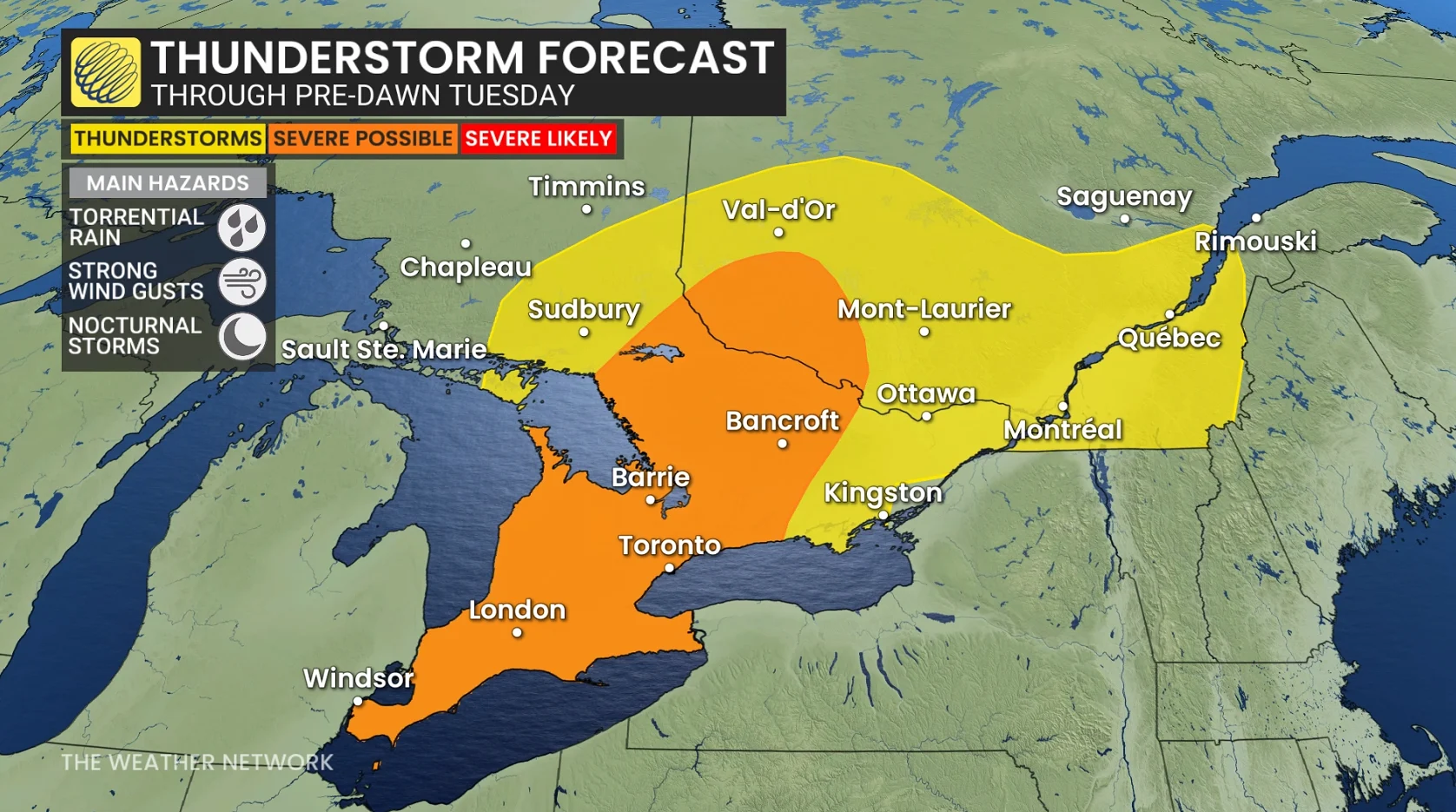
Torrential rain, small hail, and strong winds remain the primary hazards with storms through the pre-dawn hours on Tuesday.
More organized clusters of storms are forecast across extreme southwestern Ontario, potentially bringing heavier rainfall amounts and stronger winds.
Flooding risk elevated with more thunderstorms on Tuesday
The unsettled trend will persist into Tuesday as an upper trough remains over the province, transferring the biggest storm and heavy rain threat to eastern Ontario, including Ottawa and Kingston.
SEE ALSO: 5 astronomical events happening after we're gone
Persistent storms will risk local amounts of 50-80+mm of rainfall through midweek, although rainfall amounts will be highly variable across the province.
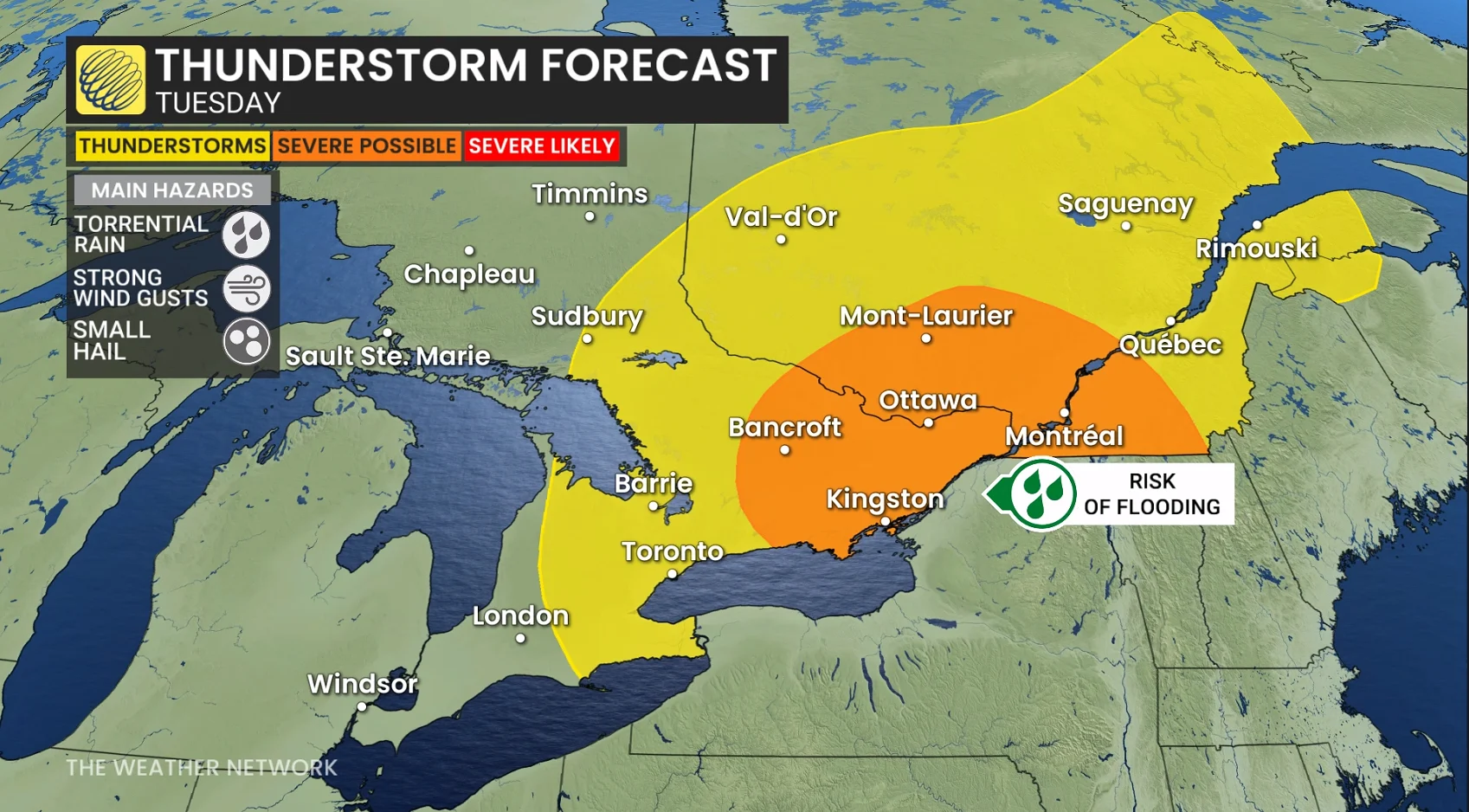
Heavy downpours and localized flooding are the biggest concerns.
Showers begin Tuesday morning, with severe thunderstorm potential increasing through the day with daytime heating.
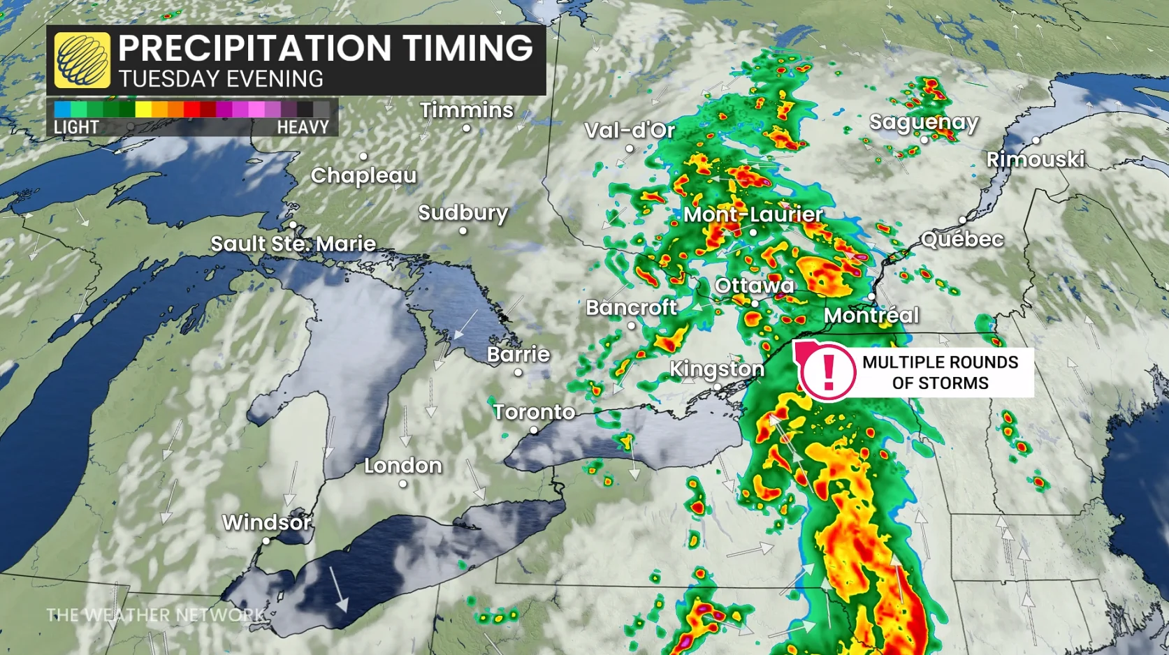
Severe storms spiral in around the low, impacting Ottawa to Montreal around the commuting hour.
Showers and heavy downpours may continue overnight Tuesday into Wednesday, with lingering showers looking increasingly likely during the latter.
WATCH: Severe storm warnings move across southern Ontario
Stay with The Weather Network for the latest updates for Ontario.