Up to 100 mm: Flood, severe storm risk grows in Alberta with weekend rain
A wild weekend of weather is in store for Alberta. As much as 50-100 mm of rain is expected for some, while others face the risk of severe storms and even late-season snow
An intensifying, low-pressure system will bring significant rainfall and the risk of severe thunderstorms across Alberta this weekend.
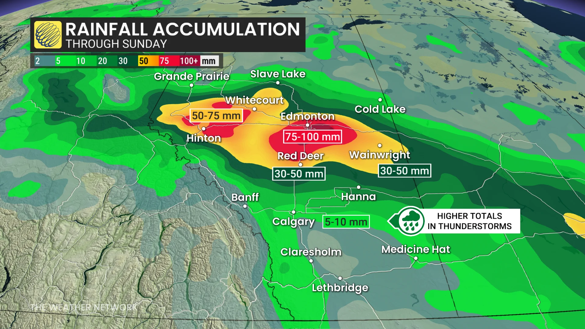
The slow-moving system will persist through Sunday, with rainfall totals ranging from 50-100 mm in parts of Hinton, Whitecourt, Red Deer, and Edmonton. Localized flooding cannot be ruled out with prolonged, intense showers.
DON'T MISS: Understanding floods: Preventative measures to minimize your risk
Severe thunderstorm risk spreads across southern Alberta Saturday
As instability peaks Saturday afternoon, the low will trigger severe thunderstorms along the QE2 corridor.
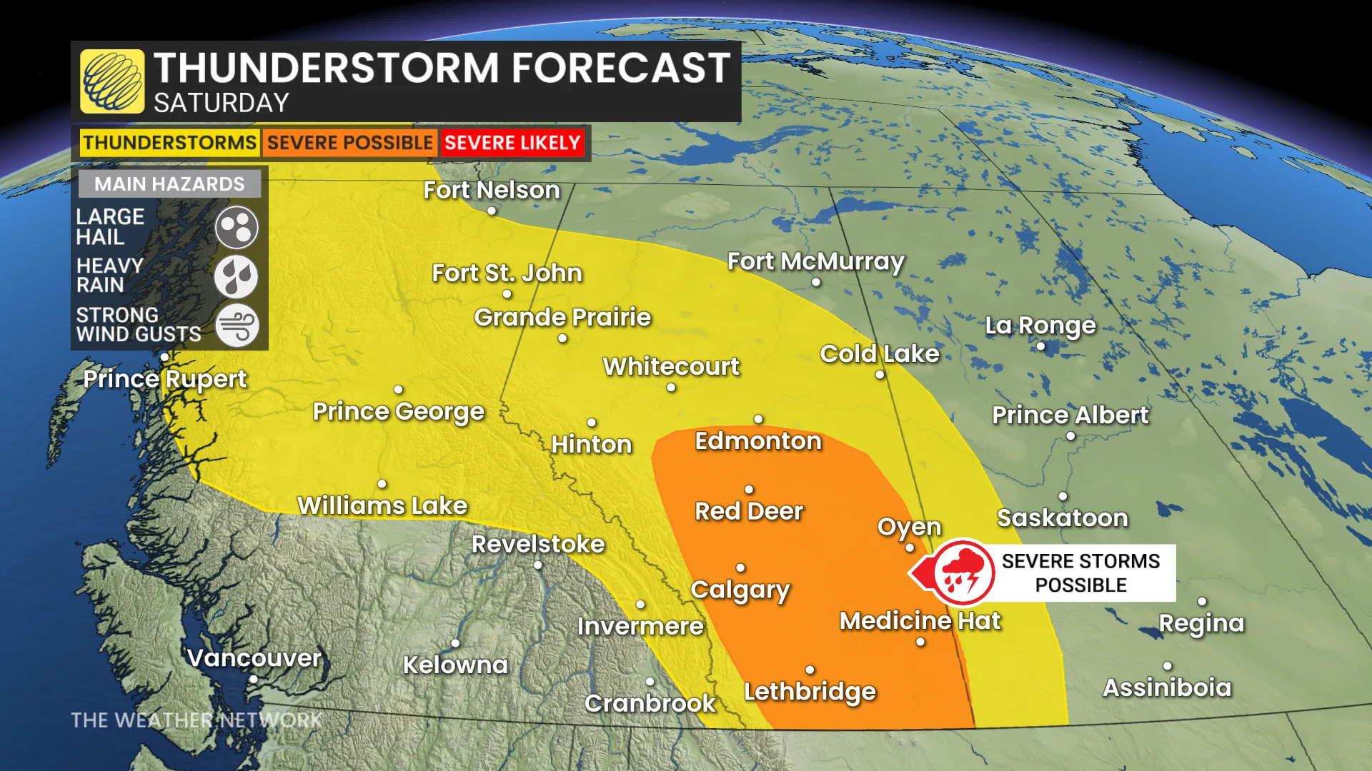
Cities and towns at risk of severe storms include Calgary, Red Deer, and locations to the east.
The primary threats will be large hail, strong wind gusts, and torrential rain.
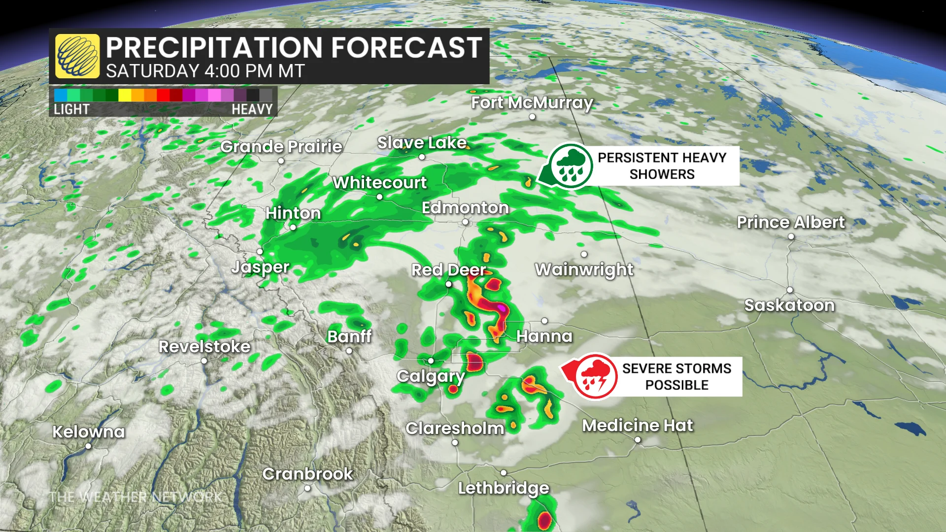
The storms are expected to organize and track eastward in the evening, producing strong winds into the overnight hours.
Strong winds will persist through Sunday and Monday as the centre of the low stalls over Alberta-Saskatchewan border, with gusts up to 80 km/h.
Snow chances grow with cooling temperatures
By Saturday night, colder air will filter in from the west, causing temperatures to drop dramatically, especially in the Rockies.
DON'T MISS: Cooler, stormy start to summer on tap for much of Canada
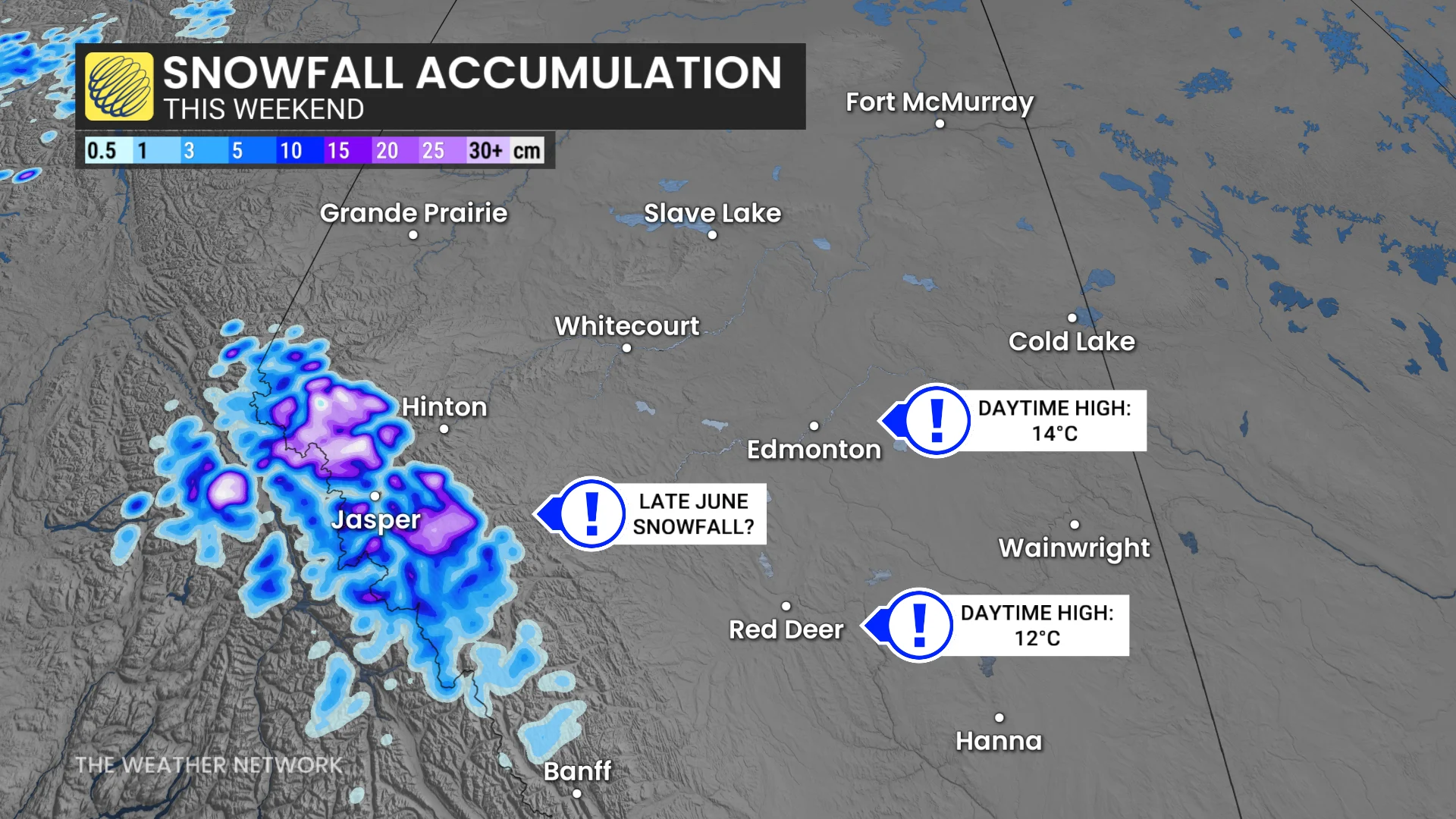
Freezing levels will fall, and snowfall is possible near Jasper.
Sunday’s daytime highs will also be well below seasonal, with 13°C in Calgary, 12°C in Red Deer, and 14°C in Edmonton (normal highs are closer to 21-22°C).
Stay tuned for updates and monitor for potential weather alerts.