Cooler, stormy start to summer on tap for much of Canada
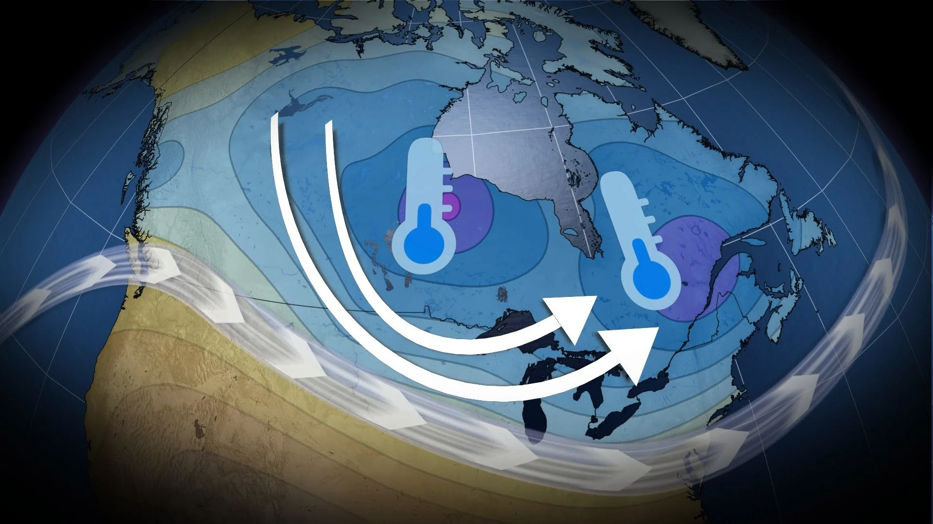
A jet stream staying south of the border will keep much of Canada on the cooler and unsettled side of things as summer officially begins
The summer solstice arrives on Sunday, but it won’t feel much like summer across much of Canada this weekend.
We’re on track for cooler temperatures and unsettled conditions from coast to coast, with only a few select locations expecting summer-like weather.
DON’T MISS: Tornado season is underway in Canada. Here’s what you need to know
Dramatic contrasts build in Western Canada
A ridge over British Columbia will keep southern portions of the province dry and warm heading into this weekend. We’ll start summer here with above-seasonal temperatures.
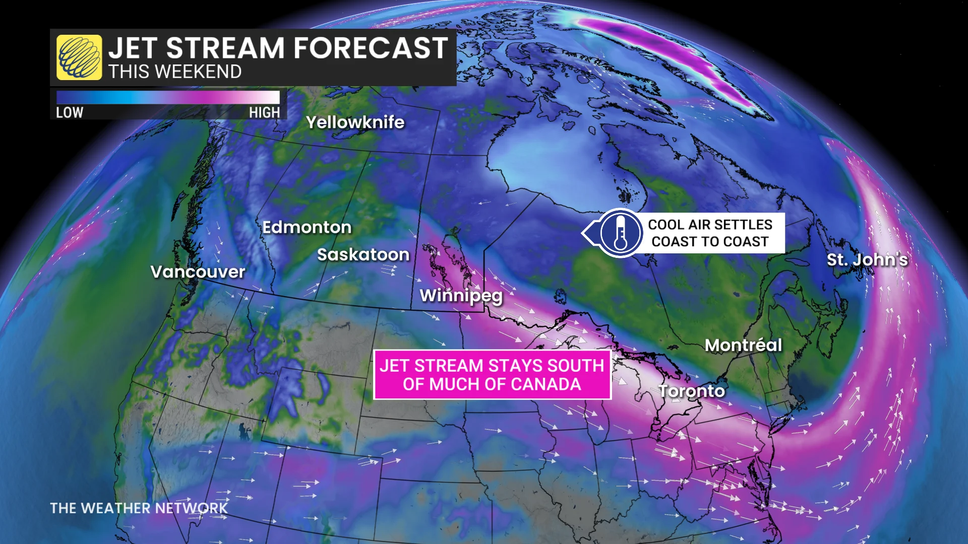
However, a much different setup will unfold farther east. A powerful system developing Saturday will move through Alberta with a risk for heavy rain, strong winds, and a potential for severe thunderstorms.
Temperatures in Alberta will fall dramatically through the weekend, with a 5-7 degree drop in Calgary sending Sunday’s high temperature down to just 12°C.
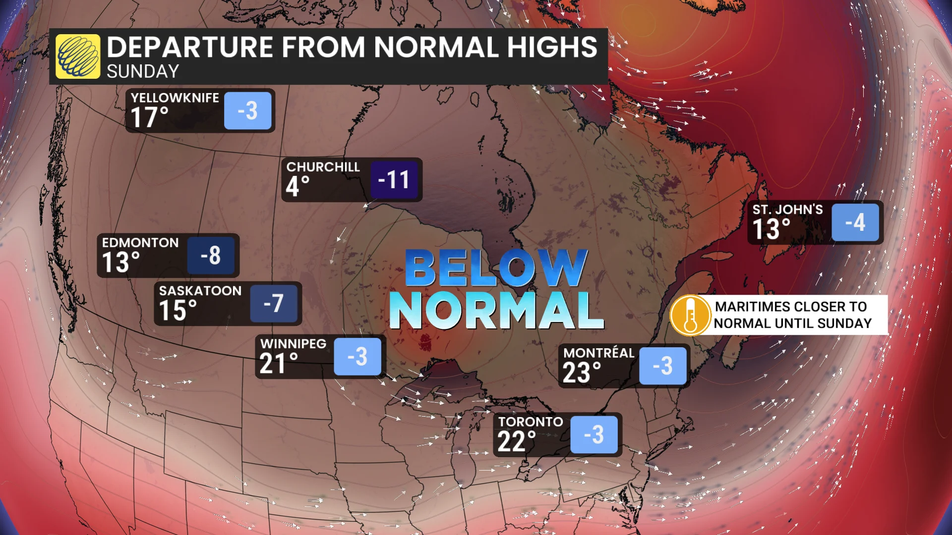
The system pushing through Alberta will continue east to bring unsettled conditions to Saskatchewan and Manitoba, while cooler temperatures prevail thanks to an upper-level trough lingering over the region.
Unsettled conditions for Ontario and Quebec
Folks across Ontario and Quebec can expect periods of rain and thunderstorms at times. Cooler conditions are on tap here, as well, where temperatures will feel more like late-May than the summer solstice.
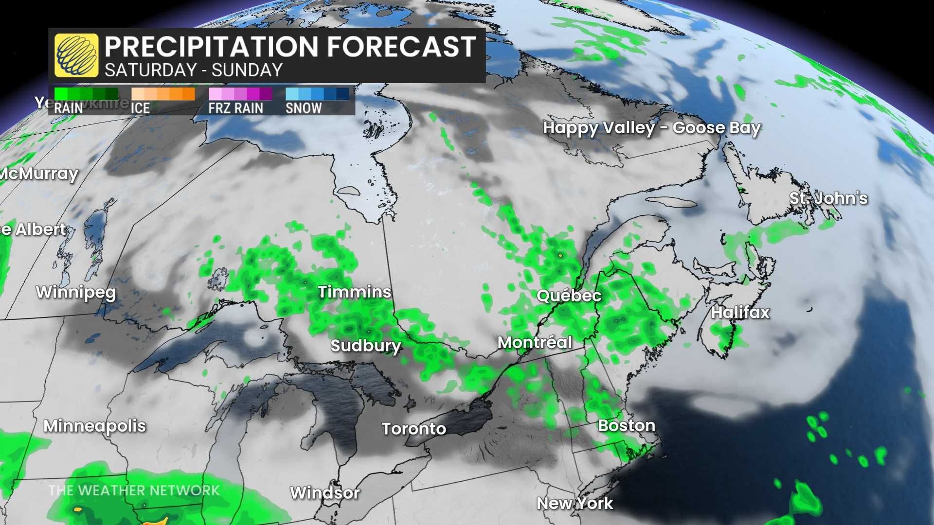
A low-pressure system will move into Atlantic Canada late Friday into Saturday, bringing rain to the Maritimes to kick off the weekend.
We’ll see changeable temperatures across the East Coast as the storm system approaches and then departs the region.
Stay with The Weather Network for all the latest on conditions in your area.