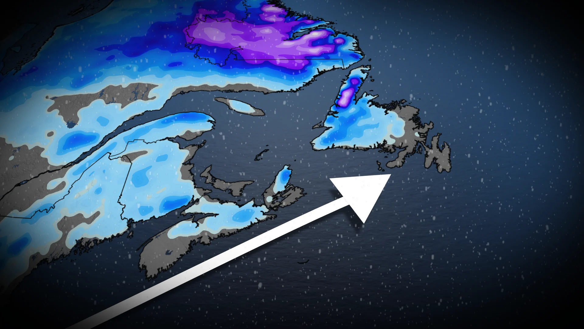
First shot of fall snow for parts of Atlantic Canada with cool air

Winter weather is coming to parts of Atlantic Canada. A messy system will have the potential of bringing the first instance of snowfall to parts of the Maritimes
Parts of Atlantic Canada may get their first taste of winter by the end of the week as a messy low takes aim at the East Coast.
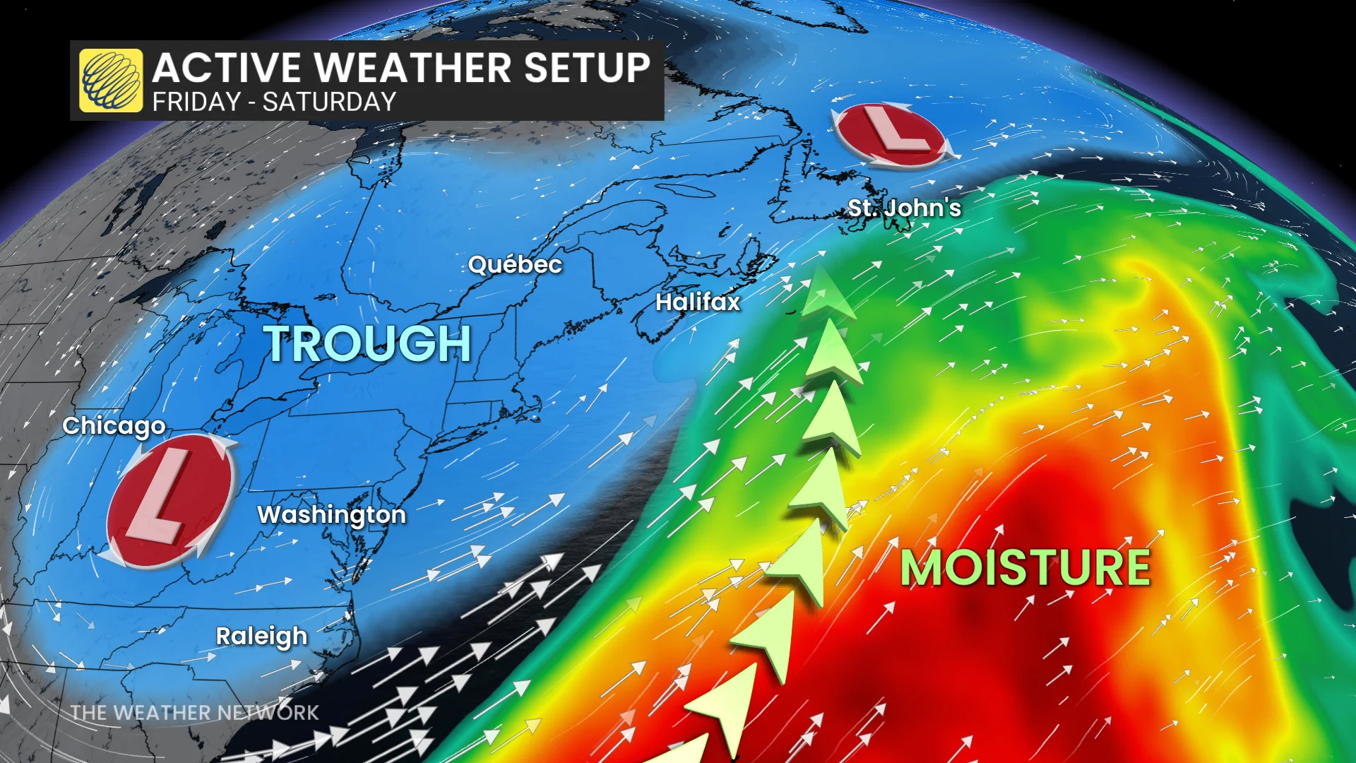
A system will clip southern Nova Scotia and Newfoundland with rain and possible snow, or a rain-snow mix, to Atlantic Canada. Parts of Nova Scotia are looking at seeing their first shot of snowfall this season.
DON'T MISS: Canada's Winter Sneak Peek: El Niño puts record warmth in play
While accumulations may not be high, for areas that see snow this week, the first snowfall can catch many drivers off guard, especially for those who haven't put their winter tires on.
Rain and snow on deck for parts of Atlantic Canada
A developing, low-pressure system off of the U.S. Northeast coast tracks into the Maritimes late Thursday into Friday.
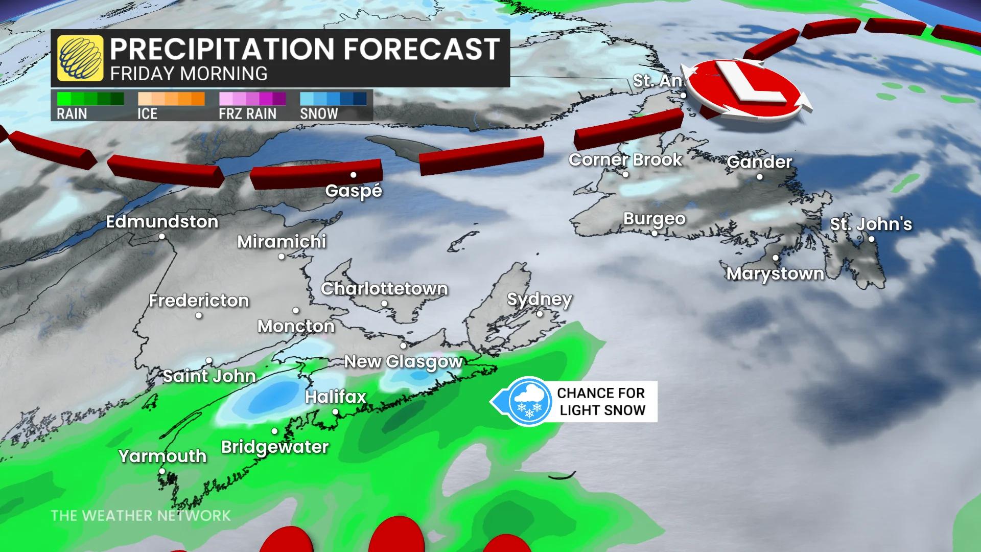
Showers grow from southwestern Nova Scotia on Friday morning, sliding across the province through the day.
Chance for a rain-snow mix for higher elevation regions of the province on Friday morning.
DON'T MISS: Winter has a few tricks up its sleeve for Eastern Canada this year
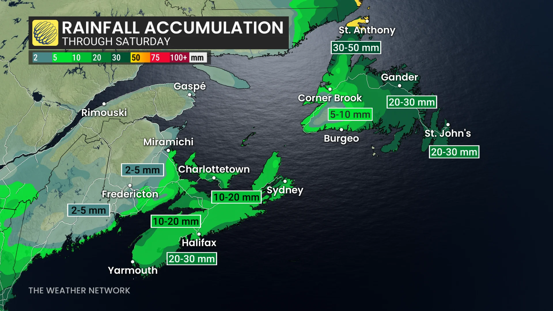
There is greater confidence for a chilly-rain event for Halifax. Forecasters will be watching if the storm tracks farther south to bring flurries into the Halifax area proper, but there is low confidence.
Normal, first instance snow in the fall for Halifax is Nov. 3, with no snowfall recorded as of yet.
Showers may only lift as far north as southern New Brunswick, while cold air in place over New Brunswick may bring flurries through Friday.
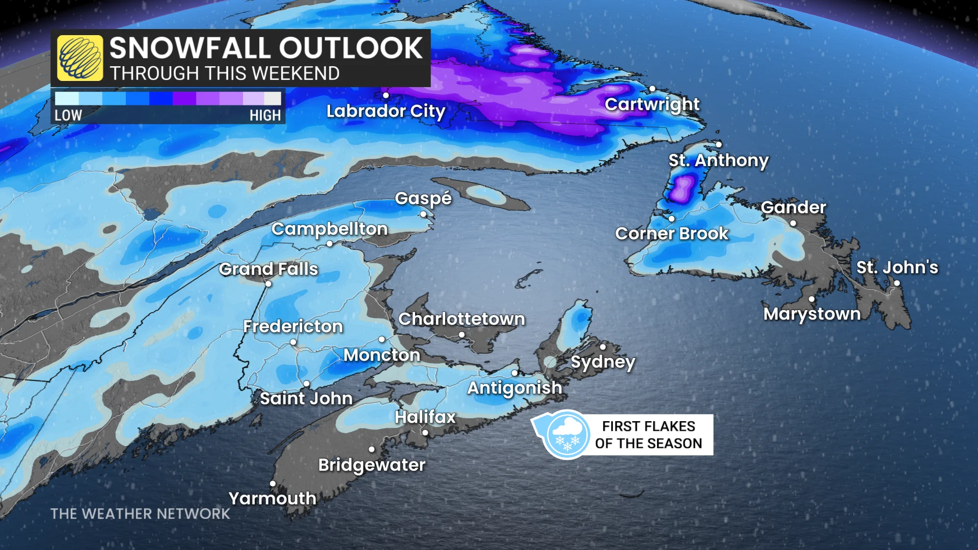
__Normal first instance of snow in the fall for Moncton: Oct. 27 (trace snow reported Nov. 10).
Accumulations should remain light as there will be frequent, rainy transitions.
Looking to Newfoundland, and not associated with the forthcoming low for the Maritimes, 5+cm of wet snow is possible across central areas of the province, including Gander and Badger.
Next week will feature an extended stretch of fair weather and trending warmer, especially across the Maritimes.
Labrador will be five to 10 degrees above seasonal for most of next week. Newfoundland will be closer to seasonal but should trend warmer late week and into the following week.
A more active pattern is expected during the final week of November.
Stay with The Weather Network for the latest updates and information on your forecast across Atlantic Canada.