Franklin gathers steam as uncertainty looms over Canadian impacts

Uncertainty remains as forecasters watch the progression of Tropical Storm Franklin as it moves north. Parts of Atlantic Canada are on alert
Visit The Weather Network's hurricane hub to keep up with the latest on tropical developments in Canada and around the world
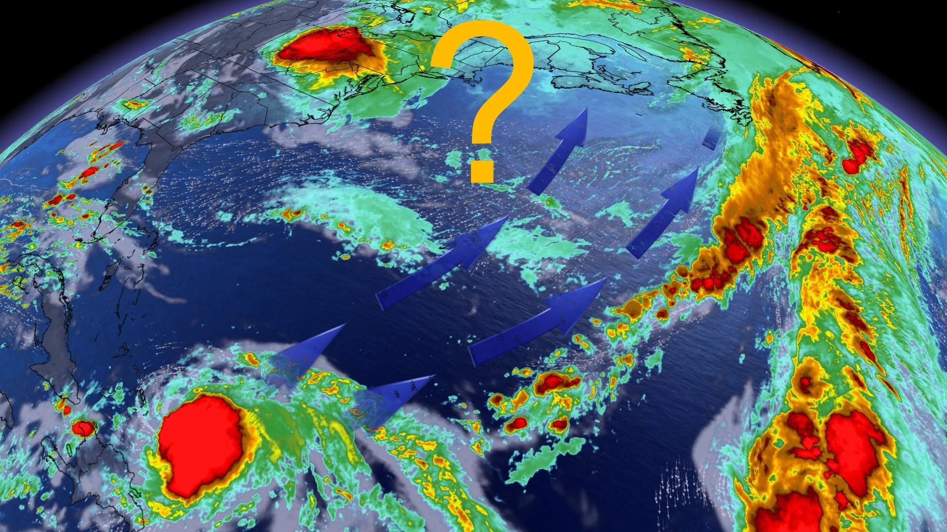
Forecasters continue to monitor the progress of Tropical Storm Franklin as it slowly gathers steam in the western Atlantic Ocean, as the storm may follow a track that could bring impacts to the Atlantic provinces next week.
The storm brought heavy rains to the Dominican Republic earlier this week before moving away from the Caribbean and pushing into the western Atlantic basin. Franklin will likely strengthen into a hurricane by this weekend as it continues north on an uncertain path.
RELATED: Four tropical cyclones form as the peak of the Atlantic hurricane season hits

"It is still too early to have confidence in the storm track for Franklin into next week," says Dr. Doug Gillham, a meteorologist at The Weather Network.
"It is possible that Franklin will escape out to sea without a significant impact to land, however, the overall pattern is somewhat concerning, with a risk that Franklin tracks further to the west, bringing heavy rain and strong winds to parts of Atlantic Canada."
The storm’s slow movement is the result of a record-setting heat dome parked over the southeastern U.S., bringing in northerly winds that are preventing Franklin from accelerating.

DON'T MISS: Six tips to manage flooding
As the heat dome weakens early next week, a ridge of high pressure will start to develop over the Atlantic Ocean, bringing in southerly winds that’ll allow Franklin to move north at a faster clip.
Meanwhile, a trough over Eastern Canada will serve as the main driver for where Franklin tracks. The timing and speed of the trough will dictate whether Franklin affects the East Coast or not.

Small changes in the storm’s path and the upper-level pattern steering it could have big implications on Franklin’s ultimate track.
As such, confidence is low on which track is more likely, but forecasters will have a better idea on the storm’s future as we head through the weekend.
WEATHER HISTORY: The 2020 Atlantic hurricane season broke an 1893 record with 4 simultaneous storms
These latest tropical developments come less than two weeks after the National Oceanic and Atmospheric Administration's (NOAA) Climate Prediction Center raised its prediction for the 2023 season from a near-normal level of activity to above normal.
Stay with The Weather Network for the latest updates throughout the Atlantic hurricane season.