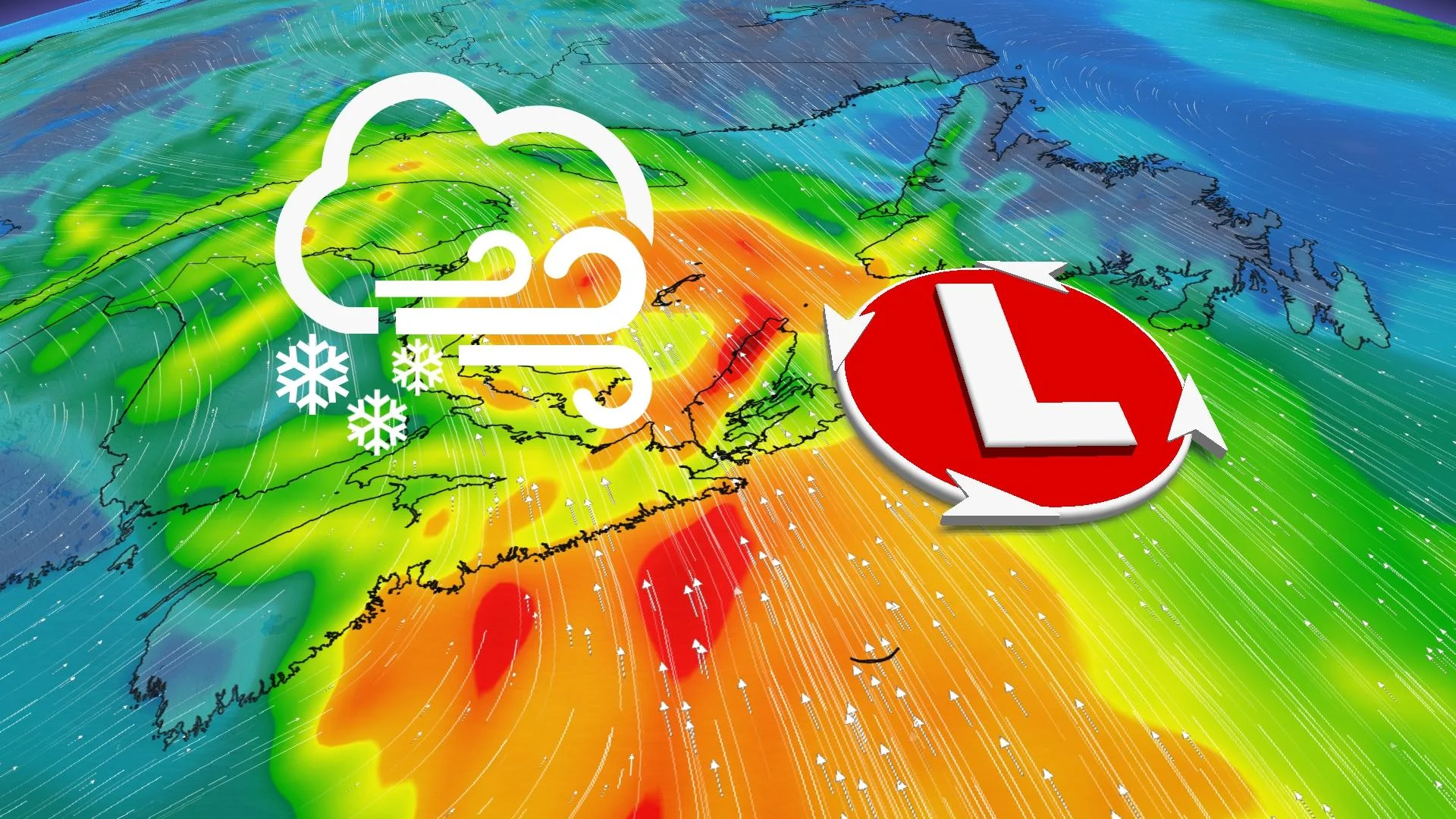
Avoid travel as major storm’s heavy snow, winds slam Newfoundland
Heavy snow and high winds will lead to near-whiteout conditions across parts of Newfoundland into Saturday
A dangerous winter storm will rage into Saturday as southeastern Newfoundland contends with blizzard-like conditions from heavy snow and gusty winds. Parts of the Avalon Peninsula could see as much as 40-70 cm of snow.
Prepare for hazardous driving conditions, widespread traffic delays, and possible road closures. Drivers are even urged to evaluate the possibility of delaying any non-essential travel until the conditions improve. Most flights into and out of St. John's Airport were cancelled through at least midday Saturday, according to the airport’s website Friday evening.
Gusty winds and ice buildup could lead to scattered power outages, as well, so plan ahead for disruptions and ensure your electronic devices are charged.
PHOTOS: Messy winter storm blankets parts of Newfoundland
Through Saturday: Storm continues overnight, ends Saturday
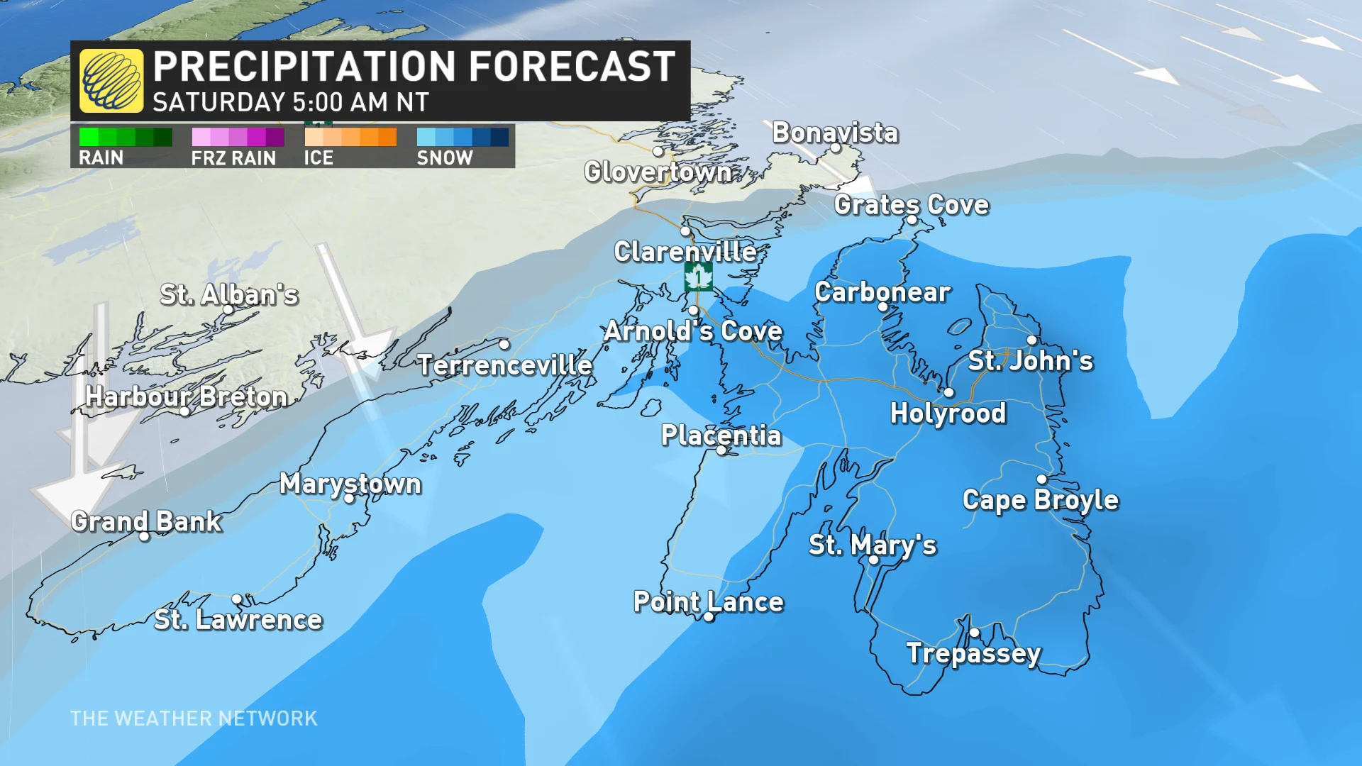
Snowfall that spread over southeastern Newfoundland through the day Friday will continue through the overnight hours, with periods of heavy snow likely across the Avalon Peninsula.
St. John’s had already seen 35+ cm of snow by early Friday evening, with plenty more on the way into Saturday.
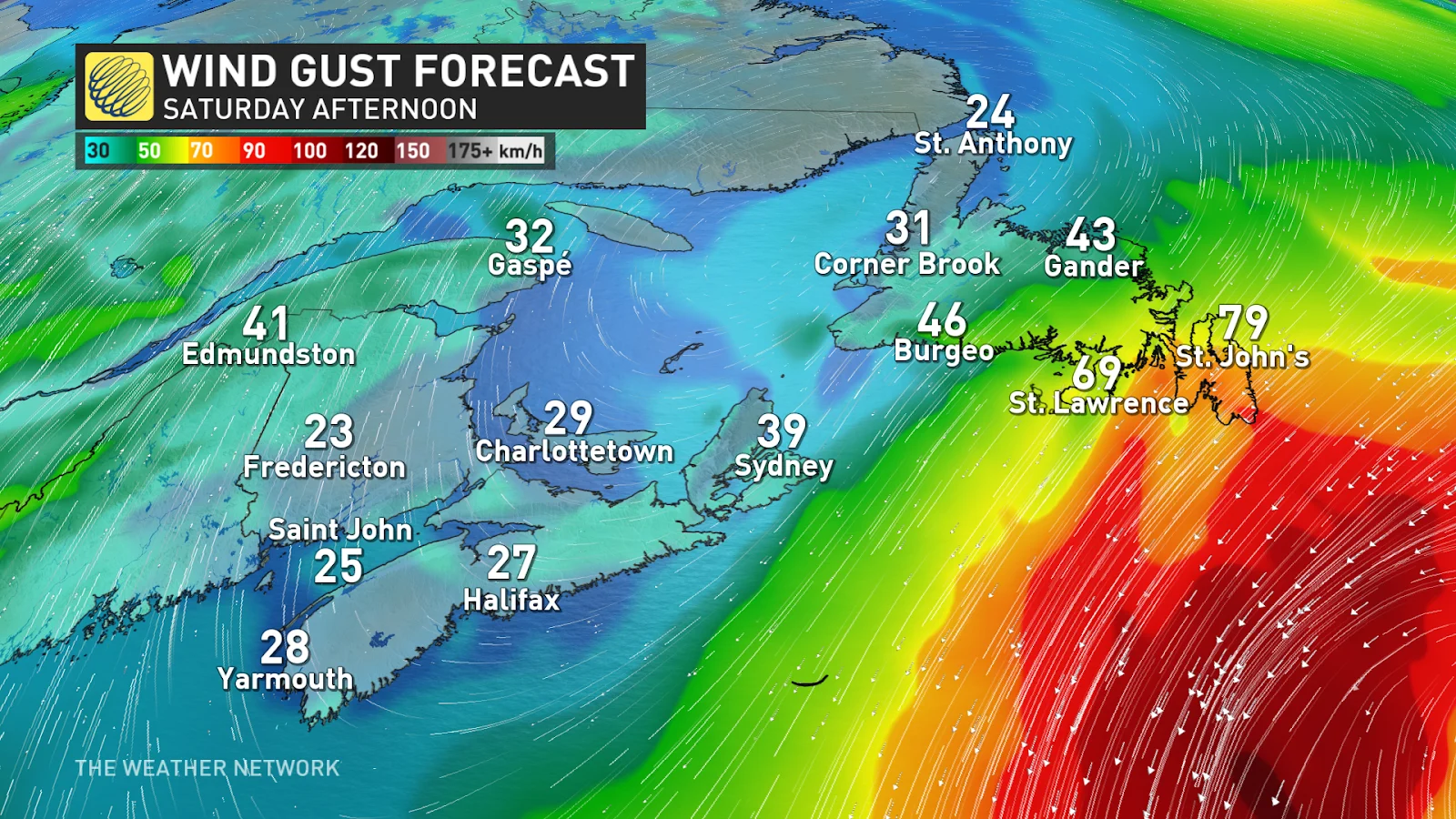
Wind gusts will reach 60-80 km/h across the Avalon and Burin peninsulas on Friday evening, increasing the potential for localized power outages and low visibility due to blowing snow. Blizzard conditions are possible across the St. John’s region.
MUST SEE: Staying safe during a power outage: Infographic
Conditions were foul enough Friday evening that the province had to pull some plows off the road across the Avalon Peninsula.
Overnight snow will linger into Saturday for the Avalon and Burin peninsulas as the final breaths of our departing system spread across the region. Snowfall rates won’t be as heavy as they were on Friday.
Precipitation will taper off into the late-morning hours as the storm exits the region, with clearing in the forecast by Saturday afternoon. Blowing snow will remain a hazard through the day Saturday even after the snow stops falling.
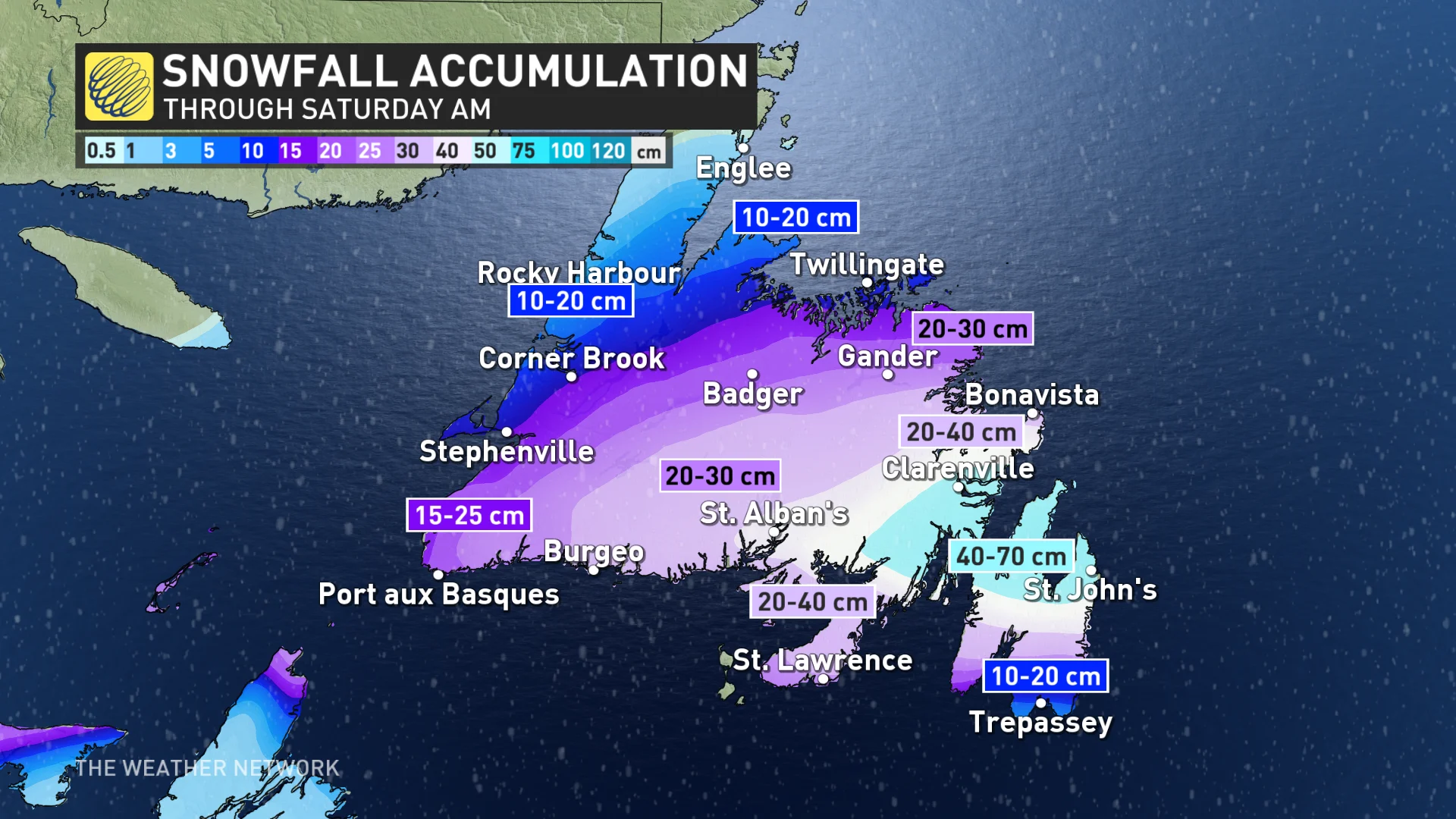
Snowfall totals of 40-70 cm are likely across the Avalon Peninsula, including St. John’s, by the time the storm ends on Saturday. This bullseye of heaviest snow is dependent on the storm’s track, as a slight shift north could allow ice to linger longer and reduce snowfall totals.
RELATED: Be aware of your heart while shovelling heavy snow
An accumulation of 6+ cm of ice pellets is possible for parts of the Avalon and Burin peninsulas by the end of the storm Saturday.
Ice pellets accumulate like snow, but can freeze into a solid slab of ice that’s extremely difficult to remove from sidewalks and roads—a risk made possible by temperatures hovering around or just below freezing through Sunday.
Disruptive ice accretion is also possible for southern communities like Trepassey and Grand Bank. Tree damage and downed power lines are possible in areas that see the most ice from prolonged freezing rain.
WATCH: Freezing rain is the WORST type of precipitation, don't underestimate it
Be sure to check back for the latest weather updates across Atlantic Canada.